Reserves in Southern Africa - SA Hikes

Difficulty Level of Hikes
Hikes outside a reserve (Western Cape)

Wupperthal100 Hike

  • Teaser Title: Wupperthal100 Hike
  • Teaser Image BG: Wupperthal100 Hike
  • Images:
    • Image: Wupperthal100 Hike
    • Image: Wupperthal100 Hike
    • Image: Wupperthal100 Hike
    • Image: Wupperthal100 Hike
    • Image: Wupperthal100 Hike
  • Total Hike Days: 0
  • Cave capacity: 0
  • Author Name: Fagala Voet
  • Author Link: https://sahikes.com/author/fagala-voet
  • Total Hike Duration: 0
  • Total Hike Distance: 0
  • Elevation Gain: 0
  • Website: https://fagalavoet.co.za
  • E-Mail: This email address is being protected from spambots. You need JavaScript enabled to view it.
  • Booking Logo Link: https://sahikes.com/author/fagala-voet
  • Location: -32.276700,19.215100
  • Hike Address:

    Start: Drakie Camp, Cederberg, Western Cape.

    Finish: Wupperthal village, Cederberg, Western Cape.

    Confirm current meeting instructions, guides, safety requirements, access permissions and booking contact directly with the operator.

  • About the area:

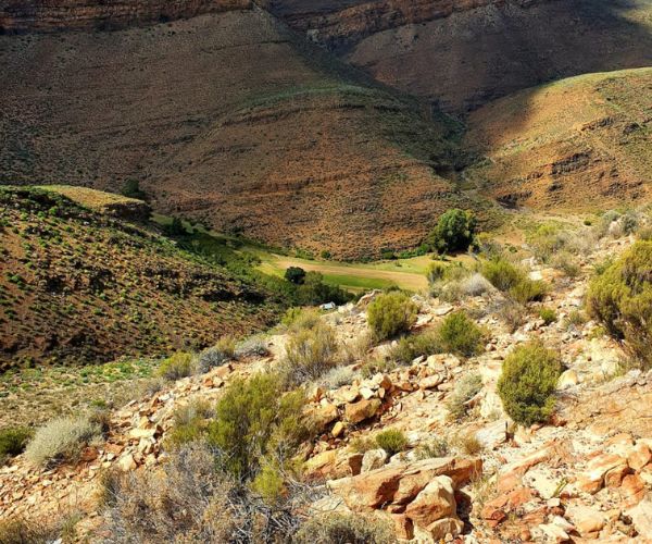
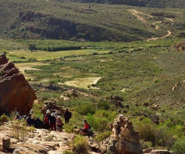
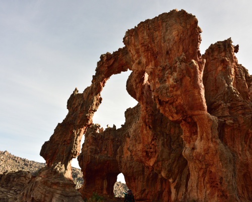
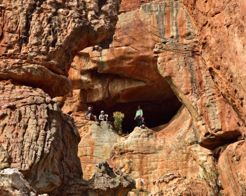
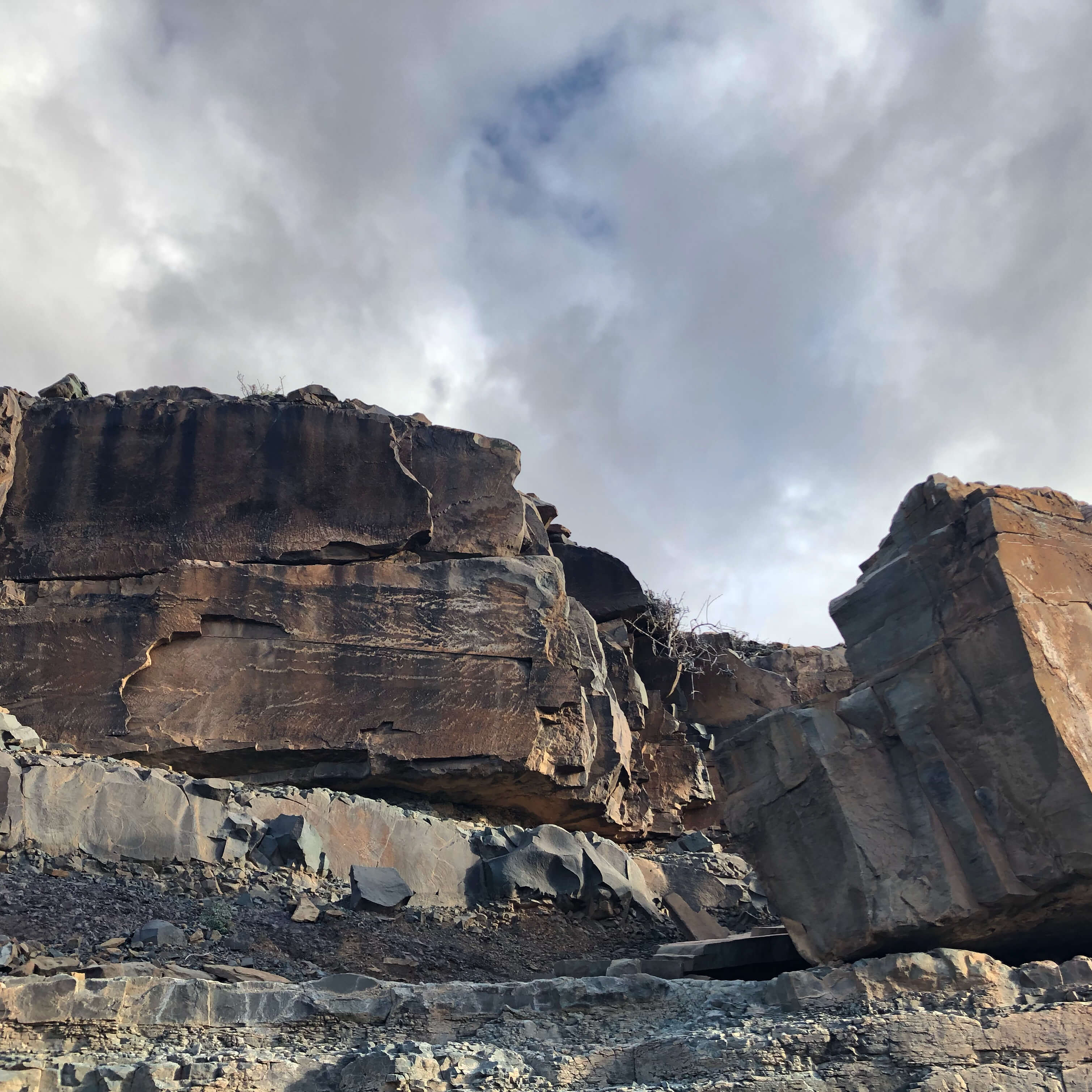
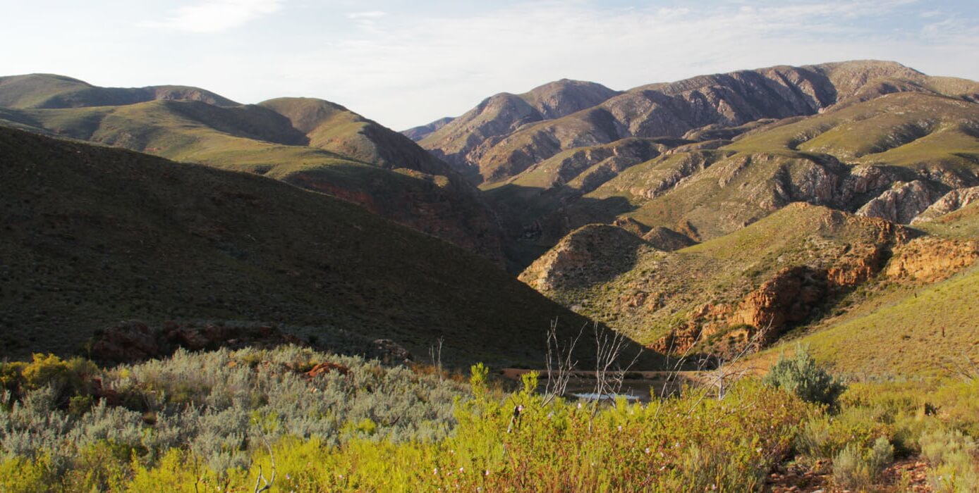
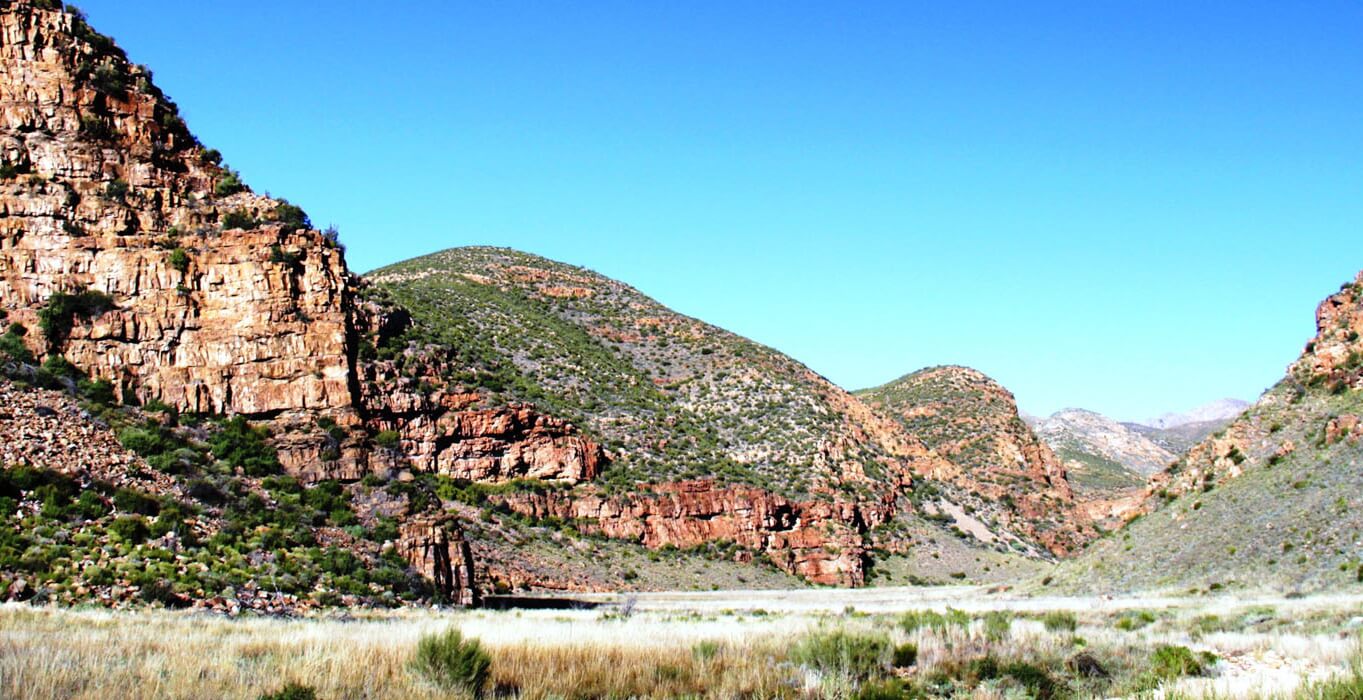
    The Wupperthal area is both fragile mountain habitat and a lived-in cultural landscape. Cedar restoration and historic paths are part of the journey, but hikers must respect local privacy, protected heritage and community rules. Rock art must never be touched, marked or entered without the guide’s direct instruction.

  • Hike Directions:

    After an arrival night at Drakie Camp, the first two walking days use the cedar-route side of the itinerary: approximately 14 km to the Heuningvlei area, followed by another 14 km back toward Drakie via mountain tracks, cedar-restoration landscape and rock formations.

    The next 18 km follows Speelkloof and two-track community connections toward camp near Eselbank. A 20 km stage then moves through fynbos, sandy track, rocky plateau and local footpaths before continuing beside a stream to Akkeba Camp.

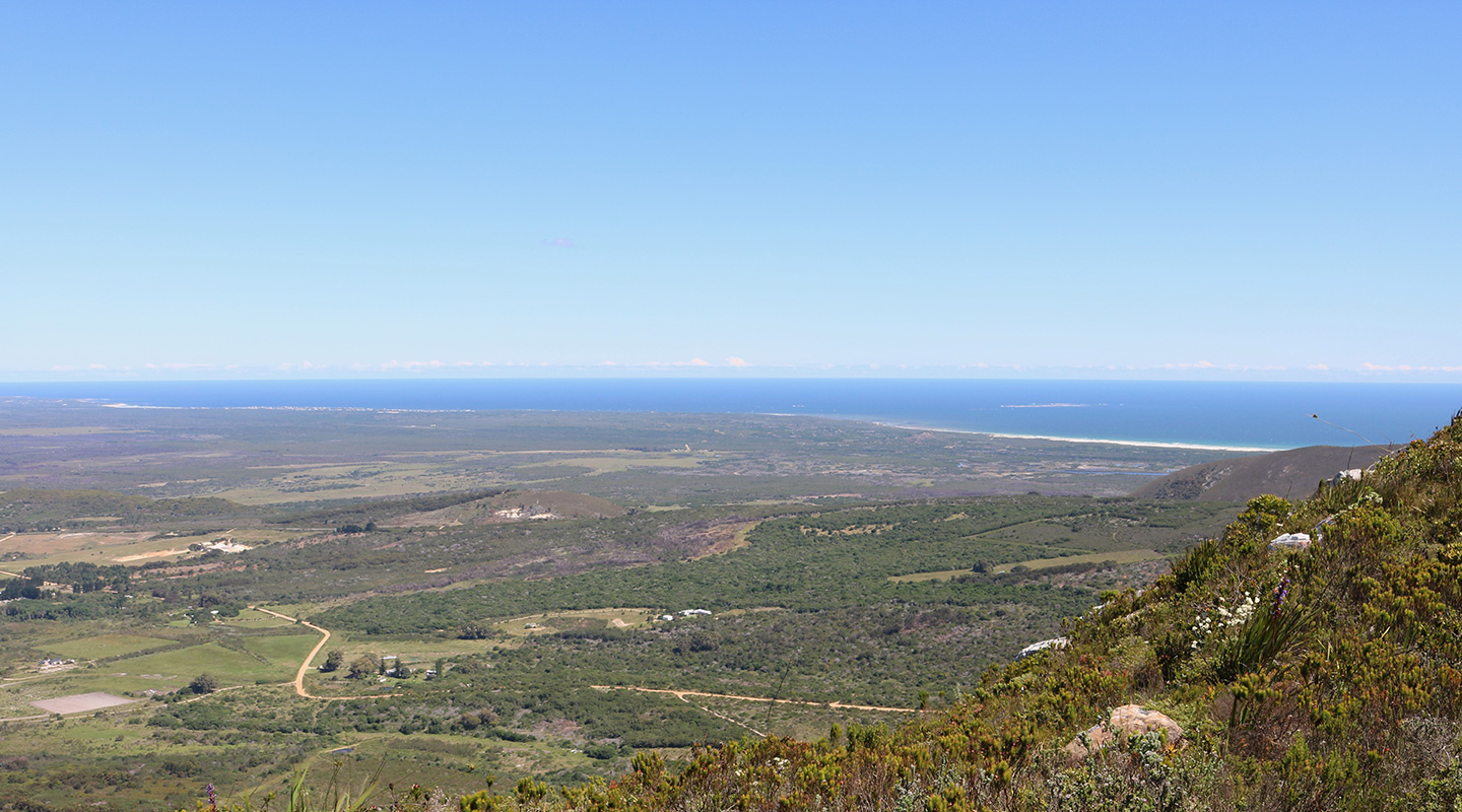
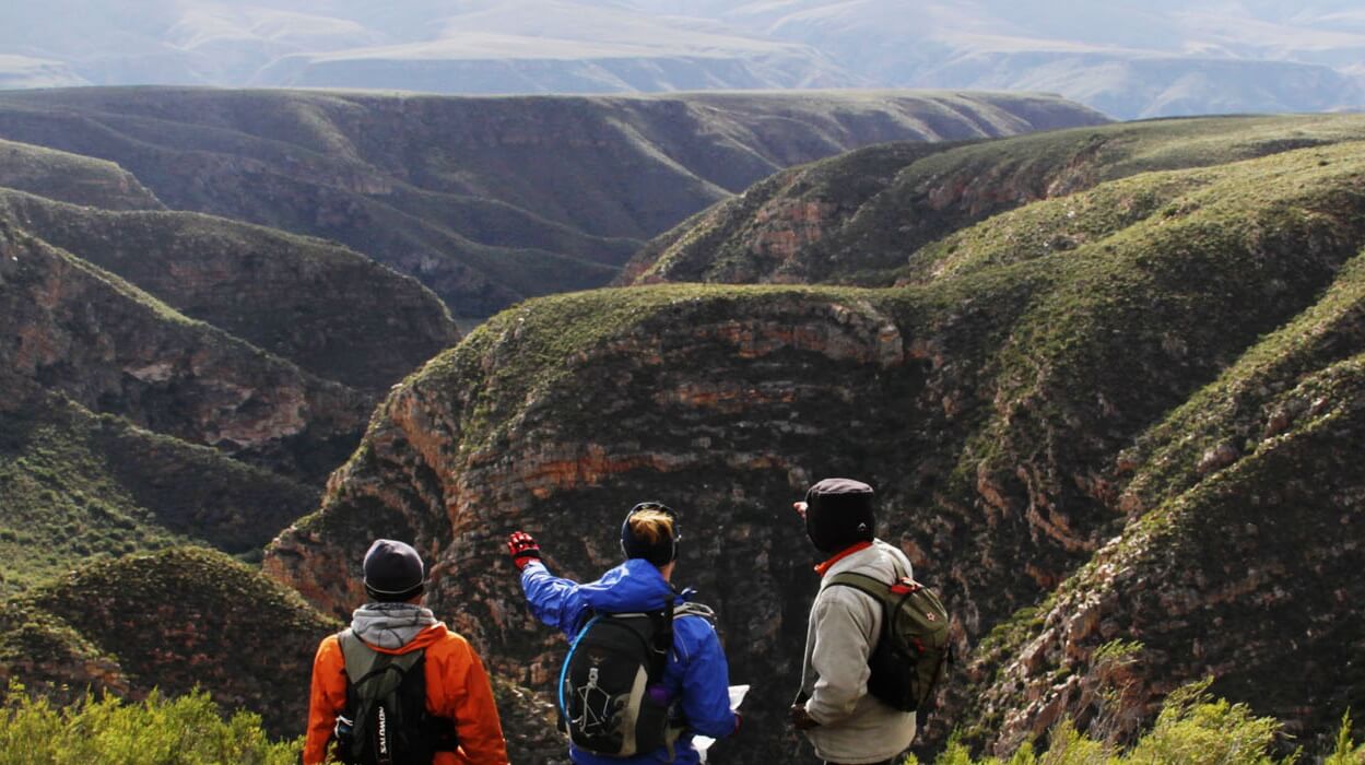
    The penultimate walking day is roughly 15 km and is the most demanding: a substantial climb leads to wide views across the Cederberg, Tankwa Karoo and the Wupperthal valley before camp at Vaalheuning. The final 12.5 km descends on a 4×4 track toward Wupperthal, including loose rocky ground, before the route finishes in the village.

    What to expect

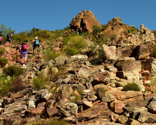
    The route ranges from single track and gravel road to rocky slopes, old vehicle routes, stream corridors and loose descents. The stage distances are manageable in isolation but demanding in sequence. The source highlights an extended climbing section and a short, notably steep part of the penultimate stage.

    Hikers need a high level of fitness, good balance and proven mountain footwear. Take a robust day pack, water capacity, sun protection, warm layers, headlamp, walking poles if appropriate, personal first aid and blister-care equipment, and sleeping/camp gear as specified for the current departure.

    Camps

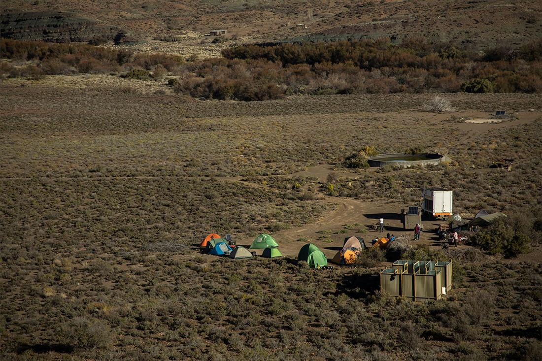
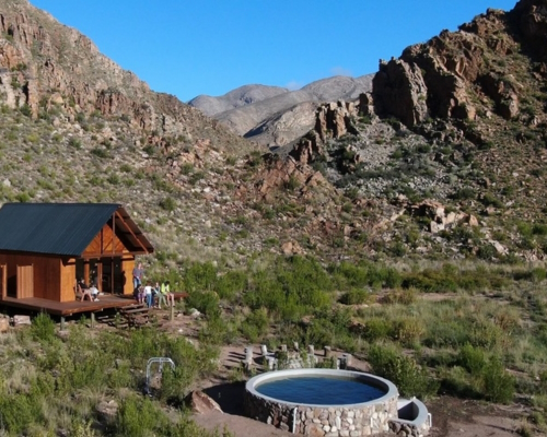
    The hike uses organised wild camps, including Drakie Camp, a camp near Eselbank, Akkeba and Vaalheuning. Luggage and camp equipment are transported between stops, with temporary water and sanitation arranged by the operator. Confirm the exact camp plan and what you must carry before booking.

Wupperthal100 is the longer Cederberg expedition that joins selected elements of the Wupperthal...
Hikes outside a reserve (Mozambique)

Thabaphaswa Mountain Sanctuary Hiking Trails

  • Teaser Title: Experience Santa Maria Trail
  • Teaser Image BG: Experience Santa Maria Trail
  • Images:
    • Image: Experience Santa Maria Trail
    • Image: Experience Santa Maria Trail
    • Image: Experience Santa Maria Trail
    • Image: Experience Santa Maria Trail
    • Image: Experience Santa Maria Trail
    • Image: Experience Santa Maria Trail
  • Total Hike Days: 0
  • Cave capacity: 0
  • Author Name: Fagala Voet
  • Author Link: https://sahikes.com/author/fagala-voet
  • Total Hike Duration: 0
  • Total Hike Distance: 0
  • Elevation Gain: 0
  • Website: https://experiencesantamaria.co.za/
  • E-Mail: This email address is being protected from spambots. You need JavaScript enabled to view it.
  • Booking Logo Link: https://sahikes.com/author/fagala-voet
  • Location: -26.795738,32.891424
  • Hike Address:

    Trail area: Ponta Malongane to Santa Maria, Mozambique

    Current route and bookings: Experience Santa Maria. Confirm current route, tide plan, border/entry requirements, guide arrangements, medical support, travel insurance and active itinerary before travelling.

  • About the area:

    The southern Mozambique coast combines long beach walking with marine life, dunes, coastal vegetation and a remarkably low-density shoreline. Wildlife, marine activities and Elephant Park visits may be available through the operator, but should be presented as optional local context rather than guarantees.

    Respect marine-reserve and community rules, leave no litter and avoid disturbing nesting or shore wildlife. Tides, weather and access conditions determine the safe line each day.

  • Hike Directions:

    Five-day route:

    Ponta Malongane to Techobanine — 11 km: A shorter opening beach stage to settle into the route.

    Techobanine to Milibangalala — 35 km: The longest and most demanding day follows remote, open coast for a sustained distance. This is the stage that requires the strongest preparation and early, conservative pacing.

    Milibangalala to Ponta Membene — 10 km: A shorter recovery stage along the coast.

    Ponta Membene to Ponta Mucumbo — 20 km: Continue south through more dramatic coastal scenery.

    Ponta Mucumbo to Santa Maria — 20 km: The final beach walk reaches Santa Maria.

    Three-day route:

    Start at Milibangalala, then walk Ponta Membene (10 km), Ponta Mucumbo (20 km) and Santa Maria (20 km). This uses the final section of the five-day trail at a friendlier overall pace.

    The route includes a crossing at the Dobela mouth that must be planned around conditions and tide. It is guide-led terrain: do not attempt river-mouth crossings or long remote beach sections independently.

    What to expect

    Walking is mostly flat but distance, heat, sand, tide, sun and exposure make it more demanding than the profile suggests. Carry a light day pack, water capacity, sun protection, well-tested footwear or the guide-approved beach-walking setup, a warm layer for evenings, rain protection, personal medication and a first-aid kit. Your support team may move main luggage, but each hiker must still be self-sufficient for the walking day.

    This is a malaria-risk area. Seek current, personal advice from a qualified travel-health professional before travel; entry, vaccination and malaria guidance changes and must never be copied from an old hiking page. Comprehensive travel and medical-evacuation cover should be confirmed directly with the current operator and insurer.

    Accommodation and trail support

    The hike is a guided, supported slackpacking journey with transfers and overnight stops. These are route logistics, not standalone accommodation content. Do not treat published meals, resort names, spa activities, game drives, snorkelling, fishing, luggage arrangements or transfer promises as fixed SA Hikes content.

    The three-day option allows more time in Santa Maria after the walk; keep that as a booking-format distinction within this article, not a separate post.

Experience Santa Maria is a linear coastal hike from the Ponta Malongane area to Santa Maria....
Hikes outside a reserve (Tanzania)

Mount Kilimanjaro Climb

  • Teaser Title: Mount Kilimanjaro Climb
  • Teaser Image BG: Mount Kilimanjaro Climb
  • Images:
    • Image: Mount Kilimanjaro Climb
    • Image: Mount Kilimanjaro Climb
    • Image: Mount Kilimanjaro Climb
    • Image: Mount Kilimanjaro Climb
    • Image: Mount Kilimanjaro Climb
    • Image: Mount Kilimanjaro Climb
    • Image: Mount Kilimanjaro Climb
  • Total Hike Days: 8
  • Cave capacity: 0
  • Author Name: Fagala Voet
  • Author Link: https://sahikes.com/author/fagala-voet
  • Total Hike Duration: 0
  • Total Hike Distance: 0
  • Elevation Gain: 0
  • Website: https://fagalavoet.co.za/tanzania/
  • E-Mail: This email address is being protected from spambots. You need JavaScript enabled to view it.
  • Booking Logo Link: https://sahikes.com/author/fagala-voet
  • Location: -3.262000,37.515000
  • Hike Address:

    Trek access: Kilimanjaro National Park, Tanzania; pre-trek logistics commonly run from Moshi or Arusha.

    Current route and bookings: Maus Safari. Confirm the licensed guide team, current park requirements, route duration, health screening, rescue provision, equipment list and active itinerary before making travel arrangements.

  • About the area:

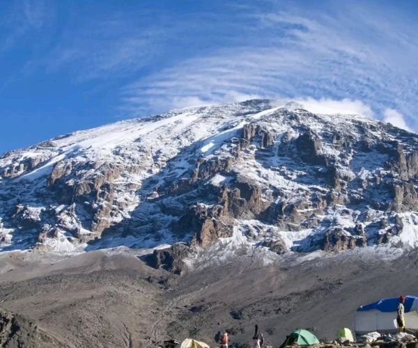
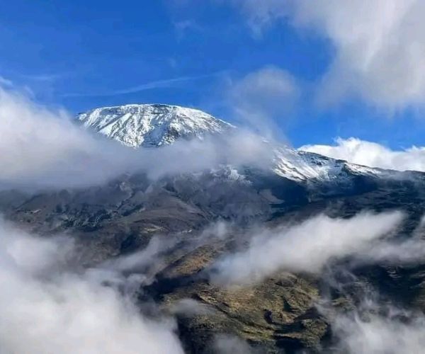
    Mount Kilimanjaro rises from northern Tanzania's plains into distinct ecological zones. The climb's extraordinary variety—from forest to high volcanic desert and summit ice—is why it is one of Africa's defining trekking experiences.

    It is also a protected mountain environment with large human pressure. Follow park and guide instructions, keep to authorised paths, use established sanitation facilities and carry out all personal waste as required.

  • Hike Directions:

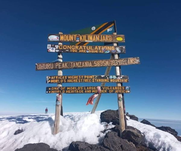
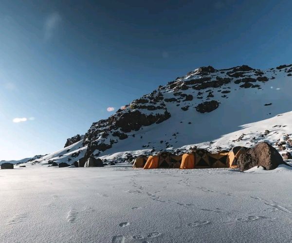
    Machame Route — six days: A scenic camping route that begins through rainforest at Machame Gate, climbs through moorland and the Shira area, then follows the southern circuit via Lava Tower, Barranco and Barafu before the summit attempt and descent through Mweka. The source describes steep terrain, the Barranco Wall and a long summit day.

    Marangu Route — six days: A hut-based ascent and descent from Marangu Gate. The six-day version includes an acclimatisation day at Horombo, then continues to Kibo Hut for the summit attempt via Gillman's Point before descending to Horombo and the gate. It is often selected for its mountain-hut format, but is still a demanding high-altitude climb.

    Lemosho Route — seven or eight days: The longer Lemosho formats offer a more gradual approach through forest and the Shira Plateau before passing Lava Tower, Barranco and the southern circuit to the summit. The eight-day option includes additional acclimatisation time and a high camp before Uhuru Peak. The source's seven-day page contains route-description inconsistencies, so the actual itinerary must be confirmed with the operator before publication.

    All route descriptions are planning context only. National Park rules, guide-led travel requirements, camp/hut allocation and the active mountain itinerary must be confirmed directly with the licensed operator.

    What to expect

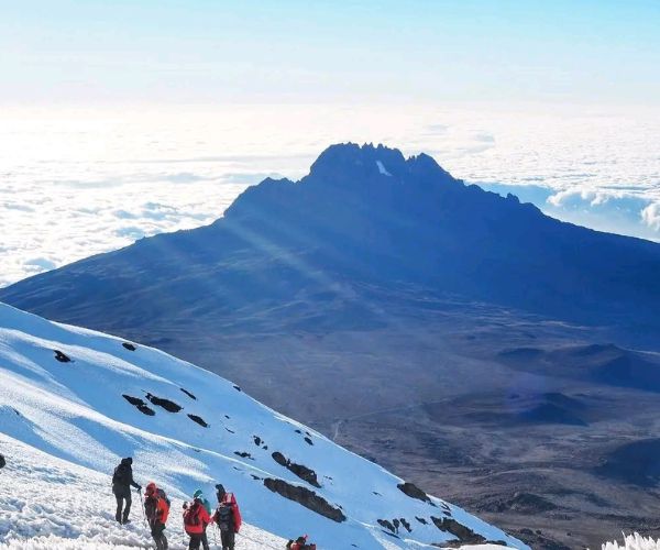
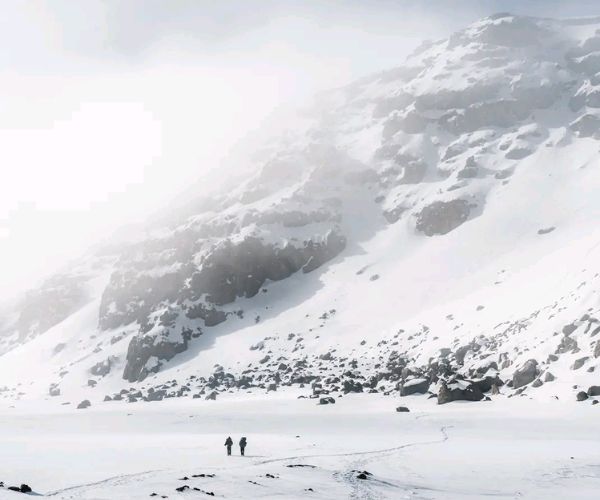
    Kilimanjaro passes through rainforest, moorland, alpine desert and glaciated summit conditions. The summit night is particularly demanding: it normally involves a midnight start, steep loose ground, severe cold, fatigue and a long descent after reaching the crater rim.

    Train well in advance and discuss fitness, pre-existing conditions, medication and altitude risk with an appropriate health professional. Do not attempt to push through symptoms of altitude illness. The guide team has the authority to slow, descend or end a climb; that decision must be respected.

    Essential personal equipment normally includes insulated layers, waterproofs, gloves, warm headwear, boots already worn in, gaiters, trekking poles, headlamp, sun protection, hydration capacity and a personal first-aid kit. Use the operator's current equipment list, not this summary, for the final packing plan.

    Camps, huts and expedition support

    Machame and Lemosho are commonly camping-based formats; Marangu is associated with mountain huts. The precise overnight plan, porter allocation, meals, rescue cover, medical provision, park fees and pre/post-climb accommodation are commercial and safety-critical details which must be confirmed before booking.

    Never assume that rates, inclusions, group size, oxygen/evacuation arrangements or accommodation named in an older itinerary remain current.

A Kilimanjaro climb is a high-altitude mountain expedition to Uhuru Peak, Africa's highest...
Hikes outside a reserve (Western Cape)

Tulbagh Disa Trail

  • Teaser Title: Tulbagh Disa Trail
  • Teaser Image BG: Tulbagh Disa Trail
  • Images:
    • Image: Tulbagh Disa Trail
    • Image: Tulbagh Disa Trail
    • Image: Tulbagh Disa Trail
    • Image: Tulbagh Disa Trail
    • Image: Tulbagh Disa Trail
    • Image: Tulbagh Disa Trail
  • Total Hike Days: 0
  • Cave capacity: 0
  • Author Name: Fagala Voet
  • Author Link: https://sahikes.com/author/fagala-voet
  • Total Hike Duration: 0
  • Total Hike Distance: 0
  • Elevation Gain: 0
  • Website: https://www.facebook.com/profile.php?id=100064421783210
  • E-Mail: This email address is being protected from spambots. You need JavaScript enabled to view it.
  • Booking Logo Link: https://sahikes.com/author/fagala-voet
  • Location: -33.2862,19.1385
  • Hike Address:

    Trail area: Witzenberg Valley, Tulbagh, Western Cape

    Current event information: Confirm the next edition through the Tulbagh Disa Trail organiser page or its current authorised booking provider.

  • About the area:

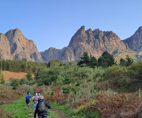
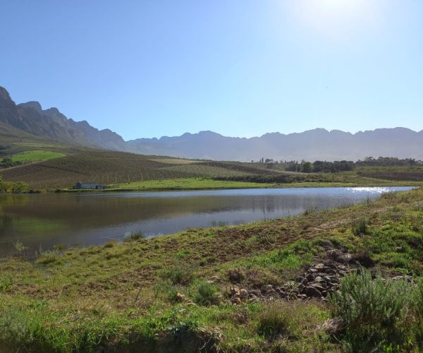
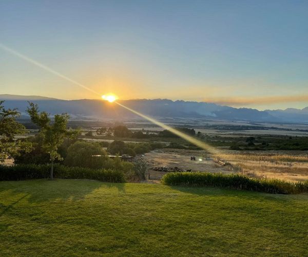
    Tulbagh lies in a broad valley framed by the Witzenberg, Obiqua and Winterhoek Mountains. The surrounding mix of vineyards, orchards, fynbos and historical buildings creates a distinctive Boland walking landscape. Spring brings blossom and seasonal colour, but it can also bring highly changeable mountain weather.

    The trail's community purpose adds to its character: participants walk through the valley while supporting local social initiatives. Confirm the current beneficiary details rather than repeating past allocations as a permanent claim.

  • Hike Directions:

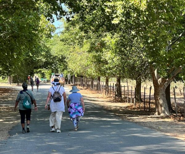
    The four-day route moves through the Witzenberg Valley on a mixture of sandy and gravel roads, fynbos tracks, mountain foothills, orchards, wine farms and historical sites. Daily lines may change from one edition to the next, so no fixed turn-by-turn route should be published from an event page.

    Expect long days of five to seven hours on foot. The total elevation gain is not described as technical mountain climbing, but the combination of distance, uneven ground and four successive walking days requires strong conditioning and well-tested footwear.

    Use the official event briefing, transport plan and current route material. Do not attempt to recreate an annual route independently across farm and private land.

    What to expect

    Spring weather in Tulbagh can vary from rain and cold conditions to early summer heat. Bring a 25–35 litre day pack with rain cover, reliable hiking shoes and socks, rain and sun protection, warm layers, a headlamp, water bottle, personal toiletries and a personal first-aid kit. Prepare feet well in advance and manage blisters early.

    Water points and event support should be treated as organiser-provided services, not as permanent public infrastructure. Every hiker remains responsible for their own health, hydration and suitability for the distance.

    Accommodation and trail support

    The historic event format has used a central Tulbagh accommodation base, with meals, daily transfers and other event support included. These arrangements are part of the fundraiser and may differ each year. They are not separate accommodation listings for SA Hikes.

    Confirm the next event's base, current support, medical plan, fundraising beneficiaries, requirements and cancellation terms directly with the organisers before making travel plans.

The Tulbagh Disa Trail is an annual four-day charity hike through the Witzenberg Valley. It...
Hikes outside a reserve (Western Cape)

Walk with Whales

  • Teaser Title: Walk with Whales
  • Teaser Image BG: Walk with Whales
  • Images:
    • Image: Walk with Whales
    • Image: Walk with Whales
    • Image: Walk with Whales
    • Image: Walk with Whales
    • Image: Walk with Whales
    • Image: Walk with Whales
  • Total Hike Days: 0
  • Cave capacity: 0
  • Author Name: Fagala Voet
  • Author Link: https://sahikes.com/author/fagala-voet
  • Total Hike Duration: 0
  • Total Hike Distance: 0
  • Elevation Gain: 0
  • Website: https://wildwellness.co.za/whales/
  • E-Mail: This email address is being protected from spambots. You need JavaScript enabled to view it.
  • Booking Logo Link: https://sahikes.com/author/fagala-voet
  • Location: -34.6683,20.2285
  • Hike Address:

    Trail area: Arniston, Whale Coast and Cape Agulhas area, Western Cape

    Current route and bookings: Wild Wellness — Walk with Whales. Confirm the current season, tide plan, route, guide availability, permits and safety procedures before travelling.

  • About the area:

    This section of the southern Cape combines turquoise coastal water, dunes, fynbos, fishing culture, archaeological landscapes and some of South Africa's most important whale-watching coast. The route reaches the Cape Agulhas area, near the geographic meeting point of the Indian and Atlantic Oceans.

    Whale viewing is generally strongest in the season when southern right whales are present offshore, but ocean conditions and wildlife behaviour are never predictable. The coast itself remains the enduring reason to walk it.

  • Hike Directions:

    Day 1 — Arniston orientation: Approximately 4 km. Begin with an introductory walk around the coastal settlement, with route options shaped by tides and access to the sea-cave area.

    Day 2 — coastal and beach stage: Approximately 14 km. A short fynbos section leads onto a long beach walk timed around low tide, followed by a final walk to the overnight base.

    Day 3 — coastal recovery stage: Approximately 11 km. Continue at low tide towards a Cape-style fishing cottage and coastal swimming areas. This is a lighter day with time for the shoreline.

    Day 4 — southward coastal stage: Approximately 16 km. The longest day follows beach, fishing-harbour and koppie terrain, with coastal viewpoints and historical features before finishing in a private-reserve setting.

    Day 5 — final coast walk: Approximately 5 km. A final elevated coastal path and heritage-guided cave visit lead into the return transport.

    Tide, weather, conservation rules and guide judgement determine the exact daily line. Do not use the route independently from this outline or enter sea caves and heritage sites outside authorised access.

    What to expect

    Wear walking shoes suitable for sand and rocky shore, and bring a light day pack, water, sun protection, warm windproof layers, rain protection, personal medication and a basic first-aid kit. Much of the beach walking takes place around low tide, so timing is a safety issue, not an optional preference.

    Treat the coast with respect. Never turn your back on the sea, keep out of unsafe surf and rip-current zones, and follow local tide advice. Historical shell-midden, cave and Strandloper-related landscapes are protected and sensitive: view them with the guide, stay on permitted paths and leave everything untouched.

    Accommodation and trail support

    The route uses luggage transfers, guided walking and a choice of shared or private accommodation formats. Those are support options within one trail product, not separate SA Hikes articles.

    Confirm active season dates, accommodation bases, group requirements, permits, current guide arrangements and transfers with the operator. The source page includes historic season information, which must not be published as current without live confirmation.

Walk with Whales is a five-day guided coastal hike along the Whale Coast, moving from Arniston...
Hikes outside a reserve (Western Cape)

Wupperthal66 Hike

  • Teaser Title: Wupperthal66 Hike
  • Teaser Image BG: Wupperthal66 Hike
  • Images:
    • Image: Wupperthal66 Hike
    • Image: Wupperthal66 Hike
    • Image: Wupperthal66 Hike
    • Image: Wupperthal66 Hike
    • Image: Wupperthal66 Hike
    • Image: Wupperthal66 Hike
    • Image: Wupperthal66 Hike
  • Total Hike Days: 0
  • Cave capacity: 0
  • Author Name: Fagala Voet
  • Author Link: https://sahikes.com/author/fagala-voet
  • Total Hike Duration: 0
  • Total Hike Distance: 0
  • Elevation Gain: 0
  • Website: https://fagalavoet.co.za
  • E-Mail: This email address is being protected from spambots. You need JavaScript enabled to view it.
  • Booking Logo Link: https://sahikes.com/author/fagala-voet
  • Location: -32.276700,19.215100
  • Hike Address:

    Start: Drakie Camp, Cederberg, Western Cape.

    Finish: Wupperthal village, Cederberg, Western Cape.

    The current meeting point, transfers, permits, route conditions and booking contact must be confirmed directly with the operator.

  • About the area:

    The route crosses a living cultural landscape as well as sensitive mountain terrain. Hikers pass through or near Cederberg communities and use paths with ongoing local significance. Respect residents’ privacy, private property, water sources and guide direction; do not treat homes, farming activity or cultural practices as trail attractions.

  • Hike Directions:

    The hike starts with an arrival night at Drakie Camp among Cederberg rock formations.

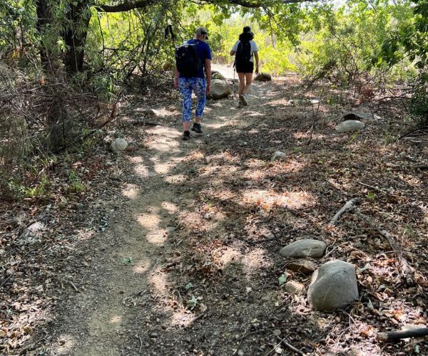
    The first walking day is about 18 km, following two-track paths through Speelkloof and past the Grashoek area before linking local routes between the Cederberg communities and reaching camp near Eselbank. The route follows a perennial river for part of the day, then uses a footpath toward Kleinvlei.

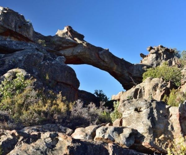
    The 20 km second stage visits the Eselbank waterfall area, moves across sandy tracks, rocky plateau and fynbos, and passes the rock feature locally known as Ereboog. A descending single track and stream-side walking lead to Akkeba Camp.

    Day four is around 15 km, with short but steep ascents on an old 4×4 route. The high point gives views over the Cederberg, Tankwa Karoo and Wupperthal valley before the group camps at Vaalheuning. The final 12.5 km descends on a 4×4 track toward Wupperthal, including loose-rock sections, and ends in the village.

    What to expect

    Underfoot conditions vary from narrow trail to sandy and gravel road, rocky plateau and loose descent. A sustained uphill section and a short, steeper rise feature on the route. Watercourses can make the valleys greener than their surroundings, but hikers should rely only on the water plan supplied by the operator.

    Bring a proven day pack, hiking shoes with good grip, trekking poles if helpful, sun protection, warm layers, personal first-aid and blister-care items, drinking-water capacity, a headlamp, personal eating gear and your own tent and bedding unless a current package specifically provides them.

    Camps

    Overnights are in remote, wild-camping locations: Drakie Camp, a site near Eselbank, Akkeba Camp and Vaalheuning. The organiser transports camp equipment and provides temporary basic sanitation and water arrangements. Confirm the current tent, shower, toilet and weather arrangements before booking.

Wupperthal66 is a guided, supported walk through exceptionally remote Cederberg mountain...
Hikes outside a reserve (Western Cape)

The Fynbos Trail

  • Teaser Title: The Fynbos Trail
  • Teaser Image BG: The Fynbos Trail
  • Images:
    • Image: The Fynbos Trail
  • Total Hike Days: 0
  • Content Images:
    • Image:
    • Image:
    • Image:
    • Image:
    • Image:
  • Cave capacity: 0
  • Author Name: Fagala Voet
  • Author Link: https://sahikes.com/author/fagala-voet
  • Total Hike Duration: 15
  • Total Hike Distance: 26
  • Elevation Gain: 0
  • Website: https://fynbostrail.co.za/
  • E-Mail: This email address is being protected from spambots. You need JavaScript enabled to view it.
  • Booking Logo Link: https://fynbostrail.co.za/
  • Location: -34.520503493924814,19.44730701908964
  • Hike Address:

    Growing the Future / Steynsbos, Walker Bay Fynbos Conservancy, near Stanford and Gansbaai, Western Cape

    Confirm the trail's current seasonal opening, support option, maps, access permissions, group requirements and weather-related advice before travel.

  • About the area:

    The Walker Bay Fynbos Conservancy lies in the biologically rich Stanford–Gansbaai area. The combination of limestone soils, coastal influence and varied terrain supports remarkable local plant diversity. The Steynsbos milkwood forest is an especially distinctive feature, an isolated forest pocket surrounded by fynbos.

    The trail also links natural heritage to working conservation: Growing the Future, Grootbos Nature Reserve and Flower Valley Conservation Trust form part of the story of ecological restoration, skills development and sustainable local livelihoods in the region.

  • Hike Directions:

    Day 1 — Steynsbos to Witvoetskloof: Approximately 6.6 km. Start at the Growing the Future project at Steynsbos and walk through coastal strandveld, milkwood forest, limestone fynbos and mountain fynbos to Fountain Bush Cottage in Witvoetskloof. Allow around three hours.

    Day 2 — Witvoetskloof to Witkrans: Approximately 11 km. Descend the Witvoetskloof Valley towards indigenous forest and a waterfall, then climb through limestone fynbos to Grootberg for wide Overberg and ocean views. Continue through Stinkhoutsbos and Flower Valley to the Witkrans Nature Reserve overnight stop.

    Day 3 — Witkrans to Steynsbos: Approximately 9 km. The final stage loops around Witkransberg and follows the Baviaansfontein Valley through indigenous forest and rare limestone fynbos. Hikers may be able to summit Swartkransberg or take the contour alternative before descending to the Steynsbos start point.

    The trail passes through private conservation land. Routes, access and seasonal operating periods are controlled by the operator; use the current trail map and instructions rather than attempting an unauthorised walk.

    What to expect

    The trail is particularly rewarding for hikers with an interest in plants, ecology and landscape change. More than 800 fynbos species have been recorded along the route, alongside distinctive milkwood forest, rare limestone vegetation, seasonal water and wide coastal views.

    Wear proper walking shoes and pack water, sun protection, weatherproof layers, a small first-aid kit, personal medication and swimwear if planning to use permitted dams or pools. Treat all plants, insects and wildlife with care. Do not pick flowers, take seeds or leave the path in sensitive fynbos.

    Camps and trail support

    The usual three-day route uses two overnight cottage bases: Fountain Bush Cottage in Witvoetskloof and Cone Bush Cottage at Witkrans Nature Reserve. Various package options may add guiding, meals and luggage transfers; the budget format may be self-guided and self-catered.

    These are trail-support arrangements rather than standalone accommodation products. Confirm the live package, the minimum group requirement, opening period, luggage arrangements, water and cooking facilities before booking.

The Fynbos Trail is a three-day circular walk through the Walker Bay Fynbos Conservancy near...
Hikes outside a reserve (Western Cape)

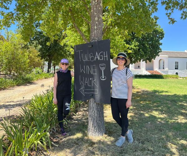
Tulbagh Wine Walk

  • Teaser Title: Tulbagh Wine Walk
  • Teaser Image BG: Tulbagh Wine Walk
  • Images:
    • Image: Tulbagh Wine Walk
    • Image: Tulbagh Wine Walk
    • Image: Tulbagh Wine Walk
    • Image: Tulbagh Wine Walk
    • Image: Tulbagh Wine Walk
    • Image: Tulbagh Wine Walk
  • Total Hike Days: 0
  • Cave capacity: 0
  • Author Name: Fagala Voet
  • Author Link: https://sahikes.com/author/fagala-voet
  • Total Hike Duration: 0
  • Total Hike Distance: 0
  • Elevation Gain: 0
  • Website: https://www.facebook.com/profile.php/?id=100064008106055
  • E-Mail: This email address is being protected from spambots. You need JavaScript enabled to view it.
  • Booking Logo Link: https://sahikes.com/author/fagala-voet
  • Location: -33.268070,19.074832
  • Hike Address:

    Trail area and base: Tulbagh Valley, Western Cape

    Current route and bookings: Confirm with the Tulbagh Wine Walk organiser or current authorised booking provider. Ask for the live programme, distances, participating venues, group requirements and transfers.

  • About the area:

    Tulbagh Valley sits beneath three mountain ranges and has a strong agricultural and architectural identity. Vineyards, olive farms, orchards and historic village streets sit alongside fynbos slopes and broad views of the Witzenberg and Obiqua country.

    Church Street is a notable historic feature of the town, with carefully restored buildings from several periods. Enjoy it as a lived-in townscape and respect private homes, businesses and conservation rules.

  • Hike Directions:

    Oakhurst Walk — approximately 13 km: Start near Oakhurst Olive Farm and walk via Theuniskraal Wine Estate, De Oude Drostdy and Tulbagh Winery before returning to the base by arranged transport.

    Forgotten Highway Walk — approximately 13 km: Follow the Obiqua Mountain side of the valley, with route visits that may include Twee Jonge Gezellen / Krone and Saronsberg. This is a scenic country walk rather than a technical mountain hike.

    A Walk Down Memory Lane — approximately 8–10 km: Visit valley estates such as Montpellier, Rijk's or Manley according to the live programme, then continue into central Tulbagh and Church Street, where Cape Dutch, Edwardian and Victorian architecture provide a historical finish.

    Stops and estate access can vary with dates, harvest activity and operator arrangements. Treat the names above as route character, not a guarantee of every venue on every departure.

    What to expect

    Pack a day pack, water bottle, sun protection, weather layer, comfortable walking shoes and personal medication. The terrain is mainly gravel and country paths, but valley temperatures can be high and weather can change. This is a guided walking-and-tasting experience, so pace yourself and stay hydrated.

    Respect working farms, vineyards and historic buildings. Do not leave marked routes, interfere with farm operations or enter private property outside the guided visit. Alcohol tastings are optional; hiking safety remains the priority.

    Accommodation and trail support

    The Wine Walk uses a central estate base and may include meals, tastings, guide services, transfers and additional activities. These are support elements of the walking programme, not separate accommodation listings.

    Package content, the number of nights, participating estates, transfers and activities change by departure. Confirm all current arrangements with the operator before booking.

The Tulbagh Wine Walk is a guided base-camp walking experience through the Tulbagh Valley. It...
Hikes outside a reserve (Eastern Cape)

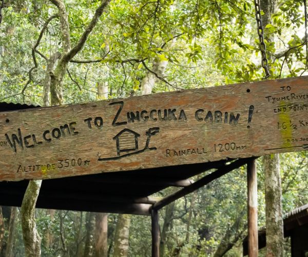
2-Day Zingcuka Loop

  • Teaser Title: 2-Day Zingcuka Loop
  • Teaser Image BG: 2-Day Zingcuka Loop
  • Images:
    • Image: 2-Day Zingcuka Loop
    • Image: 2-Day Zingcuka Loop
    • Image: 2-Day Zingcuka Loop
    • Image: 2-Day Zingcuka Loop
    • Image: 2-Day Zingcuka Loop
    • Image: 2-Day Zingcuka Loop
    • Image: 2-Day Zingcuka Loop
  • Total Hike Days: 0
  • Cave capacity: 0
  • Author Name: Fagala Voet
  • Author Link: https://sahikes.com/author/fagala-voet
  • Total Hike Duration: 0
  • Total Hike Distance: 0
  • Elevation Gain: 0
  • Website: https://fagalavoet.co.za
  • E-Mail: This email address is being protected from spambots. You need JavaScript enabled to view it.
  • Booking Logo Link: https://sahikes.com/author/fagala-voet
  • Location: -32.435050,26.940333
  • Hike Address:

    Trail base: Hogsback, Eastern Cape Route information and bookings: 2-Day Zingcuka Loop / Fagala Voet

    Confirm the chosen start and finish variation, route distance, current hut access, shuttle arrangements and weather conditions before travelling.

  • About the area:

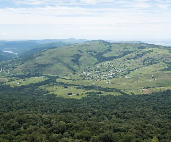
    Hogsback lies high in the Amatola Mountains, where forested gullies, grassland ridges and often-misty peaks create one of the Eastern Cape’s most atmospheric hiking settings. The Zingcuka Loop crosses the ecological boundary that makes the full Amatola Trail memorable: wet forest and streams below, open mountain country and expansive views above.

  • Hike Directions:

    Day 1 – Hogsback to Zingcuka Hut (22 km)

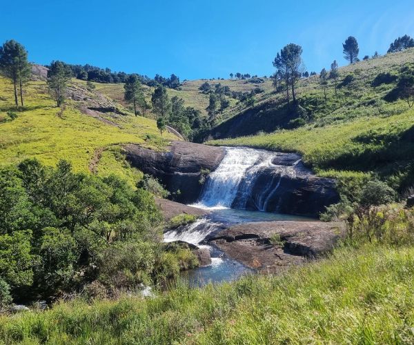
    After a shuttle to the start beyond the Madonna and Child Waterfall area, the trail climbs steeply beside a stream between Hog 1 and Hog 2. It then joins a section of the Amatola Trail, following watercourses past falls and swimming pools before traversing a cliff path with wide views. A steep descent leads into Schwarzwald Forest and Zingcuka Hut.

    The stage gains approximately 1,041 m and is a serious full day. Begin early, carry enough water and do not rely on a quick pace through the rugged forest and mountain sections.

    Day 2 – Zingcuka Hut to Hogsback (16 km)

    The return day climbs behind Hog 1, contours around the peak and works down through high country towards Hogsback. The route again follows water and waterfalls on steep ground. Depending on the agreed exit, hikers either use the longer Amatola+ continuation through Auckland Nature Reserve—taking in Madonna and Child Waterfall and the Big Tree—or leave via Wolfridge Road.

    Despite the shorter listed distance, the stage includes about 955 m of ascent and requires sure footing and good endurance.

    Huts, logistics and preparation

    Zingcuka Hut is the overnight point. The normal logistics include a shuttle to the start and safe parking in Hogsback; pre- and post-hike accommodation or food arrangements should be confirmed directly with the operator rather than assumed from the trail description.

    Some groups can arrange food or gear drops at overnight huts, but this is a support service rather than a reason to under-pack. Carry the water, food, warm waterproof layers, first aid and emergency essentials required for a self-reliant mountain day. Evacuation cover and extraction procedures should be checked before departure.

The Zingcuka Loop is a demanding two-day Hogsback hike that samples the wildest character of...
Baviaanskloof Wilderness Area

Baviaans Canyon Trail

  • Teaser Title: Baviaans Canyon Trail
  • Teaser Image BG: Baviaans Canyon Trail
  • Images:
    • Image: Baviaans Canyon Trail
    • Image: Baviaans Canyon Trail
    • Image: Baviaans Canyon Trail
    • Image: Baviaans Canyon Trail
    • Image: Baviaans Canyon Trail
  • Total Hike Days: 5
  • Cave capacity: 0
  • Author Name: Fagala Voet
  • Author Link: https://sahikes.com/author/fagala-voet
  • Total Hike Duration: 0
  • Total Hike Distance: 0
  • Elevation Gain: 0
  • Website: https://fagalavoet.co.za/baviaans-canyon-trail/
  • E-Mail: This email address is being protected from spambots. You need JavaScript enabled to view it.
  • Booking Logo Link: https://sahikes.com/author/fagala-voet
  • Location: -33.521317,23.660461
  • Hike Address:

    Start and finish: Baviaanskloof Interpretive Centre, at the western entrance to Baviaanskloof World Heritage Site Wilderness Reserve, Eastern Cape.

  • Hike Directions:

    Day 1 — Southern foothills

    Distance: 16 km

    The first stage leaves the interpretive centre for the foothills south-east of base camp. It crosses the same broad wilderness landscape as the Leopard Trail, with mountain views and changing vegetation.

    Day 2 — Kouga Mountain country

    Distance: 16 km

    The route continues through the southern section of the reserve. Expect an active day of climbing and descending rather than a flat 16-kilometre walk.

    Day 3 — Paradise Kloof

    Distance: 9 km

    The shortest day enters Paradise Kloof, where narrow canyons, deep ravines and forest contrast with the more open mountain country of the first two days.

    Day 4 — Northern Baviaans Mountains

    Distance: 17 km

    The trail turns back towards the base area on the northern side of Baviaanskloof. Plateau sections give way to ridges and repeated descents into steep ravines.

    Day 5 — Return to the interpretive centre

    Distance: 16 km

    The final stage continues through the northern mountain landscape before closing the circuit at the Baviaanskloof Interpretive Centre.

    Overnight sites and practical information

    Each overnight site has sleeping units, a shared cooking and social space, solar lighting, flush toilets, hot showers and a splash pool. The sleeping units have mattresses; hikers need a sleeping bag and pillow. The shared kitchens have gas hobs, cooking and eating equipment, while fires may only be made in the supplied fireplaces or braai areas.

    Water is piped to each camp from mountain streams for drinking, cooking and washing. Conditions vary with rainfall, so hikers should still carry water for the day and use their own judgement about treatment.

    The trail is available throughout the year. Summer heat can be intense, while winter brings cool walking temperatures and cold nights. Mountain weather changes quickly in every season, and hikers should pack for heat, rain, wind and cold.

    There is no mobile reception on the route and vehicle access is limited. Hiking groups receive a satellite phone for emergencies. Carry a first-aid kit, survival bag and thermal blanket, stay together during adverse conditions, and follow the operator's safety briefing.

The Baviaans Canyon Trail is a five-day slackpacking circuit in the Baviaanskloof World...
Hikes outside a reserve (Western Cape)

The Quiet 2 day hike | Bloukrans

  • Teaser Title: The Quiet 2 day hike | Bloukrans
  • Teaser Image BG: The Quiet 2 day hike | Bloukrans
  • Images:
    • Image: The Quiet 2 day hike | Bloukrans
    • Image: The Quiet 2 day hike | Bloukrans
    • Image: The Quiet 2 day hike | Bloukrans
  • Total Hike Days: 0
  • Content Images:
    • Image: The Quiet 2 day hike | Bloukrans
    • Image: The Quiet 2 day hike | Bloukrans
    • Image: The Quiet 2 day hike | Bloukrans
    • Image: The Quiet 2 day hike | Bloukrans
  • Cave capacity: 0
  • Author Name: SA Hikes
  • Author Link: https://sahikes.com/author/sa-hikes
  • Total Hike Duration: 0
  • Total Hike Distance: 25
  • Elevation Gain: 0
  • Hike map:
  • Website: https://fagalavoet.co.za
  • E-Mail: This email address is being protected from spambots. You need JavaScript enabled to view it.
  • Booking Logo Link: https://sahikes.com/author/fagala-voet
  • Location: -33.03138889440076,20.916725491374713
  • Hike Address:

    Bloukrans farm, situated in the lesser-known region of the Moordenaarskaroo, south of Sutherland.

  • Hike Directions:

    Accommodation and Amenities

    Participants are accommodated in tented lodgings at the basecamp on the farm, providing an ideal starting point for the two day-hikes of varying lengths. For those wishing to focus solely on hiking and relaxation around the campfire, an optional catering service is available, ensuring a comfortable and enjoyable experience. Delicious homecooked meals true to the Karoo.

    Hiking Itinerary

    Arrival the day before, preferably before dark, to settle in and experience a beautiful sunset and be fresh for the first day of hiking. Starting early for this first day is essential. The second day’s hike is short enough to still be back at camp and head back home. If the second day is done at leisure, spend another night at the campsite.

    Day 1: Bloukrans Plateau Hike

    The first day features a circular route of 15–17 km beginning at the southernmost border of the farm. The trail gradually ascends one of the highest local peaks, reaching 1050 meters above sea level. From the summit, hikers are rewarded with sweeping views of the winding canyon and the Komsberg mountains to the south of Sutherland. This challenging day includes steep jeep track ascents and descents, but the effort is well worth it, with ample opportunities for breathtaking landscape photography.

    Day 2: Bloukrans River Hike

    On the second day, experience a relaxed circular route of 10–12 km through the riverbed to the striking Bloukrans cliff face, exposed for over 300 million years and adorned with exquisite prehistoric rock art. The trail returns across the plateau via jeep track, passing through dwarf succulent and Nama Karoo veld.

    Group Information and Requirements

    • Maximum group size: 8 people
    • Suitable for experienced hikers only
    • No children under 12 years of age
    • Tented accommodation provided
    • Optional dinner catering available (entire group)
    • Own transport to the farm (preferably vehicles with higher ground clearance or 4x4)
Embark on a two-day hiking adventure on Bloukrans farm, situated in the lesser-known region of...
Garden Route National Park

Outeniqua Hiking Trail

  • Teaser Image BG: Outeniqua Hiking Trail
  • GPX Track Map:

    GPS Track Details
    Track length: 104.6 km
    Total ascent: 4115 m
    Total descent: 4176 m
    Difficulty Level: 4/5 - Hard

  • Images:
    • Image: Outeniqua Hiking Trail
    • Image: Outeniqua Hiking Trail
    • Image: Outeniqua Hiking Trail
    • Image: Outeniqua Hiking Trail
    • Image: Outeniqua Hiking Trail
    • Image: Outeniqua Hiking Trail
    • Image: Outeniqua Hiking Trail
  • Content Images:
    • Image: Outeniqua Hiking Trail
    • Image: Outeniqua Hiking Trail
    • Image: Outeniqua Hiking Trail
    • Image: Outeniqua Hiking Trail
  • Cave capacity: 0
  • Author Name: Fagala Voet
  • Author Link: https://sahikes.com/author/fagala-voet
  • Total Hike Duration: 0
  • Total Hike Distance: 108
  • Elevation Gain: 0
  • Website: https://fagalavoet.co.za/outeniqua-hiking-trail/
  • E-Mail: This email address is being protected from spambots. You need JavaScript enabled to view it.
  • Booking Logo Link: https://sahikes.com/author/fagala-voet
  • Location: -33.92454286520666,22.72646612448425
  • Hike Address:

    The hike starts at Beervlei in the Garden Route National Park and ends at Harkerville in the East between Knysna and Plettenberg Bay.

  • About the area:

    The Garden Route National Park in South Africa is a stunning showcase of the region's diverse ecosystems. Created in 2009 through the amalgamation of the Tsitsikamma and Wilderness National Parks, along with the Knysna National Lake Area, it provides a comprehensive experience of the Garden Route's natural wonders.

    Diverse Landscapes and Ecosystems

    The park's various sections offer contrasting yet equally captivating landscapes. The Tsitsikamma section is renowned for its dramatic coastline and the iconic Otter Trail. The Wilderness section features serene lakes, winding rivers, and lush vegetation. The Knysna section highlights the beauty of the Knysna lagoon. These varied environments contribute to the park's rich biodiversity, encompassing indigenous forests, vibrant fynbos, and a plethora of wildlife, including marine inhabitants like whales and dolphins.

    Outeniqua Hiking Trail: Immersing in the Mountains

    Within this expansive park, the Outeniqua Hiking Trail provides an opportunity for hikers to deeply experience the inland beauty of the Outeniqua Mountains. This multi-day trail allows for an intimate encounter with the region's unique flora and fauna, making it a key feature of the Garden Route National Park's offerings.

  • Hike Directions:

    The Outeniqua Hiking Trail offers a captivating multi-day trek through the scenic Outeniqua Mountains within the Garden Route National Park. Typically traversed from west to east, this trail requires careful planning, including securing permits from SANParks and arranging transportation between the starting and ending points. Hikers will find basic overnight accommodations in designated huts along the route, and must be prepared for variable weather conditions.

    The trail is generally divided into seven days, with each day's hike ranging from approximately 12 to 17 kilometers.

    Initial Stages

    The journey commences near Beervlei hut, progressing to Windmeulnek Hut on the first day, followed by Platbos Hut on the second.

    Mid-Trail Sections

    Subsequent days involve hikes to Millwood Hut, Rondebossie Hut, and Diepwalle Hut, each offering unique perspectives of the mountain landscape.

    Final Leg

    The concluding stages lead hikers to Fisantehoek Hut, culminating at Harkerville Hut.

The Outeniqua Trail, a captivating six-night hiking odyssey, weaves its way through the lush...
Tsitsikamma National Park

Tsitsikamma Hiking Trail

  • Teaser Title: Tsitsikamma Hiking Trail
  • Teaser Image BG: Tsitsikamma Hiking Trail
  • GPX Track Map:

    GPS Track Details
    Track length: 55.80 km
    Total ascent: 2454 m
    Total descent: 2201 m
    Difficulty Level: 3/5 - Medium

  • Images:
    • Image: Tsitsikamma Hiking Trail
    • Image: Tsitsikamma Hiking Trail
    • Image: Tsitsikamma Hiking Trail
  • Total Hike Days: 0
  • Content Images:
    • Image: Tsitsikamma Hiking Trail
    • Image: Tsitsikamma Hiking Trail
    • Image: Tsitsikamma Hiking Trail
    • Image: Tsitsikamma Hiking Trail
  • Cave capacity: 0
  • Author Name: SA Hikes
  • Author Link: https://sahikes.com/author/sa-hikes
  • Total Hike Duration: 0
  • Total Hike Distance: 63
  • Elevation Gain: 0
  • Website: https://www.mtotrails.com/location/garden%20route/5/tsitsikamma
  • E-Mail: This email address is being protected from spambots. You need JavaScript enabled to view it.
  • Booking Logo Link: https://www.mtotrails.com/
  • Location: -33.970316195211055,23.56214462727725
  • Hike Address:

    De Vasselot Rest Camp serves as the starting point for the hiking trail. To get there: Travel east from Plettenberg Bay on the N2. Turn onto the R102 towards Nature's Valley. Proceed along the R102, bypassing the turnoff to the village itself. Continue driving with the Groot River lagoon visible on your right. The entrance to De Vasselot Rest Camp will be on your right. GPS coordinates: -33.97066, 23.56176.

  • About the area:

    Tsitsikamma National Park: A Coastal Paradise

    Tsitsikamma National Park, a jewel within South Africa's Garden Route National Park, is a destination that captivates visitors with its remarkable natural beauty. Situated along the southern coast of South Africa, the park showcases a dramatic coastline characterized by rugged rocky shores and deep, verdant gorges. This diverse landscape creates an environment of breathtaking scenic views.

    A Sanctuary for Marine and Terrestrial Life

    A significant portion of the park is dedicated to a marine reserve, which plays a crucial role in safeguarding a rich tapestry of marine life. This protected area contributes to the preservation of diverse fish species and other aquatic creatures. On land, the park provides habitat for a variety of wildlife, including playful dolphins, elusive otters, and a vibrant array of bird species.

    Adventures and Natural Wonders

    Tsitsikamma National Park is renowned for its iconic features, such as the Storms River Mouth and its famous suspension bridge, offering visitors unforgettable experiences. Hiking enthusiasts are drawn to the park's extensive network of trails, including the world-renowned Otter Trail and numerous shorter day hikes. The park is also home to the "Big Tree," a magnificent ancient yellowwood, a testament to the region's natural history. For those seeking aquatic adventures, the park offers opportunities for kayaking, snorkeling, and diving. During the migration season, whale watching becomes a popular activity.

    Conservation and Cultural Significance

    Tsitsikamma National Park plays a vital role in the conservation of both terrestrial and marine ecosystems. Its marine protected area stands as one of the oldest and largest "no-take" zones globally, demonstrating a commitment to environmental preservation. The name "Tsitsikamma" itself, derived from the Khoekhoe language, meaning "place of much water," reflects the region's abundant water resources and its cultural significance.

    In essence, Tsitsikamma National Park provides an exceptional blend of coastal splendor, thrilling adventures, and profound natural wonders, making it an essential destination for anyone exploring the South African landscape.

  • Hike Directions:

    Embark on an unforgettable six-day journey through the heart of the Tsitsikamma National Park, a trek that unveils a remarkable tapestry of landscapes, from serene coastal forests to majestic mountain peaks.

    Day 1: Nature’s Valley to Kalander Hut (3.4 km, approx. 1.3 hours)

    The adventure begins with an easy stroll along the eastern bank of the Groot River lagoon. Here, the air is filled with the symphony of birdlife and the gentle murmur of the Indian Ocean. The trail weaves through tall, dry indigenous coastal forest, offering a tranquil introduction to the park's natural beauty, culminating at the Kalander Hut.

    Day 2: Kalander Hut to Bloukrans Hut (14.7 km, approx. 7 hours)

    Day two presents a more challenging ascent, rewarding hikers with panoramic vistas from Apiesrug. The changing vegetation signals the arrival of the plateau, abundant with fynbos. The majority of the day's hike, however, guides you through afromontane forest, venturing inland towards the Tsitsikamma Mountains' foothills. Bloukrans Hut, perched on a cliff edge, offers stunning views of the river gorges and distant peaks. A coca-cola colored waterfall cascades nearby, inviting you to enjoy its private rock pools.

    Day 3: Bloukrans Hut to Keurbos Hut (13.4 km, approx. 6 hours)

    This day delves deep into the Tsitsikamma Mountains and its dense forests, creating a sense of remote isolation. The historical Buffelsbos, the Bloukrans River crossing at Waterwitelsgat, and the natural jacuzzis at the Twin Tubs are highlights. The journey concludes at Keurbos Hut, nestled in a lush, wetter forest where the plaintive call of the narina trogon may be heard.

    Day 4: Keurbos Hut to Heuningbos Hut (13.4 km, approx. 6 hours)

    Day four traverses diverse habitats, featuring river crossings and the ascent of Rushes Pass, which offers majestic views. Untouched indigenous forests reveal themselves in remote mountain regions. The path descends to follow the Elandsbos River and leads to Heuningbos Hut, preceded by crossings of the Kleinbos River and the promise of a refreshing swim in a nearby pool.

    Day 5: Heuningbos Hut to Sleepkloof Hut (14.2 km, approx. 7 hours)

    The longest day of the trail involves negotiating two saddles, showcasing pristine mountain fynbos and diverse flora. Splendid Pass and Nademaalsnek offer spectacular views. The journey transitions from open mountain slopes to the wet indigenous forest of Mosterdsbos. Sleepkloof Hut, nestled in a forested gorge, provides magnificent views of the Tsitsikamma mountains, a testament to the woodcutter era.

    Day 6: Sleepkloof Hut to Paul Sauer Bridge/Storms River Village (3.2 km, approx. 1 hour)

    The final day offers a choice: a gentle two-kilometer descent to Paul Sauer Bridge, or a slightly longer walk through the tall indigenous Plaatbos Forest to Storms River Village. Both options provide a peaceful conclusion to this remarkable Tsitsikamma adventure.

The Tsitsikamma Hiking Trail is a six-day, one-way journey from Nature’s Valley through the...
Hikes outside a reserve (Eastern Cape)

Amatola Hiking Trail

  • Teaser Image BG: Amatola Hiking Trail, Hogsback
  • Images:
    • Image: Amatola Hiking Trail, Hogsback
    • Image:
    • Image:
  • Total Hike Days: 0
  • Content Images:
    • Image:
    • Image:
    • Image:
    • Image:
  • Cave capacity: 0
  • Author Name: SA Hikes
  • Author Link: https://sahikes.com/author/sa-hikes
  • Total Hike Duration: 0
  • Total Hike Distance: 100
  • Elevation Gain: 0
  • Website: https://fagalavoet.co.za
  • E-Mail: This email address is being protected from spambots. You need JavaScript enabled to view it.
  • Booking Logo Link: https://sahikes.com/author/fagala-voet
  • Location: -32.740022832319404,27.29833014266458
The Amatola Hiking Trail is a demanding point-to-point backpacking route through the Amatola...
De Hoop Nature Reserve

The Whale Trail

  • Teaser Title: One of South Africa’s iconic trails
  • Teaser Image BG: The Whale Trail
  • GPX Track Map:

    GPS Track Details
    Track length: 51.06 km
    Total ascent: 1169 m
    Total descent: 1327 m
    Difficulty Level: 3/5 - Medium

  • Images:
    • Image: The Whale Trail
    • Image: The Whale Trail
    • Image: The Whale Trail
    • Image: Potberg
    • Image: Cupidoskraal
  • Content Images:
    • Image:  Vaalkrans
    • Image: Noetsie Hut
    • Image: Hamerkop
    • Image: The Whale Trail
  • Cave capacity: 0
  • Author Name: Fagala Voet
  • Author Link: https://sahikes.com/author/fagala-voet
  • Total Hike Duration: 0
  • Total Hike Distance: 55
  • Elevation Gain: 0
  • Website: https://fagalavoet.co.za/whale-trail/
  • E-Mail: This email address is being protected from spambots. You need JavaScript enabled to view it.
  • Booking Logo Link: https://sahikes.com/author/fagala-voet
  • Location: -34.37903461334058,20.534798100546524
  • Hike Address:

    The Whale Trail begins at Potberg Hut, situated within the De Hoop Nature Reserve. To find the Potberg reserve office, you can use these GPS coordinates: 34°22'29.15"S 20°31'59.75"E.

  • About the area:

    De Hoop Nature Reserve, situated in the Western Cape of South Africa, is approximately a three-hour drive from Cape Town. This protected area, managed by CapeNature, is renowned for its diverse landscapes, encompassing both coastal and mountainous regions, and its rich biodiversity. A key attraction within the reserve is the opportunity for wildlife observation, particularly whale watching during the migration season from June to November.

  • Hike Directions:

    The journey begins at Potberg, where vehicles are left, and concludes at Koppie Alleen, from which a shuttle service returns hikers to their starting point. The Whale Trail provides a "slack-packing" experience, allowing hikers to carry only a day pack, as extra luggage is transported daily to the next hut in provided 70-liter containers. Each group, limited to six people, can transport up to 14 containers, or seven per group of six, with the option of using them as cooler boxes, which CapeNature can supply upon request.

    Daily Itinerary

    Day 1: Potberg to Cupidoskraal (15.5km, Moderate to Strenuous, approximately 8 hours)

    This is the most challenging segment, requiring an early start. The trail ascends to the summit of Potberg, offering panoramic views of Swellendam, Cape Infanta, and Cape Agulhas, and the opportunity to spot rare Cape vultures. The trail concludes with a descent to Cupidoskraal.

    Day 2: Cupidoskraal to Noetsie (15.2km, Moderate, approximately 8 hours)

    The route follows Potberg's crest through mountain fynbos, featuring stunning views of the Indian Ocean and Breede River. The trail transitions to limestone hills with unique fynbos before descending to Noetsie Bay.

    Day 3: Noetsie to Hamerkop (8.5km, Moderate, approximately 6 hours, 4 hours of walking)

    This shorter distance allows for a relaxed start and ample time to explore the coastline. Stilgat offers excellent snorkeling and swimming opportunities, and whale-watching points dot the route to Hamerkop's sandy beach.

    Day 4: Hamerkop to Vaalkrans (10.5km, Moderate, approximately 6 hours)

    The beach walk rewards hikers with spectacular views and turquoise rock pools. Hikers are advised to avoid sensitive calcrete formations and observe seabirds, while respecting the privacy of Lekkerwater Lodge guests.

    Day 5: Vaalkrans to Koppie Alleen (7km, Easy, approximately 6 hours, 2 hours of walking)

    This final, short hike allows for leisure time to enjoy the scenery, observe whales and dolphins, snorkel, or swim in the Hippo Pools before reaching the Koppie Alleen parking area.

    Accommodation and Facilities

    Each of the five overnight huts accommodates up to 12 people, with three dorm rooms, each sleeping four, primarily with bunk beds and utilitarian foam mattresses. Hikers must bring their own pillows and sleeping bags.

    The huts are fully equipped, with dishwashing liquid and toilet paper provided. Hikers should bring their own toilet paper and a small spade for the trail.

    Hikers are requested to vacate the huts by 09:00 for cleaning and luggage transport.

    All doors and windows must be hooked when opened and closed upon departure due to baboons. Mattresses and crockery/cutlery should remain inside the huts. The overnight huts are located at the foot of the Potberg mountains, and perched on sea cliffs.

    Hikers are liable for any damage caused to reserve property due to negligence.

    The trail also gives hikers the chance to explore the pristine southeastern coastline, which is one of the largest Marine Protected Areas in Africa.

The Whale Trail, a coastal gem nestled within the De Hoop Nature Reserve, offers an...
Baviaanskloof Wilderness Area

Waterkloof Hiking Trail, Baviaanskloof

  • Teaser Title: Waterkloof Hiking Trial, Baviaanskloof
  • Teaser Image BG: Waterkloof Hiking Trial, Baviaanskloof
  • Images:
    • Image: Waterkloof Hiking Trial, Baviaanskloof
    • Image: Waterkloof Hiking Trial, Baviaanskloof
    • Image: Waterkloof Hiking Trial, Baviaanskloof
    • Image: Waterkloof Hiking Trial, Baviaanskloof
  • Total Hike Days: 0
  • Content Images:
    • Image: Waterkloof Hiking Trial, Baviaanskloof
    • Image: Waterkloof Hiking Trial, Baviaanskloof
    • Image: Waterkloof Hiking Trial, Baviaanskloof
    • Image: Waterkloof Hiking Trial, Baviaanskloof
  • Cave capacity: 0
  • Author Name: SA Hikes
  • Author Link: https://sahikes.com/author/sa-hikes
  • Total Hike Duration: 2
  • Total Hike Distance: 3
  • Elevation Gain: 0
  • Website: https://bokloof.co.za/baviaanskloof-activities/
  • E-Mail: This email address is being protected from spambots. You need JavaScript enabled to view it.
  • Booking Logo Link: https://bokloof.co.za/
  • Location: -33.519387720083365,23.91208635588998
  • Hike Address:

    Ceder Falls, Baviaanskloof, 6445, South Africa.

  • About the area:

    Baviaanskloof Wilderness Area is a protected area located in the Eastern Cape Province of South Africa, celebrated for its diverse plant life, breathtaking landscapes, and rich historical significance. This extensive wilderness spans approximately 80,000 hectares and is home to a variety of native wildlife, including leopards and zebras.

    The area is open daily from 7:00 AM to 4:00 PM, with an entrance fee of R40 per person (2025). Visitors can engage in a range of activities, such as hiking, camping, fishing, and birdwatching. The Baviaanskloof offers a number of hiking trails that cater to different skill levels, from easy to difficult. 

    The challenging roads require a high-clearance 4x4 vehicle. The area is also known for its abundant wildlife, including elephants and buffalo. It's important to note that there are no shops or fuel available within the Kloof, and cell phone signal is limited.

The Waterkloof Hiking Trail is situated within the Baviaanskloof Hartland, a region renowned...
Tsitsikamma National Park

The Otter Trail

  • Teaser Title: One of South Africa's most iconic and oldest hiking trails.
  • Teaser Image BG: The Otter Trail
  • GPX Track Map:

    GPS Track Details
    Track length: 38.92 km
    Total ascent: 2241 m
    Total descent: 2255 m
    Difficulty Level: 4/5 - Hard

  • Images:
    • Image: The Otter Trail
    • Image: The Otter Trail
    • Image: The Otter Trail
  • Content Images:
    • Image: The Otter Trail
    • Image: The Otter Trail
    • Image: The Otter Trail
    • Image: The Otter Trail
  • Cave capacity: 0
  • Author Name: Fagala Voet
  • Author Link: https://sahikes.com/author/fagala-voet
  • Total Hike Duration: 0
  • Total Hike Distance: 42
  • Elevation Gain: 0
  • Website: https://fagalavoet.co.za/otter-trail/
  • E-Mail: This email address is being protected from spambots. You need JavaScript enabled to view it.
  • Booking Logo Link: https://fagalavoet.co.za/
  • Location: -34.023269416997046,23.896322456210193
  • Hike Address:

    The trail starts at the Otter Room in the Storms River Rest Camp in Garden Route National Park’s Tsitsikamma section.

  • About the area:

    Tsitsikamma National Park: A Coastal Paradise

    Tsitsikamma National Park, a jewel within South Africa's Garden Route National Park, is a destination that captivates visitors with its remarkable natural beauty. Situated along the southern coast of South Africa, the park showcases a dramatic coastline characterized by rugged rocky shores and deep, verdant gorges. This diverse landscape creates an environment of breathtaking scenic views.

    A Sanctuary for Marine and Terrestrial Life

    A significant portion of the park is dedicated to a marine reserve, which plays a crucial role in safeguarding a rich tapestry of marine life. This protected area contributes to the preservation of diverse fish species and other aquatic creatures. On land, the park provides habitat for a variety of wildlife, including playful dolphins, elusive otters, and a vibrant array of bird species.

    Adventures and Natural Wonders

    Tsitsikamma National Park is renowned for its iconic features, such as the Storms River Mouth and its famous suspension bridge, offering visitors unforgettable experiences. Hiking enthusiasts are drawn to the park's extensive network of trails, including the world-renowned Otter Trail and numerous shorter day hikes. The park is also home to the "Big Tree," a magnificent ancient yellowwood, a testament to the region's natural history. For those seeking aquatic adventures, the park offers opportunities for kayaking, snorkeling, and diving. During the migration season, whale watching becomes a popular activity.

    Conservation and Cultural Significance

    Tsitsikamma National Park plays a vital role in the conservation of both terrestrial and marine ecosystems. Its marine protected area stands as one of the oldest and largest "no-take" zones globally, demonstrating a commitment to environmental preservation. The name "Tsitsikamma" itself, derived from the Khoekhoe language, meaning "place of much water," reflects the region's abundant water resources and its cultural significance.

    In essence, Tsitsikamma National Park provides an exceptional blend of coastal splendor, thrilling adventures, and profound natural wonders, making it an essential destination for anyone exploring the South African landscape.

  • Hike Directions:

    Day 1: Embarking on the Coastal Path (4.8km, ± 2 hours)

    The journey commences with a relatively short but scenic 4.8-kilometer hike. This initial stage allows hikers to acclimate to the trail's environment, offering glimpses of the dramatic coastline and the park's lush vegetation. The estimated two-hour duration provides a gentle introduction to the physical demands of the trail.

    Day 2: Navigating the Rugged Terrain (7.9km, ± 4 hours)

    Day two presents a more substantial challenge, with a 7.9-kilometer hike that typically takes around four hours to complete. This segment involves navigating more rugged terrain, including rocky sections and undulating paths, demanding greater physical exertion and careful footing.

    Day 3: Continuing the Coastal Exploration (7.7km, ± 4 hours)

    The third day maintains a similar level of difficulty, with a 7.7-kilometer hike that also requires approximately four hours. Hikers continue to traverse the coastal landscape, encountering diverse vegetation and panoramic ocean views.

    Day 4: The Longest Stretch (13.8km, ± 6 hours)

    Day four marks the most demanding stage of the Otter Trail, with a 13.8-kilometer hike that can take up to six hours. This extended stretch tests hikers' endurance, requiring sustained effort and careful pacing. This day typically has the most elevation change.

    Day 5: The Final Descent (10.8km, ± 5 hours)

    The final day of the Otter Trail involves a 10.8-kilometer hike, typically completed in around five hours. While still challenging, this stage often involves a gradual descent towards the trail's conclusion, offering a sense of accomplishment and a final opportunity to absorb the park's natural beauty.

The Otter Trail, one of South Africa's most iconic and oldest hiking trails, winds its way...
Lindani Game & Lodges

Lindani Hiking Trails

  • Teaser Title: Lindani Hiking Trails
  • Teaser Image BG: Lindani Hiking Trails
  • Images:
    • Image: Lindani Hiking Trails
    • Image: Lindani Hiking Trails
  • Total Hike Days: 0
  • Content Images:
    • Image: Lindani Hiking Trails
    • Image: Lindani Hiking Trails
    • Image: Lindani Hiking Trails
    • Image: Lindani Hiking Trails
  • Cave capacity: 0
  • Author Name: SA Hikes
  • Author Link: https://sahikes.com/author/sa-hikes
  • Total Hike Duration: 0
  • Total Hike Distance: 12
  • Elevation Gain: 0
  • Website: https://lindani.co.za/
  • E-Mail: This email address is being protected from spambots. You need JavaScript enabled to view it.
  • Booking Logo Link: https://lindani.co.za/
  • Location: -24.046049597822122,28.339531995111443
  • Hike Address:

    Melkrivier Road, Vaalwater, Limpopo

  • About the area:

    Within the Limpopo Province lies Lindani, situated in the Waterberg Biosphere Reserve, a UNESCO site recognized for its exceptional natural value. The region's ancient mountains, diverse ecosystems, and abundant biodiversity are protected within its rugged terrain, defined by mountains, valleys, cliffs, and waterways.

  • Hike Directions:

    Kloof Trail (KLT)

    • Distance: 6.5km (loop)
    • Time: 1.5-3 hours
    • Difficulty: Easy/Moderate
    • Nearest Lodges: Stone House, Bush Camp, Thabeng
    • Description: Experience Lindani's diverse terrain! This trail blends riverside walks, gorge exploration, and open rock sections. Enjoy a mostly gradual gradient suitable for various fitness levels. A 2km river section overlaps with the Koperspruit Trail.

    Koperspruit Trail (KPT)

    • Distance: 8.0km (loop)
    • Time: 2-3 hours
    • Difficulty: Moderate
    • Nearest Lodges: Stone House, The Loft, Thabeng, Motseng, Alden Cottage
    • Description: Discover stunning scenery and varied terrain. While mostly easy, expect one steep, rocky climb. Pay attention to KPT signs as it shares a section with the Kloof Trail. Breathtaking views await!

    Mountain Trail (MTT)

    • Distance: 11.3km (loop)
    • Time: 2-4 hours
    • Difficulty: Moderate/Difficult
    • Nearest Lodges: Maroela, Molope, Bush Camp, Skebenga
    • Description: A scenic and challenging trail with rocky terrain, featuring a 360-degree lookout. Optional loops include the Big Tree & Burnt Rocks Loop (1km) and the Rock Table Loop (600m), showcasing Lindani's unique topography. Expect steep ascents/descents, though the gradient is mostly gradual. A 6km shortcut via Yellowwood Gorge is available. Carry water and food, and start early in summer.

    Melkrivier Trail (MRT)

    • Distance: 10.2km (loop)
    • Time: 2-4 hours
    • Difficulty: Moderate/Difficult
    • Nearest Lodges: Motseng, The Loft, Alden Cottage, Thabeng, Stone House
    • Description: This demanding trail traverses diverse landscapes, including steep gorges, rocky climbs, and gentle paths. Enjoy spectacular views and unique rock formations. A 7km shortcut is available. Carry ample water and start early during summer.

    Shorter Trails

    Aardvark Trail

    • Distance: 650m (out and back)
    • Time: 20-30 minutes
    • Difficulty: Easy
    • Nearest Lodges: Maroela, Bush Camp, Molope, Stone House
    • Description: A gentle woodland walk located above Maroela lodge. Combine with the Mountain Trail Rock Table Loop for a longer hike.

    Mountain Trail Rock Table Loop

    • Distance: 850m (out and back)
    • Time: 30-40 minutes
    • Difficulty: Moderate
    • Nearest Lodges: Maroela, Bush Camp, Molope, Stone House
    • Description: A short loop off the Mountain Trail with rocky sections and woodland. Accessible via the 4x4 road between Maroela and Bush Camp. Combine with the Aardvark Trail for a longer hike.

    Tree Walk

    • Distance: 1km (out and back)
    • Time: 30-40 minutes
    • Difficulty: Easy
    • Nearest Lodges: Stone House, Thabeng
    • Description: An educational walk designed for tree identification. Numbered trees on the outward journey correspond to a provided list. Return with a quiz, identifying trees marked with question marks.
Lindani Hiking Trails form a marked walking network on a Waterberg reserve near Vaalwater. This...
Hikes outside a reserve (Gauteng)

De Wildt Adventure Trails

  • Teaser Image BG: De Wildt Adventure Trails
  • Images:
    • Image: De Wildt Adventure Trails
  • Total Hike Days: 0
  • Content Images:
    • Image: De Wildt Adventure Trails
    • Image: De Wildt Adventure Trails
    • Image: De Wildt Adventure Trails
    • Image: De Wildt Adventure Trails
  • Cave capacity: 0
  • Author Name: Fagala Voet
  • Author Link: https://sahikes.com/author/fagala-voet
  • Total Hike Duration: 0
  • Total Hike Distance: 27
  • Elevation Gain: 0
  • Website: https://fagalavoet.co.za/de-wildt-adventure-trails/
  • E-Mail: This email address is being protected from spambots. You need JavaScript enabled to view it.
  • Booking Logo Link: https://sahikes.com/author/fagala-voet
  • Location: -25.6735683295211,27.950936338607793
  • Hike Address:

    R513 Yellow board no. 78E Farm Schietfontein, 0251

  • About the area:

    De Wildt Adventure Trails is located in the Magaliesberg Mountains near Hartbeespoort, offering a variety of hiking trails for all levels, from easy family-friendly walks to challenging climbs. The trails are also pet-friendly. In addition to hiking, the area is suitable for trail running and mountain biking. De Wildt 4x4 Nature Park & Resort is nearby, offering a nature drive, game drives, and more trails.

    Facilities at De Wildt Adventure Trails include a picnic area, rustic camping, and accommodation at the De Wildt Cheetah Lodge. The trails are about 30 minutes from Pretoria and 45 minutes from Johannesburg.

  • Hike Directions:

    De Wildt Adventure Trails offers a diverse selection of hiking experiences, ranging from leisurely strolls to challenging multi-day treks. 

    Kiepersol Trail (5km or 7.5km)

    • Duration: 1.5 to 2 hours
    • Elevation: Highest point 1442m, elevation gain/loss 251m/249m
    • Rating: Easy to Moderate
    • Pet-friendly.
    • Ideal for families and beginners, with an optional 2.5km Groenklip loop featuring a moss-covered rock and seasonal waterfalls.

    Peglerae Trail (6.5km or 9km)

    • Duration: 2 to 3 hours
    • Elevation: Highest point 1616m, elevation gain/loss 416m
    • Rating: Moderate
    • Pet-friendly.
    • Named after the Aloe Peglerae, offering views of Hartbeespoort Dam and the surrounding area. Popular with families.

    Dinaneni Trail (12.5km)

    • Duration: 3 to 4 hours
    • Elevation: Highest point 1661m, elevation gain/loss 508m
    • Rating: Moderate
    • Features grasslands, rock formations, and historical "kraals" dating back to the late Iron Age.

    Ktatu Loop Trail (12.5km)

    • Duration: 3.5 to 5 hours
    • Elevation: Highest point 1616m, elevation gain/loss 595m
    • Rating: Moderate to Difficult
    • A more challenging 12.5km trail, offering views towards Hartbeespoort.

    Euphorbia Loop Trail (18km)

    • Duration: 5 to 7 hours
    • Elevation: Highest point 1661m, elevation gain/loss 785m/786m
    • Rating: Difficult
    • A combination of loops, providing extensive views of Hartbeespoort Dam. Popular with trail runners.

    Wilde Sering Overnight Hike (27km total):

    • Day 1 (11.5km-15km): 5-5.5 hours, Moderate to Difficult
    • Day 2 (11.5km): 3-4 hours, Moderate base camp multiday hike, combining Peglerae, Ktatu and Wilde Sering loops on day one, and Dinaneni on day two.

    Wilde Hond Trails (4km, 6km, 8.5km & 12.5km): by appointment only.

    • Duration: 2-5 hours.
    • Elevation: Highest point 1611m, elevation gain/loss 380m/381m.
    • Rating: Easy to Moderate/Moderate.
    • Historically significant, featuring British sangars and blockhouses from the Anglo-Boer War.

    Brown Hyena Trail (25km)

    • Two-day backpack or slackpack trail.
    • Day 1: 11km, 4 hours, Moderate to Difficult.
    • Day 2: 14km, 3-4 hours, Moderate.
    • The most challenging trail, combining Euphorbia and Wilde Hond trails, designed for experienced hikers and trail runners.
Nestled within the breathtaking Magaliesberg Mountains, near the picturesque Hartbeespoort, De...
Hikes outside a reserve (Botswana)

!Xerry Wilderness Hiking Trail

  • Teaser Image BG: !Xerry Wilderness Hiking Trail
  • Images:
    • Image: !Xerry Wilderness Hiking Trail
    • Image: !Xerry Wilderness Hiking Trail
    • Image: !Xerry Wilderness Hiking Trail
    • Image: !Xerry Wilderness Hiking Trail
  • Content Images:
    • Image: !Xerry Wilderness Hiking Trail
    • Image: !Xerry Wilderness Hiking Trail
    • Image: !Xerry Wilderness Hiking Trail
    • Image: !Xerry Wilderness Hiking Trail
  • Cave capacity: 0
  • Author Name: SA Hikes
  • Author Link: https://sahikes.com/author/sa-hikes
  • Total Hike Duration: 0
  • Total Hike Distance: 0
  • Elevation Gain: 0
  • Website: https://fagalavoet.co.za
  • E-Mail: This email address is being protected from spambots. You need JavaScript enabled to view it.
  • Booking Logo Link: https://sahikes.com/author/fagala-voet
  • Location: -25.42129228546021,20.59664110185792
  • Hike Address:

    Nossob Rest Camp is located within the Kgalagadi Transfrontier Park, and is a approximately 3.5 hour drive from Twee Rivieren rest camp.

    Reservations for the !Xerry Wilderness Hiking Trail can be made at the reception desks of Twee Rivieren and Nossob Rest Camps. It is advised to book well in advance, as the trail's limited availability and popularity often result in fully booked slots.

  • About the area:

    Nestled within the serene, dry riverbed of the Nossob, Nossob Rest Camp offers an unforgettable Kalahari experience. Surrounded by expansive tree savannah, this camp is renowned for its exceptional predator sightings, making it a haven for wildlife enthusiasts.

    Accommodation and Facilities

    • Diverse Accommodation: Nossob caters to a range of preferences and budgets, providing options from comfortable guesthouses and well-equipped cottages to spacious camping sites.
    • Camp Amenities: The camp features a reception area, a refreshing swimming pool, and an informative predator information center, allowing visitors to delve deeper into the region's wildlife.
      A well-stocked shop provides essential supplies, and fuel facilities are available for those exploring the park.
    • Electricity is provided by a generator for 16.5 hours per day.

    Tranquil Atmosphere

    • The absence of phone reception contributes to the camp's tranquil and peaceful atmosphere, allowing guests to fully immerse themselves in the natural surroundings.

    Wildlife Viewing

    • Nossob is well known for great predator sightings, and the water hole near the camp, is a great place to see many animals coming to drink.
    • Essentially, Nossob offers a more secluded and wilder experience than some of the other camps in the Kgalagadi Transfrontier park.
The !Xerry Wilderness Hiking Trail, named after the diminutive steenbok (also known as the...
Baviaanskloof Wilderness Area

The Leopard Trail

  • Teaser Title: The Leopard Trail
  • Teaser Image BG: The Leopard Trail
  • Images:
    • Image: The Leopard Trail
    • Image: The Leopard Trail
    • Image: The Leopard Trail
    • Image: The Leopard Trail
    • Image: The Leopard Trail
  • Total Hike Days: 0
  • Content Images:
    • Image: The Leopard Trail
    • Image: The Leopard Trail
    • Image: The Leopard Trail
    • Image: The Leopard Trail
  • Cave capacity: 0
  • Author Name: Fagala Voet
  • Author Link: https://sahikes.com/author/fagala-voet
  • Total Hike Duration: 0
  • Total Hike Distance: 63
  • Elevation Gain: 0
  • Website: https://fagalavoet.co.za/leopard-trail/
  • E-Mail: This email address is being protected from spambots. You need JavaScript enabled to view it.
  • Booking Logo Link: https://sahikes.com/author/fagala-voet
  • Location: -33.57547296117996,23.715655215330397
  • Hike Address:

    Ceder Falls, Baviaanskloof, 6445, South Africa.

  • About the area:

    Baviaanskloof Wilderness Area is a protected area located in the Eastern Cape Province of South Africa, celebrated for its diverse plant life, breathtaking landscapes, and rich historical significance. This extensive wilderness spans approximately 80,000 hectares and is home to a variety of native wildlife, including leopards and zebras.

    The area is open daily from 7:00 AM to 4:00 PM, with an entrance fee of R40 per person (2025). Visitors can engage in a range of activities, such as hiking, camping, fishing, and birdwatching. The Baviaanskloof offers a number of hiking trails that cater to different skill levels, from easy to difficult. 

    The challenging roads require a high-clearance 4x4 vehicle. The area is also known for its abundant wildlife, including elephants and buffalo. It's important to note that there are no shops or fuel available within the Kloof, and cell phone signal is limited.

  • Hike Directions:

    This circular hike begins and concludes at Cedar Falls Base Camp, where you'll park your vehicles.

    Day 1: Kick-Start to Gabriel's Pools (9.75 km, 3-5 hours)

    • Start Time: Aim to begin no later than 2:00 PM.
    • Initial Ascent: The trail commences with a challenging climb up "Kick-Start Hill" onto the plateau.
    • Midpoint Detour (Optional): At the halfway mark, a 570-meter each-way detour leads to Gabriel's Pools, a stunning kloof featuring refreshing pools and the day's only reliable drinking water. Allow an extra hour for swimming and exploration.
    • Descent: The trail then descends into a valley, winding its way to the first overnight camp.

    Recommendation

    • Don't miss Gabriel's Pools! The kloof's beauty is truly special.

    Day 2: Rhebok Valley to Reflection Pools (18 km, 5-8 hours)

    • Gentle Start: Begin with a pleasant 5.5 km walk through Rhebok Valley.
    • Ascent and Views: From the old Cedar View detour turn-off, ascend to a saddle offering breathtaking panoramas of the Kouga and Baviaans foothills.
    • Reflection Pools: Descend to Reflection Pools for a refreshing swim and to replenish your water supply.
    • Cross-Country Hike: The remaining hike traverses the landscape, culminating in two short saddle climbs before reaching the overnight huts.

    Recommendations

    • Avoid midday hiking in summer.
    • Start early (near daybreak) to reach Reflection Pools and shade by mid-morning.
    • Enjoy an extended break at the pools before completing the final leg.
    • Bags for camp 2 arrive last, so there may be a wait.

    Day 3: Wilderness Challenge and Kasey Kloof (22 km, 6-9 hours)

    • Longest Day: This is the trail's most demanding day.
    • Challenging Climbs: Tackle the three climbs of Honeybush Hill, Inconvenient Truth, and Ain't so Bad, experiencing true wilderness.
    • Draaipunt Water Stop: At the midpoint, Draaipunt, a short 224-meter detour provides access to drinking water.
    • Kasey Kloof Descent: The second half of the day involves a 9 km descent through the picturesque Kasey Kloof.

    Recommendations

    • Begin at sunrise to conquer the three saddles during the cooler early hours.
    • Take a break at the stream at Draaipunt.
    • Enjoy the shaded and cooler walk through Kasey Kloof, where seasonal streams may offer opportunities to cool your feet.

    Day 4: Birdsong Valley and Cedar Falls (13 km, 3-5 hours)

    • Birdsong Valley: Enjoy a leisurely start through the beautiful Birdsong Valley.
    • Fond Farewell Climb: After 4 km, ascend the steep "Fond Farewell" climb to the plateau.
    • The Cauldron: Traverse "The Cauldron," a series of two small valleys that can become very hot.
    • Cedar Falls Descent: Descend into the Cedar Falls valley, leading to the base camp and a refreshing swim in the reservoir.

    Recommendations

    • Savor the final morning, appreciating the valley's beauty and wildlife.
    • Enjoy your last moments of the trail.
Immerse yourself in the untamed beauty of the Baviaanskloof World Heritage Site Wilderness...
Hikes outside a reserve (Mpumulanga)

Fanie Botha Hiking Trail, Sabie

  • Teaser Image BG: Fanie Botha Hiking Trail, Sabie
  • Images:
    • Image: Fanie Botha Hiking Trail, Sabie
    • Image: Fanie Botha Hiking Trail, Sabie
    • Image: Fanie Botha Hiking Trail, Sabie
  • Total Hike Days: 0
  • Content Images:
    • Image: Fanie Botha Hiking Trail, Sabie
    • Image: Fanie Botha Hiking Trail, Sabie
    • Image: Fanie Botha Hiking Trail, Sabie
    • Image: Fanie Botha Hiking Trail, Sabie
  • Cave capacity: 0
  • Author Name: Fagala Voet
  • Author Link: https://sahikes.com/author/fagala-voet
  • Total Hike Duration: 0
  • Total Hike Distance: 50
  • Elevation Gain: 0
  • Website: https://fagalavoet.co.za/fanie-botha-hiking-trail/
  • E-Mail: This email address is being protected from spambots. You need JavaScript enabled to view it.
  • Booking Logo Link: https://sahikes.com/author/fagala-voet
  • Location: -25.091050083419397,30.738949091946203
  • Hike Address:

    The Fanie Botha Hiking Trail is located near Sabie, South Africa.

  • About the area:

    Sabie is a charming town nestled in Mpumalanga, South Africa, renowned for its picturesque landscapes and a wide array of outdoor pursuits. While not directly situated within the Drakensberg Mountains, Sabie lies at the foothills of the Drakensberg escarpment and serves as an excellent starting point for exploring the renowned Panorama Route.

  • Hike Directions:

    The Fanie Botha Hiking Trail offers a variety of multi-day hiking options, catering to different time constraints and fitness levels. 

    2-Night Options

    These shorter trails provide a taste of the Fanie Botha experience, ideal for weekend hikers. Options include:

    • Mac Mac 2-night trail
    • Graskop 2-night trail
    • Hartbeesvlakte 2-night trail
    • Mac Mac / Bonnet 2-night trail
    • Burger 2-night trail
    • Maritzbos 2-day trail

    3-Night Options

    For those seeking a more immersive experience, the 3-night trails offer a greater exploration of the area's diverse landscapes.

    • Burger 3-night trail
    • Lone Creek 3-night trail
    • Hartbeesvlakte 3-night trail
    • Maritzbos 3-night trail
    • Mac Mac 3-night trail

    4-Night Options

    These trails allow for a more comprehensive journey through the region, providing ample time to appreciate the natural beauty. 

    • Ceylon 4-night trail
    • Maritzbos 4-night trail
    • Mount Moodie 4-night Trail

    5-Night Options

    For the most dedicated hikers, the 5-night trails offer an extensive adventure, covering a significant portion of the Fanie Botha Hiking Trail.

    • Burger 5-night trail
    • Graskop 5-night trail

    It is important to note that some of the longer trails are not circular, and that slackpacking or shuttle services may need to be arranged.

The Fanie Botha Hiking Trail, a multi-day hiking experience in the Sabie area of Mpumalanga,...
Hikes outside a reserve (North West)

B’sorah Trails

  • Teaser Image BG: B’sorah Adventures
  • Images:
    • Image: B’sorah Adventures
    • Image: B’sorah Adventures
    • Image: B’sorah Adventures
    • Image: B’sorah Adventures
    • Image: B’sorah Adventures
  • Total Hike Days: 0
  • Content Images:
    • Image: B’sorah Adventures
    • Image: B’sorah Adventures
    • Image: B’sorah Adventures
    • Image: B’sorah Adventures
  • Cave capacity: 0
  • Author Name: Fagala Voet
  • Author Link: https://sahikes.com/author/fagala-voet
  • Total Hike Duration: 0
  • Total Hike Distance: 18
  • Elevation Gain: 0
  • Website: https://fagalavoet.co.za/bsorah-tented-camp/
  • E-Mail: This email address is being protected from spambots. You need JavaScript enabled to view it.
  • Booking Logo Link: https://sahikes.com/author/fagala-voet
  • Location: -25.839305437437197,27.7798573640768
  • Hike Address:

    Farm Bassora, Broederstroom, North West Province, 0240

  • About the area:

    Farm Bassora is situated in the picturesque Broederstroom area, a location nestled within the North West province of South Africa. This region is particularly notable for its proximity to the popular Hartbeespoort Dam, and it lies in the foothills of the majestic Magaliesberg Mountains. The farm itself, bearing the postal code 0240, is home to "B'sorah Luxury Tented Camp," a destination that provides both lodging and event hosting capabilities.

    The surrounding environment of Farm Bassora is characterized by its natural splendor. Visitors can expect to encounter diverse wildlife, and the area serves as a gateway to various nature reserves. Furthermore, the location's closeness to attractions like the Cradle of Humankind and the Hartbeespoort Dam ensures that guests have access to a wide array of recreational activities. In addition, the farm is used as a location for outdoor activities, such as trail running events.

    Beyond the immediate vicinity of Farm Bassora, the Broederstroom region offers a rich tapestry of experiences. Travelers can explore cultural sites such as the Lesedi Cultural Village, or simply enjoy the tranquil atmosphere of the numerous farms that dot the landscape. The area is ideal for those seeking a blend of outdoor adventure and peaceful retreat.

  • Hike Directions:

    The hikes at B'sorah Luxury Tent & Venue range from 5km to 18km and are well-marked. They are suitable for both beginners and experienced hikers, offering beautiful views. Besides hiking, the venue also offers trails for trail running and mountain biking.

    Here's a summary of the hikes

    • Trail lengths: 5km to 18km
    • Difficulty levels: Suitable for beginners and experienced hikers
    • Scenery: Beautiful views
    • Other activities: Trail running and mountain biking
Situated near the majestic Magaliesberg Mountains and the historical Hartbeespoort Dam, B’sorah...
Hikes outside a reserve (Lesotho)

Semonkong Lodge Hiking Trails

  • Teaser Title: Semonkong Lodge Hiking Trails
  • Teaser Image BG: Semonkong Lodge Hiking Trails
  • Images:
    • Image: Semonkong Lodge Hiking Trails
    • Image: Semonkong Lodge Hiking Trails
    • Image: Semonkong Lodge Hiking Trails
  • Total Hike Days: 0
  • Content Images:
    • Image: Semonkong Lodge Hiking Trails
    • Image: Semonkong Lodge Hiking Trails
    • Image: Semonkong Lodge Hiking Trails
    • Image: Semonkong Lodge Hiking Trails
  • Cave capacity: 0
  • Author Name: Fagala Voet
  • Author Link: https://sahikes.com/author/fagala-voet
  • Total Hike Duration: 0
  • Total Hike Distance: 0
  • Elevation Gain: 0
  • Website: https://www.semonkonglodge.com/hiking-in-lesotho/
  • E-Mail: This email address is being protected from spambots. You need JavaScript enabled to view it.
  • Booking Logo Link: https://www.semonkonglodge.com/hiking-in-lesotho/
  • Location: -29.8433,28.0430
  • Hike Address:

    Semonkong Lodge, 1 Riverside Road, Semonkong, Lesotho

  • About the area:

    Semonkong, meaning "Place of Smoke," is a captivating village nestled in the heart of Lesotho's Maluti Mountains. Renowned for its breathtaking natural beauty and rich cultural heritage, it offers a unique blend of adventure and tranquility.

    Key Attractions:

    • Maletsunyane Falls: This majestic waterfall, one of the highest single-drop waterfalls in Africa, cascades 192 meters into a deep gorge. Its mist creates a "smoky" effect, giving Semonkong its name.
    • Hiking Trails: Semonkong is a hiker's paradise, with trails ranging from easy to challenging. Explore the surrounding mountains, witness stunning vistas, and encounter diverse flora and fauna.
    • Cultural Experiences: Immerse yourself in the local Basotho culture by interacting with friendly villagers, learning about their traditions, and even staying in traditional thatched huts.
    • Horseback Riding: Saddle up a Basotho pony and embark on a thrilling horseback riding adventure through the scenic landscapes.
  • Hike Directions:

    Day Hikes from Semonkong Lodge

    • Phororo Viewpoint: A 3-hour round trip to a stunning overlook of the 186-meter Maletsunyane Falls.
    • Ka Nokeng: A 5-6 hour hike offering multiple viewpoints of the falls, including a front-row seat.
    • Boalathapo Falls: A 5-6 hour hike to a lesser-known, but equally beautiful waterfall.
    • Into the Smoke: A challenging 5-6 hour hike to the base of Maletsunyane Falls, offering a unique perspective and opportunities for swimming or fishing.

    Overnight Adventures

    Immerse Yourself in Basotho Culture. Join guided overnight hikes through remote mountain villages. Ride Basotho ponies, stay in traditional huts, and experience the authentic lifestyle of the local people.

    • Ketane Waterfall Hike: A 2-day horseback riding adventure to the base of the 122-meter Ketane Waterfall.
    • Ha Letsaba Hike: A 2-day ride along the Maletsunyane Gorge to the village of Ha Letsaba.
Semonkong Lodge, nestled amidst the breathtaking Maluti Mountains of Lesotho, offers a unique...
Guides

Kalahari Red Dune Route

Dive into the timeless and stunning splendour of the Kalahari Red Dune Route....
Guides

Mzimkulu Vulture Hide

Located in the heart of the southern Drakensberg, the Mzimkulu Vulture Hide is fitted with...
Bushman's Nek Nature Reserve

Cedric's Pool Hike

  • Teaser Title: An easy family day hike
  • Teaser Image BG: Cedric's Pool Hike
  • GPX Track Map:

    GPS Track Details
    Track length: 4.47 km
    Total ascent: 106 m
    Total descent: 0 m
    Difficulty Level: 2/5 - Easy

  • Images:
    • Image: Watsonia Flower
    • Image: Bushman's Nek
    • Image: Cedric's Pool Hike
  • Content Images:
    • Image: Cedric's Pool Hike
    • Image: Cedric's Pool Hike
    • Image: Cedric's Pool
    • Image: Cedric's Pool
  • Cave capacity: 0
  • Author Name: Drakensberg Hikes
  • Author Link: https://sahikes.com/author/drakensberg-hikes
  • Total Hike Duration: 4
  • Total Hike Distance: 9
  • Elevation Gain: 106
  • Website: https://www.kznwildlife.com/
  • E-Mail: This email address is being protected from spambots. You need JavaScript enabled to view it.
  • Booking Logo Link: https://www.kznwildlife.com/
  • Location: -29.8580,29.1751
  • Hike Address:

    The starting point is at Bushman's Nek Reserve, Southern Drakensberg.

    All enquiries and bookings can be made telephonically, or by e-mail to the Ezemvelo KZN Wildlife Reservations Office:

    • Telephone: +27 (0) 33 845 1000
    • General Information: + 27 (0) 33 845 1002
    • Email: This email address is being protected from spambots. You need JavaScript enabled to view it.
  • About the area:

    Bushman's Nek is the southern most part of the Maloti Drakensberg Park and incorporates the beautiful Bushman's Nek Valley. Bushman's Nek is bound to captivate your imagination and quench your thirst for outdoor adventure.

  • Hike Directions:

    From the Ezemvelo KZN Wildlife office walk up the road to the border post. Go through the boom gate and then along a short section of concrete driveway. Cross the river twice and when on the other side, walk straight ahead, the path to the right leads to Thomathu Cave and Bushman's Cave.

    Cross the river a third time (this river can be quite high in the summer months so you may need to take off your shoes) and then follow the path along the Ngwangwane river. At 4 km's you cross the river and turn to your right, after 500m walking towards the river (on your right) you will find Cedric's Pool. The pool is a couple meters below the path.

    Retrun via the same route.

The pool is apparently named after Cedric Biggs, a former leader of the Mountain Backpackers...
Cobham Nature Reserve

Giant's Cup Trail

  • Teaser Title: The Giant's Cup Trail is the only fully “hutted” trail in the Drakensberg
  • Teaser Image BG: The Giant's Cup Trail
  • GPX Track Map:
    GPS Track Details
    Track length: 59.01 km
    Total ascent: 1839 m
    Total descent: 1722 m
    Difficulty Level: 4/5 - Hard
  • Images:
    • Image: The Giant's Cup Trail
    • Image: The Giant's Cup Trail
    • Image: The Giant's Cup Trail
  • Content Images:
    • Image: The Giant's Cup Trail
    • Image: The Giant's Cup Trail
    • Image: The Giant's Cup Trail
    • Image: Bushman's Nek hut in the distance
  • Cave capacity: 0
  • Author Name: Drakensberg Hikes
  • Author Link: https://sahikes.com/author/drakensberg-hikes
  • Total Hike Duration: 45
  • Total Hike Distance: 59
  • Elevation Gain: 1839
  • Website: https://www.kznwildlife.com/
  • E-Mail: This email address is being protected from spambots. You need JavaScript enabled to view it.
  • Booking Logo Link: https://www.kznwildlife.com/
  • Location: -29.6299,29.4118
  • Hike Address:

    The starting point is at the foot of the famous Sani Pass, highest mountain pass in South Africa.

    All enquiries and bookings can be made telephonically, or by e-mail to the Ezemvelo KZN Wildlife Reservations Office:

    • Telephone: +27 (0) 33 845 1000
    • General Information: + 27 (0) 33 845 1002
    • Email: This email address is being protected from spambots. You need JavaScript enabled to view it.
  • About the area:

    Before you take the first step, you need to get to the trail head which is 6.4 km along the Sani Pass road. The Sani Pass road is a gravel road but is accessible to most vehicles, even in bad weather. The turn-off to Sani Pass is on the left approximately 4 km north of Himeville.

    The trail head is reached by travelling along this road past the Sani Pass Hotel on your right. The South African border post is 15 km further along the road beyond the start of the trail. At the border post you may only proceed in 4 x 4 vehicles up the pass to the Lesotho border post, 6 km further. You will need a valid passport to enter Lesotho.

  • Hike Directions:

    DAY 1: SANI PASS TO PHOLELA HUT, COBHAM

    The Giant’s Cup Hiking Trail is well demarcated with route markers throughout. You will frequently encounter white footprints (180 x 70 mm in size) on trees, rocks or poles along the route. These footprints indicate the way-to-go. The trail follows the direction of the front of the foot. Numbers in the footprint indicate the number of kilometers since the start of the day’s trail. Two footprints indicate an upcoming change in direction of the trail. The change in direction is shown by two footprints pointing in the direction of the way-to-go.

    The first day from Sani Pass to Pholela Hut is 13.3 km and will take approximately 4½-6 hours, including a few rest stops. The trail starts in the parking lot at the Ezemvelo KZN Wildlife field ranger outpost 5.6 km past Sani Pass Hotel. From the outpost, you walk about 400 m along the Sani Pass road following three sharp curves in the road. The trail starts at the Giant’s Cup sign on the left of the road. For the next 2 km the trail leads left through the grassland. You will walk past rocks of an unnamed plateau but the terrain is not very steep or sheer. In order to prevent the trail from eroding, erosion barriers have been placed across the trail to channel water off the trail. These erosion barriers are often hidden under grass bushes and one should take care not to trip over them.

    DAY 2: PHOLELA HUT to MZIMKHULWANA HUT, COBHAM

    Pholela Hut to Mzimkhulwana Hut - 9 km: ± 2½ hours. (Incl. stops: ± 3½ hours) From Pholela Hut you walk diagonally to the left towards a horse paddock. The sign “Giant’s Cup 2nd Day” points right along the paddock to the Pholela River. The trail winds along the paddock and after 100 m the Giant’s Cup trail leads away from the Pholela River and to the left up the slope. After 100 m you climb some stone steps on the left where the trail makes a large bend uphill away from the paddock and over rocky substrate after which it heads off to the right. At this point if the weather is good, one has a fantastic view onto the Giant’s Cup, and you can see a large part of yesterday’s trail behind you. At the 1 km mark, you have a view of a lovely waterfall on the right.

    DAY 3: MZIMKHULWANA HUT to WINTERHOEK HUT, GARDEN CASTLE

    Day 3 meanders along a plateau between Little Bamboo Mountain (2 421 m) and Bamboo Mountain (2 366 m) and leads through a populated valley to a couple of rondavels at the base of the Garden Castle Mountain.

    Mzimkhulwana Hut to Winterhoek Hut - 12.2 km: ±4 hours (5½ hours with rest stops).

    DAY 4: WINTERHOEK HUT to SWIMAN HUT, GARDEN CASTLE

    On Day 4, the trail does not follow the mountains to the east. It goes along Garden Castle and along the crest of a ridge stretching to the north, heading towards the escarpment. The trail passes through typical highland grassland which is very rich in wildflowers in spring and summer. From Black Eagle Pass you have a good 180 degree view onto the Drakensberg escarpment.

    Winterhoek Hut to Swiman Hut - 12.8 km: ±4½ hours (6 hours with a rest)

    DAY 5: SWIMAN HUT to BUSHMAN’S NEK, GARDEN CASTLE

    The last day passes over a ridge into the narrow valley of the Mzimude River and to Langalibalele Cave below a fire lookout tower. A few high peaks help to orientate you; Mlamboja (3 309 m), Wilson’s Peak (3 276 m), Mashai (3 313 m), Mzimude (3 210 m), Walker’s Peak (3 306 m) and Devil’s Knuckles (3 028 m). You reach your destination at Bushman’s Nek where you can either drive back to Himeville or overnight in the last hiking hut or in the nearby Bushman’s Nek Hotel. Alternatively you can continue your hike up to Lesotho.

    Swiman Hut to Bushman’s Nek Hut - 12 km: ±4 hours (5 hours with a rest)

The Giants Cup trail is the only established trail in the Drakensberg. The hike is over 5 days...
Giants Castle Nature Reserve

Giant's Castle Pass

  • Teaser Title: Conquer the Giant!
  • Teaser Image BG: Giant's Castle Pass
  • GPX Track Map:

    GPS Track Details
    Track length: 2.03 km
    Total ascent: 760 m
    Total descent: 0 m
    Difficulty Level: 5/5 - Very hard

  • Images:
    • Image: Giant's Castle Pass
    • Image: Giant's Castle Pass
    • Image: Giant's Castle Pass
  • Content Images:
    • Image: Giant's Castle Pass
    • Image: Giant's Castle Pass
    • Image: Giant's Castle Pass
    • Image: Giant's Castle Pass
  • Cave capacity: 0
  • Author Name: Drakensberg Hikes
  • Author Link: https://sahikes.com/author/drakensberg-hikes
  • Total Hike Duration: 3
  • Total Hike Distance: 2
  • Elevation Gain: 760
  • Website: https://www.kznwildlife.com/
  • E-Mail: This email address is being protected from spambots. You need JavaScript enabled to view it.
  • Booking Logo Link: https://www.kznwildlife.com/
  • Location: -29.3458,29.4835
  • Hike Address:

    The starting point is at Giant's Castle Game Reserve, Central Drakensberg.

    All enquiries and bookings can be made telephonically, or by e-mail to the Ezemvelo KZN Wildlife Reservations Office:

    • Telephone: +27 (0) 33 845 1000
    • General Information: + 27 (0) 33 845 1002
    • Email: This email address is being protected from spambots. You need JavaScript enabled to view it.
  • About the area:

    Historic Giant's Castle Game Reserve, home of the eland and the majestic bearded vulture, lies in the Central Drakensberg region of the Maloti-Drakensberg Park, a World Heritage Site. Giant's Castle camp is situated on a gassy plateau among the deep valleys running down from the face of the High Drakensberg, offering glorious views for hikers and mountain climbers.

  • Hike Directions:

    Starting from the the contour path intersection for Giants Ridge and Giant's Hut follow the contour path heading towards Giant's Castle Pass. After walking 1.9km's, having crossed a stream four times, the uphill path can be seen to your left (if you continue straight you will end up at the base of Langalibalele Pass).

    Follow the path to your left heading uphill until reaching a large boulder. From here walk towards the cairns upwards and to your left (on the southern slope) with the river bed to your right which then levels off and contours down and right to a large bed of boulders in the center of the pass.

    Water is generally available here, in winter months however it's best to ensure you have sufficient water starting from the base of the pass. Next is a bit of scrambling on top of the largest rock along the stream/river. After about 100 meters, walk towards the the cairns slightly to your right heading steeply up.

    If you find yourself on lots of gravel after following the cairns head further to your right to find an easier route up this steep section. This route eventually flattens and the path becomes very clear heading towards the right of the final gully on your left. The final gully is a short but steep section and requires some easy climbing up a few boulders to the top at 3102 m.

One of the most identifiable passes of the Drakensberg Mountains, Giant's Castle Pass is a...
Bushman's Nek Nature Reserve

Thamathu Cave & Lammergeier Cave Hike

  • Teaser Image BG: Thamathu and Lammergeier Cave Hike
  • GPX Track Map:

    GPS Track Details
    Track length: 20.29 km
    Total ascent: 907 m
    Total descent: 907 m
    Difficulty Level: 4/5 - Hard

  • Images:
    • Image: Thamathu and Lammergeier Cave Hike
    • Image: Thamathu and Lammergeier Cave Hike
    • Image: Thamathu and Lammergeier Cave Hike
  • Content Images:
    • Image: Thamathu and Lammergeier Cave Hike
    • Image: Thamathu Cave ahead
    • Image: View from Lammergeier Cave
    • Image: Lammergeier Cave
  • Cave capacity: 12
  • Author Name: Drakensberg Hikes
  • Author Link: https://sahikes.com/author/drakensberg-hikes
  • Total Hike Duration: 12
  • Total Hike Distance: 21
  • Elevation Gain: 907
  • Website: https://www.kznwildlife.com/
  • E-Mail: This email address is being protected from spambots. You need JavaScript enabled to view it.
  • Booking Logo Link: https://www.kznwildlife.com/
  • Location: -29.8355,29.1383
  • Hike Address:

    The starting point is at Bushman's Nek Reserve, Southern Drakensberg.

    All enquiries and bookings can be made telephonically, or by e-mail to the Ezemvelo KZN Wildlife Reservations Office:

    • Telephone: +27 (0) 33 845 1000
    • General Information: + 27 (0) 33 845 1002
    • Email: This email address is being protected from spambots. You need JavaScript enabled to view it.
  • About the area:

    Bushman's Nek is the southern most part of the Maloti Drakensberg Park and incorporates the beautiful Bushman's Nek Valley. Bushman's Nek is bound to captivate your imagination and quench your thirst for outdoor adventure.

  • Hike Directions:

    Day 1: Bushman's Nek Camp to Thamathu Cave (6.93km - 636m elevation gain)

    Day 1 starts at the Bushman's Nek Office, where you fill in the mountain register. You pass the South African border post and then cross the stream twice and turn right (if you go straight you are heading towards Tarn Cave and would cross the stream a third time) thus walking with Bushman's River on your right. To your right on the other side of the river you will see Bushman's Nek Hut as you walk along a slightly upward path.

    After 300m where you turned right after the 2nd river crossing the path has 2 options, straight ahead which takes you to Bushman's Cave and left up the hill in front of you, this is your route, turn left and start up the hill. After climbing the 1st hill the path flattens out for a short breather, then up the next hill. The path is visible all the way as you wind up this hill on the left hand side. At the top you have now done 3.2km, the views start to show themselves all around you.

    A nice flat section is next and then up the next hill. You are heading in a West / North West direction all the way from here until just before Thamathu cave. The gradient over this next hill is pretty similar to what you have already climbed. At 5.8km (you only have 1.1km's to go) the path again has two options, a short steep uphill (this path is not well defined) of about 150m uphill or to continue straight along the contours of the hill you are on. Both will get you to Thamathu cave.

    Choosing to go left and up the hill now means that after this uphill the rest of the hike to the cave is along the contour path. Choosing to go straight at this point seems easier but your last 300m will then be uphill to the cave. The choice is yours.

    Day 2: Thamathu Cave to Lammergeier Cave via Thamathu pass (7km - 238m elevation gain to top of pass)

    Your hike starts heading up the hill on your left looking from the cave (North West). After this first hill you gently climb for 3km to the top of Thamathu pass. The views are stunning and an a clear day you will see far into Lesotho.

    Returning back on this path about 300m you turn right (South West) and will see a contour path along the slope which will take you to Goats Cave, about 900 meters away. There are a couple goat paths above the proper path to Goats Cave. Once reaching Goats Cave lunch with stunning views is a good option. Next to you at Goats Cave is the top of Lammergeier Pass and looking West is Devils Knuckles. Looking in the same direction in the distance you may notice buildings on the flats after the valley, this is Sehlabathebe Lodge in Lesotho.

    From Goats Cave its 1.1km's to Lammergeier Cave all downhill (220m elevation loss). Your route is South East into the small valley below Goats Cave. The path initially visible stops and only starts again just before the Cave. Along the way you will pass Surprise Cave (a small cave not great for sleeping in) on your right and a further 300m along is Lammergeier Cave on your right. This is a stunning cave to spend the night in.

    Day 3: Lammergeier Cave to Bushman's Nek Camp (9.58km and an elevation loss of 687m)

    Your hike starts downhill from the cave in the valley (North East). A while later the path seems to disappear, continue along the side of the hill and soon you will see a large flat with a large pool of water (usually full of water). Continue towards this and slightly to the left of the water after passing it. When getting to the edge of the hill look around and you will see the path again leading you down this hill. The path does disappear every now and then when in the gully section down the hill. You will see a stream crossing lower down, thus knowing you are heading in the right direction.

    Just after the stream crossing is Mystery Shelter (on your left). After 2km heading down the valley you will cross the Ngwangwane River and are almost at Cedric's Pool. The pool is a couple meters below the path level, walk down the path to the pool. This is a good place to cool off and relax.

    After Cedric's Pool its a flat 4.5 km's to Bushman's Nek camp heading in as Easterly direction.

A circular 3 day hike in the Bushman's Nek area. Day 1 is a moderately severe 4-5 hrs...
Bushman's Nek Nature Reserve

Whyte's Cave & Secret Cave Hike

  • Teaser Title: Test your navigation and see awesome caves!
  • Teaser Image BG: Whyte's Cave & Secret Cave Hike
  • GPX Track Map:

    GPS Track Details
    Track length: 34.68 km
    Total ascent: 1862 m
    Total descent: 1862 m
    Difficulty Level: 4/5 - Hard

  • Images:
    • Image: Whyte's Cave & Secret Cave Hike
    • Image: Whyte's Cave & Secret Cave Hike
    • Image: Whyte's Cave & Secret Cave Hike
  • Content Images:
    • Image: Whyte's Cave & Secret Cave Hike
    • Image: Whyte's Cave & Secret Cave Hike
    • Image: Whyte's Cave & Secret Cave Hike
    • Image: Rob's Cave
  • Cave capacity: 12
  • Author Name: Drakensberg Hikes
  • Author Link: https://sahikes.com/author/drakensberg-hikes
  • Total Hike Duration: 21
  • Total Hike Distance: 35
  • Elevation Gain: 1862
  • Website: https://www.kznwildlife.com/
  • E-Mail: This email address is being protected from spambots. You need JavaScript enabled to view it.
  • Booking Logo Link: https://www.kznwildlife.com/
  • Location: -29.7927,29.1859
  • Hike Address:

    The starting point is at Bushman's Nek Reserve, Southern Drakensberg.

    All enquiries and bookings can be made telephonically, or by e-mail to the Ezemvelo KZN Wildlife Reservations Office:

    • Telephone: +27 (0) 33 845 1000
    • General Information: + 27 (0) 33 845 1002
    • Email: This email address is being protected from spambots. You need JavaScript enabled to view it.
  • About the area:

    Bushman's Nek is the southern most part of the Maloti Drakensberg Park and incorporates the beautiful Bushman's Nek Valley. Bushman's Nek is bound to captivate your imagination and quench your thirst for outdoor adventure.

  • Hike Directions:

    During this hike you may pass near to one or two caves with Bushman Paintings.

    No person may access any area within 50 meter of a rock art sties unless he/she adheres to the access and control measures instituted by Amafa KwaZulu-Natal in consultation with the land owner or manager. Visitors may only visit rock art sites that are officially open for public visitation and they must either have a permit or be accompanied by an Amafa accredited custodian or guide depending on the management arrangements at each site. All of the open sites have a management plan and trained guides or custodians that will accompany the guests to the rock art site, relate the code of conduct and that would supervise the visitors’ behaviour. 

    If you are not willing to abide by these rules please do not do this hike.

    Day 1: 10km's and 840m elevation gain

    Your hike starts from behind the wooden hut where you sign in and you head along the Giant's Cup trail path which is uphill for the next four kilometers and 400m in elevation gain. It's then a gentle uphill for the next 700m with Langalibalele mountain on your right.

    At this point is a small cairn on the hill to your left and a vague path you then hike along for the next 2km's mostly uphill and about 200m in elevation gain. The path often disappears and returns now and then, as long as you head in a North West direction you are going the right way.

    You then reach a short steep section with a well defined path zigzagging up to the right. Once at the top follow the path along the contour of the hill with the valley to your right. This path brings you near Painters Cave with a stream alongside.

    Trail towards Painters Cave

    Route when you leave Giant's Cup Trail path towards Painters Cave

    You now cross over the stream and head up the hill in front of you, in a North to North East direction. There is no path and you can decide how to go up the hill, a zig-zag pattern especially after the crossing the stream is suggested as its very steep. The hill is 600m in length and 100m in elevation gain, take your time to the top.

    Steep hill after Painters Cave

    The steep hill after Painters cave

    Once at the top of the hill, walk straight down for about 50m, take off your backpacks (you will come back to this point) and head to your right going down the hill, after 200m's you will reach Sherry Cave (new). This cave in summer should have some water otherwise you carry it up from the hill you climbed a bit earlier if planning to sleep here for the night. The view's of the Drakensberg and valley below from the cave are stunning.

    Sherry Cave (New)

    Sherry Cave (new)

    Next head back to your backpacks and now head to your left, in a Northerly direction and head down the hill in a gap that will become visible as you proceed down. The hike down from where you left your backpacks is about 500m and 120m drop in elevation. You will eventually come across a path heading to your left, Westerly along the mountain with a valley on your right. Hike along the level path for about 700m and in front of you is your stop of the evening, Whyte's cave.

    Route down after Sherry Cave (New)

    Route down after Sherry cave (new) leading to the path for Whyte's cave

    Whyte's Cave

    Whyte's cave with a very high overhang, this cave is unique.

    Day 2: 10km's and 570m in elevation gain.

    After a healthy breakfast (bacon & egg with rolls for some of us) your hike starts on the path exiting the opposite side of the cave you entered from near the waterfall. Follow the path staying as close to the cliff above you on your left. After a short while you cross a stream and start heading up the hill directly in front of you, about 1km and 150m in elevation gain.

    Hill to climb after Whyte's Cave

    Hill to climb a few hundred meters after leaving Whyte's cave

    Once at the top and after enjoying the stunning views from here of the high berg, your goal is to find the gully down to Rob's Cave.

    View after climbing hill from Whyte's Cave

    View after climbing hill and before you descend towards Rob's cave

    Head to your right (North) for about 400m along and then down in a Westerly direction for about 500m and 130m down. To your right you should see the start of a narrow gully. The GPS point at the top is: -29.783319, 29.176433.

    A false path heading towards Rob's cave

    False path, only a viewpoint. If you are here head to your right over the hill alongside to the gully

    From here head down this gully entering a small forest which turns left and becomes steeper. There is a path of sorts and hold on to the trees while going down to keep your balance. You drop about 150m down and as the gully becomes flatter, Rob's cave is on your left. Finding this gully from the other direction up the hill from the Mzimudu river towards Rob's cave is easy, it's when going downhill and you can't see the cliffs that a bit or prior knowledge is very helpful.

    The gully to go down to Rob's Cave

    The gully down to Rob's cave (-29.783319, 29.176433)

    View from gully towards Rob's Cave

    Getting closer to Rob's cave heading down the gully

    View from Rob's Cave of the gully

    A little climb up to Rob's Cave from the gully

    After exploring Rob's cave from where you will see the Mzimude river below and a path on the other side of the river head down to the river for an early lunch. The downhill from here is about 1km and 280m drop, take your time and watch for footing. Hiking poles are very helpful when going down this type of hill.

    The view down to Mzimude river from Rob's cave

    The view down to Mzimude river from Rob's cave

    This detour is optional. After your rest at the stream take the path next to the stream to your left (West) for 1.5km and 150m in elevation gain. Here you will find Curtain and Wave Cave both in close proximity to each other. Next head back in the same direction on the path towards where you had an earlier lunch and continue on the path for 2.1km's and 200m gentle downhill till your reach Sherry Cave (old).

    Curtain Cave

    Curtain Cave

    Sherry Cave (old)

     Sherry Cave (old)

    Sherry cave (old) is also your marker to leave the path and head into secret valley (North West direction). At times there is a good path to follow which eventually seems to disappear as you get near Secret Cave where you will sleep for the night. The distance from Sherry Cave (old) to Secret cave is 2.5km and 250m uphill, most of the uphill being just before you get to the cave.

    Heading up Secret valley to Secret cave

     Heading up Secret valley to Secret cave

    Secret cave

     Secret cave

    View from Secret cave

    View from Secret cave

    Day 3: 17km's and 520m in elevation gain.

    Another option instead of heading back to Bushman's Nek on day three is to continue up Secret valley for about 1.5km's and 200m up the hill directly in front of you and to the right that then joins a path leading you down to Sleeping Beauty Cave and through to Garden Castle reserve. A total hiking distance of approximately 10km's if you select this option.

    The hike back to Bushman's Nek is mostly downhill, 940m of total downhill. Head back down Secret valley towards Sherry Cave (old) and cross the river where you will find the path along Hidden valley. Its 6km's and 200m downhill to the wooden bridge that joins you back onto the Giants cup trail.

    After Sherry cave (old) cross the river to find the path

    After Sherry cave (old) cross the river to find the path

    When you cross the Mzimude river about 2.7km's after Sherry Cave (old) you have the option of following the path along the stream of taking the higher path heading up the hill and then round and down to the bridge. Both ways have their benefits, the choice is yours.

    The Mizmude river

    The Mizmude river where you select to walk along the river to the wooden bridge or on the higher path.

    After a short break at the bridge follow the Giant's Cup trail path up the hill for about 4.5km's and 400m in elevation gain which brings you to Langalibalele Cave. A few faint bushman paintings are visible on the rocks that have fallen down.

    Giant's Cup trail, Mzimude river crossing

     Giant's Cup trail, Mzimude river crossing

    Langalibalele Cave

    Langalibalele Cave

    From here its a short uphill and then 4km's downhill with 400m drop back to Bushman's Nek.

    Bushman's Nek Hut in the distance

    Homeward bound - Bushman's Nek Hut in the distance
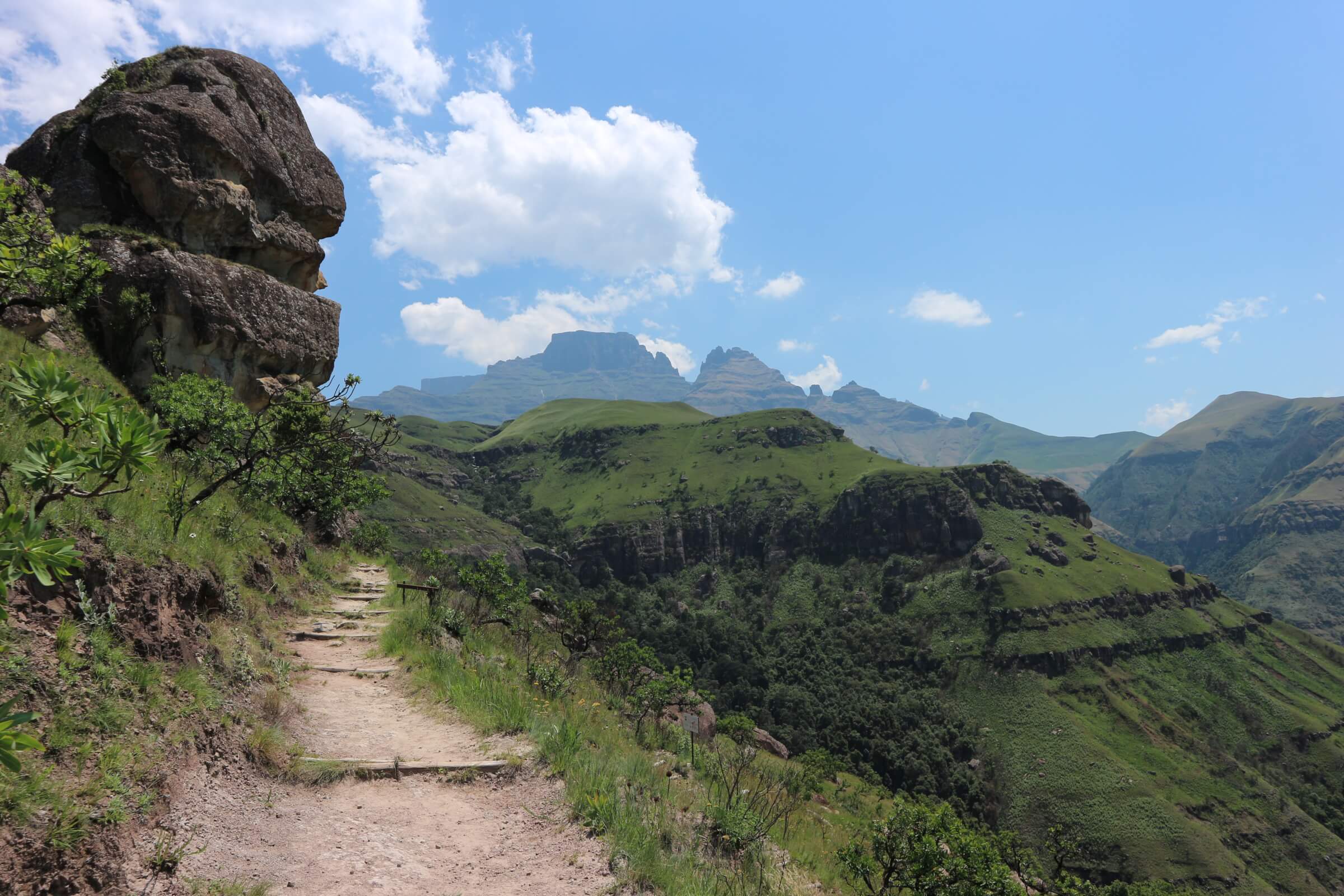
A portion of this hike has no path to follow. On the first day starting at Bushman's Nek we...
Garden Castle Nature Reserve

Rhino Peak (Thaba Ngcobo) Hike

  • Teaser Image BG: Rhino Peak Hike
  • GPX Track Map:

    GPS Track Details
    Track length: 10.03 km
    Total ascent: 1236 m
    Total descent: 59 m
    Difficulty Level: 4/5 - Hard

  • Images:
    • Image: Rhino Peak Hike
    • Image: Rhino Peak Hike
    • Image: Rhino Peak Hike
  • Content Images:
    • Image: Rhino Peak Hike
    • Image: Rhino Peak Hike
    • Image: Rhino Peak at sunset
    • Image: Rhino Peak - from Swiman Hut
  • Cave capacity: 0
  • Author Name: Drakensberg Hikes
  • Author Link: https://sahikes.com/author/drakensberg-hikes
  • Total Hike Duration: 10
  • Total Hike Distance: 20
  • Elevation Gain: 1236
  • Website: https://www.kznwildlife.com/
  • E-Mail: This email address is being protected from spambots. You need JavaScript enabled to view it.
  • Booking Logo Link: https://www.kznwildlife.com/
  • Location: -29.7126,29.1717
  • Hike Address:

    The starting point is at Garden Castle Reserve, Southern Drakensberg.

    All enquiries and bookings can be made telephonically, or by e-mail to the Ezemvelo KZN Wildlife Reservations Office:

    • Telephone: +27 (0) 33 845 1000
    • General Information: + 27 (0) 33 845 1002
    • Email: This email address is being protected from spambots. You need JavaScript enabled to view it.
  • About the area:

    The Garden Castle reserve is 35 300 hectares in extent and offers the visitor a variety of experiences. Dominated by the Rhino (a 3051m Peak which extends about 2km from the main escarpment), the area is characterized by many unusual sandstone buttresses and other formations.

  • Hike Directions:

    Starting at Garden Castle Reserve office, walk towards the gum trees to the right of the office and towards Hermits Wood Campsite. From here, follow the path up with the Mlambonja River on your right.

    You cross the Mlambonja River and climb up a short wooden ladder to the other side just before the 3km mark from the start.

    After a few hundred metres you cross the river again and then head upwards on the steepest section of the hike so far to Pillar Cave, at most this is about 1km.

    Continue along the path past Pillar Cave and in front of you is Mashai pass. The pass does not look long initially, but this is misleading as much of it is hidden in the curve to the left.

    From the river crossing after Pillar Cave things start getting more difficult. Most of the climb up the pass is east of the river and the path is difficult to follow at times. Do not walk along the riverbed, particularly on the descent and keep a lLook out for the tall rock pillars on your left, Mashai Fangs.

    Once you reach the Mashai Shelter you are at the top of the pass. From the top the path takes off across the saddle between the escarpment and the peak to your right. To reach the Rhinos Horn is a further 2 km and 150 metres in altitude. Return via the same route.

An difficult 20km hike which takes roughly 5 hours to the Rhino Peak with a total uphill of 1...
Sehlabathebe National Park

Sehlabathebe Lodge Hike

  • Teaser Title: Sehlabathebe Lodge Hike
  • Teaser Image BG: Sehlabathebe Lodge Hike
  • GPX Track Map:

    GPS Track Details
    Track length: 20.97 km
    Total ascent: 944 m
    Total descent: 283 m
    Difficulty Level: 4/5 - Hard

  • Images:
    • Image: Sehlabathebe Lodge Hike
    • Image: Sehlabathebe Lodge Hike
    • Image: Sehlabathebe Lodge Hike - Irish Cave
  • Content Images:
    • Image: Sehlabathebe Lodge Hike
    • Image: Sehlabathebe Lodge Hike
    • Image: Sehlabathebe Lodge Hike
    • Image: Sehlabathebe Lodge Hike
    • Image: Sehlabathebe Lodge Hike
    • Image: Sehlabathebe Lodge Hike
  • Cave capacity: 0
  • Author Name: SA Hikes
  • Author Link: https://sahikes.com/author/sa-hikes
  • Total Hike Duration: 16
  • Total Hike Distance: 42
  • Elevation Gain: 944
  • Website: https://www.kznwildlife.com/
  • E-Mail: This email address is being protected from spambots. You need JavaScript enabled to view it.
  • Booking Logo Link: https://www.kznwildlife.com/
  • Location: -29.8784,29.0754
  • Hike Address:

    The starting point is at Bushman's Nek Reserve, Southern Drakensberg.

    All enquiries and bookings can be made telephonically, or by e-mail to the Ezemvelo KZN Wildlife Reservations Office:

    • Telephone: +27 (0) 33 845 1000
    • General Information: + 27 (0) 33 845 1002
    • Email: This email address is being protected from spambots. You need JavaScript enabled to view it.

    Reservations for the lodge can be done through:

  • About the area:

    Bushman's Nek is the southern most part of the Maloti Drakensberg Park and incorporates the beautiful Bushman's Nek Valley. Bushman's Nek is bound to captivate your imagination and quench your thirst for outdoor adventure.

    The Sehlabathebe National Park is located in the Maloti Mountains in Qacha's Nek District, Lesotho and is part of the Maloti-Drakensberg World Heritage Site.

  • Hike Directions:

    Start your hike at the Bushmans Nek Reserve. Follow the well-marked path leading to Cedric’s Pool. This is a popular swimming spot, offering a refreshing break and stunning views. After enjoying the tranquility of Cedric’s Pool, continue your ascent towards Tarn Cave. The trail becomes more challenging as you gain elevation. Once you reach Tarn Cave, continue along the ridge, passing Irish Cave (an optional detour), a unique rock formation offering shelter.

    After Irish Cave, you'll encounter a jeep track. Follow this track, keeping the mountain range on your right. The track will lead you towards Sehlabathebe Lodge. Return via the same route.

The Bushmans Nek to Sehlabathebe Lodge hike is a challenging yet rewarding journey through the...
Dassieshoek Nature Reserve

Arangieskop Hiking Trail, Robertson

  • Teaser Image BG:
  • Images:
    • Image:
    • Image:
    • Image:
  • Total Hike Days: 0
  • Content Images:
    • Image:
    • Image:
    • Image:
    • Image:
  • Cave capacity: 0
  • Author Name: SA Hikes
  • Author Link: https://sahikes.com/author/sa-hikes
  • Total Hike Duration: 0
  • Total Hike Distance: 19
  • Elevation Gain: 0
  • Website: https://fagalavoet.co.za
  • E-Mail: This email address is being protected from spambots. You need JavaScript enabled to view it.
  • Booking Logo Link: https://sahikes.com/author/fagala-voet
  • Location: -33.753248826645695,19.884067945287732
The Wolfberg Arch, a natural wonder nestled within the rugged Cederberg Wilderness Area, is a...
Ts'ehlanyane National Park

The Litsumi Cave Trail, Maliba Lodge

  • Teaser Title: The Litsumi Cave Trail, Maliba Lodge
  • Teaser Image BG: The Litsumi Cave Trail, Maliba Lodge
  • Images:
    • Image: The Litsumi Cave Trail, Maliba Lodge
    • Image: The Litsumi Cave Trail, Maliba Lodge
    • Image: The Litsumi Cave Trail, Maliba Lodge
  • Content Images:
    • Image: The Litsumi Cave Trail, Maliba Lodge
    • Image: The Litsumi Cave Trail, Maliba Lodge
    • Image: The Litsumi Cave Trail, Maliba Lodge
    • Image: The Litsumi Cave Trail, Maliba Lodge
  • Cave capacity: 0
  • Author Name: SA Hikes
  • Author Link: https://sahikes.com/author/sa-hikes
  • Total Hike Duration: 0
  • Total Hike Distance: 9
  • Elevation Gain: 596
  • Hike map: The Litsumi Cave Trail, Maliba Lodge
  • Website: https://maliba-lodge.com/
  • E-Mail: This email address is being protected from spambots. You need JavaScript enabled to view it.
  • Booking Logo Link: https://maliba-lodge.com/
  • Location: -28.9276,28.4285
  • Hike Address:

    Your hike starts at the park entrance. There is parking next to the rangers’ offices at the gate.

  • About the area:

    The Ts'ehlanyane National Park offers a diverse range of hiking trails for adventurers of all levels. From short, leisurely walks to challenging day hikes and multi-day treks, there's something for everyone.

  • Hike Directions:

    The Litsumi Cave Trail in Tsehlanyane National Park offers a challenging 8.4km round trip hike, ascending from 1930m to 2520m above sea level. This trail starts at the park entrance, where you'll find parking near the ranger offices. Be sure to inform the rangers of your hiking plans before setting off.

    As you begin your journey, you'll pass the picnic site and enter a paddock where Basuto ponies graze. Follow the well-marked path that winds along the western side of the valley. This is the main trail to Bokong, but you'll turn off at the 3000m marker.

    Cross the river and follow a less defined path along the southern side of the valley. The trail climbs steadily for the first 600m, then crosses a stream and ascends a rocky patch. As the path fades, keep the rock waterfall in sight.

    Once you reach the waterfall, traverse the streambed for 60m. The Litsumi Cave, often home to porcupines, will be on your right, hidden behind dense vegetation. Enter with caution.

    This cave holds cultural significance for the local community, who have used it for centuries as a base for hunting activities.

The Litsumi Cave Trail in Tsehlanyane National Park is a challenging 8.4km return hike that...
Ts'ehlanyane National Park

The Circular Route, Maliba Lodge

  • Teaser Title: The Circular Route, Maliba Lodge
  • Teaser Image BG: The Circular Route, Maliba Lodge
  • Images:
    • Image: The Circular Route, Maliba Lodge
    • Image: The Circular Route, Maliba Lodge
    • Image: The Circular Route, Maliba Lodge
  • Content Images:
    • Image: The Circular Route, Maliba Lodge
    • Image: The Circular Route, Maliba Lodge
    • Image: The Circular Route, Maliba Lodge
    • Image: The Circular Route, Maliba Lodge
  • Cave capacity: 0
  • Author Name: SA Hikes
  • Author Link: https://sahikes.com/author/sa-hikes
  • Total Hike Duration: 0
  • Total Hike Distance: 13
  • Elevation Gain: 0
  • Hike map: The Litsumi Cave Trail
  • Website: https://maliba-lodge.com/
  • E-Mail: This email address is being protected from spambots. You need JavaScript enabled to view it.
  • Booking Logo Link: https://maliba-lodge.com/
  • Location: -28.9132,28.4366
  • Hike Address:

    The Circular route trail starts from the junction about 140m north of the lodge veranda, accessed off the gravel road leading to the nursery.  

  • About the area:

    The Ts'ehlanyane National Park offers a diverse range of hiking trails for adventurers of all levels. From short, leisurely walks to challenging day hikes and multi-day treks, there's something for everyone.

  • Hike Directions:

    The Maliba Circular Route is a challenging yet rewarding 13km hike that takes you through the stunning Maloti Mountains of Lesotho. Starting from the luxurious Maliba Lodge at an altitude of 2030m, the trail winds its way up to a peak of 2626m, offering breathtaking panoramic views of the surrounding valleys and mountains.

    Highlights of the hike:

    • Upper Trail to Black Pool: The trailhead starts near the lodge, leading you through diverse landscapes of mountain shrubs and grasses. You'll encounter crystal-clear streams and, eventually, the serene Black Pool, a perfect spot to rest and admire the scenery.
    • Three Cascades: As you ascend further, you'll be rewarded with the sight of the majestic Three Cascades, where water tumbles down the mountainside, creating a picturesque waterfall.  
    • Summit Crossroads: Reaching the summit, you'll find yourself at a crossroads. While the main path leads to remote villages, the circular route descends into a steep valley.
    • Ventilation Shaft: The trail takes you through a unique geological formation, the ventilation shaft, offering a glimpse into the mountain's interior.  
    • River Pool Route: The final stretch of the hike leads you back to the lodge along the scenic River Pool Route, where you can relax by the river and reflect on your adventure.  
Embark on a demanding 13km hike that ascends to a breathtaking 2626 meters above sea level....
Maloti-Drakensberg Park

Sani Mountain Escape to Thabana Ntlenyana Hike

  • Teaser Title: Sani Mountain Escape to Thabana Ntlenyana Hike
  • Teaser Image BG: Sani Mountain Escape to Thabana Ntlenyana Hike
  • GPX Track Map:

    GPS Track Details
    Track length: 34.55 km
    Total ascent: 1014 m
    Total descent: 1014 m
    Difficulty Level: 4/5 - Hard

  • Images:
    • Image: Sani Mountain Escape to Thabana Ntlenyana Hike
    • Image: Sani Mountain Escape to Thabana Ntlenyana Hike
    • Image: Sani Mountain Escape to Thabana Ntlenyana Hike
  • Content Images:
    • Image: Sani Mountain Escape to Thabana Ntlenyana Hike
    • Image: Sani Mountain Escape to Thabana Ntlenyana Hike
    • Image: Sani Mountain Escape to Thabana Ntlenyana Hike
    • Image: Sani Mountain Escape to Thabana Ntlenyana Hike
  • Cave capacity: 0
  • Author Name: SA Hikes
  • Author Link: https://sahikes.com/author/sa-hikes
  • Total Hike Duration: 0
  • Total Hike Distance: 35
  • Elevation Gain: 1014
  • Website: https://www.sanimountain.co.za/
  • E-Mail: This email address is being protected from spambots. You need JavaScript enabled to view it.
  • Booking Logo Link: https://www.sanimountain.co.za/
  • Location: -29.4682,29.2692
  • Hike Address:

    Sani Mountain Escape is perched atop the legendary Sani Pass, 2,874 meters above sea level, straddling the border between Lesotho and South Africa, just a short distance from the Lesotho border post.

  • About the area:

    Lesotho, a small, landlocked country entirely surrounded by South Africa, is often referred to as the "Kingdom in the Sky" due to its high altitude and stunning mountain scenery. Its capital, Maseru, is a vibrant city nestled amidst the dramatic Drakensberg mountain range.

    One of Lesotho's most prominent features is Thabana Ntlenyana, the highest peak in Southern Africa. At 3,482 meters (11,424 feet) above sea level, it offers breathtaking views of the surrounding landscapes. Climbing Thabana Ntlenyana is a challenging but rewarding experience, requiring physical fitness, technical climbing skills, and a love for the outdoors.

Thabana Ntlenyana is the highest mountain in Southern Africa, standing at a majestic 3,482...
Namib Naukluft National Park - Sandwich Harbour

Waterkloof Trail, Naukluft

  • Teaser Title: Waterkloof Trail, Naukluft
  • Teaser Image BG: Waterkloof Trail, Naukluft
  • GPX Track Map:

    GPS Track Details
    Track length: 15.94 km
    Total ascent: 512 m
    Total descent: 521 m
    Difficulty Level: 4/5 - Hard

  • Images:
    • Image: Waterkloof Trail, Naukluft
  • Content Images:
    • Image: Waterkloof Trail, Naukluft
    • Image: Waterkloof Trail, Naukluft
    • Image: Waterkloof Trail, Naukluft
    • Image: Waterkloof Trail, Naukluft
  • Cave capacity: 0
  • Author Name: SA Hikes
  • Author Link: https://sahikes.com/author/sa-hikes
  • Total Hike Duration: 0
  • Total Hike Distance: 17
  • Elevation Gain: 512
  • Website: https://www.nwr.com.na/resorts/naukluft-camp/
  • E-Mail: This email address is being protected from spambots. You need JavaScript enabled to view it.
  • Booking Logo Link: https://www.nwr.com.na/
  • Location: -24.2648,16.2388
  • Hike Address:

    The starting point for the Waterkloof Trail is at the Naukluft Campsite, which is located within the Namib-Naukluft National Park.

    To get to the Naukluft Campsite, you'll need to:

    • Reach Sesriem: This is the main entrance gate to the Namib-Naukluft National Park. You can reach Sesriem by car or by joining a guided tour.
    • Proceed to Naukluft Camp: Once you're inside the park, you'll need to drive to the Naukluft Campsite. This involves driving through scenic desert landscapes and potentially crossing riverbeds.
  • About the area:

    The Namib-Naukluft National Park is a vast wilderness in western Namibia, famous for its stunning landscapes and unique wildlife. It encompasses the iconic Namib Desert, the rugged Naukluft Mountains, and the pristine coastline.

    Highlights include Sossusvlei with its towering sand dunes, Sesriem Canyon, Deadvlei's haunting beauty, the Naukluft Mountains' rugged terrain, and Sandwich Harbour's unique coastal lagoon.

  • Hike Directions:

    Your adventure begins at the Naukluft Camp, a serene base camp nestled amidst the rugged beauty of the Naukluft Mountains. From here, you'll follow a well-marked trail that leads you to a refreshing spring, offering a perfect opportunity to quench your thirst and cool off.

    The trail continues its ascent, winding through pristine mountain landscapes. The path may become steeper at times, but the reward is a breathtaking summit view of the majestic Naukluft Mountains.

    After conquering the peak, you'll descend, passing by serene pools and springs. These offer a welcome respite to relax and rejuvenate before continuing your journey through a scenic gorge. The trail eventually leads back to the Naukluft Camp, concluding a memorable hiking experience.

The Waterkloof Trail, a 17km circuit, is a challenging day hike starting from the Naukluft Camp...
Namib Naukluft National Park - Sandwich Harbour

Olive Trail, Naukluft

  • Teaser Title: Olive Trail, Naukluft
  • Teaser Image BG: Olive Trail, Naukluft
  • GPX Track Map:

    GPS Track Details
    Track length: 7.99 km
    Total ascent: 427 m
    Total descent: 428 m
    Difficulty Level: 4/5 - Hard

  • Images:
    • Image: Olive Trail, Naukluft
    • Image: Olive Trail, Naukluft
  • Content Images:
    • Image: Olive Trail, Naukluft
    • Image: Olive Trail, Naukluft
  • Cave capacity: 0
  • Author Name: SA Hikes
  • Author Link: https://sahikes.com/author/sa-hikes
  • Total Hike Duration: 0
  • Total Hike Distance: 8
  • Elevation Gain: 427
  • Website: https://www.nwr.com.na/resorts/naukluft-camp/
  • E-Mail: This email address is being protected from spambots. You need JavaScript enabled to view it.
  • Booking Logo Link: https://www.nwr.com.na/
  • Location: -24.2428,16.2739
  • Hike Address:

    The starting point for the Waterkloof Trail is at the Naukluft Campsite, which is located within the Namib-Naukluft National Park.

    To get to the Naukluft Campsite, you'll need to:

    • Reach Sesriem: This is the main entrance gate to the Namib-Naukluft National Park. You can reach Sesriem by car or by joining a guided tour.
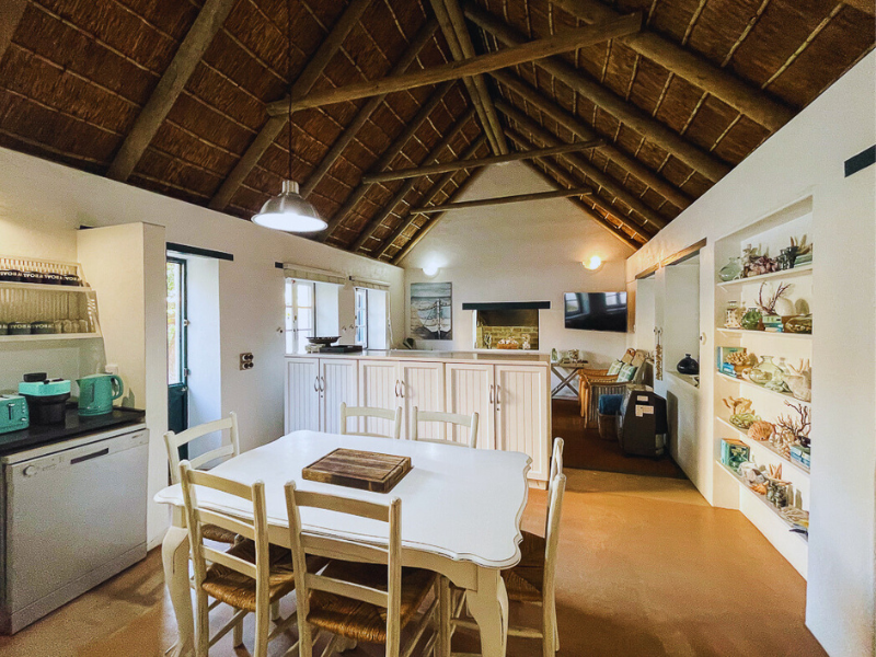
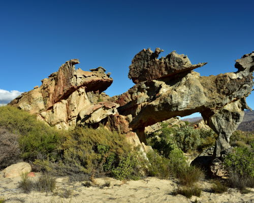
    • Proceed to Naukluft Camp: Once you're inside the park, you'll need to drive to the Naukluft Campsite. This involves driving through scenic desert landscapes and potentially crossing riverbeds.
  • About the area:

    The Namib-Naukluft National Park is a vast wilderness in western Namibia, famous for its stunning landscapes and unique wildlife. It encompasses the iconic Namib Desert, the rugged Naukluft Mountains, and the pristine coastline.

    Highlights include Sossusvlei with its towering sand dunes, Sesriem Canyon, Deadvlei's haunting beauty, the Naukluft Mountains' rugged terrain, and Sandwich Harbour's unique coastal lagoon.

  • Hike Directions:

    Initial Ascent: Begin the hike with a steep climb of 2.2km, gaining 330 meters in elevation. This will lead you to a plateau with stunning panoramic views of the surrounding landscape.

    Plateau Traverse: After enjoying the views, continue along the plateau for about 400 meters.

    Descending into the Canyon: The trail then descends into a dry riverbed. The terrain becomes increasingly rocky and challenging as you navigate through the canyon.

    The Chain Section: One of the most challenging parts of the hike involves a steep descent aided by chains. Be cautious and take your time.

    The Pool: After the challenging descent, you'll reach a beautiful, crystal-clear pool, a perfect spot to rest and rejuvenate.

    Return Journey: Retrace your steps back to the trailhead, taking in the stunning scenery and challenging terrain once more.

The Olive Trail, a 10km loop hike in Namibia's Namib-Naukluft National Park, offers a...
Hikes outside a reserve (Namibia)

Nyae Nyae Bushman Hiking Safari

  • Teaser Title: Nyae Nyae Bushman Hiking Safari
  • Teaser Image BG: Nyae Nyae Bushman Hiking Safari
  • Images:
    • Image: Nyae Nyae Bushman Hiking Safari
    • Image: Nyae Nyae Bushman Hiking Safari
  • Total Hike Days: 0
  • Content Images:
    • Image: Nyae Nyae Bushman Hiking Safari
    • Image: Nyae Nyae Bushman Hiking Safari
    • Image: Nyae Nyae Bushman Hiking Safari
    • Image: Nyae Nyae Bushman Hiking Safari
  • Cave capacity: 0
  • Author Name: Fagala Voet
  • Author Link: https://sahikes.com/author/fagala-voet
  • Total Hike Duration: 0
  • Total Hike Distance: 91
  • Elevation Gain: 0
  • Website: https://fagalavoet.co.za/nyae-naye-hiking-safari/
  • E-Mail: This email address is being protected from spambots. You need JavaScript enabled to view it.
  • Booking Logo Link: https://sahikes.com/author/fagala-voet
  • Location: -19.601496724329362,20.495185392079172
  • Hike Address:

    Tsumkwe Country Lodge is located in Tsumkwe, Namibia.

  • About the area:

    Tsumkwe is a small town located in the Otjozondjupa Region of northeastern Namibia. It's known for its rich cultural heritage, particularly its connection to the San people, often referred to as the Bushmen.

    The area surrounding Tsumkwe is characterized by arid landscapes, rocky outcrops, and vast open plains. It's a remote and pristine environment, offering unique opportunities for wildlife viewing, cultural experiences, and outdoor adventures. The Nyae Nyae Conservancy, a significant conservation area, is located near Tsumkwe and is home to diverse wildlife, including desert-adapted elephants and various bird species.

  • Hike Directions:

    Check into Tsumkwe Country Lodge from 2 PM onwards. Settle into your tented accommodation for the night. While alcoholic beverages aren't included in the package, you can purchase them at the lodge. Drinking water will be provided throughout the hike.

    Join the 6 PM briefing session with experienced guides from WWS, followed by a delicious dinner.

    Day 1: Into the Nyae Nyae

    Wake up at 5:30 AM, enjoy a quick coffee and rusks, and embark on your 25-kilometer hike. The day will be filled with stunning landscapes, including a unique baobab tree. You'll camp at Makuri Community Campsite, a comfortable setup with tents, toilets, showers, and a dining area.

    Day 2: Crossing the Aotcha Pan

    Another early start at 5:30 AM, followed by breakfast. Hike approximately 23 kilometers, crossing the vast Aotcha Pan. Camp under the shade of a majestic baobab tree, enjoying the peace and tranquility of the desert night.

    Day 3: To the Nyae Nyae Pan

    Wake up at 5:30 AM for another 23-kilometer hike. The day will take you past the Hippo Pools, offering unique wildlife sightings. Camp next to the Nyae Nyae Pan, a stunning natural wonder.

    Day 4: The Final Stretch

    Embark on the final 20-kilometer hike, returning to Tsumkwe Country Lodge. Relax by the pool, and later, experience the rich culture of the region with a visit to the oldest baobab tree.

The Nyae Nyae Bushman Hiking Safari is a 4-day, fully catered hiking adventure that takes you...
|Ai-|Ais/Richtersveld Transfrontier Park - Namibia

Fish River Canyon Hiking Trail

  • Teaser Title: Fish River Canyon Hiking Trail
  • Teaser Image BG: Fish River Canyon Hiking Trail
  • Images:
    • Image: Fish River Canyon Hiking Trail
    • Image: Fish River Canyon Hiking Trail
    • Image: Fish River Canyon Hiking Trail
    • Image: Fish River Canyon Hiking Trail
    • Image: Fish River Canyon Hiking Trail
    • Image: Fish River Canyon Hiking Trail
    • Image: Fish River Canyon Hiking Trail
    • Image: Fish River Canyon Hiking Trail
  • Content Images:
    • Image: Fish River Canyon Hiking Trail
    • Image: Fish River Canyon Hiking Trail
    • Image: Fish River Canyon Hiking Trail
    • Image: Fish River Canyon Hiking Trail
  • Cave capacity: 0
  • Author Name: Fagala Voet
  • Author Link: https://sahikes.com/author/fagala-voet
  • Total Hike Duration: 0
  • Total Hike Distance: 86
  • Elevation Gain: 0
  • Website: https://fagalavoet.co.za/fish-river-canyon-hiking-trail/
  • E-Mail: This email address is being protected from spambots. You need JavaScript enabled to view it.
  • Booking Logo Link: https://sahikes.com/author/fagala-voet
  • Location: -27.5779,17.6060
  • Hike Address:

    Hobas Viewpoint is located within the Ai-Ais Richtersveld Transfrontier Park in Namibia. It's approximately 12 kilometers from Hobas Campsite.

  • About the area:

    The Fish River Canyon is a geological wonder, renowned for its sheer size and dramatic beauty. It's the largest canyon in Africa, stretching over 160 kilometers long, up to 27 kilometers wide, and plunging to depths of nearly 550 meters.

    Key Features:

    • Immense Scale: The canyon's sheer size and depth create a breathtaking spectacle.
    • Ancient Landscape: The canyon's formation dates back millions of years, offering a glimpse into Earth's geological history.
    • Diverse Terrain: The trail traverses a variety of landscapes, including steep cliffs, sandy plains, and rocky outcrops.
    • Wildlife: The canyon is home to a diverse range of wildlife, including oryx, baboons, and various bird species.
  • Hike Directions:

    A 5-Day Itinerary for the Fish River Canyon Hike

    Day 1: Descent into the Canyon's Depths

    Your adventure begins with a steep descent into the canyon. The initial trail is challenging, with rocky terrain and switchbacks. As you descend, the canyon walls rise majestically on either side, offering breathtaking views. Once you reach the canyon floor, you'll be rewarded with a stunning landscape of sandy beaches, clear pools, and towering cliffs. Find a suitable campsite near a water source and rest for the night.

    Day 2: A Scenic Hike Along the Riverbed

    Wake up to the sound of the river flowing nearby. Today's hike follows the riverbed, offering a mix of easy walking and more challenging sections with rocky terrain and sand dunes. Keep an eye out for wildlife, such as oryx, baboons, and various bird species. As the day progresses, the landscape becomes more arid, with towering cliffs and expansive sand dunes. Find a suitable campsite near a water source or a dry riverbed.

    Day 3: Navigating the Canyon's Heart

    Today's hike is a mix of challenging terrain and stunning scenery. You'll encounter steep ascents and descents, narrow canyons, and expansive plains. The landscape is characterized by unique rock formations, deep gorges, and dramatic cliffs. As you progress, the canyon walls grow higher and the views become more spectacular. Find a suitable campsite for the night, taking into account water availability and the terrain.

    Day 4: A Challenging Day with Rewarding Views

    The fourth day is one of the most challenging of the hike. You'll encounter steep ascents, loose rock, and exposed ridges. However, the effort is rewarded with breathtaking panoramic views of the canyon. As you gain elevation, the landscape opens up, revealing vast expanses of desert and distant mountain ranges. Find a suitable campsite for the night, taking into account water availability and the terrain.

    Day 5: The Final Push to the Rim

    The final day of the hike involves a gradual ascent to the canyon rim. The terrain is less challenging than the previous days, allowing you to enjoy the scenery and reflect on your adventure. As you reach the rim, you'll be rewarded with stunning panoramic views of the canyon. Take a moment to appreciate the incredible journey you've completed. From the rim, you can hike back to the trailhead or arrange for a shuttle to transport you back to the starting point.

The Fish River Canyon, Namibia's grandest natural wonder, is a sight to behold. Its sheer scale...
Hikes outside a reserve (Namibia)

Khomas Hochland Hiking Trail

  • Teaser Title: Khomas Hochland
Hiking Trail
  • Teaser Image BG: Khomas Hochland
Hiking Trail
  • GPX Track Map:

    GPS Track Details
    Track length: 89.29 km
    Total ascent: 1694 m
    Total descent: 1694 m
    Difficulty Level: 4/5 - Hard

  • Images:
    • Image: Khomas Hochland Hiking Trail
    • Image: Khomas Hochland
Hiking Trail
    • Image: Khomas Hochland
Hiking Trail
    • Image: Khomas Hochland
Hiking Trail
    • Image: Khomas Hochland
Hiking Trail
    • Image: Khomas Hochland
Hiking Trail
  • Total Hike Days: 0
  • Content Images:
    • Image: Khomas Hochland
Hiking Trail
    • Image: Khomas Hochland
Hiking Trail
    • Image: Khomas Hochland
Hiking Trail
    • Image: Khomas Hochland
Hiking Trail
  • Cave capacity: 0
  • Author Name: SA Hikes
  • Author Link: https://sahikes.com/author/sa-hikes
  • Total Hike Duration: 0
  • Total Hike Distance: 90
  • Elevation Gain: 1694
  • Website: https://www.hikenamibia.com/
  • E-Mail: This email address is being protected from spambots. You need JavaScript enabled to view it.
  • Booking Logo Link: https://www.hikenamibia.com/
  • Location: -22.2693,16.9017
  • Hike Address:

    Duesternbrook Safari Guest Farm. 45 min from Windhoek on the new highway A1 direction Etosha, exit D1499/Okapuka.

  • About the area:

    The Khomas Hochland region of Namibia is a captivating tapestry woven with diverse landscapes, unique wildlife, and a rich cultural heritage.

    This central Namibian plateau, rising between 1700 and 2000 meters above sea level, offers a stunning array of experiences for nature lovers and cultural enthusiasts alike.  

  • Hike Directions:

    Day 1: Duesternbrook Safari Guest Farm to Otjiseva Campsite (16 km, Tough)

    Embark on a challenging trek from Duesternbrook, following the picturesque Otjiseva River. Traverse the rugged Bosveld, passing iconic landmarks like the Big Fig Tree and the enigmatic Klipmerk Gate. Navigate narrow kloofs and ascend to Toktokkie Track Rest, rewarded with breathtaking vistas. Conclude your day at the serene Gustav Posten, a wilderness haven.

    Day 2: Otjiseva to Onduno Campsite (9 km, Relax)

    Ascend the formidable Klippekou Klim, reaching the Onduno farm border. Relax at the Red Rock Lizard Rest waterfall and Partridge Pool, observing diverse birdlife. After a farm visit, descend into a vibrant riverbed teeming with wildlife. End your day at a tranquil campsite nestled beneath Baboon Mountain.

    Day 3: Onduno to Godeis Campsite (23 km, Tough)

    Brace yourself for a demanding day with long distances and significant elevation changes. Traverse expansive grasslands, cross the Godeis border, and descend into the awe-inspiring Bird Nest Gorge. Encounter thrilling wildlife, including a python and a Black Mamba, adding excitement to your journey. Conclude your day with a breathtaking sunset at the Godeis campsite.

    Day 4: Godeis to Onduno Campsite (16 km, Moderate)

    Return to Onduno via a different route, exploring the captivating Otjompaue River valley. Pass ancient San sites, the dramatic Baboon Bar Gorge, and enjoy stunning panoramic views. End your day at the familiar campsite.

    Day 5: Onduno to Monte Christo Tree House (17 km, Tough)

    Conquer Grandpa's Path, offering panoramic views of Windhoek. Experience the thrill of descending a 5-ladder waterfall. Culminate your day at the extraordinary Monte Christo Tree House, a unique and luxurious accommodation.

    Day 6: Monte Christo to Duesternbrook Safari Guest Farm (14 km, Relax)

    Enjoy a leisurely walk along the Otjiseva River, immersing yourself in serene landscapes and diverse wildlife. Conclude your unforgettable hiking adventure at your starting point, Duesternbrook Safari Guest Farm.

The Khomas Hochland Hiking Trail is a multi-day trek through the rugged and picturesque...
Namib Naukluft National Park - Sandwich Harbour

The Namib100 Hike

  • Teaser Title: The Namib100 Hike
  • Teaser Image BG: The Namib100 Hike
  • Images:
    • Image: The Namib100 Hike
    • Image: The Namib100 Hike
    • Image: The Namib100 Hike
    • Image: The Namib100 Hike
    • Image: The Namib100 Hike
  • Content Images:
    • Image: The Namib100 Hike
    • Image: The Namib100 Hike
    • Image: The Namib100 Hike
    • Image: The Namib100 Hike
  • Cave capacity: 0
  • Author Name: Fagala Voet
  • Author Link: https://sahikes.com/author/fagala-voet
  • Total Hike Duration: 0
  • Total Hike Distance: 100
  • Elevation Gain: 0
  • Website: https://fagalavoet.co.za/namib100-hike/
  • E-Mail: This email address is being protected from spambots. You need JavaScript enabled to view it.
  • Booking Logo Link: https://sahikes.com/author/fagala-voet
  • Location: -23.149068124086465,14.444150873832864
  • Hike Address:

    Dolphins Coffee Shop is located at the corner of Esplanade and 90 Atlantic Street in Walvis Bay, Namibia.

  • About the area:

    Walvis Bay is a coastal town in Namibia, known for its stunning natural beauty, rich history, and proximity to the vast Namib-Naukluft National Park. It serves as a popular gateway for visitors exploring the desert, offering a range of activities and attractions.

    Namib-Naukluft National Park is one of the largest conservation areas in the world, encompassing a vast expanse of desert, mountains, and coastline. It's renowned for its otherworldly landscapes, unique wildlife, and extreme conditions.

  • Hike Directions:

    Arrive in Walvis Bay

    Welcome Dinner & Briefing: Join fellow adventurers for a communal dinner and briefing session at Dolphins Coffee Shop.

    Day 1: Sandwich Harbour's Natural Wonders

    • Distance: 22-23 km
    • Elevation Gain: 411 m
    • Highlights: Explore the stunning Sandwich Harbour, a Ramsar wetland teeming with diverse birdlife and marine life.

    Day 2: The Rugged Coastline & Shipwreck

    • Distance: 23-24 km
    • Elevation Gain: 72 m
    • Highlights: Trek along the dramatic coastline, passing massive seal colonies and the eerie wreck of the Shawnee.

    Day 3: Coastal Serenity & Ancient Seashells

    • Distance: 20-21 km
    • Elevation Gain: 258 m
    • Highlights: Wander along the pristine shoreline, marveling at ancient oyster shells and whale bones. Connect with nature and rejuvenate your senses.

    Day 4: The Namib Desert's Intricate Beauty

    • Distance: 19-20 km
    • Elevation Gain: 95 m
    • Highlights: Discover a different side of the Namib Desert, exploring a gritty plain teeming with unique flora and fauna. Camp near the ruins of an old mining settlement.

    Day 5: Salt Pans, Shipwrecks, & the Hike's End

    • Distance: 13-14 km
    • Elevation Gain: 113 m
    • Highlights: Traverse pink salt pans and ancient ocean floors, catching glimpses of the Eduard Bohlen shipwreck. Celebrate the end of your adventure with a glass of bubbly.

    Day 6: Departure

    • Transfer to Airport: Relax and reflect on your incredible journey as you're transferred to the Walvis Bay Airport.
Forget Ordinary Hikes. Conquer the Namib100. The Namib100 isn't your...
Namib Naukluft National Park - Sandwich Harbour

The Kuiseb90 Hike

  • Teaser Title: The Kuiseb90 Hike
  • Teaser Image BG: The Kuiseb90 Hike
  • Images:
    • Image: The Kuiseb90 Hike
    • Image: The Kuiseb90 Hike
    • Image: The Kuiseb90 Hike
    • Image: The Kuiseb90 Hike
  • Content Images:
    • Image: The Kuiseb90 Hike
    • Image: The Kuiseb90 Hike
    • Image: The Kuiseb90 Hike
    • Image: The Kuiseb90 Hike
  • Cave capacity: 0
  • Author Name: Fagala Voet
  • Author Link: https://sahikes.com/author/fagala-voet
  • Total Hike Duration: 0
  • Total Hike Distance: 90
  • Elevation Gain: 0
  • Website: https://fagalavoet.co.za/kuiseb90-hike/
  • E-Mail: This email address is being protected from spambots. You need JavaScript enabled to view it.
  • Booking Logo Link: https://sahikes.com/author/fagala-voet
  • Location: -23.56131358658342,15.041228760562214
  • Hike Address:

    On day one after travelling from Walvis Bay you start at the Gobabeb Namib Research Institute, often simply referred to as Gobabeb. It is a renowned center for dryland research and training located in the heart of the Namib Desert, approximately 120 kilometers southeast of Walvis Bay, Namibia.

  • About the area:

    The Namib-Naukluft National Park is a vast wilderness in western Namibia, famous for its stunning landscapes and unique wildlife. It encompasses the iconic Namib Desert, the rugged Naukluft Mountains, and the pristine coastline.

    Highlights include Sossusvlei with its towering sand dunes, Sesriem Canyon, Deadvlei's haunting beauty, the Naukluft Mountains' rugged terrain, and Sandwich Harbour's unique coastal lagoon.

  • Hike Directions:

    The Kuiseb90: A Journey into the Heart of the Namib

    Day 1: Arrival and Desert Oasis

    Your Namibian adventure begins with a scenic transfer from Walvis Bay to the Gobabeb Namib Research Institute. As you journey through diverse landscapes, including rugged mountains and ancient dunes, you'll feel a growing sense of anticipation.

    Upon arrival at Gobabeb, a world-renowned research center, you'll have the unique opportunity to immerse yourself in the heart of the Namib Desert. This evening, gather with fellow hikers for a pre-trek briefing and a delicious communal dinner under the starlit sky.

    • Overnight: Gobabeb Namib Research Institute

    Day 2: A Gentle Start

    Embark on your first hike, gradually acclimatizing to the desert environment. As you walk towards the escarpment, you'll be captivated by the vast expanse of the Kuiseb Canyon. Set up camp amidst stunning red dunes, enjoying panoramic views and a peaceful night under the stars.

    • Distance: 5-8 km
    • Difficulty: Easy to Moderate

    Day 3: Descent into the Canyon

    Descend into the heart of the Kuiseb Canyon, following ancient animal trails. Traverse the canyon floor, encountering pristine water pools and diverse wildlife. As you ascend back to the escarpment, you'll be rewarded with breathtaking views.

    • Distance: 25 km
    • Difficulty: Moderate to Challenging

    Day 4: Deeper into the Canyon

    Continue your exploration of the canyon's depths, witnessing towering cliffs and unique rock formations. Keep an eye out for leopard tracks and other desert wildlife. Camp overnight within the canyon, immersing yourself in the serene wilderness.

    • Distance: 17 km
    • Difficulty: Moderate

    Day 5: Scenic Highs

    Ascend to a high point, offering panoramic vistas of the canyon and surrounding desert. Encounter the ancient Welwitschia plant, a unique desert survivor. Explore a lesser-known canyon with dramatic rock formations.

    • Distance: 17 km
    • Difficulty: Moderate

    Day 6: Farewell to the Canyon

    Hike through the final stretch of the canyon, savoring the last moments. Celebrate your accomplishment with a certificate presentation and a final dinner under the stars.

    • Distance: 19 km
    • Difficulty: Moderate

    Day 7: Departure

    Enjoy a final breakfast in the canyon before transferring back to Walvis Bay.

Experience the Kuiseb90 Pristine. Untouched. Unspoiled. Untamed. The Kuiseb90...
Krantzkloof Nature Reserve

Krantzkloof Nature Reserve Trails

  • GPX Track Map:

    GPS Track Details
    Track length: 39.44 km
    Total ascent: 1858 m
    Total descent: 1821 m
    Difficulty Level: 3/5 - Medium

  • Images:
    • Image:
    • Image:
    • Image:
  • Content Images:
    • Image:
    • Image:
    • Image:
    • Image:
    • Image:
    • Image:
  • Cave capacity: 0
  • Author Name: SA Hikes
  • Author Link: https://sahikes.com/author/sa-hikes
  • Total Hike Duration: 0
  • Total Hike Distance: 0
  • Elevation Gain: 0
  • Website: https://fagalavoet.co.za
  • E-Mail: This email address is being protected from spambots. You need JavaScript enabled to view it.
  • Booking Logo Link: https://sahikes.com/author/fagala-voet
  • Location: -29.8784,29.0754
  • Hike Address:

    All enquiries and bookings can be made telephonically, or by e-mail to the Ezemvelo KZN Wildlife Reservations Office:

    • Telephone: +27 (0) 33 845 1000
    • General Information: + 27 (0) 33 845 1002
    • Email: This email address is being protected from spambots. You need JavaScript enabled to view it.
  • Hike Directions:

    Kloof Falls via Molweni Trail:Difficulty: Moderate  
    Distance: 1.8 miles (2.9 km)  
    Highlights: This trail leads you through lush indigenous forests, across the Molweni River, and up to the stunning Kloof Falls.  
    Long Shadow - Molweni Falls:Difficulty: Moderate  
    Distance: 1.8 miles (2.9 km)  
    Highlights: A scenic trail that offers breathtaking views of the Molweni Gorge and the majestic Molweni Falls.  
    Mpithi Falls:Difficulty: Moderate  
    Distance: 1.3 miles (2.1 km)  
    Highlights: This trail takes you to the beautiful Mpithi Falls, where you can relax and enjoy the serene surroundings.
    Beacon Trail:Difficulty: Moderate  
    Distance: 4.3 miles (6.9 km)  
    Highlights: A longer trail that offers panoramic views of the surrounding valleys and mountains.
    Krantzkloof Loop:Difficulty: Moderate  
    Distance: 6.9 miles (11.1 km)
    Highlights: A challenging trail that takes you through diverse landscapes, including forests, grasslands, and rocky outcrops.

Golden Gate Highlands National Park

Rhebok / Ribbok Hiking Trail

  • Teaser Title: A two-day trail, which involves trekking up to the highest point in the park, Generaalskop.
  • Teaser Image BG: Rhebok / Ribbok Hiking Trail
  • GPX Track Map:

    GPS Track Details
    Track length: 27.56 km
    Total ascent: 1196 m
    Total descent: 1197 m
    Difficulty Level: 4/5 - Hard

  • Images:
    • Image: Wodehouse from Generaalskop.jpg#joomlaImage://local-images/hikes/wodehouse-from-generaalskop
    • Image: Ribboks Peak
    • Image: Ribbok Hut
  • Content Images:
    • Image: Rhebok / Ribbok Hiking Trail
    • Image: Rhebok / Ribbok Hiking Trail
    • Image: Rhebok / Ribbok Hiking Trail
    • Image: Ribbok Hut
  • Cave capacity: 0
  • Author Name: Falko Buschke
  • Author Link: https://sahikes.com/author/falko-buschke
  • Total Hike Duration: 14
  • Total Hike Distance: 28
  • Elevation Gain: 1129
  • Website: https://www.sanparks.org/parks/golden-gate-highlands/what-to-do/activities/hikes-walks-trails
  • E-Mail: This email address is being protected from spambots. You need JavaScript enabled to view it.
  • Booking Logo Link: https://www.sanparks.org/parks/golden-gate-highlands/what-to-do/activities/hikes-walks-trails
  • Location: -28.5059,28.6183
  • Hike Address:

    Golden Gate Highlands National Park, Free State

  • About the area:

    Golden Gate Highlands National Park is secretly tucked away in the rolling foothills of the Maluti Mountains and surrounded by breathtaking scenery of wildlife and lush vegetation.

    The Golden Gate National Park is a Free State Nature Reserve in South Africa, located in the north eastern part of Free State and derives its name from the brilliant shades of gold cast by the sun on the sandstone cliffs, especially the imposing Brandwag rock. The area is famous for its captivating scenery, invigorating climate and the accommodation offered in hotel rooms, rondavels (round huts) and self-catering chalets.

  • Hike Directions:

    The two-day trail, which involves trekking up to the highest point in the park (Generaalskop), gives one a wonderful way to see the park, including some of the best views out over Mont-aux-Sources and the Malutis.

    DAY ONE

    Day one is 14 km to the overnight Rhebok Hut – get an early start as, especially in summer, the days can be very hot and afternoons invariably produce an electric storm. The trail starts with a climb up Brandwag and past some of the best sandstone cliff formations in the province. The trail evens out past rock pools perfect for swimming (do not tarry too long) and through grasslands, when it descends to the overnight hut.

    DAY TWO

    Day two is 14 km and is a difficult walk, taking up to 8 hours to complete. The start includes heading up a waterfall to where the trail heads up generaalskop with some steep sections (not great to do in the heat of the day but pack clothing for any eventuality, as weather in the mountains is unpredictable). After the ascent, there is the descent (very steep in places) before venturing down a rather picturesque kloof and down to glen Reenen (hot showers all round).

The Ribbok Trail is the flagship trail in Golden Gate. The route, which covers a horizontal...
Golden Gate Highlands National Park

Wodehouse Peak Hike

  • Teaser Title: The 11km circular trail is perhaps the best, most accessible route in Golden Gate.
  • Teaser Image BG: Wodehouse Peak Hike
  • GPX Track Map:

    GPS Track Details
    Track length: 10.70 km
    Total ascent: 690 m
    Total descent: 690 m
    Difficulty Level: 4/5 - Hard

  • Images:
    • Image: Wodehouse from Generaalskop
    • Image: Wodehouse Sign
    • Image: Wodehouse Peak Hike
  • Cave capacity: 0
  • Author Name: Falko Buschke
  • Author Link: https://sahikes.com/author/falko-buschke
  • Total Hike Duration: 5
  • Total Hike Distance: 11
  • Elevation Gain: 690
  • Website: https://www.sanparks.org/parks/golden-gate-highlands/what-to-do/activities/hikes-walks-trails
  • E-Mail: This email address is being protected from spambots. You need JavaScript enabled to view it.
  • Booking Logo Link: https://www.sanparks.org/parks/golden-gate-highlands/what-to-do/activities/hikes-walks-trails
  • Location: -28.5060,28.6184
  • Hike Address:

    Golden Gate Highlands National Park, Free State

  • About the area:

    Golden Gate Highlands National Park is secretly tucked away in the rolling foothills of the Maluti Mountains and surrounded by breathtaking scenery of wildlife and lush vegetation.

    The Golden Gate National Park is a Free State Nature Reserve in South Africa, located in the north eastern part of Free State and derives its name from the brilliant shades of gold cast by the sun on the sandstone cliffs, especially the imposing Brandwag rock. The area is famous for its captivating scenery, invigorating climate and the accommodation offered in hotel rooms, rondavels (round huts) and self-catering chalets.

  • Hike Directions:

    The 11km circular trail is perhaps the best, most accessible route in Golden Gate for more ambitious hikers because it has a clearly marked path and also includes both the Brandwag Buttress and Mushroom Rock routes. A brisk pace will have you finish the hike in 4 hours although this time may vary based on you fitness levels and the time taken to view the scenery.

    From the ridge towards Wodehouse Peak, one has a spectacular view of the Glen Reenen Rest Camp in the valley below. It is also breathtaking to see the sandstone tops of Mushroom Rock, Brandwag Buttress, Boskloof  and Echo Ravine almost 500 m below. Wodehouse Peak is an excellent stepping stone for the hiker who wants a bit more adventure than the short hour-walks can offer but doesn’t want to tackle the longer, more intimidating Ribbok Trail.

    The GPS Track shows an old route taken on the easternmost part of the trail. The recommended trail is visible on Google Maps. The old trail still seems visible from aerial images, but is now probably only a game path. The recommended route is to go straight up instead of following the ridgeline.

Wodehouse Peak was named after 
Golden Gate Highlands National Park

Cathedral Cave Hike

  • Teaser Image BG: Cathedral Cave - Photo credit: Lauren
  • Images:
    • Image: Cathedral Cave - Photo credit: Lauren
    • Image: Cathedral Cave - Photo credit: The Travel Info Blogger
    • Image: Cathedral Cave
  • Total Hike Days: 0
  • Cave capacity: 0
  • Author Name: SA Hikes
  • Author Link: https://sahikes.com/author/sa-hikes
  • Total Hike Duration: 4
  • Total Hike Distance: 6
  • Elevation Gain: 100
  • Website: https://www.sanparks.org/parks/golden-gate-highlands/what-to-do/activities/hikes-walks-trails
  • E-Mail: This email address is being protected from spambots. You need JavaScript enabled to view it.
  • Booking Logo Link: https://www.sanparks.org/parks/golden-gate-highlands/what-to-do/activities/hikes-walks-trails
  • Location: -28.5060,28.6184
  • Hike Address:

    Golden Gate Highlands National Park, Free State

  • About the area:

    Golden Gate Highlands National Park is secretly tucked away in the rolling foothills of the Maluti Mountains and surrounded by breathtaking scenery of wildlife and lush vegetation.

    The Golden Gate National Park is a Free State Nature Reserve in South Africa, located in the north eastern part of Free State and derives its name from the brilliant shades of gold cast by the sun on the sandstone cliffs, especially the imposing Brandwag rock. The area is famous for its captivating scenery, invigorating climate and the accommodation offered in hotel rooms, rondavels (round huts) and self-catering chalets.

  • Hike Directions:

    A 3 km walk outbound with an elevation gain of about 100 m and a 3 km return.

About the Cathedral Cave Hike The Cathedral Cave Hike is a guided day walk in Golden...