Wodehouse from Generaalskop
Wodehouse Sign
Wodehouse Sign
Wodehouse Peak Hike
Wodehouse Peak Hike

About Wodehouse Peak Hike

Wodehouse Peak was named after Sir Philip Edmond Wodehouse, the Governer of the Cape Coloney in the 19th century. Wodehouse’s negotiations ended the conflict and the Boers and the Basotho the beacon on Wodehouse Peak (2 438 m) marked the original border between the Orange Free State and Basotholand.

Hike Directions

The 11km circular trail is perhaps the best, most accessible route in Golden Gate for more ambitious hikers because it has a clearly marked path and also includes both the Brandwag Buttress and Mushroom Rock routes. A brisk pace will have you finish the hike in 4 hours although this time may vary based on you fitness levels and the time taken to view the scenery.

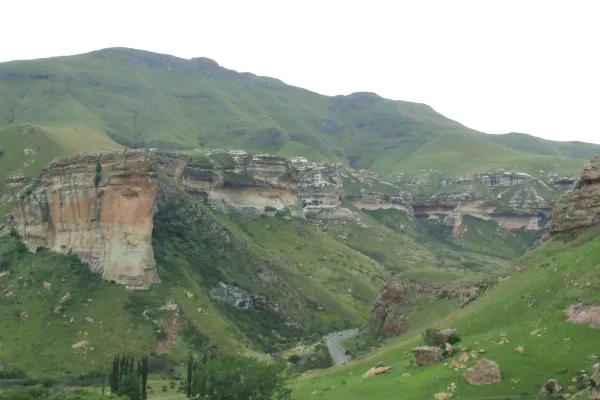
From the ridge towards Wodehouse Peak, one has a spectacular view of the Glen Reenen Rest Camp in the valley below. It is also breathtaking to see the sandstone tops of Mushroom Rock, Brandwag Buttress, Boskloof  and Echo Ravine almost 500 m below. Wodehouse Peak is an excellent stepping stone for the hiker who wants a bit more adventure than the short hour-walks can offer but doesn’t want to tackle the longer, more intimidating Ribbok Trail.

The GPS Track shows an old route taken on the easternmost part of the trail. The recommended trail is visible on Google Maps. The old trail still seems visible from aerial images, but is now probably only a game path. The recommended route is to go straight up instead of following the ridgeline.

About the area

Golden Gate Highlands National Park is secretly tucked away in the rolling foothills of the Maluti Mountains and surrounded by breathtaking scenery of wildlife and lush vegetation.

The Golden Gate National Park is a Free State Nature Reserve in South Africa, located in the north eastern part of Free State and derives its name from the brilliant shades of gold cast by the sun on the sandstone cliffs, especially the imposing Brandwag rock. The area is famous for its captivating scenery, invigorating climate and the accommodation offered in hotel rooms, rondavels (round huts) and self-catering chalets.

Address & Contact details

Golden Gate Highlands National Park, Free State

Email: This email address is being protected from spambots. You need JavaScript enabled to view it.

Track Map

GPS Track Details
Track length: 10.70 km
Total ascent: 690 m
Total descent: 690 m
Difficulty Level: 4/5 - Hard

Location Map