Reserves in Southern Africa - SA Hikes

Difficulty Level of Hikes
Drakensberg Amphitheatre

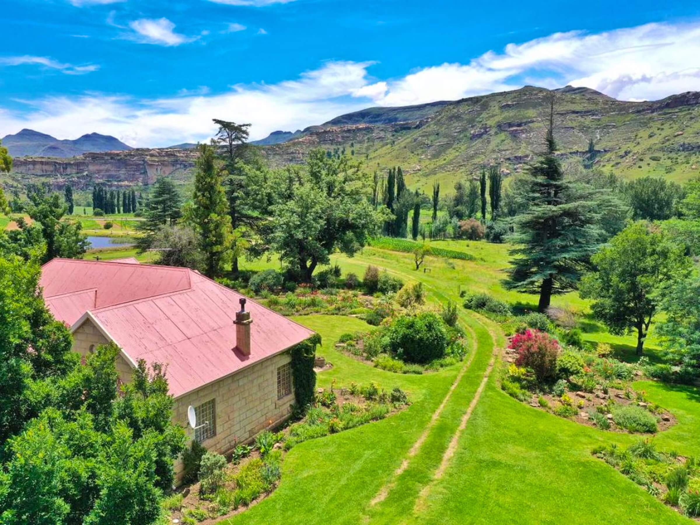
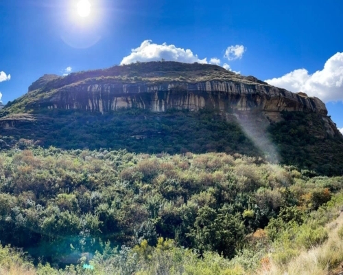
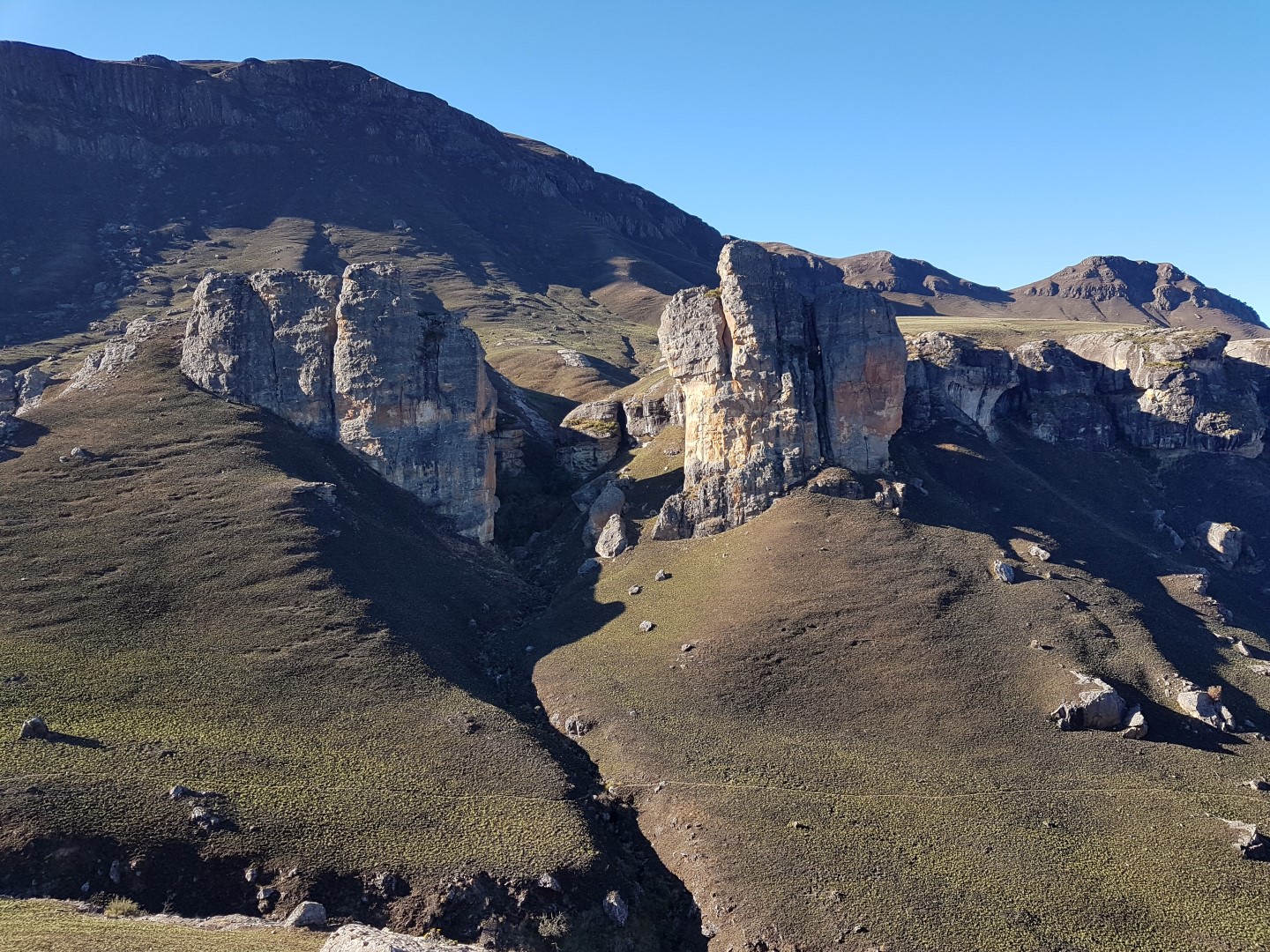
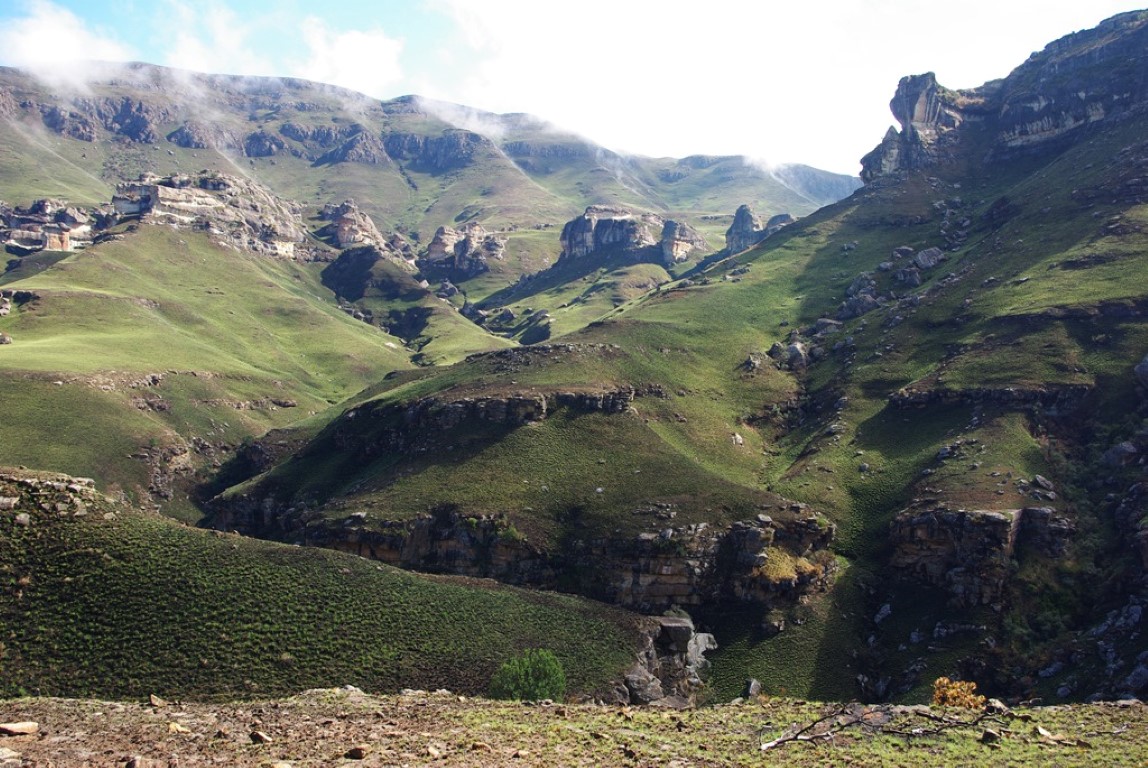
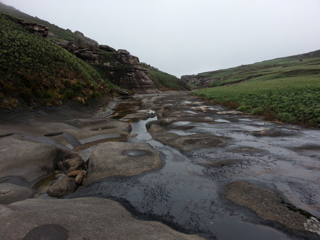
Witsieshoek Lodge to Gudu Falls

  • Teaser Title: Beautiful swimming pools await
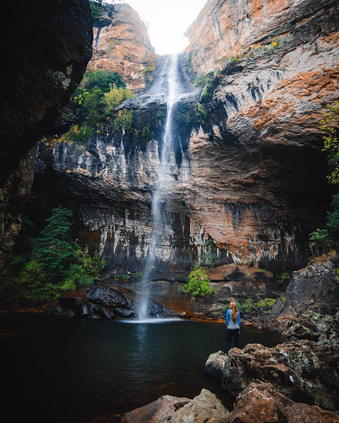
  • Teaser Image BG: Gudu Falls
  • GPX Track Map:

    GPS Track Details
    Track length: 3.61 km
    Total ascent: 0 m
    Total descent: 263 m
    Difficulty Level: 3/5 - Medium

  • Images:
    • Image: Gudu Falls
    • Image: Gudu Falls
    • Image: du Pass Gudu Falls
  • Content Images:
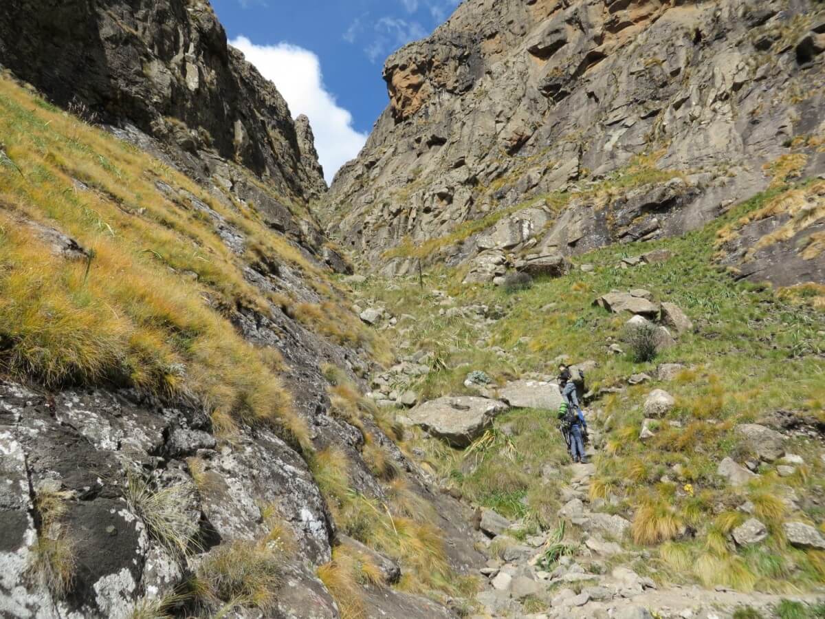
    • Image: Gudu Pass
    • Image: Sentinal
    • Image: Amphitheatre
    • Image: Gudu Falls
  • Cave capacity: 0
  • Author Name: Drakensberg Hikes
  • Author Link: https://sahikes.com/author/drakensberg-hikes
  • Total Hike Duration: 3
  • Total Hike Distance: 7
  • Elevation Gain: 263
  • Website: https://www.lekkeslaap.co.za/accommodation/witsieshoek-mountain-lodge
  • E-Mail: This email address is being protected from spambots. You need JavaScript enabled to view it.
  • Booking Logo Link: https://www.lekkeslaap.co.za/accommodation/witsieshoek-mountain-lodge
  • Location: -28.6775,28.9276
  • Hike Address:

    Witsieshoek Mountain Lodge, Phuthaditjhaba

  • About the area:

    The Qwa Qwa region around Witsieshoek Mountain Lodge is primarily inhabited by members of the Batlokoa chiefdom.

    The Batlokoa community comprises a range of different Sotho-Tswana peoples, its population ranging from Botswana to Lesotho to the Free State and Gauteng. The tribe has inhabited the areas around Witsiehoek since the mid 19th century. In 1874, a mission station of the Dutch Reformed Church was established in the area. However, the majority of the Batlokoa living in the Free State today are Catholic. While elements of traditional Batlokoa culture still survive today, such as traditional music and oral poetry, the community has adapted to a rapidly urbanising population and culture, centred on the ever-expanding capital of the Qwa Qwa region, Phuthadithjhaba (meaning meeting place of the people).

    Witsieshoek Mountain Lodge was originally built in the 1970s as a state enterprise, though former Batlokoa chief Wessels Mota built a stone hut for backpackers on the site in the 1950s. The lodge was gradually given over to the current King of the local Batlokoa community, Morena Mota (son of Wessels Mota), in the mid 90s. It was officially made a community asset by the state in 2000. Management challenges prompted the Traditional Council of the Batlokoa under their leader, Morena Mota, to enter into an agreement with Transfrontier Park Destinations (TFPD) in 2010 as management and marketing operators.

  • Hike Directions:

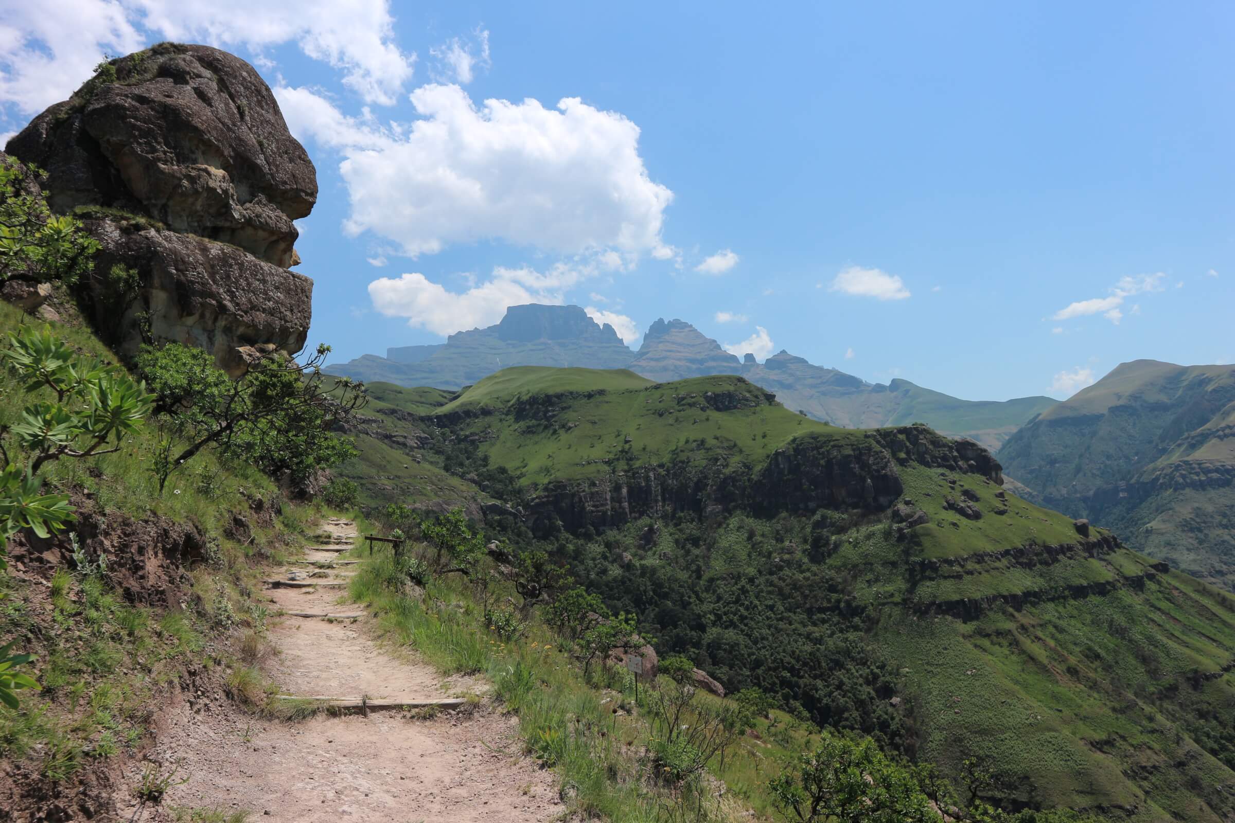
    Gudu Falls walk follows the path which travels parallel to the Metsi Matsho Trail, ie. on the south side of the fence.

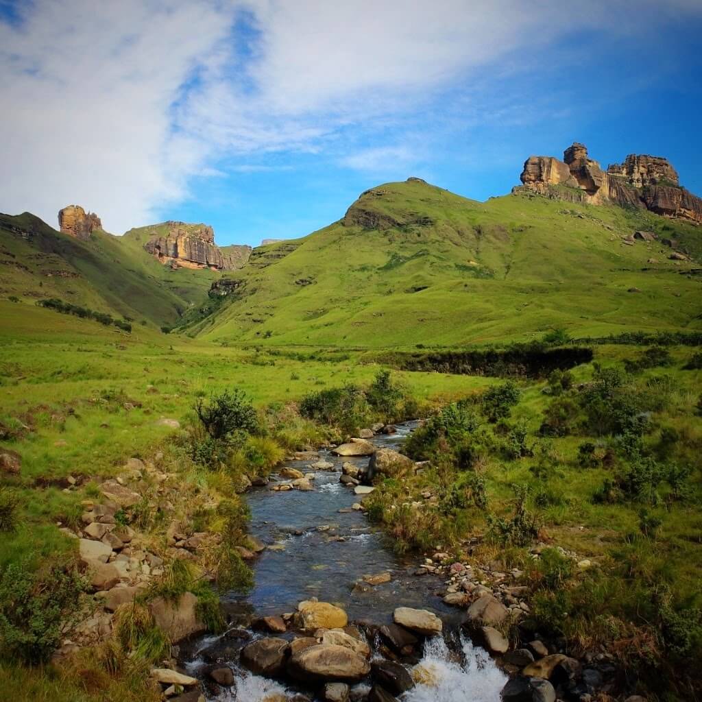
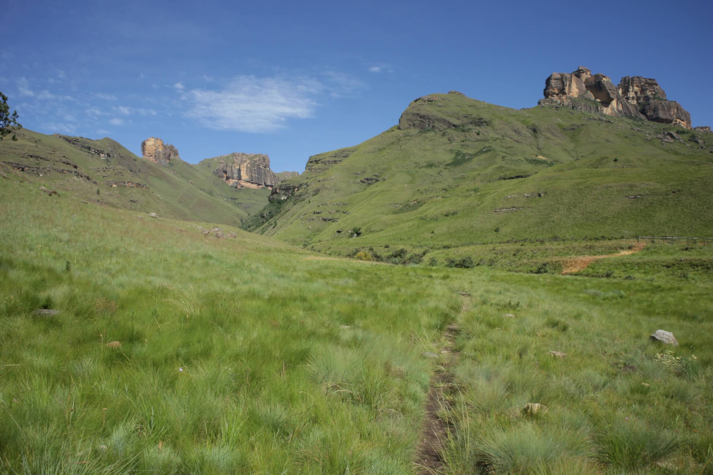
    Follow this path as it winds its way along the top of the ridge, right past the Gudu stream catchment area until the Plowmanskop Ridge is reached, which is easily located and a positive way of not losing the route. This ridge has magnificent views of the Diamond, the Castle Rocks and the entire Royal Natal Park area. At this point, turn right (southeast) and follow the sketchy path which winds its way across the grassy slopes, down a gentle slope towards the end of Plowmanskop. Nearing the end of this gentle slope, it eases to the right and down into the valley to the Falls lip.

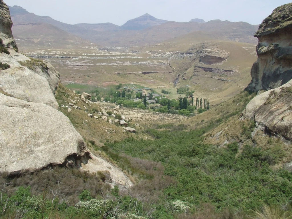
    This small valley has beautiful swimming pools, within 20 metres of the actual falls, with a lovely lunch area and one tends to relax too much, at this very picturesque spot.

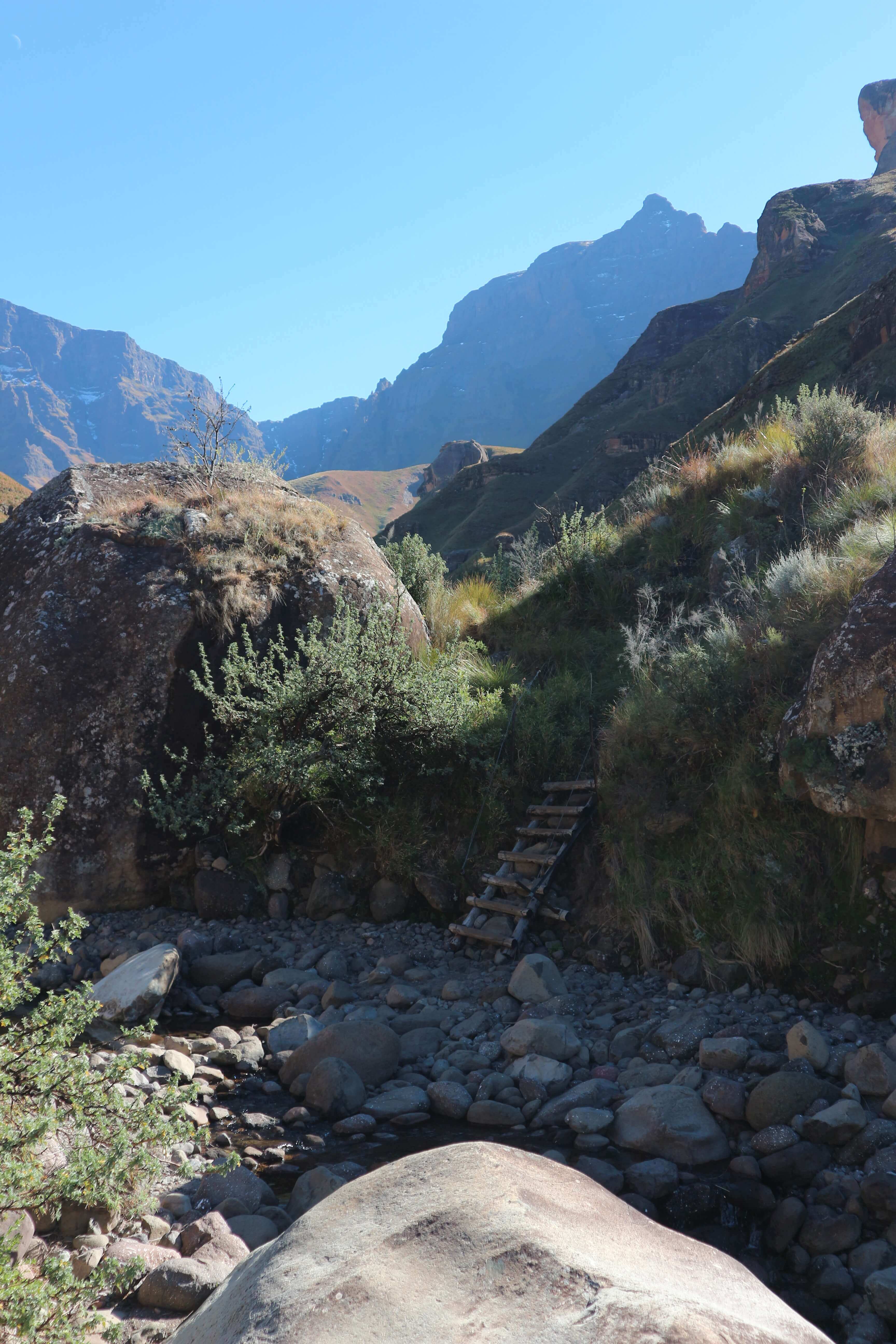
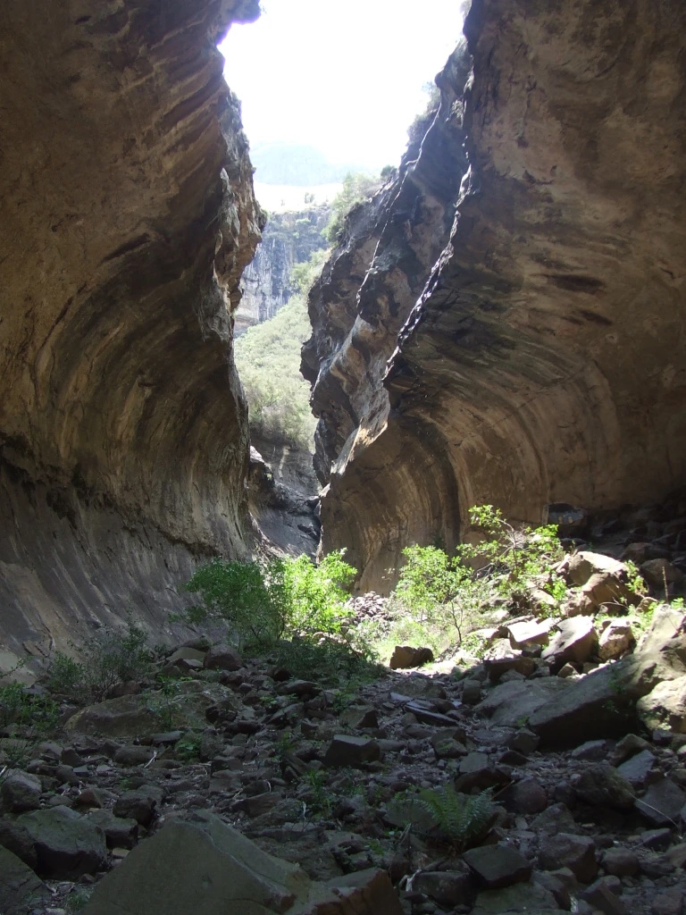
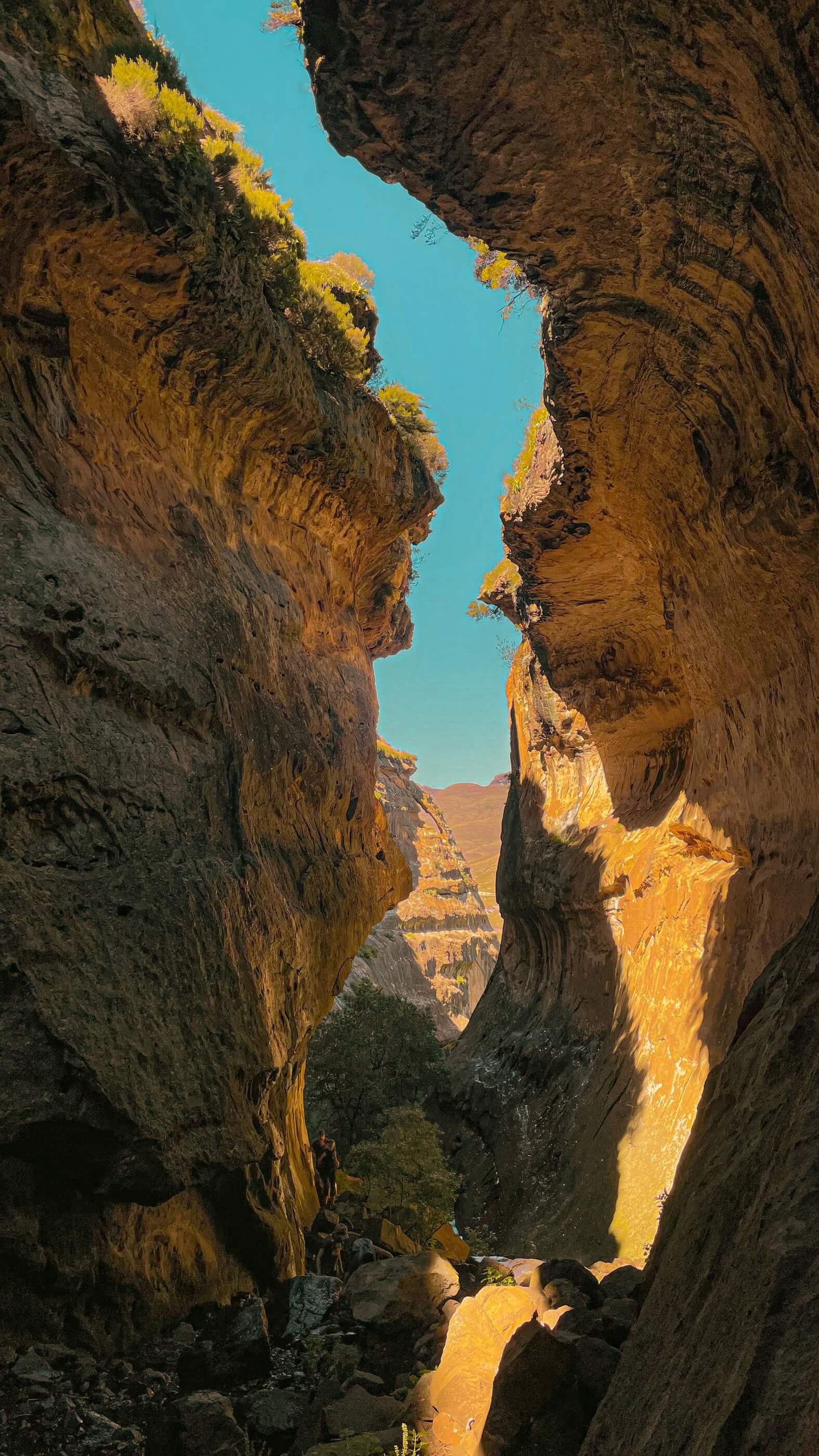
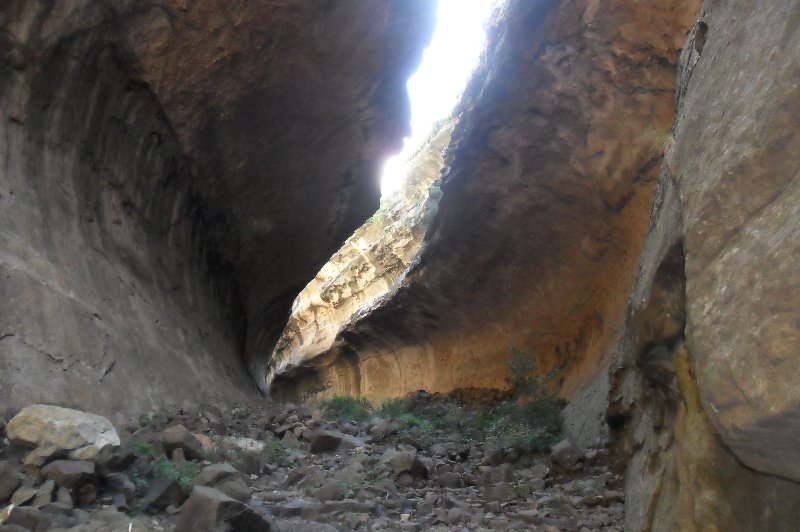
    The return trip can be via the “Crack” route and hence back up to the original path at the upper ridge. From the Gudu Falls lip, climb out and locate the path going in a westerly direction (towards the Main Berg) and follow this path to almost the top of the Crack, at which point, one leaves the crack path to climb up to the ridge (in a north/west direction) and hence, home.If this walk/climb is intended for a day’s outing, then climbing down the Crack is a further alternate route home as the path at the base of the crack leads up the Mahai Valley and on up to Witsieshoek Mountain Lodge. This crack is a freak of nature, easily negotiated, with the help of a small chain ladder near the base. It really is an experience worth the effort.

A 3.6 km hike to the top of Gudu Falls via the “Crack” with an elevation drop of 263m along the...
Drakensberg Amphitheatre

Amphitheatre, Tugela Falls via Chain Ladder Pass

  • Teaser Title: Visit the highest waterfall in the world!
  • Teaser Image BG: Chain Ladder Pass
  • GPX Track Map:

    GPS Track Details
    Track length: 4.20 km
    Total ascent: 616 m
    Total descent: 158 m
    Difficulty Level: 3/5 - Medium

  • Images:
    • Image: Chain Ladder Pass
    • Image: Eland Falls
    • Image: Chain Ladder Hike
  • Content Images:
    • Image: A frozen Tugela Falls
    • Image: The Witches
    • Image: View from the Amphitheatre
    • Image: Eland Falls
  • Cave capacity: 0
  • Author Name: Drakensberg Hikes
  • Author Link: https://sahikes.com/author/drakensberg-hikes
  • Total Hike Duration: 5
  • Total Hike Distance: 8
  • Elevation Gain: 616
  • Website: https://www.lekkeslaap.co.za/accommodation/witsieshoek-mountain-lodge
  • E-Mail: This email address is being protected from spambots. You need JavaScript enabled to view it.
  • Booking Logo Link: https://www.lekkeslaap.co.za/accommodation/witsieshoek-mountain-lodge
  • Location: -28.7525,28.8946
  • Hike Address:

    Witsieshoek Mountain Lodge, Phuthaditjhaba

  • About the area:

    The Qwa Qwa region around Witsieshoek Mountain Lodge is primarily inhabited by members of the Batlokoa chiefdom.

    The Batlokoa community comprises a range of different Sotho-Tswana peoples, its population ranging from Botswana to Lesotho to the Free State and Gauteng. The tribe has inhabited the areas around Witsiehoek since the mid 19th century. In 1874, a mission station of the Dutch Reformed Church was established in the area. However, the majority of the Batlokoa living in the Free State today are Catholic. While elements of traditional Batlokoa culture still survive today, such as traditional music and oral poetry, the community has adapted to a rapidly urbanising population and culture, centred on the ever-expanding capital of the Qwa Qwa region, Phuthadithjhaba (meaning meeting place of the people).

    Witsieshoek Mountain Lodge was originally built in the 1970s as a state enterprise, though former Batlokoa chief Wessels Mota built a stone hut for backpackers on the site in the 1950s. The lodge was gradually given over to the current King of the local Batlokoa community, Morena Mota (son of Wessels Mota), in the mid 90s. It was officially made a community asset by the state in 2000. Management challenges prompted the Traditional Council of the Batlokoa under their leader, Morena Mota, to enter into an agreement with Transfrontier Park Destinations (TFPD) in 2010 as management and marketing operators.

  • Hike Directions:

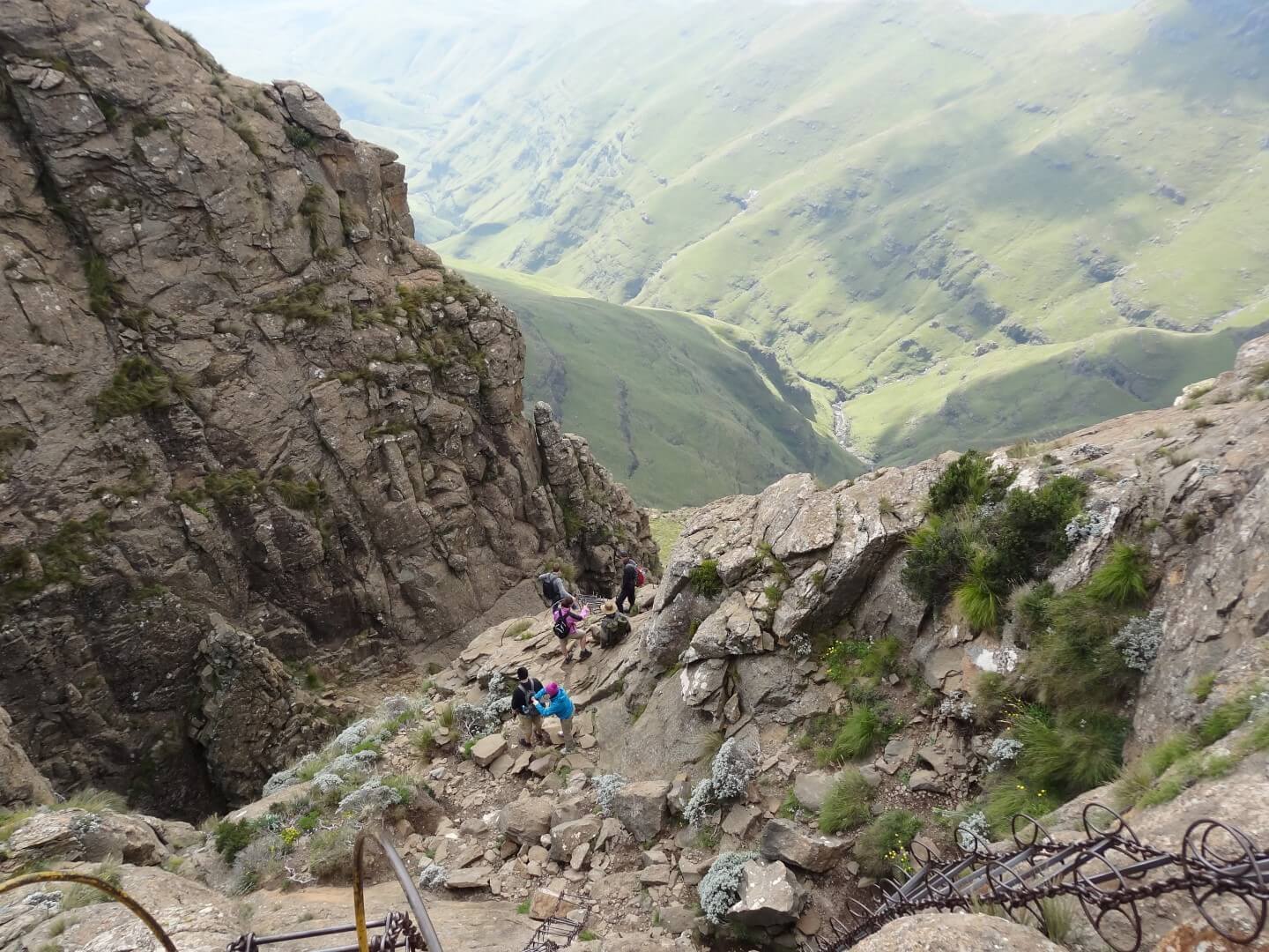
    Follow the path from Sentinal Car Park, up to the right of the Witches, toward Sentinel, where the zig-zags take their toll, skirting around the base of Sentinel, along the contour path to the chain ladder. Along the way, one passes the Sentinel Cave (tucked 20 metres above the path) and also the Gully, which presents an alternative route up, for those too nervous of the ladder.

    From the Car Park to the base of the ladder usually takes the average walker about an hour to an hour and a half. From the top of the ladder there is a well-defined path leading to the “Hut” and to the top of Tugela Falls.

    Tugela Falls is the tallest waterfall in the world. Watching the water flow off into the world below is a sight not-soon forgotten. It is an accepted fact that provided that there are no clouds, this walk around the top is only a pleasure and one can spend hours exploring the many features of this area. However, if one is returning to the Lodge for the night, then please leave the top by 3:00 pm at the latest.

The Chain Ladder is one of the easiest hikes as far as Berg passes go. This trail is also the...
Drakensberg Amphitheatre

Chain Ladder Pass, Tugela Falls & Beacon Buttress Gully

  • Teaser Title: Visit the highest waterfall in the world!
  • Teaser Image BG: View from the Amphitheatre
  • GPX Track Map:

    GPS Track Details
    Track length: 10.59 km
    Total ascent: 749 m
    Total descent: 748 m
    Difficulty Level: 3/5 - Medium

  • Images:
    • Image: Beacon Buttress Gully
    • Image: Eland Falls
    • Image: Beacon Buttress Gully
  • Content Images:
    • Image: A frozen Tugela Falls
    • Image: The Witches
    • Image: Chain Ladder Pass, Tugela Falls & Beacon Buttress Gully
    • Image: Chain Ladders
  • Cave capacity: 0
  • Author Name: Drakensberg Hikes
  • Author Link: https://sahikes.com/author/drakensberg-hikes
  • Total Hike Duration: 7
  • Total Hike Distance: 11
  • Elevation Gain: 748
  • Website: https://www.lekkeslaap.co.za/accommodation/witsieshoek-mountain-lodge
  • E-Mail: This email address is being protected from spambots. You need JavaScript enabled to view it.
  • Booking Logo Link: https://www.lekkeslaap.co.za/accommodation/witsieshoek-mountain-lodge
  • Location: -28.7275,28.8909
  • Hike Address:

    Witsieshoek Mountain Lodge, Phuthaditjhaba

  • About the area:

    The Qwa Qwa region around Witsieshoek Mountain Lodge is primarily inhabited by members of the Batlokoa chiefdom.

    The Batlokoa community comprises a range of different Sotho-Tswana peoples, its population ranging from Botswana to Lesotho to the Free State and Gauteng. The tribe has inhabited the areas around Witsiehoek since the mid 19th century. In 1874, a mission station of the Dutch Reformed Church was established in the area. However, the majority of the Batlokoa living in the Free State today are Catholic. While elements of traditional Batlokoa culture still survive today, such as traditional music and oral poetry, the community has adapted to a rapidly urbanising population and culture, centred on the ever-expanding capital of the Qwa Qwa region, Phuthadithjhaba (meaning meeting place of the people).

    Witsieshoek Mountain Lodge was originally built in the 1970s as a state enterprise, though former Batlokoa chief Wessels Mota built a stone hut for backpackers on the site in the 1950s. The lodge was gradually given over to the current King of the local Batlokoa community, Morena Mota (son of Wessels Mota), in the mid 90s. It was officially made a community asset by the state in 2000. Management challenges prompted the Traditional Council of the Batlokoa under their leader, Morena Mota, to enter into an agreement with Transfrontier Park Destinations (TFPD) in 2010 as management and marketing operators.

  • Hike Directions:

    Follow the path from Sentinal Car Park, up to the right of the Witches, toward Sentinel, where the zig-zags take their toll, skirting around the base of Sentinel, along the contour path to the chain ladder. Along the way, one passes the Sentinel Cave (tucked 20 metres above the path) and also the Gully, which presents an alternative route up, for those too nervous of the ladder.

    From the Car Park to the base of the ladder usually takes the average walker about an hour to an hour and a half. From the top of the ladder there is a well-defined path leading to the “Hut” and to the top of Tugela Falls.

    Return via Beacon Buttress gully. Use the gps map to find the gully for your return. This hike can also be done by going up Beacon Buttress gully and then down the chain ladders. This route direction is a lot more difficult and makes this a difficult hike. It takes 45 minutes to an hour to climb up Beacon Buttress gully, depending on your fitness level.

A circular day hike starting at Sentinal Car Park and up to the Chain Ladder which is one of...
Hikes outside a reserve (Free State)

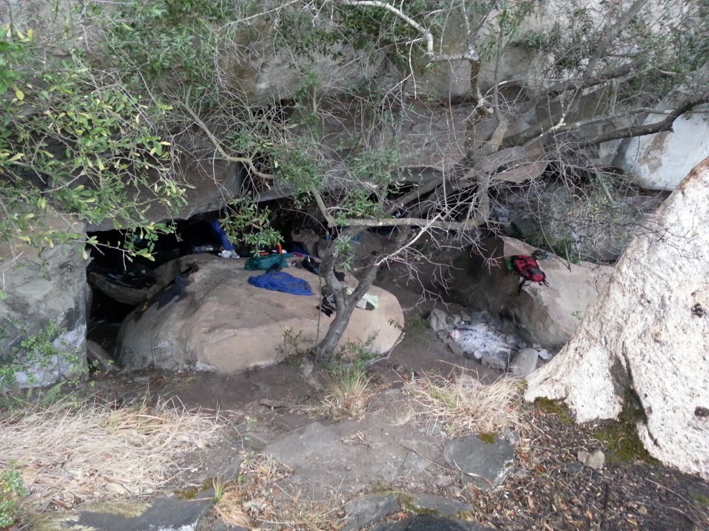
Mount Perazim Hiking Trail (Cannibal Hiking Trail)

  • Teaser Title: Impressive mountain views, river walks, and forest ambles to boulder hopping.
  • Teaser Image BG: Mount Perazim Hiking Trail Cave
  • GPX Track Map:

    Mount Perazim Hiking Trail - Day 1

    GPS Track Details
    Track length: 10.02 km
    Total ascent: 727 m
    Total descent: 542 m
    Difficulty Level: 3/5 - Medium

    Mount Perazim Hiking Trail - Day 2

    GPS Track Details
    Track length: 6.55 km
    Total ascent: 226 m
    Total descent: 340 m
    Difficulty Level: 3/5 - Medium

  • Images:
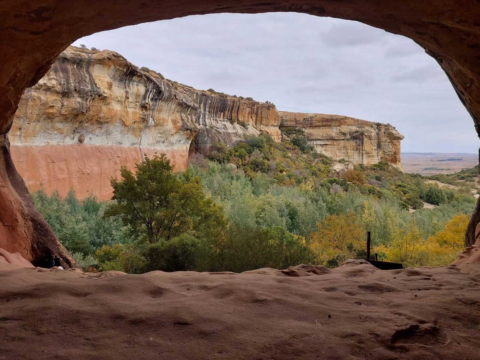
    • Image: Mount Perazim Hiking Trail Cave
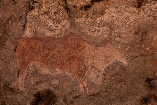
    • Image: Mount Perazim Hiking Trail - Bushman Painting
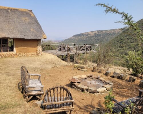
    • Image: Mount Perazim Hiking Trail - fire pit
  • Total Hike Days: 0
  • Content Images:
    • Image: Melkstal
    • Image: Mount Perazim Hiking Trail
    • Image: School House
    • Image: Mount Perazim Hiking Trail
  • Cave capacity: 0
  • Author Name: SA Hikes
  • Author Link: https://sahikes.com/author/sa-hikes
  • Total Hike Duration: 8
  • Total Hike Distance: 17
  • Elevation Gain: 727
  • Website: https://www.lekkeslaap.co.za/accommodation/st-fort-farm
  • E-Mail: This email address is being protected from spambots. You need JavaScript enabled to view it.
  • Booking Logo Link: https://www.lekkeslaap.co.za/accommodation/st-fort-farm
  • Location: -28.5605,28.4128
  • Hike Address:
    The starting point is at St Fort Farm, 6km on the Fouriesburg Road, Clarens
  • About the area:

    A meeting place. Where time stands still, the weary find rest and the adventurous play.

    St Fort has been in the Goldblatt family since 1964. We are country folk at heart. Time is measured by the sun and the changing seasons, and things happen as they should, slow and steady. Not surprisingly, St Fort has always been characterized as an open home with warm hospitality and a big heart. Stepping onto St Fort takes one back to a bygone era when life was simpler.

  • Hike Directions:

    The Mount Perazim Trail is a circular 2-day route with day 1 being approximately 9 km and day 2 is 7 km. The route takes you through differing landscapes, from impressive mountain views to river walks, and forest ambles to boulder hopping in and along gorges.

    On the first day, the trail passes overhang caves with rock ‘kraals’, one of which has Bushman Paintings. You overnight in a substantial overhang cave.

    The second day offers breath-taking views of the Malutis including Horeb, Woodhouse, Generaalskop, Visierskerf, and George’s Pimple.

    This is a hikers hike, well-marked, and provides all the amenities that a hiker demands, with numerous picnic spots, a swimming hole, interesting scenery, and a level of hiking that fits the serious hikers but is not too strenuous for the beginner hiker.

The widely known and well-loved Cannibal Trail has undergone a name change to Mount Perazim...
Hikes outside a reserve (Free State)

Sporekrans Hiking Trail

  • Teaser Title: A hike that will exceed all your expectations!
  • Teaser Image BG: Sporekrans Hiking Trail
  • GPX Track Map:

    GPS Track Details
    Track length: 13.66 km
    Total ascent: 522 m
    Total descent: 545 m
    Difficulty Level: 3/5 - Medium

  • Images:
    • Image: Sporekrans Hiking Trail
    • Image: Sporekrans Hiking Trail
    • Image: Sporekrans Hiking Trail
  • Total Hike Days: 0
  • Content Images:
    • Image: Sporekrans Hiking Trail
    • Image: Sporekrans Hiking Trail
    • Image: Sporekrans Hiking Trail
    • Image: Sporekrans Hiking Trail
  • Cave capacity: 26
  • Author Name: Fagala Voet
  • Author Link: https://sahikes.com/author/fagala-voet
  • Total Hike Duration: 12
  • Total Hike Distance: 18
  • Elevation Gain: 545
  • Website: https://www.kznwildlife.com/
  • E-Mail: This email address is being protected from spambots. You need JavaScript enabled to view it.
  • Booking Logo Link: https://www.kznwildlife.com/
  • Location: -28.4902,28.0489
  • Hike Address:

    45km’s from Bethlehem situated in the Bergdeel Private Nature reserve in the heart of the Witteberg Mountains.

  • About the area:

    The Bergdeel Private Nature reserve is between Bethlehem and Fouriesburg in the Eastern Free State.

    The Witteberg or Witteberge is a South African mountain range just off the south-west corner of Lesotho. The range, which rises to 2408 metres, stretches for about 60 km (37 mi) from Lundin's Neck in the east to Lady Grey in the west.


  • Hike Directions:

    On this overnight trail a wide variety, of up to 17 game species and various bird life, roaming the immaculate fields and mountains at Bergdeel Private Nature reserve, welcomes you. Nestled in the heart of the Witteberge with its dense bushes and mountain streams, this is a trail that will revitalize your soul.

    On the first day (12 km) the trail starts off with a beautiful wood bridge under a sandstone cliff and then passes the rare Bald Ibis’s breeding spot. You then enter “Stinkhout Kloof” completely surrounded by White-stinkwood trees where the trail leads to “Marriage Corner”, a romantic resting place. Further on, Caracals ladder takes you up to Angel’s Height, God’s little finger and the Bushmen’s Baths. At midday the hiker can cool off at the Mermaids pools, a highlight to look forward to. The day ends off in Bushmen’s Cave where the ancient Bushmen’s presence can be felt, and the turmoil of city life is forgotten. Water is available in rainy season but take enough water along.

    The second day (4.5 km) takes you deeper into the reserve with lots of surprises installed for you. A visit is an absolute must and an experience that cannot easily be matched.

    First and second night can be spent in the base camp, or you can spend the second night in the cave.

The Sporekrans hiking trail is another example of a trail that opens up the Kaleidoscope of...
Bushman's Nek Nature Reserve

Tarn Cave Hike

  • Teaser Title: Southern Drakensberg Magic
  • Teaser Image BG: Tarn Cave Hike
  • GPX Track Map:

    GPS Track Details
    Track length: 8.93 km
    Total ascent: 646 m
    Total descent: 1 m
    Difficulty Level: 3/5 - Medium

  • Images:
    • Image: Tarn Cave
    • Image: Tarn Cave
    • Image: Tarn Cave
  • Content Images:
    • Image: Cedric's Pool
    • Image: View from Tarn Cave
    • Image: Tarn Cave
    • Image: Devils Knuckles from Tarn Cave
  • Cave capacity: 8
  • Author Name: Drakensberg Hikes
  • Author Link: https://sahikes.com/author/drakensberg-hikes
  • Total Hike Duration: 8
  • Total Hike Distance: 18
  • Elevation Gain: 646
  • Website: https://www.kznwildlife.com/
  • E-Mail: This email address is being protected from spambots. You need JavaScript enabled to view it.
  • Booking Logo Link: https://www.kznwildlife.com/
  • Location: -29.8584,29.1379
  • Hike Address:

    The starting point is at Bushman's Nek Reserve, Southern Drakensberg.

    All enquiries and bookings can be made telephonically, or by e-mail to the Ezemvelo KZN Wildlife Reservations Office:

    • Telephone: +27 (0) 33 845 1000
    • General Information: + 27 (0) 33 845 1002
    • Email: This email address is being protected from spambots. You need JavaScript enabled to view it.
  • About the area:

    Bushman's Nek is the southern most part of the Maloti Drakensberg Park and incorporates the beautiful Bushman's Nek Valley. Bushman's Nek is bound to captivate your imagination and quench your thirst for outdoor adventure.

  • Hike Directions:

    The most common route to reach the cave from Bushman's Nek reserve is Tarn Cave Pass.

    You cross the Ngwangwane River 3 times in the first 1km. The path is relatively flat for the first 4.5 kms till you reach Cedric’s Pool. The easy to follow path from Cedric's Pool is steep in places but manageable and at one section about 2 kms from Cedric's Pools you have a 2m ledge to go up, you may need to hoist your backpacks up and scramble up the rock face.

    At the top of the ridge you will encounter a large rock formation with a small hole through it. The path to Tarn Cave continues to your right, passing a very large tarn on your left. The path becoms less distinct and more difficult to follow at this point. You are less than 250 metres from the cave which is situated just in front and to the right of you towards the escarpment and the vista looking onto the Devil’s Knuckles.

Tarn Cave is a great cave to stay overnight in the Bushman's Nek area. The hike is 8.9km's to...
Monks Cowl Nature Reserve

The Sphinx Hike

  • Teaser Title: Best day hike with panoramic views in the Drakensberg
  • Teaser Image BG: The Sphinx Hike
  • GPX Track Map:

    GPS Track Details
    Track length: 2.36 km
    Total ascent: 319 m
    Total descent: 49 m
    Difficulty Level: 3/5 - Medium

  • Images:
    • Image: The Sphinx Hike
    • Image: The Sphinx Hike
    • Image: The Sphinx Hike
  • Content Images:
    • Image: The Sphinx
    • Image: The Sphinx Hike
    • Image: The Sphinx Hike
    • Image: The Sphinx
  • Cave capacity: 0
  • Author Name: Drakensberg Hikes
  • Author Link: https://sahikes.com/author/drakensberg-hikes
  • Total Hike Duration: 3
  • Total Hike Distance: 5
  • Elevation Gain: 319
  • Website: https://www.kznwildlife.com/
  • E-Mail: This email address is being protected from spambots. You need JavaScript enabled to view it.
  • Booking Logo Link: https://www.kznwildlife.com/
  • Location: -29.0559,29.3984
  • Hike Address:

    The starting point is at Monks Cowl Nature Reserve, Central Drakensberg.

    All enquiries and bookings can be made telephonically, or by e-mail to the Ezemvelo KZN Wildlife Reservations Office:

    • Telephone: +27 (0) 33 845 1000
    • General Information: + 27 (0) 33 845 1002
    • Email: This email address is being protected from spambots. You need JavaScript enabled to view it.
  • About the area:

    Monks Cowl is the gateway to some of the most magnificent mountain Wilderness areas in South Africa. Taking its name from the distinctive mountain between Champagne Castle and Cathedral Peak, Monks Cowl marks the access to the Mlambonja and Mdedelelo mountain Wilderness areas.

  • Hike Directions:

    Your start is at the Monks Cowl Nature Reserve car park. The path starts past and up behind the office where you fill in the Mountain Register following the Sterkspruit/Mpofana upstream. About 500 m along  there is a direction sign where you head off to the left and after another 500 m you come to a T-junction where you head right and up some steep zigzagging steps. 

    At the top the zigzags the path heads around to the right, as it makes its way onto the lower section of The Sphinx. You then cross the second tributary of the Mpofana where you will find Crystal Falls.

    This would be a good place to refill your water bottle for a rest the the hike to The Sphinx. 

    Continuing along the trail, you will pass through more forested areas before starting the ascent towards the Sphinx. The climb is moderate but steady, with the elevation gain providing a good workout. As you approach the Sphinx, the forest opens up, revealing breathtaking views of the surrounding landscape.

    Upon reaching the Sphinx, you are rewarded with magnificent 360-degree views. 

A moderate walk from Monks Cowl of 2.4 km and elevation of 312 m to the Sphinx passing Crystal...
Bushman's Nek Nature Reserve

Thamathu Cave Hike

  • Teaser Image BG: Thamathu Cave
  • GPX Track Map:

    GPS Track Details
    Track length: 6.90 km
    Total ascent: 595 m
    Total descent: 11 m
    Difficulty Level: 4/5 - Hard

  • Images:
    • Image: Thamathu Cave
    • Image: Thamathu Cave
    • Image: Thamathu Cave
  • Content Images:
    • Image: Thamathu Cave
    • Image: Thamathu Cave
    • Image: Thamathu Cave Hike - the mushroom
    • Image: Sunrise from Thamathu Cave
  • Cave capacity: 12
  • Author Name: Drakensberg Hikes
  • Author Link: https://sahikes.com/author/drakensberg-hikes
  • Total Hike Duration: 7
  • Total Hike Distance: 14
  • Elevation Gain: 595
  • Website: https://www.kznwildlife.com/
  • E-Mail: This email address is being protected from spambots. You need JavaScript enabled to view it.
  • Booking Logo Link: https://www.kznwildlife.com/
  • Location: -29.8319,29.1503
  • Hike Address:

    The starting point is at Bushman's Nek Reserve, Southern Drakensberg.

    All enquiries and bookings can be made telephonically, or by e-mail to the Ezemvelo KZN Wildlife Reservations Office:

    • Telephone: +27 (0) 33 845 1000
    • General Information: + 27 (0) 33 845 1002
    • Email: This email address is being protected from spambots. You need JavaScript enabled to view it.
  • About the area:

    Bushman's Nek is the southern most part of the Maloti Drakensberg Park and incorporates the beautiful Bushman's Nek Valley. Bushman's Nek is bound to captivate your imagination and quench your thirst for outdoor adventure.

  • Hike Directions:

    Start at the Bushman's Nek Office, where you fill in the mountain register. You pass the South African border post and then cross the stream twice and turn right (if you go straight you are heading towards Tarn Cave and would cross the stream a third time) thus walking with Bushman's River on your right. To your right on the other side of the river you will see Bushman's Nek Hut as you walk along a slightly upward path.

    After 300m where you turned right after the 2nd river crossing the path has 2 options, straight ahead which takes you to Bushman's Cave and left up the hill in front of you, this is your route, turn left and start up the hill. After climbing the 1st hill the path flattens out for a short breather, then up the next hill. The path is visible all the way as you wind up this hill on the left hand side. At the top you have now done 3.2km, the views start to show themselves all around you.

    A nice flat section is next and then up the next hill. You are heading in a West / North West direction all the way from here until just before Thamathu cave. The gradient over this next hill is pretty similar to what you have already climbed. At 5.8km (you only have 1.1km's to go) the path again has two options, a short steep uphill (this path is not well defined) of about 150m uphill or to continue straight along the contours of the hill you are on. Both will get you to Thamathu cave.

    Choosing to go left and up the hill now means that after this uphill the rest of the hike to the cave is along the contour path. Choosing to go straight at this point seems easier but your last 300m will then be uphill to the cave. The choice is yours.

A moderately severe 4-5 hrs hike (10 km's) This hike follows a well-defined path on the...
Cobham Nature Reserve

Mzimkulwana Hut and Lakes Cave Hike

  • Teaser Image BG: Mzimkulwana Hut and Lakes Cave Hike
  • GPX Track Map:

    GPS Track Details
    Track length: 29.98 km
    Total ascent: 902 m
    Total descent: 903 m
    Difficulty Level: 3/5 - Medium

  • Images:
    • Image: Mzimkulwana Hut and Lakes Cave Hike
    • Image: Mzimkulwana Hut and Lakes Cave Hike
    • Image: Mzimkulwana Hut and Lakes Cave Hike
    • Image: Mzimkulwana Hut and Lakes Cave Hike
  • Content Images:
    • Image: Sunrise above Lakes Cave
    • Image: The Policeman
    • Image: Mzimkulwana Hut
    • Image: Mzimkulwana Hut and Lakes Cave Hike
  • Cave capacity: 8
  • Author Name: Drakensberg Hikes
  • Author Link: https://sahikes.com/author/drakensberg-hikes
  • Total Hike Duration: 14
  • Total Hike Distance: 30
  • Elevation Gain: 902
  • Website: https://www.kznwildlife.com/
  • E-Mail: This email address is being protected from spambots. You need JavaScript enabled to view it.
  • Booking Logo Link: https://www.kznwildlife.com/
  • Location: -29.7065839,29.356133173583515
  • Hike Address:

    The starting point is at Cobham Nature Reserve, Southern Drakensberg.

    All enquiries and bookings can be made telephonically, or by e-mail to the Ezemvelo KZN Wildlife Reservations Office:

    • Telephone: +27 (0) 33 845 1000
    • General Information: + 27 (0) 33 845 1002
    • Email: This email address is being protected from spambots. You need JavaScript enabled to view it.
  • About the area:

    Cobham is situated in the Southern part of the Maloti Drakensberg Park and is approximately 150 km from Pietermaritzburg. Dominated by Hodgson's Peaks which enclose the Giants Cup, Cobham is a 52,000-ha section of the Maloti Drakensberg Park in the southern 'berg adjacent to Himeville Village.

  • Hike Directions:

    Day 1: From Cobham (North is Ndlovini Peak and to the right is Grandma Peak then Emerald Dome)

    From Pholela Hut you walk diagonally to the left towards a horse paddock. The sign “Giant’s Cup 2nd Day” points right along the paddock to the Pholela River. The trail winds along the paddock and after 100 m the Giant’s Cup trail leads away from the Pholela River and to the left up the slope. After 100 m you climb some stone steps on the left where the trail makes a large bend uphill away from the paddock and over rocky substrate after which it heads off to the right. At the 1 km mark, you have a view of a lovely waterfall on the right looking towards Allens Shelter.

    After 3 km and 200 m altitude you cross over a plateau in the direction of Siphongweni Ridge (2 151 m). On the left of the trail you will see large sandstone rocks - The Tortoise Rocks. After following the ridge for a while, the trail takes you to the left and southern side of eSiphongweni Ridge. Once you have reached the sandstone rocks that the trail passes on the left, the vegetation becomes a densertypical fynbos vegetation with Proteas, Helichrysum bushes and Leucosidea (Ou hout).

    After Bathplug Cave, the trail makes a large bend around Siphongweni Ridge. At the 7 km mark you walk through a Protea woodland and have a lovely view on a forest patch in a gorge below you on the left. At 7.2 km you cross a small stream. After 300 m you will see Mzimkhulwana hut. A bridge leads over the Mzimkhulwana River to the hut.

    View from Mzimkhulwana Hut

    • South is Bamboo Mountain (4km)
    • West is Little Bamboo Mountain (4.5km)
    • River below the hut is Mzimkhulwana River
    • River above the hut is Siphongweni River
    • North / North South is eSiphongweni Peak which has Mpongweni Shelters and Siphongweni Cave (2.6km)
    • North / North West The Pimple Mountain (1.3km)
    • Behind The Pimple is Amakehla Pass (11km)

    Day 2

    Mzimkhylwana Hut -> Hike till level with The Pimple, then cross the river and hike uphill to Siphongweni Cave (3.5km – 350m up) -> Whale Back (5.4km) -> Titty (6.6km) -> The Policeman (7.6km) -> Lakes Cave (9.3km)

    View from Lakes Cave

    • East is Camel Rock (850m)
    • North West is Amakehla Pass (3.5 km) / Left is Minaret Pass (North view)
    • Peaks North (NNE) is Hodgsons Peak South and North
    • 3rd peak to the right is Sani Peak
    • Left of Minaret Pass is The Block, Sandleni Pinnacle, No Mans Peak, Verkyker Buttress and Peak and Rhino Peak
    • SW below is Weavers Cave (1.89km)

    Day 3

    Lakes Cave -> Nutcracker Cave (2.3km) -> C53 Shelter (4.8km) -> Monster Rocks (6.1km) -> Boundry Rock (7.7km) -> Cobham (12km)

A stunning 3-day hike. If you want a moderately easy hike, enjoy seeing Bushman Paintings with...
Cobham Nature Reserve

Gxalingenwa Cave Circular Hike

  • Teaser Image BG: Gxalingenwa Cave Circular Hike
  • GPX Track Map:

    GPS Track Details
    Track length: 23.84 km
    Total ascent: 696 m
    Total descent: 696 m
    Difficulty Level: 3/5 - Medium

  • Images:
    • Image: Gxalingenwa Cave Circular Hike
    • Image: Gxalingenwa Cave Circular Hike
    • Image: Gxalingenwa Cave Circular Hike
  • Content Images:
    • Image: Gxalingenwa Cave Circular Hike
    • Image: Gxalingenwa Cave Circular Hike
    • Image: Gxalingenwa Cave Circular Hike
    • Image: Gxalingenwa Cave Circular Hike
  • Cave capacity: 10
  • Author Name: Drakensberg Hikes
  • Author Link: https://sahikes.com/author/drakensberg-hikes
  • Total Hike Duration: 9
  • Total Hike Distance: 24
  • Elevation Gain: 696
  • Website: https://www.kznwildlife.com/
  • E-Mail: This email address is being protected from spambots. You need JavaScript enabled to view it.
  • Booking Logo Link: https://www.kznwildlife.com/
  • Location: -29.6358238,29.3620441
  • Hike Address:

    The starting point is at Cobham Nature Reserve, Southern Drakensberg.

    All enquiries and bookings can be made telephonically, or by e-mail to the Ezemvelo KZN Wildlife Reservations Office:

    • Telephone: +27 (0) 33 845 1000
    • General Information: + 27 (0) 33 845 1002
    • Email: This email address is being protected from spambots. You need JavaScript enabled to view it.
  • About the area:

    Cobham is situated in the Southern part of the Maloti Drakensberg Park and is approximately 150 km from Pietermaritzburg. Dominated by Hodgson's Peaks which enclose the Giants Cup, Cobham is a 52,000-ha section of the Maloti Drakensberg Park in the southern 'berg adjacent to Himeville Village.

  • Hike Directions:

    Starting at Cobham (Pholela Hut behind you) walk alongside the campsite to your right and cross the Pholela River suspension bridge ahead. You are backtracking along day one of the Giant’s Cup Trail path.

    Stay on the path that turns left after the suspension bridge, about 600m along the path splits left crossing Trout Beck River which is the Giants Cup Trail. You can continue on this path or head right past bypass ridge. Both paths join up again a little while later.

    Just after 7km into the hike, the Giants Path Trail path you have been on turns right to Ngenwa Cave, continue straight, you are now on the path to Gxalingenwa Cave. Just after 12km's on your left up a steep path after crossing wooden bridge is Gxalingenwa Cave.

    It is a good idea to collect some water from the Gxalingenwa river at this point in winter before hiking up to the cave.

    On day 2 start back on the same path, about 2km along take the turnoff to the right on a undulating traverse. After about 2km the path curves sharply round to the right with Emerald stream ahead.

    You cross the river twice before it stays to the right-hand bank for the last 2.5 km and pass Pinnacle Rock where the San Rock Art depicts spiritual ceremonies and the Sharma's transformation to other forms. It’s about 3km from here back to Cobham on the same path.

12.5 km's (5 hours) from Pholela Hut to Gxalingenwa Cave and 11.5 km (4 hours) return via...
Garden Castle Nature Reserve

Sleeping Beauty Cave Hike

  • Teaser Image BG: Sleeping Beauty Cave Hike
  • GPX Track Map:

    GPS Track Details
    Track length: 3.72 km
    Total ascent: 381 m
    Total descent: 12 m
    Difficulty Level: 3/5 - Medium

  • Images:
    • Image: Sleeping Beauty Cave Hike
    • Image: Sleeping Beauty Cave Hike
    • Image:
  • Content Images:
    • Image:
    • Image:
    • Image:
  • Cave capacity: 10
  • Author Name: Drakensberg Hikes
  • Author Link: https://sahikes.com/author/drakensberg-hikes
  • Total Hike Duration: 4
  • Total Hike Distance: 8
  • Elevation Gain: 381
  • Website: https://www.kznwildlife.com/
  • E-Mail: This email address is being protected from spambots. You need JavaScript enabled to view it.
  • Booking Logo Link: https://www.kznwildlife.com/
  • Location: -29.7489,29.1763
  • Hike Address:

    The starting point is at Garden Castle Reserve, Southern Drakensberg.

    All enquiries and bookings can be made telephonically, or by e-mail to the Ezemvelo KZN Wildlife Reservations Office:

    • Telephone: +27 (0) 33 845 1000
    • General Information: + 27 (0) 33 845 1002
    • Email: This email address is being protected from spambots. You need JavaScript enabled to view it.
  • About the area:

    The Garden Castle reserve is 35 300 hectares in extent and offers the visitor a variety of experiences. Dominated by the Rhino (a 3051m Peak which extends about 2km from the main escarpment), the area is characterized by many unusual sandstone buttresses and other formations.

  • Hike Directions:

    Starting from Garden Castle Reserve head to the left (Swiman Hut direction) and cross the wooden bridge over the stream. The path leads comfortably along a stream which you cross twice just after the 2km mark. Cross the stream again about 500m further along. The path becomes more strenuous now as you head uphill.

    Many steep steps lead up through the bushes to the Sleeping Beauty Cave.

    If you follow the trail further, you will reach Engagement Cave, which offers a cozy and sheltered sleeping spot for two people. Return via the same route.

An easy 2 hour hike over 3.7 km with a total uphill of 381m. The cave is huge and offers...
Garden Castle Nature Reserve

Pillar Cave Hike

  • Teaser Title: Family day hike with stunning views.
  • Teaser Image BG: Pillar Cave Hike
  • GPX Track Map:

    GPS Track Details
    Track length: 4.30 km
    Total ascent: 287 m
    Total descent: 11 m
    Difficulty Level: 3/5 - Medium

  • Images:
    • Image: Pillar Cave Hike
    • Image: Pillar Cave Hike
    • Image: Pillar Cave Hike
    • Image: Pillar Cave Hike
    • Image: Pillar Cave Hike
    • Image: Pillar Cave - Wooden Ladders
  • Content Images:
    • Image: Pillar Cave - top left of path
    • Image: The Rhino - Pillar Cave Hike
    • Image: Pillar Cave
    • Image: View from Pillar Cave
  • Cave capacity: 12
  • Author Name: SA Hikes
  • Author Link: https://sahikes.com/author/sa-hikes
  • Total Hike Duration: 5
  • Total Hike Distance: 9
  • Elevation Gain: 287
  • Website: https://www.kznwildlife.com/
  • E-Mail: This email address is being protected from spambots. You need JavaScript enabled to view it.
  • Booking Logo Link: https://www.kznwildlife.com/
  • Location: -29.7291,29.1763
  • Hike Address:

    The starting point is at Garden Castle Reserve, Southern Drakensberg.

    All enquiries and bookings can be made telephonically, or by e-mail to the Ezemvelo KZN Wildlife Reservations Office:

    • Telephone: +27 (0) 33 845 1000
    • General Information: + 27 (0) 33 845 1002
    • Email: This email address is being protected from spambots. You need JavaScript enabled to view it.
  • About the area:

    The Garden Castle reserve is 35 300 hectares in extent and offers the visitor a variety of experiences. Dominated by the Rhino (a 3051m Peak which extends about 2km from the main escarpment), the area is characterized by many unusual sandstone buttresses and other formations.

  • Hike Directions:

    Starting at Garden Castle Reserve office, walk towards the gum trees to the right of the office and towards Hermits Wood Campsite. From here, follow the path up with the Mlambonja River on your right.

    You cross the Mlambonja River and climb up a short wooden ladder to the other side just before the 3km mark from the start.

    After a few hundred metres you cross the river again and then head upwards on the steepest section of the hike to Pillar Cave, at most this is about 1km. Return via the same route.

A great family day hike to Pillar Cave where you can have lunch at the cave while enjoying the...
Maloti-Drakensberg Park

Sani Pass Hike

  • Teaser Image BG: Sani Pass Hike
  • GPX Track Map:

    GPS Track Details
    Track length: 7.93 km
    Total ascent: 924 m
    Total descent: 10 m
    Difficulty Level: 4/5 - Hard

  • Images:
    • Image: Sani Pass Hike
    • Image: Sani Pass Hike
  • Content Images:
    • Image: Sani Pass
    • Image: Sani Pass
    • Image: Sani Pass
    • Image: Sani Pass
  • Cave capacity: 0
  • Author Name: SA Hikes
  • Author Link: https://sahikes.com/author/sa-hikes
  • Total Hike Duration: 8
  • Total Hike Distance: 20
  • Elevation Gain: 924
  • Website: https://www.kznwildlife.com/
  • E-Mail: This email address is being protected from spambots. You need JavaScript enabled to view it.
  • Booking Logo Link: https://www.kznwildlife.com/
  • Location: -29.5845,29.2855
  • Hike Address:

    The starting point is at the SA border post car park about 5.5 km after the Sani Pass Hotel.

    All enquiries can be made telephonically, or by e-mail to the Ezemvelo KZN Wildlife Reservations Office:

    • Telephone: +27 (0) 33 845 1000
    • General Information: + 27 (0) 33 845 1002
    • Email: This email address is being protected from spambots. You need JavaScript enabled to view it.
  • About the area:

    Sani Pass is between the Cobham Rervere dominated by Hodgson's Peaks and Vergelegen.

  • Hike Directions:

    The hike statrts from South Africa's border station in the valley up to the Lesotho border. This is the only connecting road from South Africa to Lesotho's eastern border.

    Your hike follows a gravel road from the border station with parking in South Africa. The last meters are steeper, it is after all the third steepest pass in the world.

A difficult 8 hour hike (16 km's) The hike up the pass begins in the car park 5.5 km past
Augrabies Falls National Park

Klipspringer Hiking Trail - Augrabies Falls

  • Teaser Image BG: Klipspringer Rest Camp
  • GPX Track Map:

    Day 1

    GPS Track Details
    Track length: 11.42 km
    Total ascent: 51 m
    Total descent: 73 m
    Difficulty Level: 4/5 - Hard


    Day 2

    GPS Track Details
    Track length: 10.71 km
    Total ascent: 166 m
    Total descent: 179 m
    Difficulty Level: 4/5 - Hard


    Day 3

    GPS Track Details
    Track length: 12.01 km
    Total ascent: 112 m
    Total descent: 75 m
    Difficulty Level: 4/5 - Hard

  • Images:
    • Image: Klipspringer Hiking Trail
    • Image: Klipspringer Hiking Trail
    • Image: Klipspringer Hiking Trail
  • Content Images:
    • Image: Klipspringer Hiking Trail
    • Image: Klipspringer Hiking Trail
    • Image: Klipspringer Hiking Trail
    • Image: Klipspringer Hiking Trail
  • Cave capacity: 0
  • Author Name: Fagala Voet
  • Author Link: https://sahikes.com/author/fagala-voet
  • Total Hike Duration: 18
  • Total Hike Distance: 35
  • Elevation Gain: 329
  • Website: https://fagalavoet.co.za/klipspringer-hiking-trail/
  • E-Mail: This email address is being protected from spambots. You need JavaScript enabled to view it.
  • Booking Logo Link: https://sahikes.com/author/fagala-voet
  • Location: -28.592374,20.334239
  • Hike Address:

    Augrabies Rest Camp. Augrabies Falls National Park’s Main Rest Camp provides fully-equipped, air-conditioned chalets and cottages with self-catering facilities. There is also a camping site, with more than half of the camp sites set in a wonderfully shady area. The camp sites have electricity and besides the usual ablution facilities there is also a communal kitchen, laundry and ironing room.

  • About the area:

    Augrabies Falls National Park is in one of the most remote places of the Northern Cape and many guests prefer to drive there, following the N14. Its location makes it the perfect place to stop off when going to or coming from the Kgalagadi National Park

  • Hike Directions:

    Day one starts from the rest camp where accommodation can be booked for before and after the hike as there is no provision for trialists at the start. The first part of the trail offers the hiker some incredible views of the falls and the river gorge. The trail hugs the side of the gorge for the first part of the hike before meandering its way across rugged, rocky terrain. From here the trail roughly follows the gorge to the Fish Eagle Hut. The area is rough and a good pair of hiking boots is recommended. Despite the sparseness of the vegetation some beautiful examples of flora are to be found along the route.

    Day two starts with a short climb up the hill behind the hut before heading down a small valley into the gorge. It is recommended to walk slightly above the Orange River for the first couple kilometers in the gorge to avoid boulder climbing right along the water’s edge. The trail follows the Orange River approximately 3.7km to a position below the Eco Corner viewpoint. The wide drainage line you encounter after approximately 3 km past Echo Corner (see the Arendsnes landmark) will lead you to the Berghut (Mountain hut) Shortly after the trail joins a vehicle track you will see the hut to the left.

    Day three follows the dirt road for a short while before heading towards Swartrante (Black Ridges). After crossing Swartrante, the trail follows roads periodically until reaching Moon Rock after which it joins the Dassie Trail for approximately the last 2.5km before reaching the rest camp.

    A maximum of 12 hikers and minimum of 2 hikers can use the trail at any time. Booking requests are only accepted 11 months or less in advance. Accommodation for the nights prior to and upon completion of the hike, is not included in the trail reservation and must be reserved separately.

    Hikers must be self-sufficient except for bunk beds, mattresses, firewood, braai grid, water for washing, kettle and a potjie which are provided. A flush toilet is also available. No electricity or showers are provided. The water on the trail is not suitable for human consumption and we suggest you provide your own or purify available water available at the overnight huts or from the river.

The Klipspringer Hiking Trail is situated in the Augrabies Falls National Park is situated in...
Hikes outside a reserve (Northern Cape)

Kamiesberg Adventures

  • Teaser Title: Kamiesberg Adventures
  • Teaser Image BG: Kamiesberg Adventures
  • GPX Track Map:

    The 6-Day, 100km Slackpack/Backpack Hiking Trail starts at Rhoodebergkloof at an elevation of 451m.

    Kamiesberg 6

    The 10-Day, 247km Slackpack Hiking Trail, starts and ends in Garies.

    Kamiesberg 10

  • Images:
    • Image: Kamiesberg Adventures
    • Image: Kamiesberg Adventures
    • Image: Kamiesberg Adventures - Pass at Kheis
    • Image: Kamiesberg Adventures - Rhoodebergkloof
    • Image: Kamiesberg Adventures - Studers pass
  • Total Hike Days: 0
  • Content Images:
    • Image: Kamiesberg Adventures
    • Image: Kamiesberg Adventures
    • Image: Kamiesberg Adventures
    • Image: Kamiesberg Adventures
  • Cave capacity: 0
  • Author Name: SA Hikes
  • Author Link: https://sahikes.com/author/sa-hikes
  • Total Hike Duration: 0
  • Total Hike Distance: 0
  • Elevation Gain: 0
  • Website: https://www.kamiesbergavonture.com/
  • E-Mail: This email address is being protected from spambots. You need JavaScript enabled to view it.
  • Booking Logo Link: https://www.kamiesbergavonture.com/
  • Location: -30.56539660245794,17.99058444601443
  • Hike Address:

    The trails are circle routes on the outskirts of Garies which starts and ends at, or close to Garies.

  • About the area:

    The Kamiesberg area has always been known as a tourist attraction during the flowering season, but it does not only shine during the flowering season. The Kamiesberg mountains boasts fifty-seven endemic plant species, along with a further 57 near endemics which are restricted to the higher peaks (above 1300m) and to the Renosterveld plateau (900-1200m). Especially important upland areas are the three highest peaks - Rooiberg, Sneeukop, and Eselkop.

  • Hike Directions:

    The trails are circle routes on the outskirts of Garies which starts and ends at, or close to Garies. There are different options to choose from in order to select the option that is best suited to your needs.

    The 'Kamiesberg 6' is a 6 day, 100km slackpack or backpack hiking trail that runs up Studer's Pass and Groenkloof Pass to the town of Leliefontein, after which it meanders through the unique Kamiesberg landscape, through the towns of Tweerivier and Kheis, to Rhoodebergkloof.

    ​Another option for hiking is the 'Kamiesberg 10' which is a 10 day, 247km slackpack hiking trail stretching from Garies, through the Sandveld to the coast and back. It includes destinations like Spoegrivier, Kheis, Sarrisam, Varswater, Boulder Bay, Bethel's Rock and many more.

The Kamiesberg mountain range stretches for about 140km from Garies in the south to Springbok...
Northern Cape

Diamond Discovery Trail

  • Teaser Title: Diamond Discovery Trail
  • Teaser Image BG: Diamond Discovery Trail
  • Images:
    • Image: Diamond Discovery Trail
    • Image: Diamond Discovery Trail
    • Image: Diamond Discovery Trail
  • Content Images:
    • Image: Diamond Discovery Trail
    • Image: Diamond Discovery Trail
    • Image: Diamond Discovery Trail
    • Image: Diamond Discovery Trail
  • Cave capacity: 0
  • Author Name: Fagala Voet
  • Author Link: https://sahikes.com/author/fagala-voet
  • Total Hike Duration: 24
  • Total Hike Distance: 50
  • Elevation Gain: 0
  • Website: https://fagalavoet.co.za/diamond-discovery-trail/
  • E-Mail: This email address is being protected from spambots. You need JavaScript enabled to view it.
  • Booking Logo Link: https://sahikes.com/author/fagala-voet
  • Location: -29.67899496363002,17.069180118414646
  • Hike Address:

    Kleinzee, which is a small, picturesque town located on the Diamond Coast of South Africa. It's known for its stunning beaches, rugged coastline, and rich history.

  • About the area:

    The Diamond Coast is a stunning stretch of coastline in South Africa, renowned for its pristine beaches, rugged cliffs, and rich history. Located along the Atlantic Ocean, this region is famous for its association with the diamond rush of the 19th century.  

  • Hike Directions:

    Day 0: Arrival at Kleinzee

    Choose your accommodation at Die Houthoop Gasteplaas en Opelug Restaurant. They offer camping, basic wendy houses and luxury options. Please make your reservation in advance.

    Day 1: Hike to Buffelsrivier and Kleinzee Museum

    Embark on a 12-15 km hike from Die Houthoop, traversing farms, reaching the Buffelsrivier, exploring Molleneux Reserve, and concluding at the Kleinzee Museum. This 5-6 hour hike is rated as difficult (8). At the end of the hike, we'll pick you up at the museum and transport you back to the Houthoop overnight site.

    Day 2: Hike to Buffelsrivier Estuary

    Drive to the Kleinzee Museum and park your vehicles. Begin a 12 km hike from the museum, passing through the Kleinzee golf course, reaching the Buffelsrivier Estuary, turning south, and following the coastline to the old Kleinzee Yacht Club. This 5-6 hour hike is rated as difficult (8). We'll pick you up at the Yacht Club and transport you back to your vehicles. Overnight at the Houthoop.

    Day 3: Hike along the Diamond Coast

    Drive to the Kleinzee Yacht Club and park your vehicles. Embark on a 17-19 km hike from the Yacht Club, heading towards Goraapkop, the border of Brazil, and then descending to the coast. Hike north along the pristine coastline of the Diamond Coast. This 6-8 hour hike is rated as moderately difficult (7.5). At the end of the hike, we'll transport owners of vehicles back to their parked cars.

The Diamond Discovery Trail meanders along approximately 50km, from east to west along what is...
Northern Cape

Namaqua Flower Hunt Hiking Trail

  • Teaser Title: The absolute best of Namakwa!
  • Teaser Image BG: Namaqua Flower Hunt Hiking Trail
  • Images:
    • Image: Namaqua Flower Hunt Hiking Trail
    • Image: Namaqua Flower Hunt Hiking Trail
    • Image: Namaqua Flower Hunt Hiking Trail
  • Content Images:
    • Image: Namaqua Flower Hunt Hiking Trail
    • Image: Namaqua Flower Hunt Hiking Trail
    • Image: Namaqua Flower Hunt Hiking Trail
    • Image: Namaqua Flower Hunt Hiking Trail
  • Cave capacity: 0
  • Author Name: Fagala Voet
  • Author Link: https://sahikes.com/author/fagala-voet
  • Total Hike Duration: 30
  • Total Hike Distance: 58
  • Elevation Gain: 0
  • Website: https://fagalavoet.co.za/flowerhunt-hiking-trail/
  • E-Mail: This email address is being protected from spambots. You need JavaScript enabled to view it.
  • Booking Logo Link: https://sahikes.com/author/fagala-voet
  • Location: -29.617216765998325,17.803364874811667
  • Hike Address:

    Jakkalswater Gasteplaas is a serene retreat nestled in the heart of Namaqualand, South Africa. Surrounded by breathtaking desert landscapes and the majestic Kamiesberg Mountains, this guest farm offers a tranquil escape for nature enthusiasts. Located approximately 13 kilometers outside of Springbok on the Nababeep road, Jakkalswater Gasteplaas is a peaceful oasis where visitors can unwind and reconnect with nature. The farm's unique location provides easy access to the nearby town of Nababeep, known for its vibrant wildflowers during the spring season.

  • About the area:

    Nababeep is a charming town nestled in the heart of Namaqualand, South Africa. Renowned for its breathtaking floral displays during the spring, Nababeep offers a unique and unforgettable experience for nature lovers. The town is surrounded by vast, arid landscapes that come alive with a kaleidoscope of colors when the wildflowers bloom. Beyond its natural beauty, Nababeep also boasts a rich mining history, evident in the town's architecture and local heritage.

    Visitors can explore the Glory Hole, a fascinating geological formation, and learn about the region's mining past. With its friendly locals, stunning scenery, and unique cultural experiences, Nababeep is a hidden gem waiting to be discovered.

  • Hike Directions:

    Day 1: Nababeep
    Start your day with a hearty breakfast at 8:00 AM. At 9:00 AM, embark on your first hike to the picturesque town of Nababeep, known for its vibrant wildflowers. Explore the fascinating Glory Hole, a geological wonder, and return to the guest farm via the scenic Namaqua Rocky outcrops. This hike is approximately 12-16 kilometers. Conclude the day with a delicious dinner at 6:00 PM.

    Day 2: Okiep
    Begin your second day with breakfast at 8:00 AM. Depart towards Okiep and venture into the mountains for a breathtaking hike. Discover the best spots for flower viewing along the historic OCC road. Enjoy a 14-kilometer hike during the day, keeping an eye out for the elusive Klipbok in the Copper Mountains. End the day with a satisfying dinner at 6:00 PM.

    Day 3: Modderfontein
    Start your third day with breakfast at 8:00 AM. Head towards Modderfontein for a full-day adventure in the veld. Explore unique rock formations, admire the beautiful wildflowers, and discover natural springs teeming with birdlife. This hike is approximately 12-16 kilometers. Enjoy a delicious dinner at 6:00 PM to wrap up the day.

    Day 4: Komaggas to Houthoop
    On your fourth day, begin by breaking down camp at 7:00 AM. Have breakfast at 8:00 AM and depart from Jakkalswater. At 12:00 PM, take a short hike through the Acacia forest just outside of Komaggas. Arrive at Houthoop at 4:00 PM and set up camp for the night. Enjoy a delicious dinner at 6:00 PM.

    Day 5: Kleinzee
    Start your fifth day with breakfast at 8:00 AM. Depart for the coastal town of Kleinzee. Hike 16 kilometers and visit the Kleinzee Museum to learn about the fascinating history of diamond mining and local folklore. Return to Houthoop in the afternoon and enjoy the warm hospitality of the locals. Have dinner at Houthoop and reminisce about your flower-hunting adventures around a cozy campfire.

    Day 6: Departure
    On your final day, enjoy a leisurely breakfast at 8:00 AM. Depart from Houthoop at 11:00 AM and embark on your journey to your next destination.

Namaqua National Park

Namaqua Silver Sands Trail

  • Teaser Title: Namaqua Silver Sands Trail
  • Teaser Image BG: Namaqua Silver Sands Trail
  • Images:
    • Image: Namaqua Silver Sands Trail
    • Image: Namaqua Silver Sands Trail
    • Image: Namaqua Silver Sands Trail
  • Content Images:
    • Image: Namaqua Silver Sands Trail
    • Image: Namaqua Silver Sands Trail
    • Image: Namaqua Silver Sands Trail
    • Image: Namaqua Silver Sands Trail
  • Cave capacity: 0
  • Author Name: SA Hikes
  • Author Link: https://sahikes.com/author/sa-hikes
  • Total Hike Duration: 24
  • Total Hike Distance: 48
  • Elevation Gain: 0
  • Website: https://www.namaquasilversands.co.za/
  • E-Mail: This email address is being protected from spambots. You need JavaScript enabled to view it.
  • Booking Logo Link: https://www.namaquasilversands.co.za/
  • Location: -30.560702691330185,17.990248103086714
  • Hike Address:

    Basecamp is situated directly on the beachfront at Bamboescamp. Each campsite features a spacious 3x3m dome tent, complete with two comfortable stretchers and a camping mattress. For your convenience, we also provide hot showers, a well-equipped kitchen, and communal tents for socializing.

  • About the area:

    Namaqua National Park is a breathtaking natural wonderland located on the West Coast of South Africa, renowned for its arid landscapes, diverse flora and fauna, and spectacular floral displays during the spring season. The park encompasses a vast area of desert and semi-desert terrain, characterized by rolling hills, rugged mountains, and sandy plains.

    One of the most captivating features of Namaqua National Park is its annual floral spectacle. Every spring, the desert comes alive with a vibrant explosion of wildflowers, transforming the arid landscape into a sea of color. Millions of flowers, including daisies, vygies, and ericas, bloom in a dazzling array of hues, creating a breathtaking and unforgettable sight. Visitors from around the world flock to the park to witness this natural phenomenon and experience the unique beauty of the Namaqua region.

  • Hike Directions:

    Silver Sands Trail: A 6-Day Hiking Adventure

    Day 1: Gathering in Garies and Settling In

    Your adventure begins in the charming town of Garies, where you'll meet your fellow hikers and the Silver Sands tour operator. From here, you'll be transported to the base camp, a picturesque location nestled amidst the stunning Namaqua National Park. Upon arrival, relax and unwind as you enjoy welcome drinks, a delicious West Coast meal, and the soothing sounds of the ocean.

    Day 2: Spoegrivier Caves and Coastal Hike

    Embark on your first day's hike, starting with a scenic drive through the Namaqua National Park to the fascinating Spoegrivier Caves. From here, you'll embark on a 15km coastal hike, marveling at the dramatic cliffs, pristine beaches, and abundant wildlife. After a rewarding day of exploration, return to base camp for a well-deserved shower, sundowners, and a delicious meal.

    Day 3: Silver Sands Dune Trail

    Experience the thrill of hiking through the majestic moving dunes of the Namaqua National Park. This day's trail offers breathtaking views of silver sands, white granite rock formations, and a diverse array of marine life. Return to base camp to relax and recharge before enjoying a delicious dinner.

    Day 4: Hondeklipbaai and Aristea Shipwreck

    Venture to the picturesque town of Hondeklipbaai, a historical gem with charming streets and unique attractions. Explore the town's landmarks, including the Aristea Shipwreck, and enjoy a leisurely lunch at one of the local restaurants.

    Day 5: Groenriver to Base Camp

    Conclude your hiking adventure with a scenic hike from Groenriver back to base camp. This final trail offers a different perspective of the Namaqua National Park, with varying landscapes and geological formations. Celebrate your achievements with a farewell dinner and campfire gathering.

    Day 6: Farewell and Departure

    Bid farewell to your new friends and the stunning Namaqua National Park as you return to Garies to conclude your unforgettable 6-day hiking adventure.

Embark on an unforgettable 5-night, 6-day slack-packing adventure along the stunning West Coast...
Namaqua National Park

Schaap River Canyon Hike

  • Teaser Title: Schaap River Canyon Hike
  • Teaser Image BG: Schaap River Canyon Hike
  • Images:
    • Image: Schaap River Canyon Hike
    • Image: Schaap River Canyon Hike
    • Image: Schaap River Canyon Hike
  • Content Images:
    • Image: Schaap River Canyon Hike
    • Image: Schaap River Canyon Hike
    • Image: Schaap River Canyon Hike
    • Image: Schaap River Canyon Hike
  • Cave capacity: 0
  • Author Name: SA Hikes
  • Author Link: https://sahikes.com/author/sa-hikes
  • Total Hike Duration: 0
  • Total Hike Distance: 65
  • Elevation Gain: 0
  • Website: https://nigramoep.co.za/activities/hiking-trails/
  • E-Mail: This email address is being protected from spambots. You need JavaScript enabled to view it.
  • Booking Logo Link: https://nigramoep.co.za/activities/hiking-trails/
  • Location: -29.5325,17.5854
  • Hike Address:

    The Schaap River Canyon is accessible as part of guided hiking tours, often offered by local operators. You can also reach the area by car, but it's important to have a reliable vehicle and be prepared for the rugged terrain.

  • About the area:

    The Schaap River Canyon is a stunning natural feature located in the Namaqualand region of South Africa. It's characterized by its towering, ochre-colored rock walls, which have been sculpted over millennia by the forces of nature. The canyon is home to a diverse range of flora and fauna, including unique plant species, klipspringer, and various bird species.

    The best time to visit the Schaap River Canyon is during the spring (August to September) when the Namaqua flowers are in bloom. However, the canyon is also beautiful during other times of the year, offering a unique experience in every season.

  • Hike Directions:

    Day 1: Arrival at Nigramoep

    Arrive at Nigramoep Farm by 2:00 PM and settle into your shared accommodation. Enjoy a welcome briefing and a delicious dinner.

    Day 2: Descent into the Schaap River Canyon

    After breakfast, embark on an 18-kilometer hike through the scenic Schaap River Canyon. Traverse rocky terrain, admire panoramic vistas, and discover hidden rock pools and unique flora. End your day with a refreshing shower and a hearty meal at your base camp.

    Days 3-5: Exploring the Canyon's Depths

    Continue your exploration of the canyon, covering approximately 12-17 kilometers each day. Discover hidden trails, admire stunning rock formations, and encounter diverse wildlife. Enjoy the tranquility of your base camp and the delicious meals provided.

    Day 6: Farewell to the Canyon

    After a final breakfast, return to the main guest area at Nigramoep Farm. Celebrate your adventure with a farewell toast and transportation back to your departure point.

Discover the Hidden Gems of the Schaap River Canyon Embark on a...
Kgalagadi Transfrontier Park

Kalahari Red Dune Hiking

  • Teaser Title: Kalahari Red Dune Hiking
  • Teaser Image BG: Kalahari Red Dune Hiking
  • Images:
    • Image: Kalahari Red Dune Hiking
    • Image: Kalahari Red Dune Hiking
    • Image: Kalahari Red Dune Hiking
  • Content Images:
    • Image: Kalahari Red Dune Hiking
    • Image: Kalahari Red Dune Hiking
    • Image: Kalahari Red Dune Hiking
    • Image: Kalahari Red Dune Hiking
  • Cave capacity: 0
  • Author Name: SA Hikes
  • Author Link: https://sahikes.com/author/sa-hikes
  • Total Hike Duration: 0
  • Total Hike Distance: 52
  • Elevation Gain: 0
  • Website: https://trisport.co.za/kalahari-5-day-hiking-traverse/
  • E-Mail: This email address is being protected from spambots. You need JavaScript enabled to view it.
  • Booking Logo Link: https://trisport.co.za/kalahari-5-day-hiking-traverse/
  • Location: -27.671281537360134,20.773294617212628
  • Hike Address:

    The hikes starts at Kalahari Goerapan, a charming lodge nestled amidst the breathtaking landscapes of the Kalahari Desert. Its rustic yet comfortable accommodations offer a perfect retreat for those seeking tranquility and adventure. The lodge is ideally situated for exploring the nearby salt pans, red sand dunes, and the enigmatic Lost City. Guests can enjoy various activities such as hiking, birdwatching, and stargazing, all while immersing themselves in the serene beauty of the Kalahari.

    With its warm hospitality and stunning surroundings, Kalahari Goerapan provides an unforgettable experience for travelers seeking a unique and authentic African adventure.

  • About the area:

    Kgalagadi Transfrontier Park is a vast and unspoiled wilderness area that straddles the border between South Africa and Botswana. Renowned for its diverse wildlife, breathtaking landscapes, and ancient sand dunes, the park offers an unforgettable experience for nature lovers. Visitors can spot a variety of iconic African animals, including lions, leopards, elephants, and cheetahs, as well as numerous bird species.

    The park's arid climate and unique geological formations create a stunning backdrop for exploring the desert. Visitors can enjoy activities such as game drives, hiking, camping, and stargazing, all while immersing themselves in the tranquility and beauty of the Kalahari Desert.

  • Hike Directions:

    Day 1: Arrival and Welcome

    Afternoon: Arrive at Kalahari Goerapan, check-in, and relax.
    Evening: Meet for a welcome drink and dinner.

    Day 2: Salt Pans and Red Dunes

    Morning: Enjoy breakfast and hike over salt pans and red sand dunes.
    Afternoon: Check out and drive to Molopo Lodge. Check in and enjoy sundowners on a sand dune.
    Evening: Dinner at Molopo Lodge.

    Day 3: Camel Milking and Lost City

    Morning: Breakfast, check out, and drive to Koppieskraal. Experience camel milking and a hike through the Lost City.
    Afternoon: Packed lunch at Koppieskraal farmhouse. Drive to Dreghorn Game Reserve, check in, and swim.
    Evening: Dinner at Dreghorn Game Reserve.

    Day 4: San Guided Hike and Game Drive

    Morning: Breakfast and a guided hike with a Komani San. Learn about the local history and wildlife.
    Afternoon: Lunch at Ant Koeras, a Komani San kitchen. Relax or enjoy the swimming pool.
    Evening: Game drive and sundowners on the dunes. Dinner.

    Day 5: Meerkat Encounter and Kgalagadi Lodge

    Morning: Breakfast and a meerkat encounter. Hike on Kalahari trails and learn to "read the newspaper" by looking at animal tracks.
    Afternoon: Drive to Kgalagadi Lodge, enjoy lunch and swimming.
    Evening: Sunset game drive with snacks and drinks. Dinner.

    Day 6: Sunrise Hike and Departure

    Morning: Enjoy a sunrise hike and breakfast.
    Late Morning: Check out and depart, or book an extra night at Kgalagadi Lodge.

Embark on a Kalahari Adventure Experience the magic of the Kalahari...
Richtersveld Transfrontier Park

Richtersveld Hiking Tour

  • Teaser Title: Richtersveld Hiking Tour
  • Teaser Image BG: Richtersveld Hiking Tour
  • Images:
    • Image: Richtersveld Hiking Tour
    • Image: Richtersveld Hiking Tour
    • Image: Richtersveld Hiking Tour
  • Content Images:
    • Image: Richtersveld Hiking Tour
    • Image: Richtersveld Hiking Tour
    • Image: Richtersveld Hiking Tour
    • Image: Richtersveld Hiking Tour
  • Cave capacity: 0
  • Author Name: SA Hikes
  • Author Link: https://sahikes.com/author/sa-hikes
  • Total Hike Duration: 0
  • Total Hike Distance: 58
  • Elevation Gain: 0
  • Website: https://heuningland.com/richtersveld-hiking-tour
  • E-Mail: This email address is being protected from spambots. You need JavaScript enabled to view it.
  • Booking Logo Link: https://heuningland.com/richtersveld-hiking-tour
  • Location: -28.183374103368344,17.17804923732761
  • Hike Address:

    De Hoop is a picturesque campsite located in the Richtersveld National Park, offering a tranquil base for exploring the surrounding desert landscape. Situated near the Orange River, De Hoop provides stunning views of the mountains and river, as well as access to various hiking trails and outdoor activities. With its basic camping facilities and peaceful atmosphere, De Hoop is an ideal spot for nature lovers and those seeking a truly authentic desert experience.

  • About the area:

    The Richtersveld is a remote and arid desert region located in the Northern Cape province of South Africa, bordering Namibia. Known for its dramatic landscapes, towering mountains, and unique flora and fauna, the Richtersveld is a UNESCO World Heritage Site. The region is characterized by its arid climate, sparse vegetation, and stunning rock formations, making it a popular destination for adventure seekers and nature enthusiasts.

  • Hike Directions:

    A Challenging Adventure in the Richtersveld

    Day 1: Arrival at De Hoop

    Arrive at De Hoop campsite.
    Relax by the river and enjoy dinner as the mountains change color at sunset.
    Overnight at De Hoop.

    Day 2: Tattasberg Viewing Point (21km)

    Bush Camp: All equipment is transported.
    Shower: Use a 2-liter ice cream container.
    Route: Jeep track, approximately 12km near the Orange River, then south.
    Climb: Approximately 300m over 9km.
    Hike: Past the old diamond mine prospecting ditch and up a wide kloof to Tattasberg viewing point.
    Overnight: Camp among granite boulders with stunning sunset and sunrise views.

    Day 3: Kokerboomkloof (12km, 6-9 hours)

    Flushing Toilets: All equipment is transported.
    Shower: Use a 2-liter ice cream container.
    No Road: Climb boulders and hike through an open kloof.
    Tattasberg: Hike as high as safely possible.
    Peak: Enjoy breathtaking views and explore massive granite boulders.
    Registry: Hike to the triangle beacon (1.5km) and sign the registry.
    Descent: Carefully descend down the mountain, passing quiver trees.

    Day 4: Richtersberg Camp (15km)

    Cold Showers and Flushing Toilets
    Undiscovered Kloof: Hike in the riverbed and down waterfalls twice (10km each).
    Jeep Track: Last 7km is a jeep track near the Orange River.

    Day 5: Return to De Hoop (10km+)

    Option 1: Hike directly back to De Hoop (10km).
    Option 2: Hike 2km into the Abiekwarivier's 4x4 route, explore unique cliffs, and return to De Hoop (total 24km).
    Relax: Enjoy a gathering around the fire by the river.

    Day 6: Departure

    Sleep at De Hoop: Tour guide accompanies everyone out.
    Breakfast and Farewell: Say goodbye until next time.

    Note: This itinerary offers a challenging and rewarding adventure in the remote Richtersveld. Be prepared for rugged terrain, limited amenities, and the possibility of encountering wildlife.

A 6-Day Adventure in South Africa's Extreme Desert Embark on a...
Tankwa Karoo National Park

Elandsberg Trail

  • Teaser Title: Elandsberg Trail
  • Teaser Image BG: Elandsberg Trail
  • Images:
    • Image: Elandsberg Trail
    • Image: Elandsberg Trail
    • Image: Elandsberg Trail
  • Content Images:
    • Image: Elandsberg Trail
    • Image: Elandsberg Trail
    • Image: Elandsberg Trail
    • Image: Elandsberg Trail
  • Cave capacity: 0
  • Author Name: SA Hikes
  • Author Link: https://sahikes.com/author/sa-hikes
  • Total Hike Duration: 0
  • Total Hike Distance: 8
  • Elevation Gain: 201
  • Website: https://www.lekkeslaap.co.za/accommodation/sanparks-elandsberg-wilderness-camp
  • E-Mail: This email address is being protected from spambots. You need JavaScript enabled to view it.
  • Booking Logo Link: https://www.lekkeslaap.co.za/accommodation/sanparks-elandsberg-wilderness-camp
  • Location: -32.17514405311409,19.973781991736416
  • Hike Address:

    Elandsberg Wilderness Camp is the primary accommodation option in the area. It offers secluded and romantic cottages with stunning views of the Karoo plains and the Roggeveld Escarpment. Each cottage is equipped with basic amenities like a kitchen, bathroom, and a fireplace.

    You can book your stay at Elandsberg Wilderness Camp through SANParks' official website or through various online booking platforms. It's important to note that Elandsberg Wilderness Camp is a remote location, so be prepared for a rustic and off-the-grid experience.

  • About the area:

    The Tankwa Karoo National Park is a vast and stunning wilderness area located in the Northern Cape province of South Africa. It's renowned for its unique landscapes, diverse wildlife, and incredible stargazing opportunities.

The Elandsberg Trail is a rewarding 7.4-kilometer journey through the heart of the Tankwa Karoo...
Oorlogskloof Nature Reserve

Oorlogskloof Rock Pigeon Trial

  • Teaser Title: Oorlogskloof Rock Pigeon Trial
  • Teaser Image BG: Oorlogskloof Rock Pigeon Trial
  • GPX Track Map:

    GPS Track Details
    Track length: 53.52 km
    Total ascent: 1576 m
    Total descent: 1425 m
    Difficulty Level: 4/5 - Hard

  • Images:
    • Image: Oorlogskloof Rock Pigeon Trial
    • Image: Oorlogskloof Rock Pigeon Trial
    • Image: Oorlogskloof Rock Pigeon Trial
  • Content Images:
    • Image: Oorlogskloof Rock Pigeon Trial
    • Image: Oorlogskloof Rock Pigeon Trial
    • Image: Oorlogskloof Rock Pigeon Trial
    • Image: Oorlogskloof Rock Pigeon Trial
  • Cave capacity: 0
  • Author Name: SA Hikes
  • Author Link: https://sahikes.com/author/sa-hikes
  • Total Hike Duration: 0
  • Total Hike Distance: 52
  • Elevation Gain: 1576
  • Website: http://denc.ncpg.gov.za/index.php/component/sppagebuilder/?view=page&id=7&Itemid=43
  • E-Mail: This email address is being protected from spambots. You need JavaScript enabled to view it.
  • Booking Logo Link: http://denc.ncpg.gov.za/index.php/component/sppagebuilder/?view=page&id=7&Itemid=43
  • Location: -31.442825104682683,19.070943065672953
  • Hike Address:

    Oorlogskloof Nature Reserve is situated approximately 16 kilometers from the town of Nieuwoudtville on the Bokkeveld Plateau, and 350 kilometers from Cape Town.

  • About the area:

    Oorlogskloof Nature Reserve is a captivating wilderness area located in the Northern Cape province of South Africa. Renowned for its dramatic landscapes, diverse flora and fauna, and challenging hiking trails, it's a must-visit destination for outdoor enthusiasts.

  • Hike Directions:

    Day 1: Groot Tuin to Brakwater (4km, 2-3 hours)

    Begin your adventure at Groot Tuin, where the trail winds through historical ruins and offers breathtaking views of the Saaikloof Gorge. As you ascend, the path becomes more rugged, leading you to the edge of the gorge.

    Day 2: Brakwater to Driefontein (8.5km, 6-7 hours)

    This day presents a significant challenge as you navigate a series of ladders and ropes to reach the plateau. The reward for your efforts is a refreshing swim in the "last water" pool and the opportunity to explore ancient San rock art sites at Driefontein campsite.

    Day 3: Driefontein to Doltuin (12km, 6-8 hours)

    The trail continues to ascend, offering glimpses of the unique geology of the area. At Kameel se Gat, you'll encounter fascinating stone structures built by early farmers and a historic cemetery. The highlight of the day is the challenging climb through a chimney to reach the top of the gorge.

    Day 4: Doltuin to Pramkoppie (17km, 6-8 hours)

    Prepare for a thrilling day of rock scrambling as you navigate ten impressive rock arches. The trail culminates at Arrie se Punt, the highest point on the route, offering panoramic views of the Knersvlakte.

    Day 5: Pramkoppie to Groot Tuin (10.7km, 5-7 hours)

    The final day of your adventure presents one last challenge: a steep descent through a chimney. Once you emerge from the narrow passage, you'll follow the trail back to Groot Tuin, reflecting on your incredible journey through the Oorlogskloof.

    Important Considerations:

    • Fitness Level: This trail demands a high level of fitness and experience in hiking challenging terrain.
    • Equipment: Pack essential hiking gear, including sturdy footwear, appropriate clothing, a backpack, and camping equipment.
    • Permits: Obtain a permit from the Oorlogskloof Nature Reserve before embarking on the trail.
    • Water: While there are water sources along the route, it's advisable to carry additional water, especially during the dry season.
    • Wildlife: Be mindful of wildlife, particularly snakes. Wear appropriate footwear and avoid disturbing animals.

    By planning your trip carefully and respecting the wilderness, you can embark on an unforgettable adventure on the Oorlogskloof Rock Pigeon Trail.

Are you ready for an epic 5-day, 52km hiking adventure? The Oorlogskloof Rock Pigeon Trail,...
Hikes outside a reserve (Northern Cape)

Bloemhof Karoo - Great Karoo Meanders

  • Teaser Title: Bloemhof Karoo
  • Teaser Image BG: Bloemhof Karoo
  • Images:
    • Image: Bloemhof Karoo
    • Image: Bloemhof Karoo
    • Image: Bloemhof Karoo
  • Total Hike Days: 0
  • Content Images:
    • Image: Bloemhof Karoo
    • Image: Bloemhof Karoo
    • Image: Bloemhof Karoo
    • Image: Bloemhof Karoo
  • Cave capacity: 0
  • Author Name: SA Hikes
  • Author Link: https://sahikes.com/author/sa-hikes
  • Total Hike Duration: 0
  • Total Hike Distance: 0
  • Elevation Gain: 0
  • Website: https://bloemhof-karoo.co.za/
  • E-Mail: This email address is being protected from spambots. You need JavaScript enabled to view it.
  • Booking Logo Link: https://bloemhof-karoo.co.za/hiking-cycling-in-the-karoo/
  • Location: -31.5375307879324,23.682685646151945
  • Hike Address:

    Bloemhof Karoo is located in the Northern Cape, South Africa, approximately 25 kilometers south of Richmond on the N1 highway.

  • About the area:

    The Bloemhof Karoo area is located in the semi-arid Great Karoo region of the Northern Cape, South Africa. Known for its vast, open landscapes and clear night skies, the area offers a unique experience. Popular activities in the area include game drives, hiking, stargazing, and birdwatching.

    Bloemhof Karoo itself is a historic guest farm offering comfortable accommodation and a range of activities.  

  • Hike Directions:

    Great Karoo Meanders

    Immerse yourself in the breathtaking landscapes of the Great Karoo.

    3-Night Hiking Package at Bloemhof Karoo

    • Unwind and explore: Arrive at Bloemhof Karoo and stretch your legs with a sunset stroll to Kudu Rock.
    • Day 2: Gorge and Vlei: Embark on an easy 18km hike through the Bloemhof Gorge, encountering diverse wildlife like Scimitar Oryx and Lechwe.
    • Day 3: Rietfontein Adventure: Challenge yourself with a 21km hike to Rietfontein, where you'll picnic by the Karu Blu water spring and witness stunning Karoo scenery.
    • Relax and Recharge: Enjoy delicious Karoo cuisine, cozy accommodations, and stargazing at Bloemhof Karoo.

    4-Night Hiking and Cultural Package

    • Days 1-3: Experience the same incredible hiking trails as the 3-night package.
    • Day 4: Richmond and Graaff-Reinet: Explore the charming town of Richmond, visiting the MAP Modern Art Projects and Horse Museum. Then, journey to the historic town of Graaff-Reinet and stay at the luxurious Drostdy Hotel.
    • Cultural Immersion: Discover the rich history and unique culture of the Karoo. Visit Nieu Bethesda, a quirky artist's village, and explore the historic streets of Graaff-Reinet.

    Important Notes:

    • Fitness Level: While the hikes are moderate, longer loops require a good level of fitness.
    • Support: Full back-up and support are provided throughout your adventure.
    • Accommodation: Enjoy comfortable accommodations at Bloemhof Karoo and the luxurious Drostdy Hotel.
    • Cuisine: Savor delicious Karoo cuisine, including traditional dishes like roosterkoek, Karoo lamb chops, and smoor.
Nestled amidst the rugged beauty of the Northern Cape's Great Karoo, Bloemhof Karoo is a...
Hikes outside a reserve (Western Cape)

Lion’s Head, Cape Town

  • Teaser Image BG:
  • Images:
    • Image:
    • Image:
    • Image:
  • Total Hike Days: 0
  • Content Images:
    • Image:
    • Image:
    • Image:
    • Image:
  • Cave capacity: 0
  • Author Name: SA Hikes
  • Author Link: https://sahikes.com/author/sa-hikes
  • Total Hike Duration: 3
  • Total Hike Distance: 5
  • Elevation Gain: 348
  • Website: https://fagalavoet.co.za
  • E-Mail: This email address is being protected from spambots. You need JavaScript enabled to view it.
  • Booking Logo Link: https://sahikes.com/author/fagala-voet
  • Location: -33.935045933392814,18.389094243025347
Lion's Head, a majestic peak overlooking Cape Town, is a must-do for any visitor seeking...
Hikes outside a reserve (Western Cape)

Wolfberg Arch, Cederberg

  • Teaser Image BG:
  • Images:
    • Image:
    • Image:
    • Image:
  • Total Hike Days: 0
  • Content Images:
    • Image:
    • Image:
    • Image:
    • Image:
  • Cave capacity: 0
  • Author Name: SA Hikes
  • Author Link: https://sahikes.com/author/sa-hikes
  • Total Hike Duration: 0
  • Total Hike Distance: 16
  • Elevation Gain: 0
  • Website: https://fagalavoet.co.za
  • E-Mail: This email address is being protected from spambots. You need JavaScript enabled to view it.
  • Booking Logo Link: https://sahikes.com/author/fagala-voet
  • Location: -32.44357967203883,19.253692793805495
The Wolfberg Arch, a natural wonder nestled within the rugged Cederberg Wilderness Area, is a...
Moolmanshoek Private Game Reserve

Sphinx Hiking Trail, Moolmanshoek

  • Teaser Image BG: Sphinx Hiking Trail, Moolmanshoek
  • Images:
    • Image: Sphinx Hiking Trail, Moolmanshoek
    • Image: Sphinx Hiking Trail, Moolmanshoek
    • Image: Sphinx Hiking Trail, Moolmanshoek
  • Content Images:
    • Image: Sphinx Hiking Trail, Moolmanshoek
    • Image: Sphinx Hiking Trail, Moolmanshoek
    • Image: Sphinx Hiking Trail, Moolmanshoek
    • Image: Sphinx Hiking Trail, Moolmanshoek
  • Cave capacity: 0
  • Author Name: Fagala Voet
  • Author Link: https://sahikes.com/author/fagala-voet
  • Total Hike Duration: 0
  • Total Hike Distance: 16
  • Elevation Gain: 0
  • Website: https://fagalavoet.co.za/sphinx-hiking-trial-moolmanshoek/
  • E-Mail: This email address is being protected from spambots. You need JavaScript enabled to view it.
  • Booking Logo Link: https://sahikes.com/author/fagala-voet
  • Location: -28.632156747251937,27.99932785279674
  • Hike Address:

    The Moolmanshoek Private Game and Nature Reserve is a hidden gem nestled in the Eastern Free State, between the charming towns of Ficksburg and Rosendal.

  • About the area:

    The Eastern Free State district of Ficksburg is a charming town nestled between the Maluti Mountains, offering a blend of natural beauty, agricultural richness, and historical significance.

  • Hike Directions:

    As you traverse the trail, you'll encounter a diverse array of landscapes. From the serene poplar grove and the towering bluegum trees to the rugged mountain terrain, each step offers a unique experience. The trail winds through the Serengeti Game Camp, where you may spot herds of zebra, wildebeest, and various antelope species grazing on the plains.

    A highlight of the trail is the stunning natural swimming hole, a deep, spiral-shaped pool perfect for a refreshing dip. The trail then leads you to the Witgatbad, another inviting swimming spot. For the adventurous, the summit of Visierskerf Mountain beckons, offering panoramic views of the Free State and Maluti Mountains.

    A Journey Through History and Nature

    The Sphinx Trail continues to captivate with its rich history and natural beauty. You'll pass through ancient caves, once used as a goat kraal and rumored to have served as an arsenal during wartime. The trail also winds through lush indigenous forests, where you can spot a variety of bird species, including the majestic black eagle.

The Sphinx Trail, nestled within the picturesque Moolmanshoek Private Game Reserve in the...
Moolmanshoek Private Game Reserve

Waterkloof Hiking Trail, Moolmanshoek

  • Teaser Image BG: Waterkloof Hiking Trial, Moolmanshoek
  • Images:
    • Image: Waterkloof Hiking Trial, Moolmanshoek
    • Image: Waterkloof Hiking Trial, Moolmanshoek
    • Image: Waterkloof Hiking Trial, Moolmanshoek
  • Total Hike Days: 0
  • Content Images:
    • Image: Waterkloof Hiking Trial, Moolmanshoek
    • Image: Waterkloof Hiking Trial, Moolmanshoek
    • Image: Waterkloof Hiking Trial, Moolmanshoek
    • Image: Waterkloof Hiking Trial, Moolmanshoek
  • Cave capacity: 0
  • Author Name: Fagala Voet
  • Author Link: https://sahikes.com/author/fagala-voet
  • Total Hike Duration: 0
  • Total Hike Distance: 33
  • Elevation Gain: 0
  • Hike map: Waterkloof Hiking Trial, Moolmanshoek
  • Website: https://fagalavoet.co.za/waterkloof-hiking-trial-moolmanshoek/
  • E-Mail: This email address is being protected from spambots. You need JavaScript enabled to view it.
  • Booking Logo Link: https://sahikes.com/author/fagala-voet
  • Location: -28.632156747251937,27.99932785279674
  • Hike Address:

    The Moolmanshoek Private Game and Nature Reserve is a hidden gem nestled in the Eastern Free State, between the charming towns of Ficksburg and Rosendal.

  • About the area:

    The Eastern Free State district of Ficksburg is a charming town nestled between the Maluti Mountains, offering a blend of natural beauty, agricultural richness, and historical significance.

  • Hike Directions:

    Days 1 & 2: The Core Waterkloof Experience

    The Waterkloof Trail, nestled within the stunning Moolmanshoek Private Nature and Game Reserve in the Eastern Free State, offers a captivating multi-day hiking experience. With the iconic Visierskerf and Sikonjella’s Hat mountains as its backdrop, this trail is a hiker's paradise.

    The adventure begins at the Moolmanshoek guest house, where breathtaking views of Visierskerf set the stage for the journey. The trail, also known as the Bundu and Gorge Trail, weaves through diverse landscapes, starting with an old fruit orchard and transitioning to grasslands and cultivated fields. As you venture deeper into the reserve, the trail winds along a riverine valley, passing a majestic sandstone overhang and leading to the first gorge. Here, hikers can take a refreshing swim in the rock pools and enjoy a well-deserved tea break.

    The trail continues along a contour path, ascending to the top of the sandstone-carved kloof. For the more adventurous, the summit of Sikonjella’s Hat (2,330 m) offers panoramic views of the surrounding area. The trail then descends into the second waterkloof, a subtropical oasis with a crystal-clear mountain stream, perfect for a leisurely lunch.

    The final stretch of the first day’s hike leads to the Barolong overnight camp, a cozy cave nestled beneath a magnificent sandstone overhang. Here, hikers can choose to sleep under the stars or in the traditional wattle-and-daub rooms. As the sun sets, the tranquility of the natural surroundings creates a truly unforgettable experience.

    The second day’s hike takes you along sandstone cliffs, past the Porcupine look-out point, offering stunning vistas of the surrounding valleys. Energetic hikers can challenge themselves by climbing to the summit of Visierskerf mountain (2,440 m). The trail then descends to the last of the waterkloofs, including the secluded Witgatbad, where hikers can relax in one of the seven pristine pools. The trail then meanders across the veld, leading back to the base camp.

    Day 3: A Scenic Trek to the Sphinx

    The three-day hike follows the contours at the base of Jacobsberg to the Sphinx mountain hut. The third day’s walk takes you along a grove of willow trees to a large swimming pool and a waterhole, where reed lookouts offer panoramic views. The trail then traverses cultivated lands and veld before returning to the base camp.

The Waterkloof Trail, nestled within the Moolmanshoek Private Nature and Game Reserve in the...
Hikes outside a reserve (Free State)

Langberg Breakaway and Hiking Trails

  • Teaser Image BG: Langberg Breakaway and Hiking Trails
  • Images:
    • Image: Langberg Breakaway and Hiking Trails
    • Image: Langberg Breakaway and Hiking Trails
    • Image: Langberg Breakaway and Hiking Trails
  • Total Hike Days: 0
  • Content Images:
    • Image: Langberg Breakaway and Hiking Trails
    • Image: Langberg Breakaway and Hiking Trails
    • Image: Langberg Breakaway and Hiking Trails
    • Image: Langberg Breakaway and Hiking Trails
  • Cave capacity: 0
  • Author Name: Fagala Voet
  • Author Link: https://sahikes.com/author/fagala-voet
  • Total Hike Duration: 0
  • Total Hike Distance: 22
  • Elevation Gain: 0
  • Website: https://fagalavoet.co.za/langberg-breakaway/
  • E-Mail: This email address is being protected from spambots. You need JavaScript enabled to view it.
  • Booking Logo Link: https://sahikes.com/author/fagala-voet
  • Location: -27.482493557598573,29.218495112676766
  • Hike Address:

    Plaas Koefontein, Vrede, 9835, Free State. Vrede is a charming town located in the Eastern Free State province of South Africa. It's known for its agricultural significance, being a hub for the production of maize, wheat, wool, mutton, beef, dairy products, and poultry.

  • About the area:

    Vrede is nestled amidst rolling hills and stunning landscapes, offering opportunities for outdoor activities like hiking, mountain biking, and birdwatching.

    • Historical Significance: The town has a rich history dating back to the 19th century. It features historical buildings and monuments that reflect its past.
    • Agricultural Hub: Vrede plays a crucial role in South Africa's agricultural sector, contributing to the country's food production.
    • Tranquil Atmosphere: Vrede offers a peaceful and laid-back atmosphere, making it an ideal escape from the hustle and bustle of city life.

    Overall, Vrede is a delightful town that offers a blend of natural beauty, historical significance, and agricultural charm. It's a great destination for those seeking a tranquil and authentic South African experience.

  • Hike Directions:

    Day 1: A Mountain Adventure

    Lace up your boots and get ready for a 14km trek into the heart of the Langberg Mountains. You'll hike through stunning valleys and past ancient rock art. Keep an eye out for unique rock formations and maybe even spot some fossils.

    Day 2: A Peaceful Stroll

    Take it easy on Day 2 with an 8km walk through the grasslands. Follow the beautiful Spruit Sonder Drift, a stream that winds its way through the farm. It's a perfect way to relax and enjoy the peace and quiet of the countryside.

Discover the serene beauty and warm hospitality of the Eastern Free State at Langberg Breakaway...
Hikes outside a reserve (Free State)

Sediba Hiking Trail

  • Teaser Title: Sediba Hiking Trail
  • Teaser Image BG: Sediba Hiking Trail
  • Images:
    • Image: Sediba Hiking Trail
    • Image: Sediba Hiking Trail
    • Image: Sediba Hiking Trail
  • Total Hike Days: 0
  • Content Images:
    • Image: Sediba Hiking Trail
    • Image: Sediba Hiking Trail
    • Image: Sediba Hiking Trail
    • Image: Sediba Hiking Trail
  • Cave capacity: 0
  • Author Name: Fagala Voet
  • Author Link: https://sahikes.com/author/fagala-voet
  • Total Hike Duration: 0
  • Total Hike Distance: 11
  • Elevation Gain: 0
  • Hike map: Sediba Hiking Trail
  • Website: https://fagalavoet.co.za/sediba-hiking-trail/
  • E-Mail: This email address is being protected from spambots. You need JavaScript enabled to view it.
  • Booking Logo Link: https://sahikes.com/author/fagala-voet
  • Location: -27.698044743428454,29.60650850035958
  • Hike Address:

    The Sediba Hiking Trail is located near the town of Memel in the northeastern Free State province of South Africa.

  • About the area:

    Memel is a tranquil village nestled in the northeastern corner of the Free State. Known for its stunning natural beauty, the area offers rolling hills, picturesque mountain streams, and diverse wildlife. The town's name, which means "surrounded by water," is a testament to its abundant water sources and lush landscapes. Memel is a popular destination for outdoor enthusiasts, particularly hikers and birdwatchers.

  • Hike Directions:

    The Sediba Hiking Trail offers two stunning circular routes that start and end at the base camp:

    Day 1: The 10.5km Trail

    Embark on a challenging hike through diverse landscapes, including rolling grasslands, rocky cliffs, and lush river valleys. As you ascend the trail, you'll be rewarded with breathtaking vistas of distant mountains and the quaint village of Memel. The trail is marked with white footprints and features thrilling challenges like ladders, bridges, and narrow passages. Keep an eye out for wildlife, such as rhebuck, duiker, and steenbok.

    Day 2: The 6km Trail

    This shorter route takes you along the ridge, offering panoramic views of Seekoeivlei and the winding Klip River. The trail is marked with yellow footprints and features numerous ladders and bridges that traverse rocky terrain and water streams. The Ou Hout Trail, named after the dominant tree species, provides a unique hiking experience.

    Birdwatching Paradise

    The grassland and Seekoeivlei wetlands are home to an impressive variety of bird species, including 230 recorded species and 15 Red Data species, such as the Crowned, Blue, and Wattled Crane, as well as the Rudds and Bota's Lark.

The Sediba Hiking Trail is located near the tranquil village of Memel in the northeastern Free...
Hikes outside a reserve (Free State)

Mosemane Guest Farm and Hiking Trails

  • Teaser Title: Mosemane Guest Farm and Hiking Trails
  • Teaser Image BG: Mosemane Guest Farm and Hiking Trails
  • Images:
    • Image: Mosemane Guest Farm and Hiking Trails
    • Image: Mosemane Guest Farm and Hiking Trails
    • Image: Mosemane Guest Farm and Hiking Trails
  • Total Hike Days: 0
  • Content Images:
    • Image: Mosemane Guest Farm and Hiking Trails
    • Image: Mosemane Guest Farm and Hiking Trails
    • Image: Mosemane Guest Farm and Hiking Trails
    • Image: Mosemane Guest Farm and Hiking Trails
  • Cave capacity: 0
  • Author Name: Fagala Voet
  • Author Link: https://sahikes.com/author/fagala-voet
  • Total Hike Duration: 0
  • Total Hike Distance: 9
  • Elevation Gain: 0
  • Website: https://fagalavoet.co.za/mosemane-guest-farm/
  • E-Mail: This email address is being protected from spambots. You need JavaScript enabled to view it.
  • Booking Logo Link: https://sahikes.com/author/fagala-voet
  • Location: -28.554708639917962,27.9535726492566
  • Hike Address:

    Mosemane Guest Farm is located off the R70, in Rosendal, Eastern Free State, South Africa.

  • About the area:

    Rosendal, situated in the Eastern Free State province of South Africa, is a charming small town renowned for its artistic flair and stunning natural beauty. Surrounded by the majestic Witteberg mountains, Rosendal offers a tranquil escape from the hustle and bustle of city life.

    The town's artistic community adds a vibrant touch to its picturesque landscape. You'll find unique art galleries, studios, and craft shops showcasing the work of talented local artists. The annual Rosendal Arts Festival is a highlight, attracting visitors from far and wide to experience the town's creative energy.

    For nature lovers, Rosendal offers a plethora of outdoor activities. Hiking trails wind through the surrounding mountains, providing breathtaking views and opportunities for birdwatching. The nearby Witteberg Nature Reserve is a haven for hikers and nature enthusiasts, offering challenging trails and diverse wildlife.

  • Hike Directions:

    Embark on an unforgettable journey through the stunning Maluti Mountains.

    Hiking Trails

    9km Challenge Trail:

    A thrilling adventure through diverse landscapes, including grasslands, dongas, and rocky outcrops.
    Discover hidden gems like the Owl's Eyes, Cathedral, natural showers, and a fairy garden.
    Conquer challenging climbs aided by ladders and chains, leading to breathtaking panoramic views.

    5km Leisure Trail

    A more relaxed hike along a scenic stream, perfect for families and nature lovers.
    Mountain Biking

    16km Mountain Bike Trail

    A demanding ride through scenic trails, offering a unique perspective of the farm.

Located at the foothills of the Maluti Mountains in the Eastern Free State, Mosemane Guest Farm...
Vredefort Dome

Thwane Bush Camp

  • Teaser Title: Thwane Bush Camp
  • Teaser Image BG: Thwane Bush Camp
  • Images:
    • Image: Thwane Bush Camp
    • Image: Thwane Bush Camp
    • Image: Thwane Bush Camp
  • Content Images:
    • Image: Thwane Bush Camp
    • Image: Thwane Bush Camp
    • Image: Thwane Bush Camp
    • Image: Thwane Bush Camp
  • Cave capacity: 0
  • Author Name: Fagala Voet
  • Author Link: https://sahikes.com/author/fagala-voet
  • Total Hike Duration: 0
  • Total Hike Distance: 12
  • Elevation Gain: 0
  • Website: https://fagalavoet.co.za/thwane-bush-camp/
  • E-Mail: This email address is being protected from spambots. You need JavaScript enabled to view it.
  • Booking Logo Link: https://sahikes.com/author/fagala-voet
  • Location: -26.94896417450039,27.323000195501326
  • Hike Address:

    Thwane Bush Camp is located in the Vredefort Dome World Heritage Site, approximately 12 km from Vredefort and 17 km from Parys in the Free State province of South Africa.

  • About the area:

    The Vredefort Dome is a UNESCO World Heritage Site located in South Africa. It is the oldest and largest confirmed impact crater on Earth, formed approximately 2 billion years ago when a massive asteroid collided with the planet.  

    Key features of the Vredefort Dome:

    • Immense Size: The original crater is estimated to have been 250-300 kilometers in diameter.
    • Geological Significance: It offers a unique opportunity to study the Earth's ancient history and the impact of catastrophic events.  
    • Stunning Landscapes: The area boasts beautiful landscapes, including rolling hills, valleys, and unique rock formations.  
    • Diverse Wildlife: The Vredefort Dome region is home to a variety of wildlife, including various bird species, mammals, and reptiles.
  • Hike Directions:

    Thwane Bush Camp offers a diverse range of hiking trails, each providing unique opportunities to explore the stunning landscapes and rich history of the Vredefort Dome World Heritage Site.

    Meteorite Hiking Trail

    This 12-kilometer moderate-difficulty trail offers a comprehensive exploration of the Vredefort Dome. As you traverse the ancient landscape, you'll be treated to breathtaking vistas, unique rock formations, and glimpses of the massive impact crater. Keep an eye out for a variety of wildlife, including diverse bird species and elusive mammals.

    Bushveld Bliss Trail

    For a more leisurely experience, the Bushveld Bliss Trail is the perfect choice. This 5-kilometer easy trail winds through serene bushveld, offering a tranquil escape from the hustle and bustle. As you meander along the path, you'll have the opportunity to spot a variety of birdlife and other wildlife. This trail is ideal for families and those seeking a relaxing outdoor experience.

    Sunset Peak Trail

    If you're looking for a challenging hike with rewarding views, the Sunset Peak Trail is the perfect option. This 8-kilometer trail takes you to the summit of a nearby peak, offering panoramic views of the Vredefort Dome. The trail is steep in parts, but the effort is rewarded with breathtaking vistas and opportunities to spot wildlife.

Situated amidst the breathtaking hills of the Vredefort Dome World Heritage Site, Thwane Bush...
Hikes outside a reserve (Free State)

Imla Guest Farm

  • Teaser Title: Imla Guest Farm
  • Teaser Image BG: Imla Guest Farm
  • Images:
    • Image: Imla Guest Farm
    • Image: Imla Guest Farm
    • Image: Imla Guest Farm
  • Total Hike Days: 0
  • Content Images:
    • Image: Imla Guest Farm
    • Image: Imla Guest Farm
    • Image: Imla Guest Farm
    • Image: Imla Guest Farm
  • Cave capacity: 0
  • Author Name: Fagala Voet
  • Author Link: https://sahikes.com/author/fagala-voet
  • Total Hike Duration: 0
  • Total Hike Distance: 16
  • Elevation Gain: 0
  • Website: https://fagalavoet.co.za/imla-guest-farm/
  • E-Mail: This email address is being protected from spambots. You need JavaScript enabled to view it.
  • Booking Logo Link: https://sahikes.com/author/fagala-voet
  • Location: -28.77919784602839,27.710076173665296
  • Hike Address:

    IMLA Guest Farm is located in Clocolan, Eastern Free State, South Africa. It's a working farm situated on Marabeng Mountain.

  • About the area:

    Clocolan, officially renamed Hlohlolwane, is a small town in the Free State Province of South Africa. It's situated on the grasslands at the foot of the Hlohlowane Mountain, about 36 km from Ficksburg on the R26.

    • History: The town was established in 1906 and obtained municipal status in 1910. It was originally named after the Sotho word "Hlohlowane," meaning "stand up and fight," but the name was mispronounced by newcomers.  
    • Agriculture: The area is known for its agriculture, particularly asparagus, wheat, maize, potatoes, and cattle farming. It's also a significant producer of sunflowers and cherries.
  • Hike Directions:

    Explore the breathtaking beauty of the Eastern Free State with a variety of outdoor activities:

    Hiking Trails:

    IMLA Guest Farm offers a network of hiking trails that cater to all fitness levels, from leisurely strolls to challenging hikes. Here are a few of the popular trails:

    The Porcupine Trail:

    • Distance: 6km, 10km, or 16km
    • Description: This trail starts from the guesthouse and circles around and over Marabeng. The longer 16km route offers stunning views and challenging terrain.

    The Kirklington Trail:

    • Distance: 30km
    • Description: This trail starts at the guesthouse, traverses Marabeng, circles around Kirklington, and returns to the guesthouse.

    The Bushman Trail:

    • Distance: 20km
    • Description: This trail takes you from the guesthouse across the plains to Goewerneurskop, where you can admire ancient Bushman paintings. The trail ends at a refreshing swimming pool, and a vehicle is provided for the return trip.
IMLA, a name rooted in the Hebrew meaning "Whom God will replenish," embodies the spirit of...
Ts'ehlanyane National Park

The Waterfall Trail, Maliba Lodge

  • Teaser Title: The Waterfall Trail, Maliba Lodge
  • Teaser Image BG: The Waterfall Trail, Maliba Lodge
  • Images:
    • Image: The Waterfall Trail, Maliba Lodge
    • Image: The Waterfall Trail, Maliba Lodge
    • Image: The Waterfall Trail, Maliba Lodge
  • Content Images:
    • Image: The Waterfall Trail, Maliba Lodge
    • Image: The Waterfall Trail, Maliba Lodge
    • Image: The Waterfall Trail, Maliba Lodge
    • Image: The Waterfall Trail, Maliba Lodge
  • Cave capacity: 0
  • Author Name: SA Hikes
  • Author Link: https://sahikes.com/author/sa-hikes
  • Total Hike Duration: 0
  • Total Hike Distance: 9
  • Elevation Gain: 0
  • Hike map: The Waterfall Trail, Maliba Lodge
  • Website: https://maliba-lodge.com/
  • E-Mail: This email address is being protected from spambots. You need JavaScript enabled to view it.
  • Booking Logo Link: https://maliba-lodge.com/
  • Location: -28.9132,28.4366
  • Hike Address:

    The Lower trail starts from the junction about 140m north of the lodge veranda, accessed off the gravel road leading to the nursery.  

  • About the area:

    The Ts'ehlanyane National Park offers a diverse range of hiking trails for adventurers of all levels. From short, leisurely walks to challenging day hikes and multi-day treks, there's something for everyone.

  • Hike Directions:

    Begin your hike by following the path towards the Lower Trail. At the split, veer right towards the River Chalets and the river pool. Cross the river and pass through Gate #8.

    The trail leads through a dense forest, offering opportunities to spot wildlife such as bushbuck, owls, and eland. The path is well-defined but can be muddy or slippery in certain sections.

    The final stretch of the trail is the most challenging, involving a steep climb through the valley. The path can be overgrown in some areas, requiring careful navigation. Be mindful of the exposed granite sections, especially when wet.

    Take in the awe-inspiring sight of the waterfall cascading down the mountainside.

The Waterfall Trail at Maliba Lodge is a challenging yet rewarding hike that takes you through...
Ts'ehlanyane National Park

The Upper Trail to Black Pool, Maliba Lodge

  • Teaser Title: The Upper Trail to Black Pool, Maliba Lodge
  • Teaser Image BG: The Upper Trail to Black Pool, Maliba Lodge
  • Images:
    • Image: The Upper Trail to Black Pool, Maliba Lodge
    • Image: The Upper Trail to Black Pool, Maliba Lodge
    • Image: The Upper Trail to Black Pool, Maliba Lodge
  • Content Images:
    • Image: The Upper Trail to Black Pool, Maliba Lodge
    • Image: The Upper Trail to Black Pool, Maliba Lodge
    • Image: The Upper Trail to Black Pool, Maliba Lodge
    • Image: The Upper Trail to Black Pool, Maliba Lodge
  • Cave capacity: 0
  • Author Name: SA Hikes
  • Author Link: https://sahikes.com/author/sa-hikes
  • Total Hike Duration: 0
  • Total Hike Distance: 6
  • Elevation Gain: 0
  • Hike map: The Upper Trail to Black Pool, Maliba Lodge
  • Website: https://maliba-lodge.com/
  • E-Mail: This email address is being protected from spambots. You need JavaScript enabled to view it.
  • Booking Logo Link: https://maliba-lodge.com/
  • Location: -28.9132,28.4366
  • Hike Address:

    The Upper trail starts from the junction about 140m north of the lodge veranda, accessed off the gravel road leading to the nursery.  

  • About the area:

    The Ts'ehlanyane National Park offers a diverse range of hiking trails for adventurers of all levels. From short, leisurely walks to challenging day hikes and multi-day treks, there's something for everyone.

  • Hike Directions:

    The Upper Trail to Black Pool at Maliba Lodge offers a challenging yet rewarding hiking experience through the stunning Maloti Mountains. This trail is a popular choice for hikers seeking breathtaking views, diverse ecosystems, and a sense of adventure.

    Here are the hiking directions:

    • Start at the junction: The Lower trail starts from the junction about 140m north of the lodge veranda, accessed off the gravel road leading to the nursery.  
    • Initial Ascent: Begin your hike by ascending a moderate uphill path. The trail is well-marked with distance markers. As you climb, you'll pass through a diverse ecosystem, including indigenous forests, grasslands, and rocky outcrops. Keep an eye out for the unique flora and fauna of the Maloti Mountains.
    • Panoramic Views: As you continue your ascent, you'll be rewarded with stunning panoramic views of the surrounding valleys and mountains. The trail offers glimpses of the Hlotse River winding its way through the landscape.
    • Black Pool: After a moderate climb, you'll reach Black Pool, a serene oasis nestled amidst the mountains.

    This crystal-clear pool is perfect for a refreshing dip or a peaceful picnic.

The Upper Trail to Black Pool at Maliba Lodge offers a challenging yet rewarding hiking...
Ts'ehlanyane National Park

The Lower Trail to Black Pool, Maliba Lodge

  • Teaser Title: The Lower Trail to Black Pool, Maliba Lodge
  • Teaser Image BG: The Lower Trail to Black Pool, Maliba Lodge
  • Images:
    • Image: The Lower Trail to Black Pool, Maliba Lodge
    • Image: The Lower Trail to Black Pool, Maliba Lodge
    • Image: The Lower Trail to Black Pool, Maliba Lodge
  • Content Images:
    • Image: The Lower Trail to Black Pool, Maliba Lodge
    • Image: The Lower Trail to Black Pool, Maliba Lodge
    • Image: The Lower Trail to Black Pool, Maliba Lodge
    • Image: The Lower Trail to Black Pool, Maliba Lodge
  • Cave capacity: 0
  • Author Name: SA Hikes
  • Author Link: https://sahikes.com/author/sa-hikes
  • Total Hike Duration: 0
  • Total Hike Distance: 6
  • Elevation Gain: 0
  • Hike map: The Lower Trail to Black Pool, Maliba Lodge
  • Website: https://maliba-lodge.com/
  • E-Mail: This email address is being protected from spambots. You need JavaScript enabled to view it.
  • Booking Logo Link: https://maliba-lodge.com/
  • Location: -28.9132,28.4366
  • Hike Address:

    The Lower trail starts from the junction about 140m north of the lodge veranda, accessed off the gravel road leading to the nursery.  

  • About the area:

    The Ts'ehlanyane National Park offers a diverse range of hiking trails for adventurers of all levels. From short, leisurely walks to challenging day hikes and multi-day treks, there's something for everyone.

  • Hike Directions:

    The Lower Trail to Black Pool at Maliba Lodge is a gentle 3.1km walk that takes about 1 hour 20 minutes to complete. This route follows the Hlotse River and is almost the same distance as the Upper route but has fewer climbs, making it enjoyable for all age groups.  

    Here are the hiking directions:

    • Start at the junction: The Lower trail starts from the junction about 140m north of the lodge veranda, accessed off the gravel road leading to the nursery.  
    • Follow the marked path: The trail is a clearly marked path with markers showing the distance covered in meters.
    • Descend gently: The start of the trail at the lodge is at 2030 meters above sea level. From here it descends gently to 1993m where you meet a t-junction.  
    • Turn left at the T-junction: Turn left and follow the river in a northeasterly direction.
    • Enjoy the riverine forest: This path passes through the riverine forest, allowing for a shady walk with numerous birds twittering away.
    • Reach Black Pool: The path leads to the "Lets'a-Lets'o," or Black Lake, which is at 2080 meters above sea level. This is a good place to enjoy a snack and liquid refreshment.
The Maliba Lower Trail to Black Pool is a serene 3.1km (1.9-mile) walk that takes approximately...
Hikes outside a reserve (Lesotho)

Malealea Lodge Hiking Trails

  • Teaser Title: Malealea Lodge Hiking Trails
  • Teaser Image BG: Malealea Lodge Hiking Trails
  • Images:
    • Image: Malealea Lodge Hiking Trails
    • Image: Malealea Lodge Hiking Trails
    • Image: Malealea Lodge Hiking Trails
  • Total Hike Days: 0
  • Content Images:
    • Image: Malealea Lodge Hiking Trails
    • Image: Malealea Lodge Hiking Trails
    • Image: Malealea Lodge Hiking Trails
    • Image: Malealea Lodge Hiking Trails
  • Cave capacity: 0
  • Author Name: Fagala Voet
  • Author Link: https://sahikes.com/author/fagala-voet
  • Total Hike Duration: 0
  • Total Hike Distance: 0
  • Elevation Gain: 0
  • Website: https://fagalavoet.co.za/malealea-lodge-and-hiking-trails/
  • E-Mail: This email address is being protected from spambots. You need JavaScript enabled to view it.
  • Booking Logo Link: https://sahikes.com/author/fagala-voet
  • Location: -29.828047294573224,27.60001521534945
  • Hike Address:

    Malealea Lodge is nestled in the serene beauty of Western Lesotho, located in the picturesque village of Malealea.

  • About the area:

    Malealea is a captivating village nestled in the heart of Lesotho's Western Highlands. Renowned for its breathtaking natural beauty, rich cultural heritage, and warm hospitality, Malealea offers a truly authentic African experience.

    Surrounded by dramatic mountains, rolling hills, and crystal-clear rivers, Malealea's stunning scenery is a sight to behold. Visitors can explore the area on horseback, guided by experienced local horsemen. The village also boasts a variety of hiking trails, ranging from easy to challenging, that lead to hidden waterfalls, ancient rock art, and panoramic vistas.

    Beyond its natural beauty, Malealea offers a unique opportunity to immerse oneself in the local Basotho culture. Visitors can interact with friendly villagers, witness traditional customs and practices, and gain insights into the rich history and traditions of the region.

    At night, the clear skies of Malealea provide an ideal setting for stargazing. Far from city lights, visitors can marvel at the countless stars and celestial wonders.

Malealea Lodge offers a diverse range of hiking trails to suit every adventurer, from leisurely...
Damaraland

Sorris Sorris Hiking Safari

  • Teaser Title: Sorris Sorris Hiking Safari
  • Teaser Image BG: Sorris Sorris Hiking Safari
  • Images:
    • Image: Sorris Sorris Hiking Safari
    • Image: Sorris Sorris Hiking Safari
    • Image: Sorris Sorris Hiking Safari
    • Image: Sorris Sorris Hiking Safari
  • Content Images:
    • Image: Sorris Sorris Hiking Safari
    • Image: Sorris Sorris Hiking Safari
    • Image: Sorris Sorris Hiking Safari
    • Image: Sorris Sorris Hiking Safari
  • Cave capacity: 0
  • Author Name: Fagala Voet
  • Author Link: https://sahikes.com/author/fagala-voet
  • Total Hike Duration: 0
  • Total Hike Distance: 80
  • Elevation Gain: 0
  • Website: https://fagalavoet.co.za/sorris-sorris-hiking-safari/
  • E-Mail: This email address is being protected from spambots. You need JavaScript enabled to view it.
  • Booking Logo Link: https://sahikes.com/author/fagala-voet
  • Location: -20.7271,14.6843
  • Hike Address:

    Madisa Camp is located in Damaraland, D2612 road to Twyfelfontein, Namibia.

  • About the area:

    Damaraland, a region in northwestern Namibia, is renowned for its rugged beauty and unique wildlife. It's characterized by vast, arid landscapes, towering mountains, and ancient rock formations. One of its most iconic features is the Brandberg Mountain, home to the famous White Lady rock painting.

    Damaraland is also home to the desert-adapted elephant, a remarkable creature that has adapted to survive in this harsh environment. The region offers a variety of outdoor activities, including hiking, camping, and game drives, allowing visitors to immerse themselves in its stunning natural beauty.

  • Hike Directions:

    Check into Madisa Camp from 2 PM onwards. While alcoholic beverages aren't included, drinking water will be provided throughout the hike. Your vehicle will be securely parked at the camp during your adventure.

    Join the 6 PM briefing session with experienced guides from WWS, followed by a delicious dinner to fuel your upcoming days.

    Days 1 and 2: Into the Heart of Damaraland

    Wake up at 5:30 AM, enjoy a quick coffee and rusks, and embark on your daily 20-kilometer hike. Day 1 will take you across vast dune fields towards the majestic Brandberg Mountain. On Day 2, the terrain transitions from dunes to harder gravel as you make your way towards the Ugab River.

    Each evening, you'll arrive at a comfortable wild campsite equipped with tents, toilets, showers, and a dining area. Relax under the starlit sky and enjoy a hearty dinner.

    Day 3: Along the Ugab River

    Another 5:30 AM wake-up call, followed by breakfast, sets the stage for your final 20-kilometer hike. Follow the course of the Ugab River, passing through stunning landscapes and potentially encountering unique wildlife.

    Day 4: The Final Stretch

    Conclude your adventure with a final 20-kilometer hike along the Ugab River. Once you reach the end point, you'll be transported back to Madisa Camp. Spend your final night at the camp, reflecting on the incredible experiences of the past few days.

The Sorris Sorris Hiking Safari is a unique opportunity to explore the stunning landscapes of...
Namib Naukluft National Park - Sandwich Harbour

Wüstenquell Hiking Safari

  • Teaser Title: Wüstenquell Hiking Safari
  • Teaser Image BG: Wüstenquell Hiking Safari
  • Images:
    • Image: Wüstenquell Hiking Safari
    • Image: Wüstenquell Hiking Safari
    • Image: Wüstenquell Hiking Safari
    • Image: Wüstenquell Hiking Safari
    • Image: Wüstenquell Hiking Safari
    • Image: Wüstenquell Hiking Safari
  • Content Images:
    • Image: Wüstenquell Hiking Safari
    • Image: Wüstenquell Hiking Safari
    • Image: Wüstenquell Hiking Safari
    • Image: Wüstenquell Hiking Safari
  • Cave capacity: 0
  • Author Name: Fagala Voet
  • Author Link: https://sahikes.com/author/fagala-voet
  • Total Hike Duration: 0
  • Total Hike Distance: 40
  • Elevation Gain: 0
  • Website: https://fagalavoet.co.za/wustenquell-hiking-safari/
  • E-Mail: This email address is being protected from spambots. You need JavaScript enabled to view it.
  • Booking Logo Link: https://sahikes.com/author/fagala-voet
  • Location: -22.61864457492214,15.355408649226863
  • Hike Address:

    Wüstenquell Guestfarm is located in the Namib desert, more precisely in the gravel Namib east of Swakopmund.

  • About the area:

    The Namib-Naukluft National Park is a vast wilderness in western Namibia, famous for its stunning landscapes and unique wildlife. It encompasses the iconic Namib Desert, the rugged Naukluft Mountains, and the pristine coastline.

    Highlights include Sossusvlei with its towering sand dunes, Sesriem Canyon, Deadvlei's haunting beauty, the Naukluft Mountains' rugged terrain, and Sandwich Harbour's unique coastal lagoon.

  • Hike Directions:

    Arrival and Preparation

    Your adventure begins at Wüstenquell Lodge, where you'll check-in from 2 PM onwards. Arrange transfers in advance if needed. For the first night, cozy up in a tent under the vast Namibian sky. While alcoholic beverages aren't included, refreshing drinking water will be provided throughout the hike.

    After settling in, join the 6 PM briefing session with experienced guides from WWS. This is followed by a hearty dinner to fuel your upcoming days.

    Days 1 and 2: Into the Namib

    Rise and shine at 5:30 AM, grab a quick cup of coffee and rusks, and embark on your daily 12-kilometer hike. Immerse yourself in the breathtaking landscapes of the Namib Naukluft Park, traversing through dry riverbeds and marveling at iconic rock formations, including the famous Eagle Rock. Keep an eye out for the park's diverse wildlife, such as oryx, zebra, and springbok.

    As the sun sets, arrive at a secluded wild campsite. Relax in comfortable tents, freshen up in the provided showers and toilets, and savor a delicious dinner under the starlit Namibian sky.

    Day 3: The Final Stretch

    On the final day, wake up to a 5:30 AM wake-up call and enjoy a hearty breakfast. Embark on the last 12-kilometer hike, concluding your journey back at Wüstenquell Lodge.

    Unwind by the pool, relive the day's adventures around a campfire, and indulge in a final delicious dinner.

The Wüstenquell Hiking Safari is a 3-day, 40km slackpacking hike through the Namib Naukluft...
Hikes outside a reserve (Namibia)

Etendeka Hiking Trail

  • Teaser Title: Etendeka Hiking Trail
  • Teaser Image BG: Etendeka Hiking Trail
  • Images:
    • Image: Etendeka Hiking Trail
    • Image: Etendeka Hiking Trail
    • Image: Etendeka Hiking Trail
    • Image: Etendeka Hiking Trail
    • Image: Etendeka Hiking Trail
    • Image: Etendeka Hiking Trail
  • Total Hike Days: 0
  • Content Images:
    • Image: Etendeka Hiking Trail
    • Image: Etendeka Hiking Trail
    • Image: Etendeka Hiking Trail
    • Image: Etendeka Hiking Trail
  • Cave capacity: 0
  • Author Name: SA Hikes
  • Author Link: https://sahikes.com/author/sa-hikes
  • Total Hike Duration: 0
  • Total Hike Distance: 45
  • Elevation Gain: 0
  • Website: https://etendeka-hikes.com/
  • E-Mail: This email address is being protected from spambots. You need JavaScript enabled to view it.
  • Booking Logo Link: https://etendeka-hikes.com/
  • Location: -19.886326065465575,13.936626670251117
  • Hike Address:

    Palmwag Lodge is located in the Palmwag Concession, Damaraland, Namibia.

  • About the area:

    The Etendeka Concession, a vast, untamed wilderness in Namibia's Kaokoland region, is a captivating destination for those seeking an authentic African adventure. This remote and rugged landscape, shaped by ancient volcanic activity, offers a stunning array of geological formations, from towering basalt mountains to expansive lava plains.  

    One of the most striking features of the Etendeka Concession is the Grootberg Massif, a majestic mountain range that dominates the horizon. Its dramatic peaks and deep canyons provide a dramatic backdrop for exploring the diverse ecosystems within the concession.  

    The Etendeka Concession is a place of unparalleled beauty and ecological significance. Its remote location and pristine wilderness offer a truly unforgettable experience for nature lovers and adventure seekers alike.

  • Hike Directions:

    Day 1: A Scenic Start

    Your Etendeka adventure begins at Palmwag Lodge, where you'll meet your experienced guide and fellow hikers. After a brief orientation, you'll embark on a scenic 2-3 hour hike into the Etendeka Concession. As you traverse the pristine, rocky plains, your guide will share insights into the region's unique ecology, pointing out distinctive desert flora and fauna. Keep your camera ready to capture the breathtaking vistas and elusive wildlife.

    Day 2: Ascending to Hill Camp

    Wake up to the sounds of the African bush and fuel up with a hearty breakfast. Your second day involves a more challenging 15-20km hike to Hill Camp. The trail winds through diverse landscapes, offering opportunities to spot animal tracks and learn about the area's rich history. As you ascend to the summit of Crystal Mountain, you'll be rewarded with panoramic views that stretch as far as the eye can see.

    Day 3: Exploring Crystal Mountain

    After a restful night under the stars, you'll embark on a circular hike around Crystal Mountain. This 5-6 hour trek takes you through a captivating valley, where you'll encounter unique rock formations and fascinating geological features. Return to camp for a leisurely lunch and a short afternoon walk to further explore the area.

    Day 4: Descending to Etendeka Mountain Camp

    On the final day, you'll descend from Hill Camp to Etendeka Mountain Camp. This shorter hike allows you to soak in the beauty of the surrounding landscapes one last time. Once at the camp, you have the option to either relax and unwind or embark on a scenic drive back to Palmwag Lodge. The drive offers stunning vistas of the Etendeka region, providing a fitting conclusion to your unforgettable adventure.

The Etendeka Hiking Trail is a multi-day guided walking adventure through the remote and...
Namib Naukluft National Park - Sandwich Harbour

Big Daddy Dune

  • Teaser Title: Big Daddy Dune
  • Teaser Image BG: Big Daddy Dune
  • GPX Track Map:

    GPS Track Details
    Track length: 6.94 km
    Total ascent: 249 m
    Total descent: 249 m
    Difficulty Level: 3/5 - Medium

  • Images:
    • Image: Big Daddy Dune
    • Image: Big Daddy Dune
  • Content Images:
    • Image: Big Daddy Dune
    • Image: Big Daddy Dune
  • Cave capacity: 0
  • Author Name: SA Hikes
  • Author Link: https://sahikes.com/author/sa-hikes
  • Total Hike Duration: 0
  • Total Hike Distance: 7
  • Elevation Gain: 249
  • Website: https://www.nwr.com.na/resorts/sesriem-campsite/
  • E-Mail: This email address is being protected from spambots. You need JavaScript enabled to view it.
  • Booking Logo Link: https://www.nwr.com.na/namib-naukluft-park/
  • Location: -24.7677,15.3029
  • Hike Address:

    Big Daddy Dune is located in the Sossusvlei area of the Namib Desert in Namibia. It's situated between Sossusvlei and Deadvlei.

  • About the area:

    Sossusvlei and Deadvlei are two of the most iconic and otherworldly landscapes in the Namib Desert, Namibia.

    Sossusvlei

    • A Salt Pan: Sossusvlei is a salt and clay pan surrounded by towering sand dunes. It's the endpoint of the Tsauchab River, which rarely flows, bringing water to the pan only after heavy rains.
    • Towering Dunes: The area is famous for its massive sand dunes, some of the highest in the world. Big Daddy, at 325 meters, is one of the most prominent.
    • Otherworldly Beauty: The stark, red sand dunes contrasting with the white salt pan create a surreal and breathtaking landscape.

    Deadvlei

    • A Dried-Up Lake: Deadvlei is a clay pan located near Sossusvlei. It was once a wetland, but as the climate changed, sand dunes blocked the river, leaving the pan dry.
    • Dead Trees: The pan is dotted with the skeletal remains of ancient camel thorn trees. These trees died centuries ago but haven't decomposed due to the extremely dry climate.
    • Unique Contrast: The white clay pan, the dark, dead trees, and the towering red dunes create a striking and unforgettable scene.
  • Hike Directions:

    Start at the Deadvlei Parking Area and follow the ridge that leads up to the top of the dune. There is no marked trail, but the path is generally easy to follow.

    • Distance: The round trip distance is approximately 7 kilometers.
    • Elevation Gain: The elevation gain is around 249 meters.
    • Time: The hike typically takes around 2.5 hours to complete, including time for rest and taking in the views.

    Important Notes:

    • Best Time to Hike: The best time to hike Big Daddy Dune is early in the morning to avoid the heat of the day.
    • Water: Be sure to bring plenty of water, as it can get very hot and dry in the Namib Desert.
    • Sun Protection: Wear sunscreen, a hat, and sunglasses to protect yourself from the sun.
    • Footwear: Wear sturdy hiking boots with good traction.
    • Permits: You will need a permit to enter the Namib-Naukluft National Park.
Soaring 325 meters above the desert floor, Big Daddy is the undisputed king of the Sossusvlei...
Waterberg Plateau National Park

Waterberg Plateau Loop

  • Teaser Title: Waterberg Plateau Viewpoint Loop
  • Teaser Image BG: Waterberg Plateau Viewpoint Loop
  • GPX Track Map:

    GPS Track Details
    Track length: 8.48 km
    Total ascent: 166 m
    Total descent: 165 m
    Difficulty Level: 3/5 - Medium

  • Images:
    • Image: Waterberg Plateau Viewpoint Loop
    • Image: Waterberg Plateau Viewpoint Loop
    • Image: Waterberg Plateau Viewpoint Loop
  • Cave capacity: 0
  • Author Name: SA Hikes
  • Author Link: https://sahikes.com/author/sa-hikes
  • Total Hike Duration: 0
  • Total Hike Distance: 9
  • Elevation Gain: 166
  • Website: https://waterberg-wilderness.com/
  • E-Mail: This email address is being protected from spambots. You need JavaScript enabled to view it.
  • Booking Logo Link: https://waterberg-wilderness.com/
  • Location: -20.4826,17.2893
  • Hike Address:

    The Waterberg Plateau Park is located 68 kilometers east of the town of Otjiwarongo in central Namibia. You can start the loop at Waterberg Andersson Camp or Waterberg Valley Lodge.

  • About the area:

    The Waterberg Plateau is a majestic landmark in Namibia, known for its rich biodiversity and historical significance.

    Natural Beauty

    • Atop the Kalahari: The plateau rises dramatically above the Kalahari Desert, offering breathtaking views of the surrounding plains.  
    • Ancient Landscapes: The plateau boasts geological formations dating back over 850 million years, making it a treasure trove for geologists and history enthusiasts.  
    • Diverse Habitats: The plateau supports a variety of ecosystems, from savannah grasslands to rocky outcrops, creating a haven for numerous wildlife species.
  • Hike Directions:

    Starting Point: Andersson Camping Site

    • Lovebird Gorge: Head towards Lovebird Gorge, following the trail through a beautiful gorge with lush vegetation and stunning rock formations.
    • Quelle: Continue on the trail to Quelle, a scenic viewpoint offering panoramic views of the Waterberg Plateau.
    • Fountain Trail: From Quelle, follow the Fountain Trail, which leads you through a scenic valley with a refreshing spring.
    • Dassie Trail: The trail then merges with the Dassie Trail, taking you along a ridge with stunning views of the surrounding landscape.
    • Andersson Camping Site: The Dassie Trail eventually leads back to Andersson Camping Site, completing the loop.
The Waterberg Plateau Loop is a scenic hiking trail that offers stunning views of the Waterberg...
Spitzkoppe Nature Reserve

Spitzkoppe: The Matterhorn of Africa Trails

  • Teaser Title: Spitzkoppe: The Matterhorn of Africa Trails
  • Teaser Image BG: Spitzkoppe: The Matterhorn of Africa Trails
  • Images:
    • Image: Spitzkoppe: The Matterhorn of Africa Trails
    • Image: Spitzkoppe: The Matterhorn of Africa Trails
    • Image: Spitzkoppe: The Matterhorn of Africa Trails
  • Content Images:
    • Image: Spitzkoppe: The Matterhorn of Africa Trails
    • Image: Spitzkoppe: The Matterhorn of Africa Trails
    • Image: Spitzkoppe: The Matterhorn of Africa Trails
    • Image: Spitzkoppe: The Matterhorn of Africa Trails
  • Cave capacity: 0
  • Author Name: SA Hikes
  • Author Link: https://sahikes.com/author/sa-hikes
  • Total Hike Duration: 5
  • Total Hike Distance: 7
  • Elevation Gain: 0
  • Website: https://www.spitzkoppe.com/
  • E-Mail: This email address is being protected from spambots. You need JavaScript enabled to view it.
  • Booking Logo Link: https://www.spitzkoppe.com/
  • Location: -21.8234,15.1940
  • Hike Address:

    Spitzkoppe Nature Reserve is located approximately 150 kilometers northeast of Swakopmund and 278 kilometers northwest of Windhoek.

  • About the area:

    The Spitzkoppe area is a stunning natural wonder located in the Namib Desert of Namibia. It's often referred to as the "Matterhorn of Africa" due to its distinctive shape and dramatic rise from the surrounding plains.

  • Hike Directions:

    The Pontok Route is a popular hike in the Spitzkoppe Nature Reserve, offering stunning views of the surrounding landscape. Here's a general guide to the route:

    • Start at the Pontok Trailhead: This is usually near the main campsite area. Look for signs indicating the Pontok Route.
    • Ascent: The trail begins with a steady ascent, winding its way up the side of the mountain. The path is well-defined but can be steep in some sections.
    • Rocky Terrain: As you gain elevation, the terrain becomes more rocky. Be cautious, especially on loose rocks.
    • Panoramic Views: As you approach the summit, you'll be rewarded with breathtaking panoramic views of the Spitzkoppe massif, the surrounding desert, and distant mountains.
    • The Summit: The summit of Pontok offers a spectacular 360-degree view. Take your time to enjoy the scenery and capture some memorable photos.
    • Descent: The descent follows the same route as the ascent. Take your time and be cautious on the steep sections.

    The Matterhorn Route is a challenging hike that requires experience and proper equipment. It's essential to have a good level of fitness and experience with scrambling over rocks. While there are no specific marked trails, here's a general guide:

    1. Start at the Base:

    Begin your hike from the base of Gross Spitzkoppe. The exact starting point will depend on the specific route you choose. Look for cairns (man-made piles of rocks) that mark the trail. These are common markers in the area and can guide you.

    2. Ascend the Slopes:

    The initial ascent involves climbing over large boulders and navigating steep slopes. Use your hands and feet to pull yourself up, and be cautious of loose rocks. Look for the best footholds and handholds to maintain a steady pace.

    3. The Scramble:

    As you get higher, the scrambling becomes more intense. You may encounter narrow ledges, exposed sections, and challenging rock formations. Use caution and take your time. If you're unsure, consider turning back.

    4. The Summit Approach:

    The final section to the summit can be the most challenging. You may need to use your hands and feet to climb over the final obstacles. The views from the summit are truly breathtaking, but the reward is worth the effort.
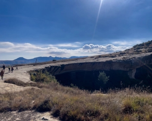
    The Bushman Circle Route is a popular hike in the Spitzkoppe Nature Reserve, offering a unique blend of natural beauty, cultural history, and challenging terrain. Here's a general guide to the route:

    1. Start at the Trailhead:

    Begin your hike from the designated trailhead for the Bushman Circle Route. Look for signs and markers that indicate the trail.

    2. Scenic Valley Walk:

    The initial part of the hike takes you through a scenic valley. Enjoy the unique rock formations and the tranquility of the desert landscape.

    3. Ancient Rock Art:

    Along the trail, you'll encounter ancient Bushman rock art sites. Take your time to appreciate these fascinating depictions of animals, people, and spiritual symbols.

    4. Challenging Ascent:

    The route then ascends steeply, often involving a challenging chain climb. Use caution and take your time, especially on wet or slippery rocks.

    5. Panoramic Viewpoint:

    After the challenging climb, you'll reach a stunning viewpoint with panoramic views of the surrounding landscape. Take a break to admire the breathtaking scenery and capture some memorable photos.

    6. Descent:

    The descent follows a different path, offering a variety of terrain and views. Be cautious, especially on the steeper sections.

Spitzkoppe Nature Reserve offers a variety of hiking trails to suit different fitness levels...
Damaraland

Damaraland Camino

  • Teaser Title: Damaraland Camino
  • Teaser Image BG: Damaraland Camino
  • Images:
    • Image: Damaraland Camino
    • Image: Damaraland Camino
    • Image: Damaraland Camino
    • Image: Damaraland Camino
  • Content Images:
    • Image: Damaraland Camino
    • Image: Damaraland Camino
    • Image: Damaraland Camino
    • Image: Damaraland Camino
  • Cave capacity: 0
  • Author Name: Fagala Voet
  • Author Link: https://sahikes.com/author/fagala-voet
  • Total Hike Duration: 0
  • Total Hike Distance: 60
  • Elevation Gain: 0
  • Website: https://fagalavoet.co.za/the-damaraland-camino/
  • E-Mail: This email address is being protected from spambots. You need JavaScript enabled to view it.
  • Booking Logo Link: https://sahikes.com/author/fagala-voet
  • Location: -20.727052671527524,14.684834641460379
  • Hike Address:

    Madisa Camp is located in Damaraland, D2612 road to Twyfelfontein, Namibia.

  • About the area:

    Damaraland, a region in northwestern Namibia, is renowned for its rugged beauty and unique wildlife. It's characterized by vast, arid landscapes, towering mountains, and ancient rock formations. One of its most iconic features is the Brandberg Mountain, home to the famous White Lady rock painting.

    Damaraland is also home to the desert-adapted elephant, a remarkable creature that has adapted to survive in this harsh environment. The region offers a variety of outdoor activities, including hiking, camping, and game drives, allowing visitors to immerse themselves in its stunning natural beauty.

  • Hike Directions:

    A 6-Day Adventure

    Day 1: Arrival and Orientation

    Your Namibian adventure kicks off with a scenic drive from Windhoek to Camp Madisa. Along the way, you'll stop for lunch in the charming mining town of Uis, nestled beneath the majestic Brandberg Mountain.

    Once at camp, settle into your tent, meet your fellow travelers, and enjoy a delicious braai under the starry African sky.

    Day 2: Following the Goantagab River (15km)

    Embark on your first full day of hiking along the dry Goantagab Riverbed. As you traverse the sandy terrain, keep an eye out for unique flora and fauna. Lunch is served at a mobile camp, where you can relax in the shade before another night under the stars.

    Day 3: Uphill to Euphorbia Camp (15km)

    Today’s hike takes you uphill, offering breathtaking views of the surrounding landscape. Keep your eyes peeled for elusive black rhinos as you ascend towards Euphorbia Camp.

    Day 4: Downhill to Cheetah Camp (15km)

    Descent towards Cheetah Camp, passing through stunning desert landscapes. Enjoy a leisurely afternoon at camp, soaking up the tranquility of the wilderness.

    Day 5: The Grand Finale (15km)

    The final day of hiking leads you to the iconic Brandberg White Lady Lodge. Traverse a mini-escarpment and follow the Ugab River to your destination. Celebrate your accomplishment with a farewell braai and optional elephant drive.

    Day 6: Departure

    After a leisurely breakfast, your shuttle will transfer you back to Windhoek, leaving you with unforgettable memories of your Damaraland Camino experience.

The Damaraland Camino is a 6-day, 5-night guided hiking adventure through the breathtaking...
Tankwa Karoo National Park

Tankwa Camino

  • Teaser Title: Tankwa Camino
  • Teaser Image BG: Tankwa Camino
  • Images:
    • Image: Tankwa Camino
    • Image: Tankwa Camino
    • Image: Tankwa Camino
  • Content Images:
    • Image: Tankwa Camino
    • Image: Tankwa Camino
    • Image: Tankwa Camino
    • Image: Tankwa Camino
  • Cave capacity: 0
  • Author Name: SA Hikes
  • Author Link: https://sahikes.com/author/sa-hikes
  • Total Hike Duration: 0
  • Total Hike Distance: 232
  • Elevation Gain: 0
  • Website: https://www.tankwacamino.com/tankwa-camino
  • E-Mail: This email address is being protected from spambots. You need JavaScript enabled to view it.
  • Booking Logo Link: https://www.tankwacamino.com/tankwa-camino
  • Location: -31.475207569550196,19.77286433480412
  • Hike Address:

    The camino starts in Calvinia, a charming town nestled in the heart of the Northern Cape province of South Africa. Known for its stunning natural beauty and rich cultural heritage, it offers a unique blend of tranquility and adventure.

  • About the area:

    The Tankwa Karoo is a vast, arid region in South Africa, renowned for its dramatic landscapes, unique flora and fauna, and clear night skies. It's a place of stark beauty, where the harsh, rugged terrain contrasts with moments of surprising delicacy.

    Key Features

    • Arid Beauty: The Tankwa Karoo is characterized by its arid climate, sparse vegetation, and rocky outcrops.
    • Unique Flora: Despite the harsh conditions, the region is home to a variety of unique plant species, many of which are endemic to the area.
    • Clear Night Skies: The remote location and lack of light pollution make the Tankwa Karoo an ideal place for stargazing.
    • Diverse Wildlife: While the region may seem desolate, it supports a variety of wildlife, including mammals, reptiles, and birds.
    • Geological Wonders: The Tankwa Karoo boasts fascinating geological formations, such as ancient rock formations and unique rock art.
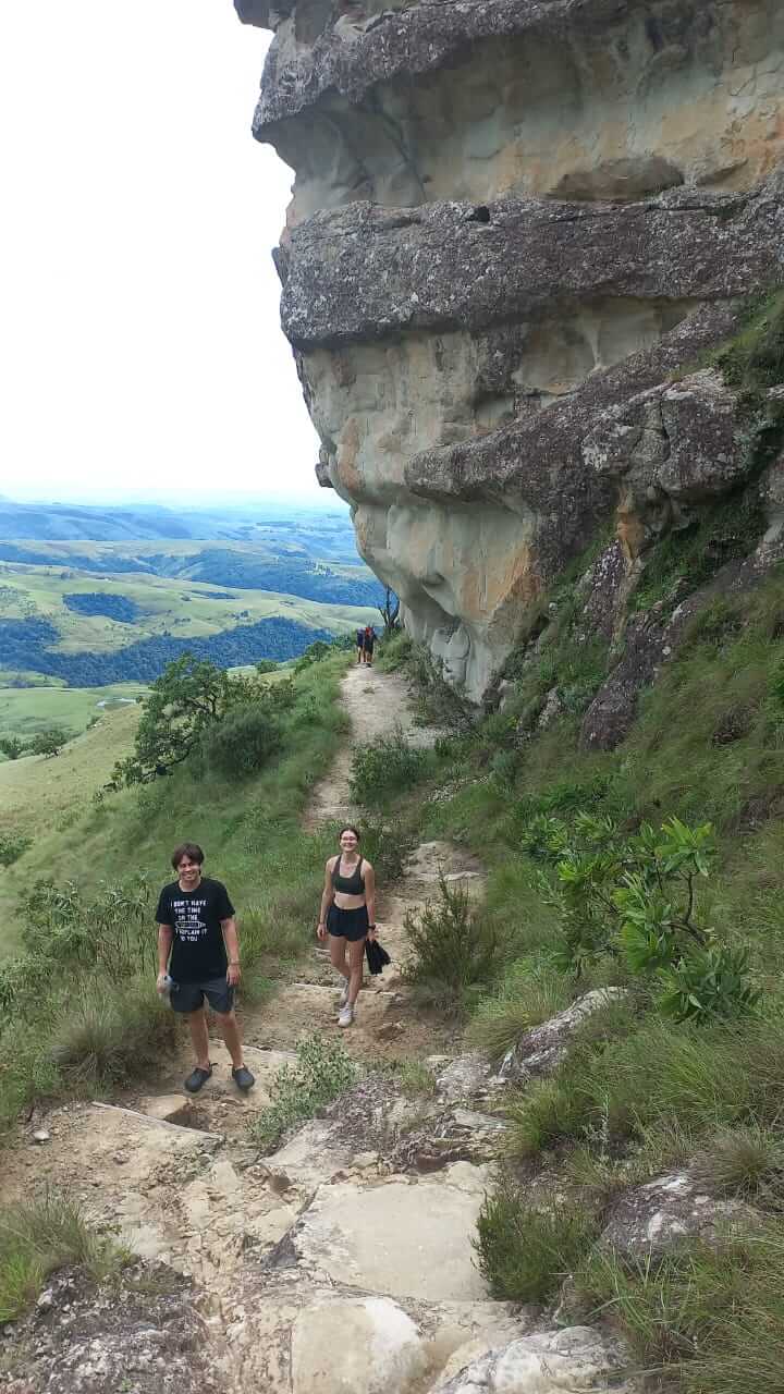
    The Tankwa Karoo National Park is a protected area within the region, offering visitors a chance to experience its pristine wilderness. With its unique combination of natural beauty, cultural heritage, and outdoor adventure, the Tankwa Karoo is a must-visit destination for nature lovers and adventure seekers.

  • Hike Directions:

    The route follows the R355, a gravel road that stretches from Calvinia in the Northern Cape to Ceres.

Embark on a contemporary interpretation of the "Great Trek," the Tankwa Camino, and immerse...
Namib Naukluft National Park - Sandwich Harbour

Naukluft Hiking Trail

  • Teaser Title: Naukluft Hiking Trail
  • Teaser Image BG: Naukluft Hiking Trail
  • Images:
    • Image: Naukluft Hiking Trail
    • Image: Naukluft Hiking Trail
    • Image: Naukluft Hiking Trail
    • Image: Naukluft Hiking Trail
    • Image: Naukluft Hiking Trail
    • Image: Naukluft Hiking Trail
    • Image: Naukluft Hiking Trail
    • Image: Naukluft Hiking Trail
  • Content Images:
    • Image: Naukluft Hiking Trail
    • Image: Naukluft Hiking Trail
    • Image: Naukluft Hiking Trail
    • Image: Naukluft Hiking Trail
  • Cave capacity: 0
  • Author Name: Fagala Voet
  • Author Link: https://sahikes.com/author/fagala-voet
  • Total Hike Duration: 0
  • Total Hike Distance: 120
  • Elevation Gain: 0
  • Website: https://fagalavoet.co.za/naukluft-hiking-trail/
  • E-Mail: This email address is being protected from spambots. You need JavaScript enabled to view it.
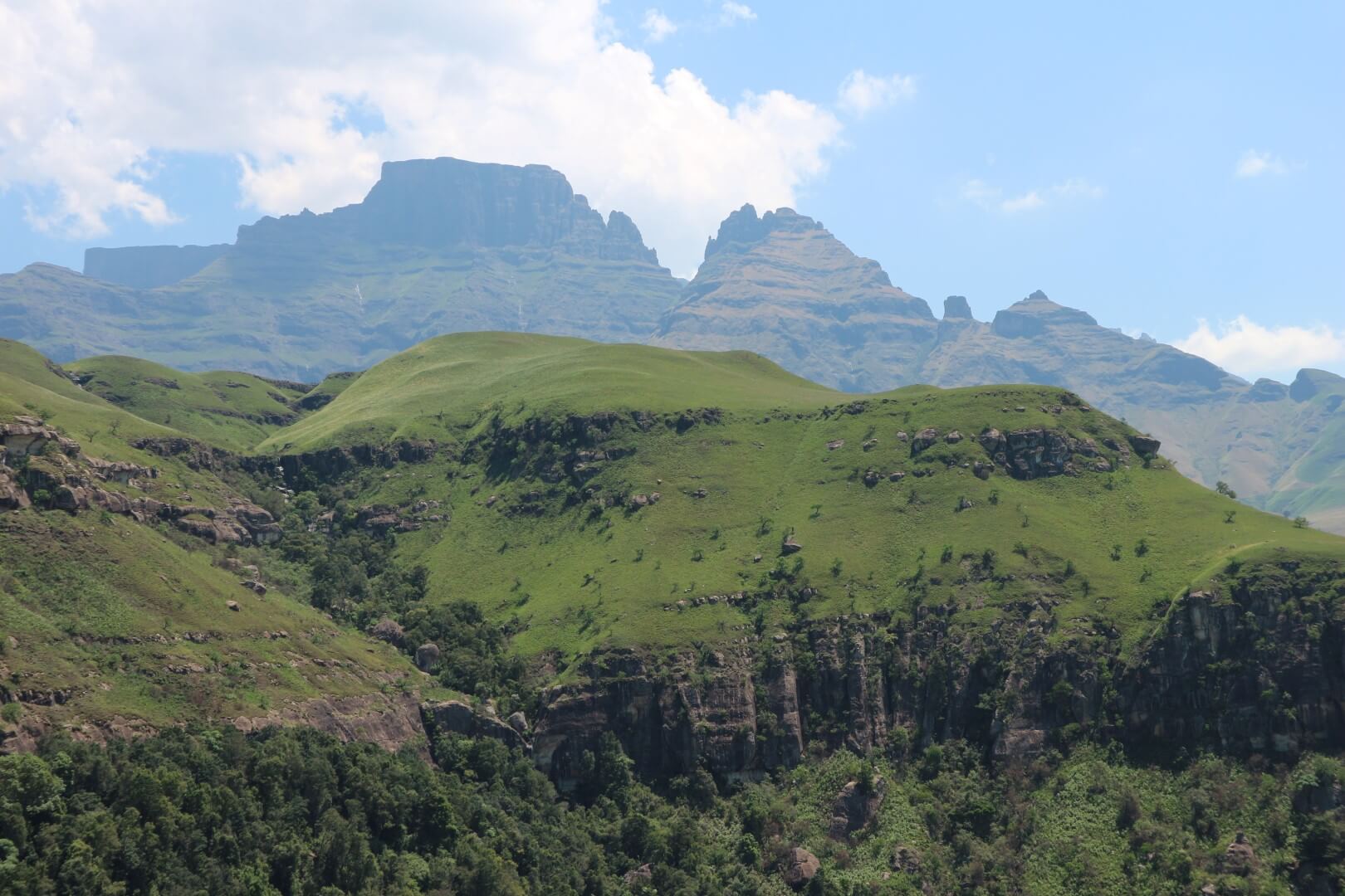
  • Booking Logo Link: https://sahikes.com/author/fagala-voet
  • Location: -24.2621,16.2429
  • Hike Address:

    The starting point for the Naukluft Hiking Trail is at the Naukluft Campsite, which is located within the Namib-Naukluft National Park.
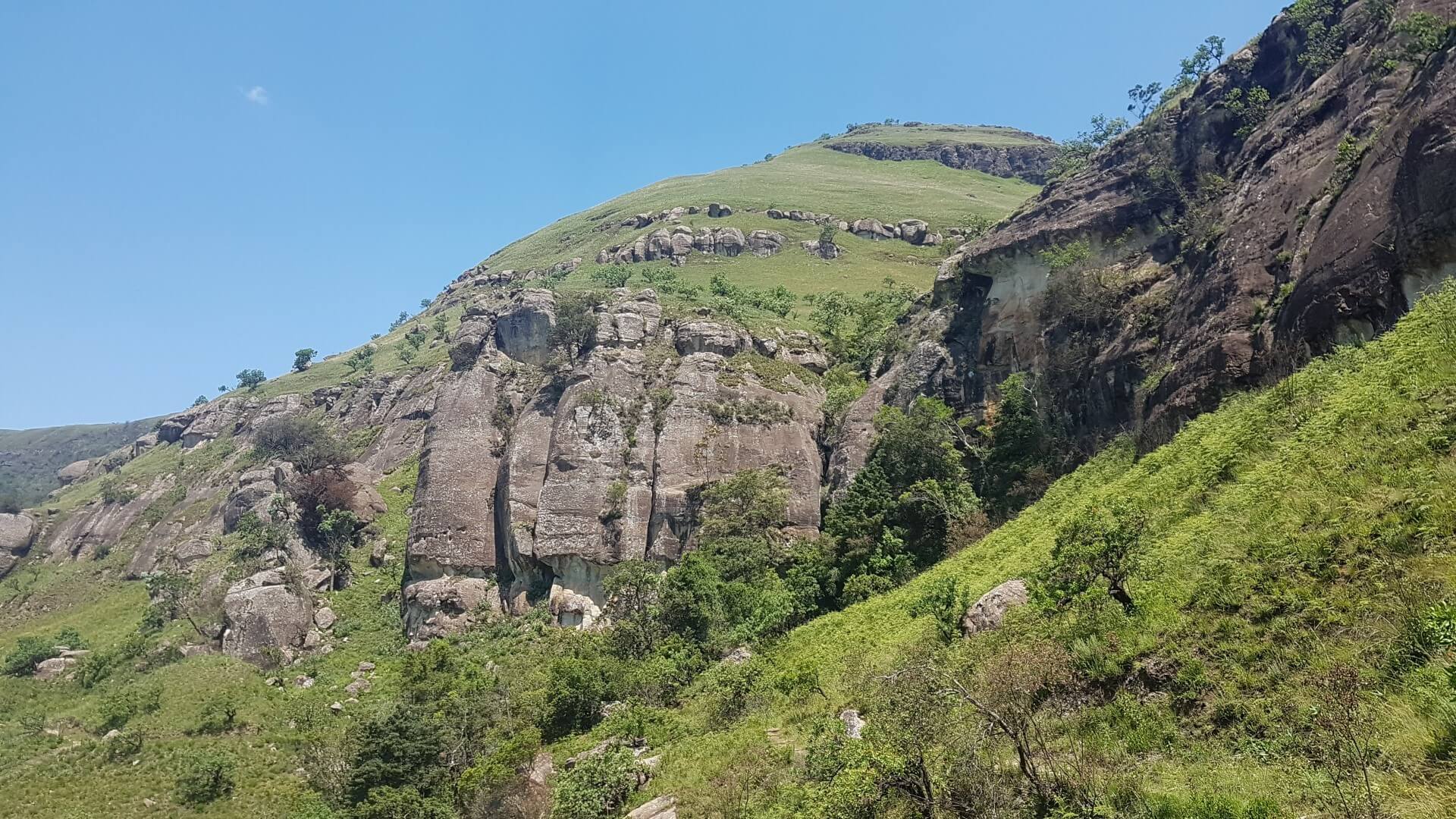
    To get to the Naukluft Campsite, you'll need to:

    • Reach Sesriem: This is the main entrance gate to the Namib-Naukluft National Park. You can reach Sesriem by car or by joining a guided tour.
    • Proceed to Naukluft Camp: Once you're inside the park, you'll need to drive to the Naukluft Campsite. This involves driving through scenic desert landscapes and potentially crossing riverbeds.
  • About the area:

    The Namib-Naukluft National Park is a vast wilderness in western Namibia, famous for its stunning landscapes and unique wildlife. It encompasses the iconic Namib Desert, the rugged Naukluft Mountains, and the pristine coastline.

    Highlights include Sossusvlei with its towering sand dunes, Sesriem Canyon, Deadvlei's haunting beauty, the Naukluft Mountains' rugged terrain, and Sandwich Harbour's unique coastal lagoon.

  • Hike Directions:

    Day 1: Naukluft Campsite to Putte Shelter

    Start your adventure by ascending the mountainside, passing through scenic viewpoints and a shady kloof. End your day at the Putte Shelter.

    • Hiking time: 6 hours
    • Distance: 14 km

    Day 2: Putte Shelter to Ubusis Hut

    Hike through the Ubusis Kloof, passing by Cathedral Fountain, a picturesque spot for a lunch break. Descend a challenging dry waterfall before reaching the Ubusis Hut.
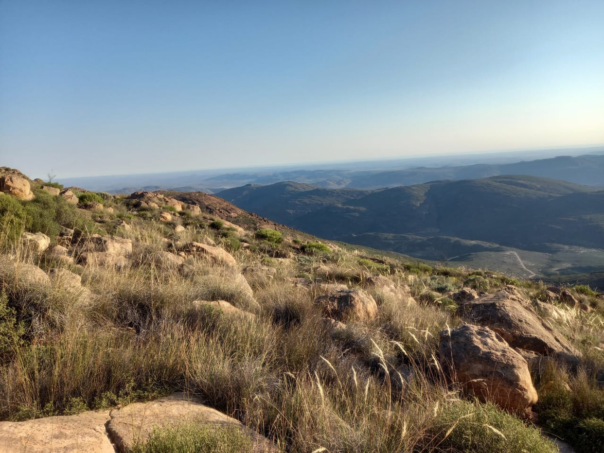
    • Hiking time: 7-9 hours
    • Distance: 15 km

    Day 3: Ubusis Hut to Adlerhorst Shelter

    Retrace your steps to the Bergpos windmill, then embark on a relatively easy hike to the Adlerhorst Shelter.
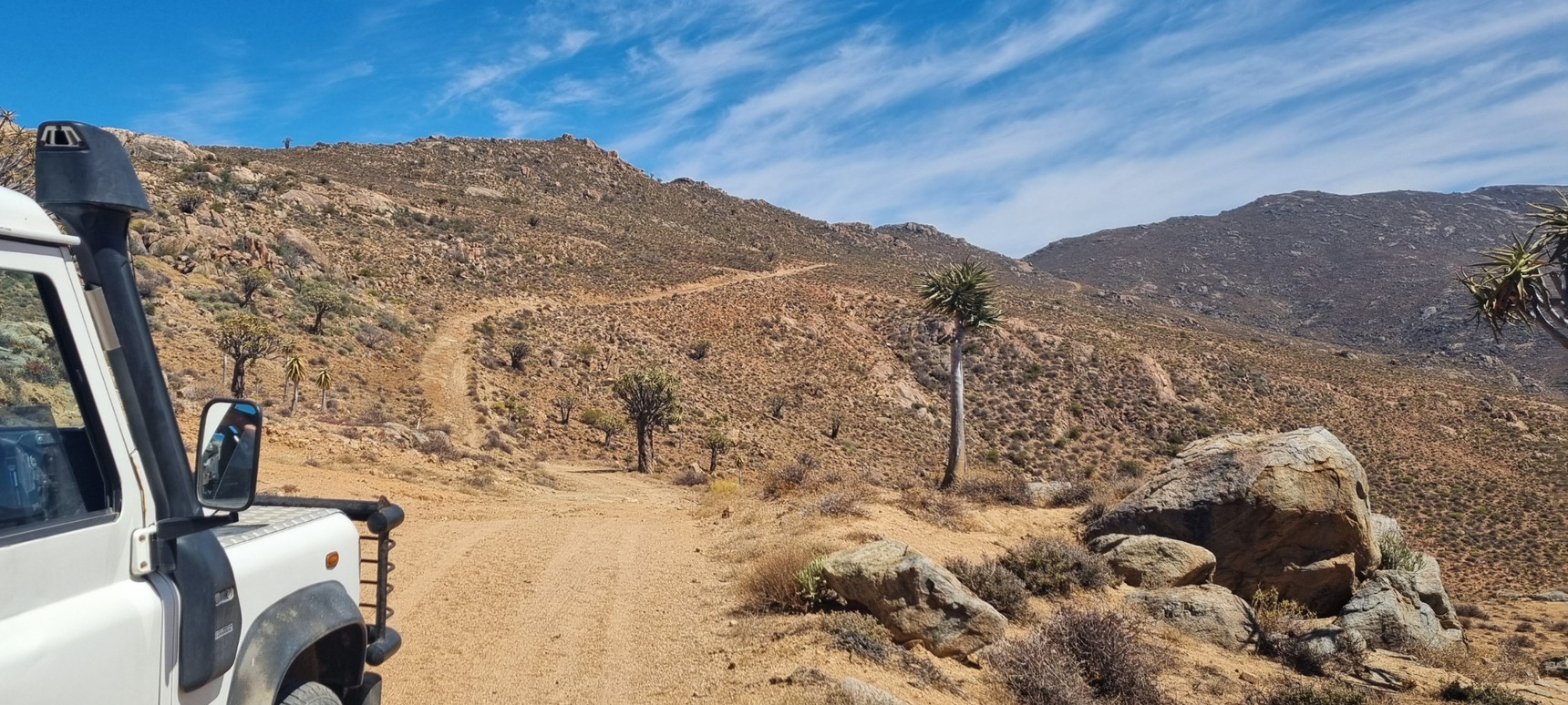
    • Hiking time: 6-7 hours
    • Distance: 12 km

    Day 4: Adlerhorst Shelter to Tsams Oost Shelter

    Hike through the scenic Zebra Kloof, ascending a steep mountainside and descending into the Tsams Oost Valley.

    • Hiking time: 7-8 hours
    • Distance: 17 km

    Day 5: Tsams Oost Shelter to Die Valle Shelter

    Climb a 200m mountainside, traverse a long valley, and ascend to the Die Valle Shelter.

    • Hiking time: 6-7 hours
    • Distance: 17 km

    Day 6: Die Valle Shelter to Tufa Shelter

    Hike through a narrow gorge, ascend a steep waterfall, and traverse a plateau before descending to the Tufa Shelter.

    • Hiking time: 6 hours
    • Distance: 16 km

    Day 7: Tufa Shelter to Kapokvlakte Shelter

    Ascend a steep waterfall, enjoy stunning mountain views, and hike across a plateau to the Kapokvlakte Shelter.

    • Hiking time: 5 hours
    • Distance: 14 km

    Day 8: Kapokvlakte Shelter to Hiker’s Haven

    Hike across a plateau, descend through kloofs, and reach the final destination: Hiker's Haven.

    • Hiking time: 5 hours
    • Distance: 16 km
The Naukluft Hiking Trail is a challenging and rewarding adventure through the rugged and...
Highmoor Nature Reserve

Caracal Cave Hike

  • Teaser Title: Caracal Cave Hike in Highmoor Reserve, KwaZulu-Natal
  • Teaser Image BG: Caracal Cave Hike in Highmoor Reserve, KwaZulu-Natal
  • GPX Track Map:

    GPS Track Details
    Track length: 5.28 km
    Total ascent: 55 m
    Total descent: 177 m
    Difficulty Level: 2/5 - Easy

  • Images:
    • Image: Caracal Cave
    • Image: Caracal Cave
  • Content Images:
    • Image: View looking towards Caracal Cave
    • Image: The steep hill on the way back from Caracal Cave
    • Image: The 2nd dam (Salma Dam) you pass on the way to Caracal Cave
    • Image: Caracal Cave Hike
  • Cave capacity: 8
  • Author Name: Drakensberg Hikes
  • Author Link: https://sahikes.com/author/drakensberg-hikes
  • Total Hike Duration: 4
  • Total Hike Distance: 10
  • Elevation Gain: 177
  • Website: https://www.kznwildlife.com/
  • E-Mail: This email address is being protected from spambots. You need JavaScript enabled to view it.
  • Booking Logo Link: https://www.kznwildlife.com/
  • Location: -29.2891,29.5997
  • Hike Address:

    The starting point is at Highmoor Reserve, Central Drakensberg.

    All enquiries and bookings can be made telephonically, or by e-mail to the Ezemvelo KZN Wildlife Reservations Office:

    • Telephone: +27 (0) 33 845 1000
    • General Information: + 27 (0) 33 845 1002
    • Email: This email address is being protected from spambots. You need JavaScript enabled to view it.
  • About the area:

    Highmoor Nature Reserve is bordered by Kamberg and Lotheni to the South and Giants Castle to the North. Highmoor forms part of the Mkhomazi Wilderness Area and is approximately 14 749 hectares in extent and boasts a huge array of rare, endemic and endangered species.

    Visitors to Highmoor return again and again as there is an incredible sense of freedom emanating from the wide landscapes of mountains, grasslands and streams. Highmoor possesses seven tastefully concealed campsites which are reputed to be both the highest and quaintest campsites in KwaZulu-Natal.

  • Hike Directions:

    From the Highmoor Reserve car park head Northwest towards a gate and turn right at the sign. After 250m going downhill cross the stream over the wooden bridge and after another 250m after the stream crossing take the path to the left (the right leads to the small Kamloops Dam wall).

    In front of you is the Salma Dam, cross the stream and walk past the dam (Salma Dam) turning right to cross the stream. The dam is now to your left. After a slight uphill you head slightly downwards towards the Shasta Dam which you pass on your left. After this dam is a small knoll on your right and the path turns right (the small path to your left is to Fulton's Rock). You are now walking along the spur, stop and enjoy the views to your left and right.

    You then head down the hill towards Caracal Cave (have a look at the picture above - this is about 4km into the hike, you have 1.2km's to go). At the bottom of the hill the path goes above the cave and slightly past, you then turn left and go down to the cave on your left. Return via the same route.

Caracal Cave easily accommodates 8 people and is approximately 5.2km's from the Highmoor...
Golden Gate Highlands National Park

Mushroom Rock Hike

  • Teaser Image BG: Mushroom Rock Hike
  • GPX Track Map:

    GPS Track Details
    Track length: 720.0 m
    Total ascent: 79 m
    Total descent: 10 m
    Difficulty Level: 1/5 - Very easy

  • Images:
    • Image: Mushroom Rock Hike
  • Content Images:
    • Image: Mushroom Rock Hike
    • Image: Mushroom Rock Hike
  • Cave capacity: 0
  • Author Name: Falko Buschke
  • Author Link: https://sahikes.com/author/falko-buschke
  • Total Hike Duration: 1
  • Total Hike Distance: 2
  • Elevation Gain: 79
  • Website: https://www.sanparks.org/parks/golden-gate-highlands/what-to-do/activities/hikes-walks-trails
  • E-Mail: This email address is being protected from spambots. You need JavaScript enabled to view it.
  • Booking Logo Link: https://sahikes.com/author/fagala-voet
  • Location: -28.5060,28.6184
  • Hike Address:

    Golden Gate Highlands National Park, Free State

  • About the area:

    Golden Gate Highlands National Park is secretly tucked away in the rolling foothills of the Maluti Mountains and surrounded by breathtaking scenery of wildlife and lush vegetation.

    The Golden Gate National Park is a Free State Nature Reserve in South Africa, located in the north eastern part of Free State and derives its name from the brilliant shades of gold cast by the sun on the sandstone cliffs, especially the imposing Brandwag rock. The area is famous for its captivating scenery, invigorating climate and the accommodation offered in hotel rooms, rondavels (round huts) and self-catering chalets.

  • Hike Directions:

    Instead, the best views of Mushroom Rock are those from the other side of the main road through the park: along the Ribbok Trail or the Zuluhoek (Afrikaans for Zulu’s Corner) vehicle lookout point. Nevertheless, the imposing cliffs are still worth a close-up visit, but it is probably best to incorporate your visit to Mushroom Rock with your trek up to Wodehouse Peak.

The trail to Mushroom Rock is the least spectacular in Golden Gate. It should only take 50...
Golden Gate Highlands National Park

Echo Ravine Hike

  • Teaser Image BG: Echo Ravine Hike
  • GPX Track Map:

    GPS Track Details
    Track length: 910.0 m
    Total ascent: 159 m
    Total descent: 0 m
    Difficulty Level: 2/5 - Easy

  • Images:
    • Image: Echo Ravine Hike
    • Image: Echo Ravine Hike
    • Image: Echo Ravine Hike
  • Cave capacity: 0
  • Author Name: Falko Buschke
  • Author Link: https://sahikes.com/author/falko-buschke
  • Total Hike Duration: 1
  • Total Hike Distance: 2
  • Elevation Gain: 159
  • Website: https://www.sanparks.org/parks/golden-gate-highlands/what-to-do/activities/hikes-walks-trails
  • E-Mail: This email address is being protected from spambots. You need JavaScript enabled to view it.
  • Booking Logo Link: https://www.sanparks.org/parks/golden-gate-highlands/what-to-do/activities/hikes-walks-trails
  • Location: -28.5060,28.6184
  • Hike Address:

    Golden Gate Highlands National Park, Free State

  • About the area:

    Golden Gate Highlands National Park is secretly tucked away in the rolling foothills of the Maluti Mountains and surrounded by breathtaking scenery of wildlife and lush vegetation.

    The Golden Gate National Park is a Free State Nature Reserve in South Africa, located in the north eastern part of Free State and derives its name from the brilliant shades of gold cast by the sun on the sandstone cliffs, especially the imposing Brandwag rock. The area is famous for its captivating scenery, invigorating climate and the accommodation offered in hotel rooms, rondavels (round huts) and self-catering chalets.

  • Hike Directions:

    It should take 25 minutes to reach the ravine, where erosion has created a cavern between two cliffs that nearly meet 10-15 m above. During the rainy season (October – March) water trickles from the overhanging cliffs to create an eerie atmosphere in the cool and shady hollow. The whole back-and-forth route is only 1.8 km so it is a great little walk that can be incorporated with hike to Brandwag Buttress or Wodehouse Peak.

Echo Ravine is one of the most picturesque short routes in Golden Gate Highlands National Park....
Golden Gate Highlands National Park

Boskloof Hike

  • Teaser Title: A short, easy back-and-forth trail starting from the Glen Reenen Rest Camp
  • Teaser Image BG: Boskloof Hike
  • GPX Track Map:

    GPS Track Details
    Track length: 1.05 km
    Total ascent: 164 m
    Total descent: 0 m
    Difficulty Level: 2/5 - Easy

  • Images:
    • Image: Boskloof Hike
    • Image: Boskloof Hike
    • Image:
  • Cave capacity: 0
  • Author Name: Falko Buschke
  • Author Link: https://sahikes.com/author/falko-buschke
  • Total Hike Duration: 1
  • Total Hike Distance: 2
  • Elevation Gain: 164
  • Website: https://www.sanparks.org/parks/golden-gate-highlands/what-to-do/activities/hikes-walks-trails
  • E-Mail: This email address is being protected from spambots. You need JavaScript enabled to view it.
  • Booking Logo Link: https://www.sanparks.org/parks/golden-gate-highlands/what-to-do/activities/hikes-walks-trails
  • Location: -28.5060,28.6184
  • Hike Address:

    Golden Gate Highlands National Park, Free State

  • About the area:

    Golden Gate Highlands National Park is secretly tucked away in the rolling foothills of the Maluti Mountains and surrounded by breathtaking scenery of wildlife and lush vegetation.

    The Golden Gate National Park is a Free State Nature Reserve in South Africa, located in the north eastern part of Free State and derives its name from the brilliant shades of gold cast by the sun on the sandstone cliffs, especially the imposing Brandwag rock. The area is famous for its captivating scenery, invigorating climate and the accommodation offered in hotel rooms, rondavels (round huts) and self-catering chalets.

  • Hike Directions:

    Most of the walk is along a gentle upward path through dense vegetation. Near the end of the trail – at the foot of a overhanging sandstone cliff – the route rises above the vegetation line and gives a view of the Glen Reenen Campsite.

The route to Boskloof (Afrikaans for Bush Gorge) is a short, easy back-and-forth trail starting...