Reserves in Southern Africa - SA Hikes

Types of Hikes
Hikes outside a reserve (Namibia)

Khomas Hochland Hiking Trail

  • Teaser Title: Khomas Hochland
Hiking Trail
  • Teaser Image BG: Khomas Hochland
Hiking Trail
  • GPX Track Map:

    GPS Track Details
    Track length: 89.29 km
    Total ascent: 1694 m
    Total descent: 1694 m
    Difficulty Level: 4/5 - Hard

  • Images:
    • Image: Khomas Hochland Hiking Trail
    • Image: Khomas Hochland
Hiking Trail
    • Image: Khomas Hochland
Hiking Trail
    • Image: Khomas Hochland
Hiking Trail
    • Image: Khomas Hochland
Hiking Trail
    • Image: Khomas Hochland
Hiking Trail
  • Total Hike Days: 0
  • Content Images:
    • Image: Khomas Hochland
Hiking Trail
    • Image: Khomas Hochland
Hiking Trail
    • Image: Khomas Hochland
Hiking Trail
    • Image: Khomas Hochland
Hiking Trail
  • Cave capacity: 0
  • Author Name: SA Hikes
  • Author Link: https://sahikes.com/author/sa-hikes
  • Total Hike Duration: 0
  • Total Hike Distance: 90
  • Elevation Gain: 1694
  • Website: https://www.hikenamibia.com/
  • E-Mail: This email address is being protected from spambots. You need JavaScript enabled to view it.
  • Booking Logo Link: https://www.hikenamibia.com/
  • Location: -22.2693,16.9017
  • Hike Address:

    Duesternbrook Safari Guest Farm. 45 min from Windhoek on the new highway A1 direction Etosha, exit D1499/Okapuka.

  • About the area:

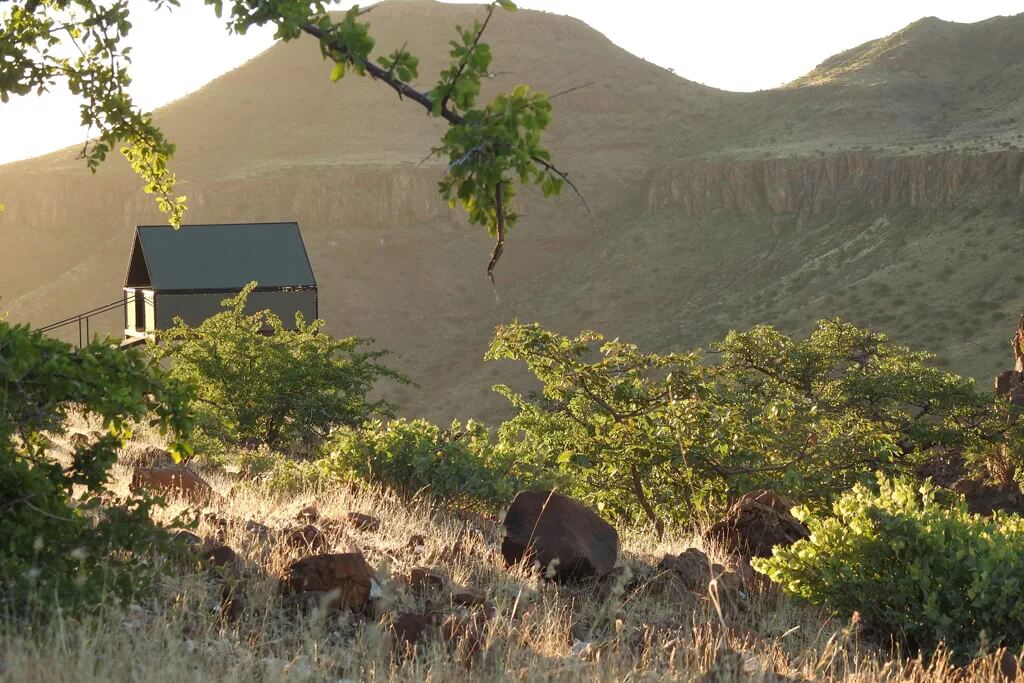
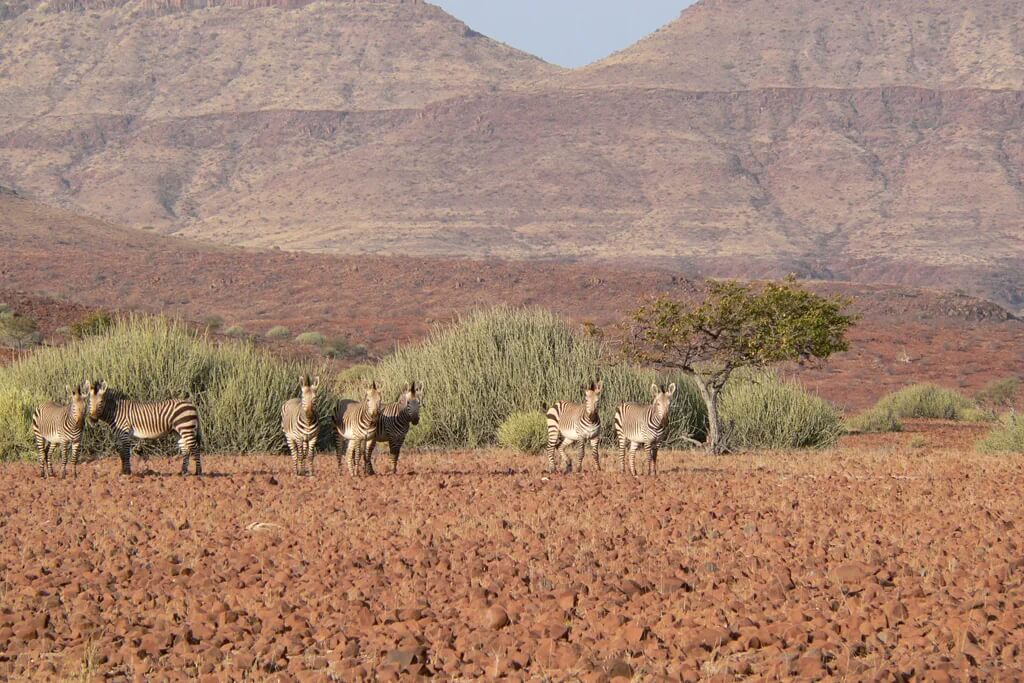
    The Khomas Hochland region of Namibia is a captivating tapestry woven with diverse landscapes, unique wildlife, and a rich cultural heritage.

    This central Namibian plateau, rising between 1700 and 2000 meters above sea level, offers a stunning array of experiences for nature lovers and cultural enthusiasts alike.  

  • Hike Directions:

    Day 1: Duesternbrook Safari Guest Farm to Otjiseva Campsite (16 km, Tough)

    Embark on a challenging trek from Duesternbrook, following the picturesque Otjiseva River. Traverse the rugged Bosveld, passing iconic landmarks like the Big Fig Tree and the enigmatic Klipmerk Gate. Navigate narrow kloofs and ascend to Toktokkie Track Rest, rewarded with breathtaking vistas. Conclude your day at the serene Gustav Posten, a wilderness haven.

    Day 2: Otjiseva to Onduno Campsite (9 km, Relax)

    Ascend the formidable Klippekou Klim, reaching the Onduno farm border. Relax at the Red Rock Lizard Rest waterfall and Partridge Pool, observing diverse birdlife. After a farm visit, descend into a vibrant riverbed teeming with wildlife. End your day at a tranquil campsite nestled beneath Baboon Mountain.

    Day 3: Onduno to Godeis Campsite (23 km, Tough)

    Brace yourself for a demanding day with long distances and significant elevation changes. Traverse expansive grasslands, cross the Godeis border, and descend into the awe-inspiring Bird Nest Gorge. Encounter thrilling wildlife, including a python and a Black Mamba, adding excitement to your journey. Conclude your day with a breathtaking sunset at the Godeis campsite.

    Day 4: Godeis to Onduno Campsite (16 km, Moderate)

    Return to Onduno via a different route, exploring the captivating Otjompaue River valley. Pass ancient San sites, the dramatic Baboon Bar Gorge, and enjoy stunning panoramic views. End your day at the familiar campsite.

    Day 5: Onduno to Monte Christo Tree House (17 km, Tough)

    Conquer Grandpa's Path, offering panoramic views of Windhoek. Experience the thrill of descending a 5-ladder waterfall. Culminate your day at the extraordinary Monte Christo Tree House, a unique and luxurious accommodation.

    Day 6: Monte Christo to Duesternbrook Safari Guest Farm (14 km, Relax)

    Enjoy a leisurely walk along the Otjiseva River, immersing yourself in serene landscapes and diverse wildlife. Conclude your unforgettable hiking adventure at your starting point, Duesternbrook Safari Guest Farm.
The Khomas Hochland Hiking Trail is a multi-day trek through the rugged and picturesque...
Hikes outside a reserve (Namibia)

Etendeka Hiking Trail

  • Teaser Title: Etendeka Hiking Trail
  • Teaser Image BG: Etendeka Hiking Trail
  • Images:
    • Image: Etendeka Hiking Trail
    • Image: Etendeka Hiking Trail
    • Image: Etendeka Hiking Trail
    • Image: Etendeka Hiking Trail
    • Image: Etendeka Hiking Trail
    • Image: Etendeka Hiking Trail
  • Total Hike Days: 0
  • Content Images:
    • Image: Etendeka Hiking Trail
    • Image: Etendeka Hiking Trail
    • Image: Etendeka Hiking Trail
    • Image: Etendeka Hiking Trail
  • Cave capacity: 0
  • Author Name: SA Hikes
  • Author Link: https://sahikes.com/author/sa-hikes
  • Total Hike Duration: 0
  • Total Hike Distance: 45
  • Elevation Gain: 0
  • Website: https://etendeka-hikes.com/
  • E-Mail: This email address is being protected from spambots. You need JavaScript enabled to view it.
  • Booking Logo Link: https://etendeka-hikes.com/
  • Location: -19.886326065465575,13.936626670251117
  • Hike Address:

    Palmwag Lodge is located in the Palmwag Concession, Damaraland, Namibia.

  • About the area:

    The Etendeka Concession, a vast, untamed wilderness in Namibia's Kaokoland region, is a captivating destination for those seeking an authentic African adventure. This remote and rugged landscape, shaped by ancient volcanic activity, offers a stunning array of geological formations, from towering basalt mountains to expansive lava plains.  

    One of the most striking features of the Etendeka Concession is the Grootberg Massif, a majestic mountain range that dominates the horizon. Its dramatic peaks and deep canyons provide a dramatic backdrop for exploring the diverse ecosystems within the concession.  

    The Etendeka Concession is a place of unparalleled beauty and ecological significance. Its remote location and pristine wilderness offer a truly unforgettable experience for nature lovers and adventure seekers alike.

  • Hike Directions:

    Day 1: A Scenic Start

    Your Etendeka adventure begins at Palmwag Lodge, where you'll meet your experienced guide and fellow hikers. After a brief orientation, you'll embark on a scenic 2-3 hour hike into the Etendeka Concession. As you traverse the pristine, rocky plains, your guide will share insights into the region's unique ecology, pointing out distinctive desert flora and fauna. Keep your camera ready to capture the breathtaking vistas and elusive wildlife.

    Day 2: Ascending to Hill Camp

    Wake up to the sounds of the African bush and fuel up with a hearty breakfast. Your second day involves a more challenging 15-20km hike to Hill Camp. The trail winds through diverse landscapes, offering opportunities to spot animal tracks and learn about the area's rich history. As you ascend to the summit of Crystal Mountain, you'll be rewarded with panoramic views that stretch as far as the eye can see.

    Day 3: Exploring Crystal Mountain

    After a restful night under the stars, you'll embark on a circular hike around Crystal Mountain. This 5-6 hour trek takes you through a captivating valley, where you'll encounter unique rock formations and fascinating geological features. Return to camp for a leisurely lunch and a short afternoon walk to further explore the area.

    Day 4: Descending to Etendeka Mountain Camp

    On the final day, you'll descend from Hill Camp to Etendeka Mountain Camp. This shorter hike allows you to soak in the beauty of the surrounding landscapes one last time. Once at the camp, you have the option to either relax and unwind or embark on a scenic drive back to Palmwag Lodge. The drive offers stunning vistas of the Etendeka region, providing a fitting conclusion to your unforgettable adventure.

The Etendeka Hiking Trail is a multi-day guided walking adventure through the remote and...
Namib Naukluft National Park - Sandwich Harbour

Big Daddy Dune

  • Teaser Title: Big Daddy Dune
  • Teaser Image BG: Big Daddy Dune
  • GPX Track Map:

    GPS Track Details
    Track length: 6.94 km
    Total ascent: 249 m
    Total descent: 249 m
    Difficulty Level: 3/5 - Medium

  • Images:
    • Image: Big Daddy Dune
    • Image: Big Daddy Dune
  • Content Images:
    • Image: Big Daddy Dune
    • Image: Big Daddy Dune
  • Cave capacity: 0
  • Author Name: SA Hikes
  • Author Link: https://sahikes.com/author/sa-hikes
  • Total Hike Duration: 0
  • Total Hike Distance: 7
  • Elevation Gain: 249
  • Website: https://www.nwr.com.na/resorts/sesriem-campsite/
  • E-Mail: This email address is being protected from spambots. You need JavaScript enabled to view it.
  • Booking Logo Link: https://www.nwr.com.na/namib-naukluft-park/
  • Location: -24.7677,15.3029
  • Hike Address:

    Big Daddy Dune is located in the Sossusvlei area of the Namib Desert in Namibia. It's situated between Sossusvlei and Deadvlei.

  • About the area:

    Sossusvlei and Deadvlei are two of the most iconic and otherworldly landscapes in the Namib Desert, Namibia.

    Sossusvlei

    • A Salt Pan: Sossusvlei is a salt and clay pan surrounded by towering sand dunes. It's the endpoint of the Tsauchab River, which rarely flows, bringing water to the pan only after heavy rains.
    • Towering Dunes: The area is famous for its massive sand dunes, some of the highest in the world. Big Daddy, at 325 meters, is one of the most prominent.
    • Otherworldly Beauty: The stark, red sand dunes contrasting with the white salt pan create a surreal and breathtaking landscape.

    Deadvlei

    • A Dried-Up Lake: Deadvlei is a clay pan located near Sossusvlei. It was once a wetland, but as the climate changed, sand dunes blocked the river, leaving the pan dry.
    • Dead Trees: The pan is dotted with the skeletal remains of ancient camel thorn trees. These trees died centuries ago but haven't decomposed due to the extremely dry climate.
    • Unique Contrast: The white clay pan, the dark, dead trees, and the towering red dunes create a striking and unforgettable scene.
  • Hike Directions:

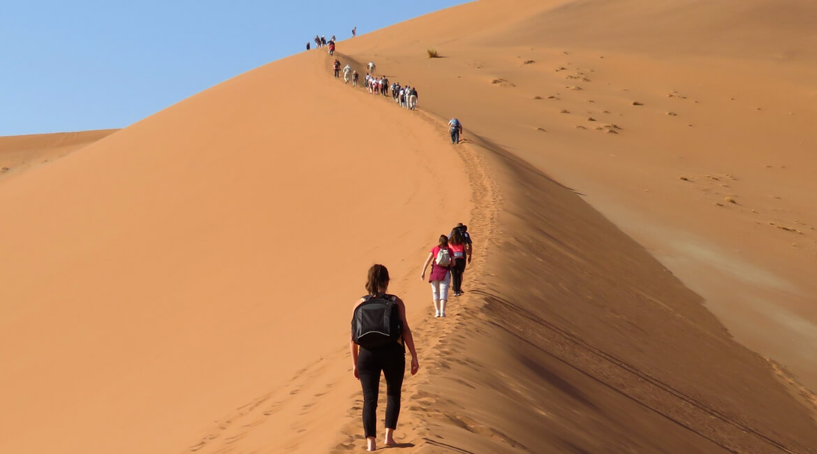
    Start at the Deadvlei Parking Area and follow the ridge that leads up to the top of the dune. There is no marked trail, but the path is generally easy to follow.

    • Distance: The round trip distance is approximately 7 kilometers.
    • Elevation Gain: The elevation gain is around 249 meters.
    • Time: The hike typically takes around 2.5 hours to complete, including time for rest and taking in the views.

    Important Notes:

    • Best Time to Hike: The best time to hike Big Daddy Dune is early in the morning to avoid the heat of the day.
    • Water: Be sure to bring plenty of water, as it can get very hot and dry in the Namib Desert.
    • Sun Protection: Wear sunscreen, a hat, and sunglasses to protect yourself from the sun.
    • Footwear: Wear sturdy hiking boots with good traction.
    • Permits: You will need a permit to enter the Namib-Naukluft National Park.
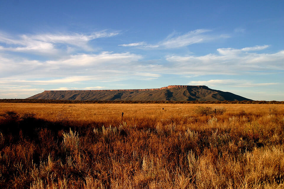
Soaring 325 meters above the desert floor, Big Daddy is the undisputed king of the Sossusvlei...
Waterberg Plateau National Park

Waterberg Plateau Loop

  • Teaser Title: Waterberg Plateau Viewpoint Loop
  • Teaser Image BG: Waterberg Plateau Viewpoint Loop
  • GPX Track Map:

    GPS Track Details
    Track length: 8.48 km
    Total ascent: 166 m
    Total descent: 165 m
    Difficulty Level: 3/5 - Medium

  • Images:
    • Image: Waterberg Plateau Viewpoint Loop
    • Image: Waterberg Plateau Viewpoint Loop
    • Image: Waterberg Plateau Viewpoint Loop
  • Cave capacity: 0
  • Author Name: SA Hikes
  • Author Link: https://sahikes.com/author/sa-hikes
  • Total Hike Duration: 0
  • Total Hike Distance: 9
  • Elevation Gain: 166
  • Website: https://waterberg-wilderness.com/
  • E-Mail: This email address is being protected from spambots. You need JavaScript enabled to view it.
  • Booking Logo Link: https://waterberg-wilderness.com/
  • Location: -20.4826,17.2893
  • Hike Address:

    The Waterberg Plateau Park is located 68 kilometers east of the town of Otjiwarongo in central Namibia. You can start the loop at Waterberg Andersson Camp or Waterberg Valley Lodge.

  • About the area:

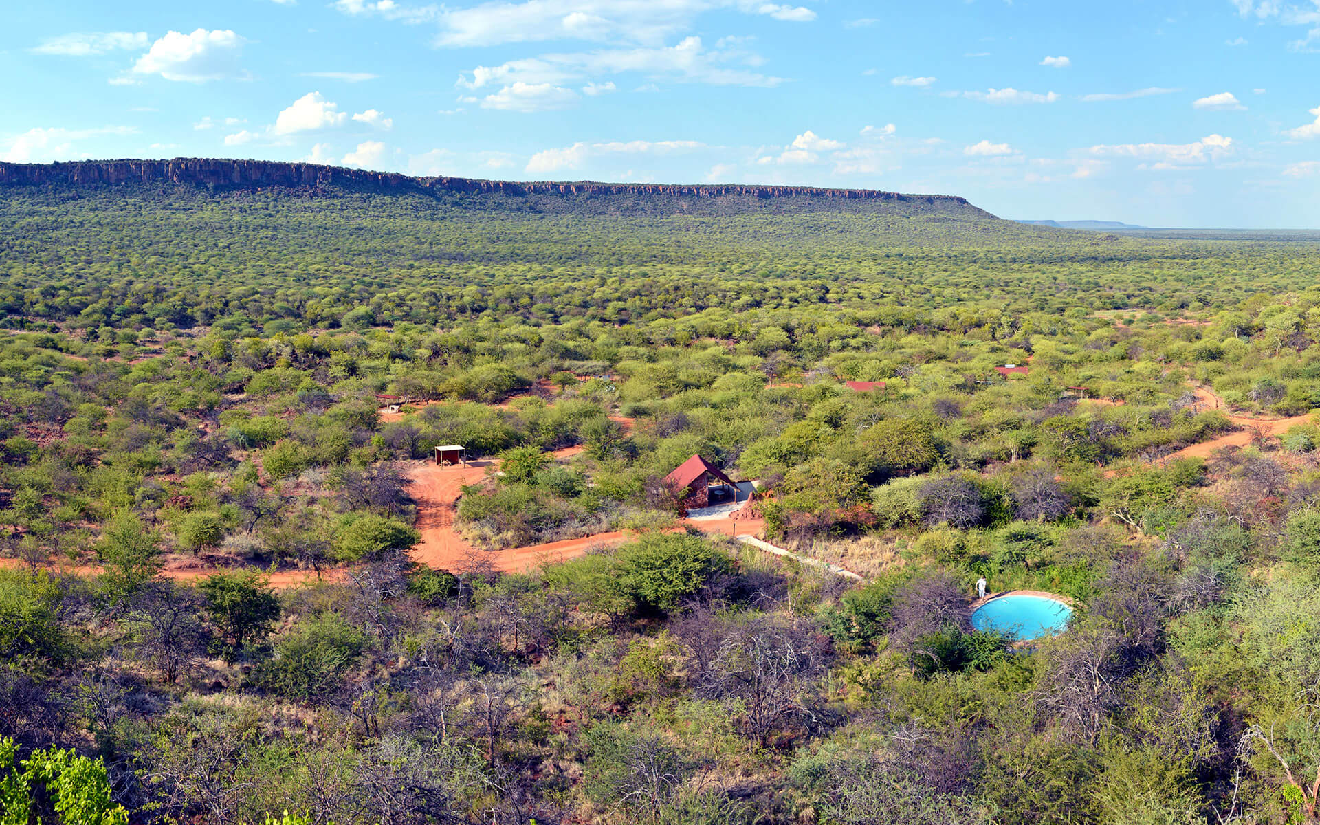
    The Waterberg Plateau is a majestic landmark in Namibia, known for its rich biodiversity and historical significance.

    Natural Beauty

    • Atop the Kalahari: The plateau rises dramatically above the Kalahari Desert, offering breathtaking views of the surrounding plains.  
    • Ancient Landscapes: The plateau boasts geological formations dating back over 850 million years, making it a treasure trove for geologists and history enthusiasts.  
    • Diverse Habitats: The plateau supports a variety of ecosystems, from savannah grasslands to rocky outcrops, creating a haven for numerous wildlife species.
  • Hike Directions:

    Starting Point: Andersson Camping Site

    • Lovebird Gorge: Head towards Lovebird Gorge, following the trail through a beautiful gorge with lush vegetation and stunning rock formations.
    • Quelle: Continue on the trail to Quelle, a scenic viewpoint offering panoramic views of the Waterberg Plateau.
    • Fountain Trail: From Quelle, follow the Fountain Trail, which leads you through a scenic valley with a refreshing spring.
    • Dassie Trail: The trail then merges with the Dassie Trail, taking you along a ridge with stunning views of the surrounding landscape.
    • Andersson Camping Site: The Dassie Trail eventually leads back to Andersson Camping Site, completing the loop.
The Waterberg Plateau Loop is a scenic hiking trail that offers stunning views of the Waterberg...
Spitzkoppe Nature Reserve

Spitzkoppe: The Matterhorn of Africa Trails

  • Teaser Title: Spitzkoppe: The Matterhorn of Africa Trails
  • Teaser Image BG: Spitzkoppe: The Matterhorn of Africa Trails
  • Images:
    • Image: Spitzkoppe: The Matterhorn of Africa Trails
    • Image: Spitzkoppe: The Matterhorn of Africa Trails
    • Image: Spitzkoppe: The Matterhorn of Africa Trails
  • Content Images:
    • Image: Spitzkoppe: The Matterhorn of Africa Trails
    • Image: Spitzkoppe: The Matterhorn of Africa Trails
    • Image: Spitzkoppe: The Matterhorn of Africa Trails
    • Image: Spitzkoppe: The Matterhorn of Africa Trails
  • Cave capacity: 0
  • Author Name: SA Hikes
  • Author Link: https://sahikes.com/author/sa-hikes
  • Total Hike Duration: 5
  • Total Hike Distance: 7
  • Elevation Gain: 0
  • Website: https://www.spitzkoppe.com/
  • E-Mail: This email address is being protected from spambots. You need JavaScript enabled to view it.
  • Booking Logo Link: https://www.spitzkoppe.com/
  • Location: -21.8234,15.1940
  • Hike Address:

    Spitzkoppe Nature Reserve is located approximately 150 kilometers northeast of Swakopmund and 278 kilometers northwest of Windhoek.

  • About the area:

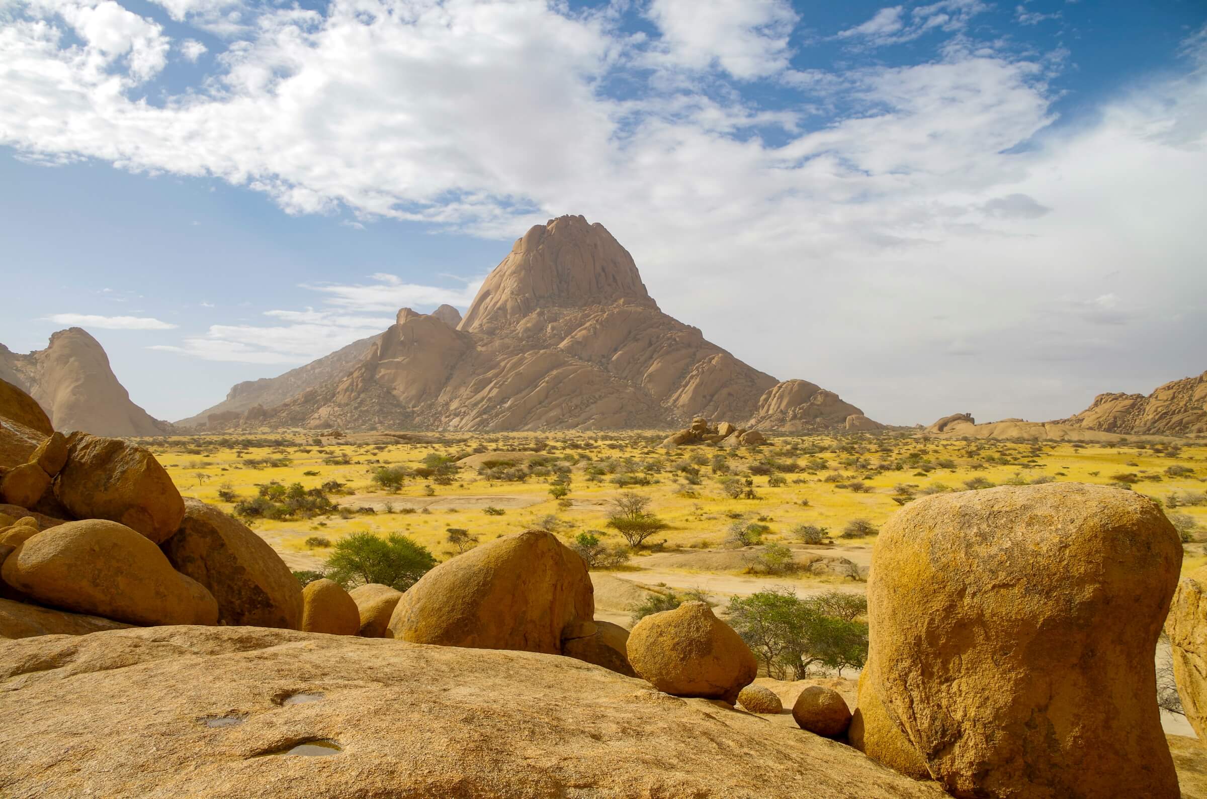
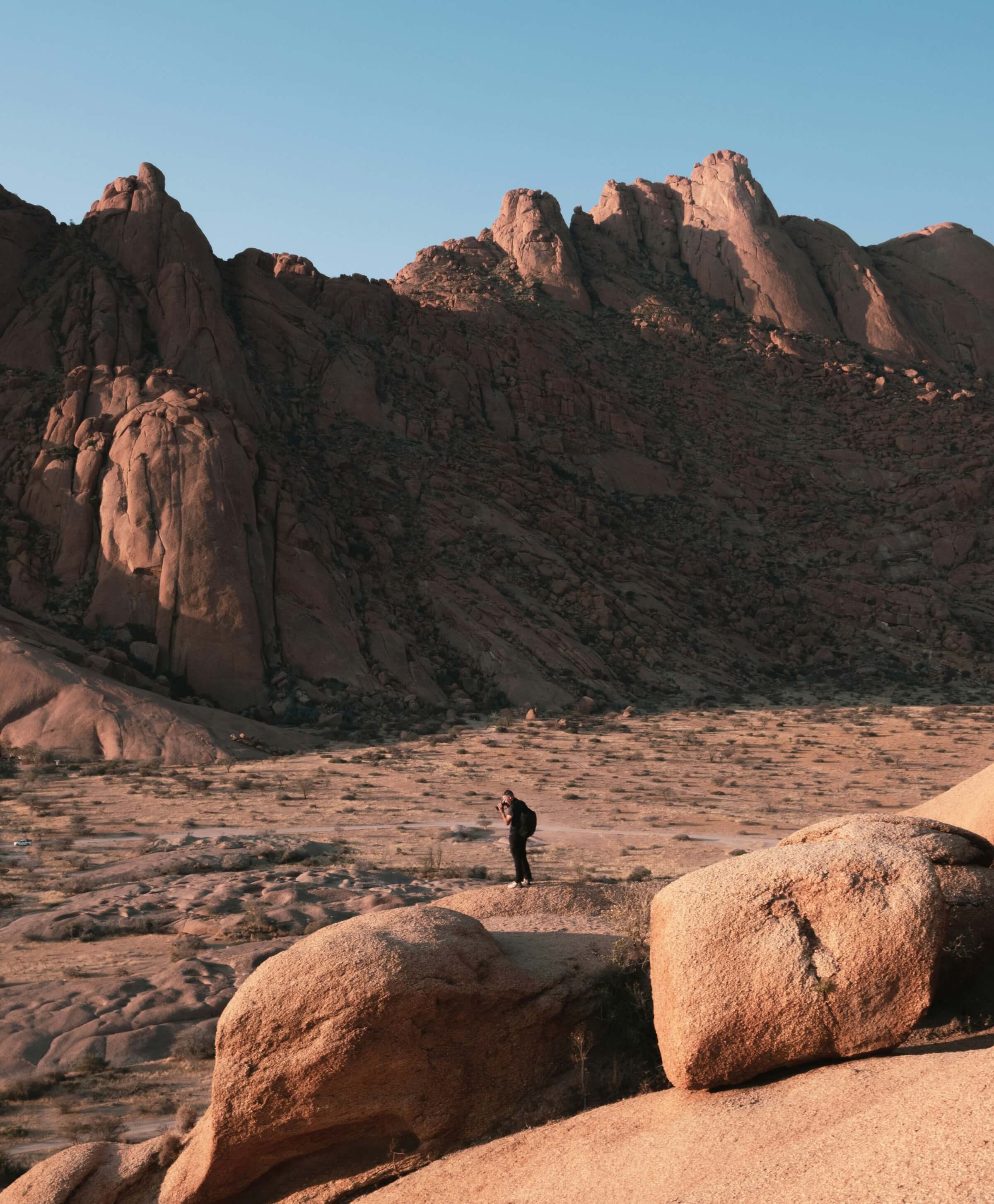
    The Spitzkoppe area is a stunning natural wonder located in the Namib Desert of Namibia. It's often referred to as the "Matterhorn of Africa" due to its distinctive shape and dramatic rise from the surrounding plains.

  • Hike Directions:

    The Pontok Route is a popular hike in the Spitzkoppe Nature Reserve, offering stunning views of the surrounding landscape. Here's a general guide to the route:

    • Start at the Pontok Trailhead: This is usually near the main campsite area. Look for signs indicating the Pontok Route.
    • Ascent: The trail begins with a steady ascent, winding its way up the side of the mountain. The path is well-defined but can be steep in some sections.
    • Rocky Terrain: As you gain elevation, the terrain becomes more rocky. Be cautious, especially on loose rocks.
    • Panoramic Views: As you approach the summit, you'll be rewarded with breathtaking panoramic views of the Spitzkoppe massif, the surrounding desert, and distant mountains.
    • The Summit: The summit of Pontok offers a spectacular 360-degree view. Take your time to enjoy the scenery and capture some memorable photos.
    • Descent: The descent follows the same route as the ascent. Take your time and be cautious on the steep sections.

    The Matterhorn Route is a challenging hike that requires experience and proper equipment. It's essential to have a good level of fitness and experience with scrambling over rocks. While there are no specific marked trails, here's a general guide:

    1. Start at the Base:

    Begin your hike from the base of Gross Spitzkoppe. The exact starting point will depend on the specific route you choose. Look for cairns (man-made piles of rocks) that mark the trail. These are common markers in the area and can guide you.

    2. Ascend the Slopes:

    The initial ascent involves climbing over large boulders and navigating steep slopes. Use your hands and feet to pull yourself up, and be cautious of loose rocks. Look for the best footholds and handholds to maintain a steady pace.

    3. The Scramble:

    As you get higher, the scrambling becomes more intense. You may encounter narrow ledges, exposed sections, and challenging rock formations. Use caution and take your time. If you're unsure, consider turning back.

    4. The Summit Approach:

    The final section to the summit can be the most challenging. You may need to use your hands and feet to climb over the final obstacles. The views from the summit are truly breathtaking, but the reward is worth the effort.

    The Bushman Circle Route is a popular hike in the Spitzkoppe Nature Reserve, offering a unique blend of natural beauty, cultural history, and challenging terrain. Here's a general guide to the route:

    1. Start at the Trailhead:

    Begin your hike from the designated trailhead for the Bushman Circle Route. Look for signs and markers that indicate the trail.

    2. Scenic Valley Walk:

    The initial part of the hike takes you through a scenic valley. Enjoy the unique rock formations and the tranquility of the desert landscape.

    3. Ancient Rock Art:

    Along the trail, you'll encounter ancient Bushman rock art sites. Take your time to appreciate these fascinating depictions of animals, people, and spiritual symbols.

    4. Challenging Ascent:

    The route then ascends steeply, often involving a challenging chain climb. Use caution and take your time, especially on wet or slippery rocks.

    5. Panoramic Viewpoint:

    After the challenging climb, you'll reach a stunning viewpoint with panoramic views of the surrounding landscape. Take a break to admire the breathtaking scenery and capture some memorable photos.

    6. Descent:

    The descent follows a different path, offering a variety of terrain and views. Be cautious, especially on the steeper sections.

Spitzkoppe Nature Reserve offers a variety of hiking trails to suit different fitness levels...
Namib Naukluft National Park - Sandwich Harbour

The Namib100 Hike

  • Teaser Title: The Namib100 Hike
  • Teaser Image BG: The Namib100 Hike
  • Images:
    • Image: The Namib100 Hike
    • Image: The Namib100 Hike
    • Image: The Namib100 Hike
    • Image: The Namib100 Hike
    • Image: The Namib100 Hike
  • Content Images:
    • Image: The Namib100 Hike
    • Image: The Namib100 Hike
    • Image: The Namib100 Hike
    • Image: The Namib100 Hike
  • Cave capacity: 0
  • Author Name: Fagala Voet
  • Author Link: https://sahikes.com/author/fagala-voet
  • Total Hike Duration: 0
  • Total Hike Distance: 100
  • Elevation Gain: 0
  • Website: https://fagalavoet.co.za/namib100-hike/
  • E-Mail: This email address is being protected from spambots. You need JavaScript enabled to view it.
  • Booking Logo Link: https://sahikes.com/author/fagala-voet
  • Location: -23.149068124086465,14.444150873832864
  • Hike Address:

    Dolphins Coffee Shop is located at the corner of Esplanade and 90 Atlantic Street in Walvis Bay, Namibia.

  • About the area:

    Walvis Bay is a coastal town in Namibia, known for its stunning natural beauty, rich history, and proximity to the vast Namib-Naukluft National Park. It serves as a popular gateway for visitors exploring the desert, offering a range of activities and attractions.

    Namib-Naukluft National Park is one of the largest conservation areas in the world, encompassing a vast expanse of desert, mountains, and coastline. It's renowned for its otherworldly landscapes, unique wildlife, and extreme conditions.

  • Hike Directions:

    Arrive in Walvis Bay

    Welcome Dinner & Briefing: Join fellow adventurers for a communal dinner and briefing session at Dolphins Coffee Shop.

    Day 1: Sandwich Harbour's Natural Wonders

    • Distance: 22-23 km
    • Elevation Gain: 411 m
    • Highlights: Explore the stunning Sandwich Harbour, a Ramsar wetland teeming with diverse birdlife and marine life.

    Day 2: The Rugged Coastline & Shipwreck

    • Distance: 23-24 km
    • Elevation Gain: 72 m
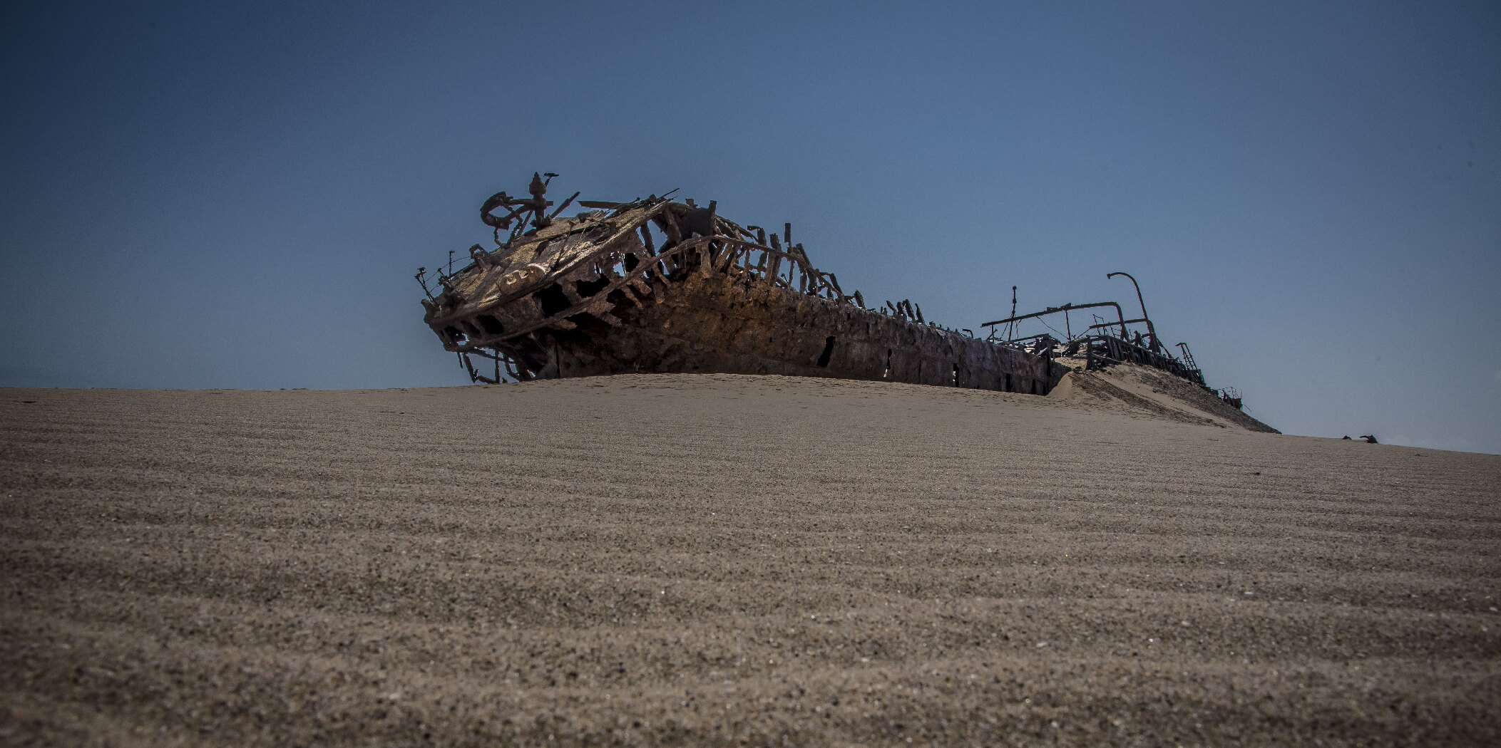
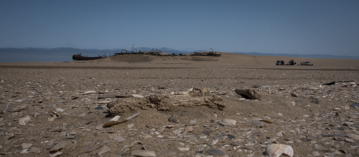
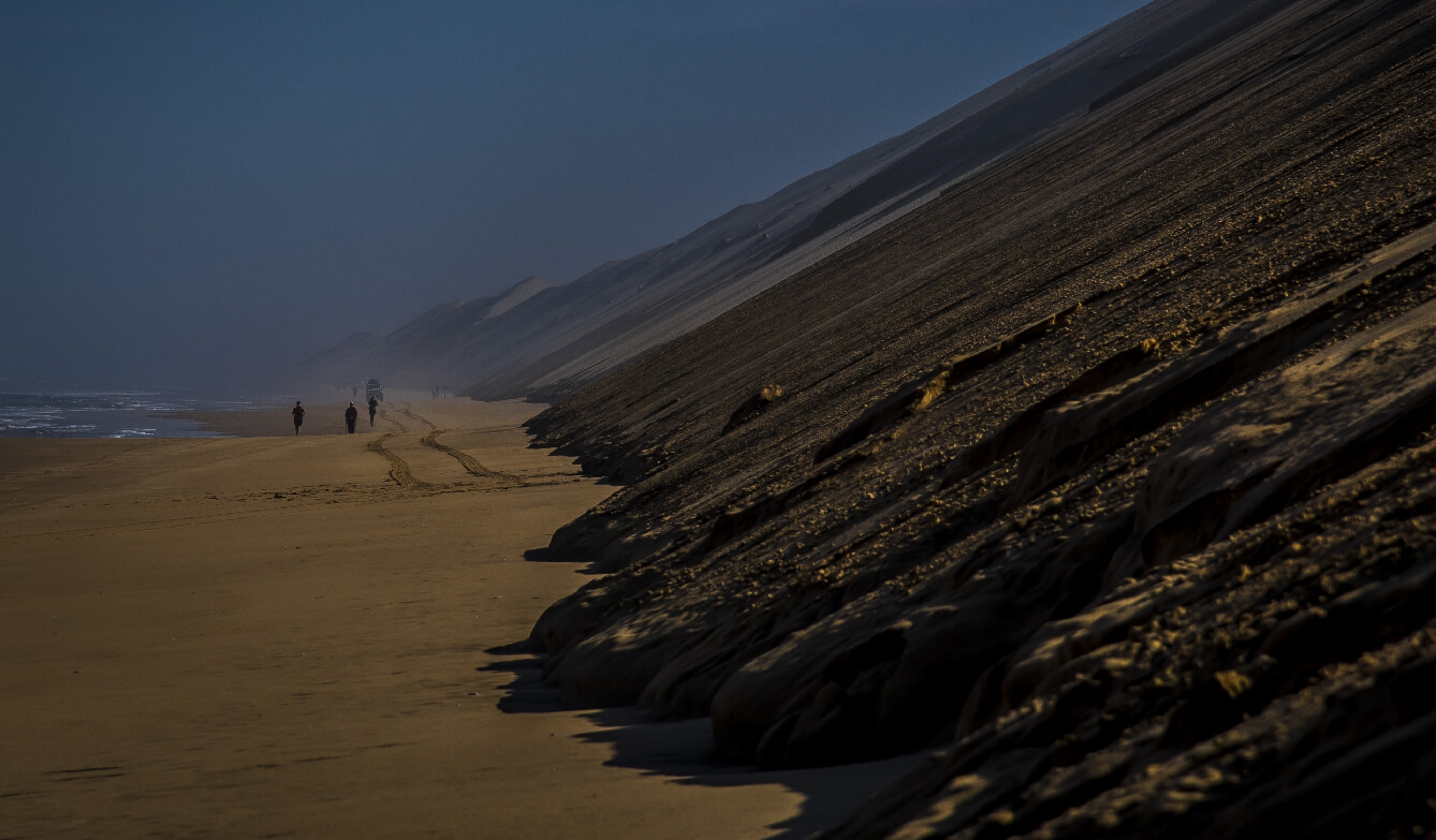
    • Highlights: Trek along the dramatic coastline, passing massive seal colonies and the eerie wreck of the Shawnee.

    Day 3: Coastal Serenity & Ancient Seashells

    • Distance: 20-21 km
    • Elevation Gain: 258 m
    • Highlights: Wander along the pristine shoreline, marveling at ancient oyster shells and whale bones. Connect with nature and rejuvenate your senses.

    Day 4: The Namib Desert's Intricate Beauty

    • Distance: 19-20 km
    • Elevation Gain: 95 m
    • Highlights: Discover a different side of the Namib Desert, exploring a gritty plain teeming with unique flora and fauna. Camp near the ruins of an old mining settlement.

    Day 5: Salt Pans, Shipwrecks, & the Hike's End

    • Distance: 13-14 km
    • Elevation Gain: 113 m
    • Highlights: Traverse pink salt pans and ancient ocean floors, catching glimpses of the Eduard Bohlen shipwreck. Celebrate the end of your adventure with a glass of bubbly.

    Day 6: Departure

    • Transfer to Airport: Relax and reflect on your incredible journey as you're transferred to the Walvis Bay Airport.
Forget Ordinary Hikes. Conquer the Namib100. The Namib100 isn't your...
Namib Naukluft National Park - Sandwich Harbour

The Kuiseb90 Hike

  • Teaser Title: The Kuiseb90 Hike
  • Teaser Image BG: The Kuiseb90 Hike
  • Images:
    • Image: The Kuiseb90 Hike
    • Image: The Kuiseb90 Hike
    • Image: The Kuiseb90 Hike
    • Image: The Kuiseb90 Hike
  • Content Images:
    • Image: The Kuiseb90 Hike
    • Image: The Kuiseb90 Hike
    • Image: The Kuiseb90 Hike
    • Image: The Kuiseb90 Hike
  • Cave capacity: 0
  • Author Name: Fagala Voet
  • Author Link: https://sahikes.com/author/fagala-voet
  • Total Hike Duration: 0
  • Total Hike Distance: 90
  • Elevation Gain: 0
  • Website: https://fagalavoet.co.za/kuiseb90-hike/
  • E-Mail: This email address is being protected from spambots. You need JavaScript enabled to view it.
  • Booking Logo Link: https://sahikes.com/author/fagala-voet
  • Location: -23.56131358658342,15.041228760562214
  • Hike Address:

    On day one after travelling from Walvis Bay you start at the Gobabeb Namib Research Institute, often simply referred to as Gobabeb. It is a renowned center for dryland research and training located in the heart of the Namib Desert, approximately 120 kilometers southeast of Walvis Bay, Namibia.

  • About the area:

    The Namib-Naukluft National Park is a vast wilderness in western Namibia, famous for its stunning landscapes and unique wildlife. It encompasses the iconic Namib Desert, the rugged Naukluft Mountains, and the pristine coastline.

    Highlights include Sossusvlei with its towering sand dunes, Sesriem Canyon, Deadvlei's haunting beauty, the Naukluft Mountains' rugged terrain, and Sandwich Harbour's unique coastal lagoon.

  • Hike Directions:

    The Kuiseb90: A Journey into the Heart of the Namib

    Day 1: Arrival and Desert Oasis

    Your Namibian adventure begins with a scenic transfer from Walvis Bay to the Gobabeb Namib Research Institute. As you journey through diverse landscapes, including rugged mountains and ancient dunes, you'll feel a growing sense of anticipation.

    Upon arrival at Gobabeb, a world-renowned research center, you'll have the unique opportunity to immerse yourself in the heart of the Namib Desert. This evening, gather with fellow hikers for a pre-trek briefing and a delicious communal dinner under the starlit sky.

    • Overnight: Gobabeb Namib Research Institute

    Day 2: A Gentle Start

    Embark on your first hike, gradually acclimatizing to the desert environment. As you walk towards the escarpment, you'll be captivated by the vast expanse of the Kuiseb Canyon. Set up camp amidst stunning red dunes, enjoying panoramic views and a peaceful night under the stars.

    • Distance: 5-8 km
    • Difficulty: Easy to Moderate

    Day 3: Descent into the Canyon

    Descend into the heart of the Kuiseb Canyon, following ancient animal trails. Traverse the canyon floor, encountering pristine water pools and diverse wildlife. As you ascend back to the escarpment, you'll be rewarded with breathtaking views.

    • Distance: 25 km
    • Difficulty: Moderate to Challenging

    Day 4: Deeper into the Canyon

    Continue your exploration of the canyon's depths, witnessing towering cliffs and unique rock formations. Keep an eye out for leopard tracks and other desert wildlife. Camp overnight within the canyon, immersing yourself in the serene wilderness.

    • Distance: 17 km
    • Difficulty: Moderate

    Day 5: Scenic Highs

    Ascend to a high point, offering panoramic vistas of the canyon and surrounding desert. Encounter the ancient Welwitschia plant, a unique desert survivor. Explore a lesser-known canyon with dramatic rock formations.

    • Distance: 17 km
    • Difficulty: Moderate

    Day 6: Farewell to the Canyon

    Hike through the final stretch of the canyon, savoring the last moments. Celebrate your accomplishment with a certificate presentation and a final dinner under the stars.

    • Distance: 19 km
    • Difficulty: Moderate

    Day 7: Departure

    Enjoy a final breakfast in the canyon before transferring back to Walvis Bay.

Experience the Kuiseb90 Pristine. Untouched. Unspoiled. Untamed. The Kuiseb90...
Damaraland

Damaraland Camino

  • Teaser Title: Damaraland Camino
  • Teaser Image BG: Damaraland Camino
  • Images:
    • Image: Damaraland Camino
    • Image: Damaraland Camino
    • Image: Damaraland Camino
    • Image: Damaraland Camino
  • Content Images:
    • Image: Damaraland Camino
    • Image: Damaraland Camino
    • Image: Damaraland Camino
    • Image: Damaraland Camino
  • Cave capacity: 0
  • Author Name: Fagala Voet
  • Author Link: https://sahikes.com/author/fagala-voet
  • Total Hike Duration: 0
  • Total Hike Distance: 60
  • Elevation Gain: 0
  • Website: https://fagalavoet.co.za/the-damaraland-camino/
  • E-Mail: This email address is being protected from spambots. You need JavaScript enabled to view it.
  • Booking Logo Link: https://sahikes.com/author/fagala-voet
  • Location: -20.727052671527524,14.684834641460379
  • Hike Address:

    Madisa Camp is located in Damaraland, D2612 road to Twyfelfontein, Namibia.

  • About the area:

    Damaraland, a region in northwestern Namibia, is renowned for its rugged beauty and unique wildlife. It's characterized by vast, arid landscapes, towering mountains, and ancient rock formations. One of its most iconic features is the Brandberg Mountain, home to the famous White Lady rock painting.

    Damaraland is also home to the desert-adapted elephant, a remarkable creature that has adapted to survive in this harsh environment. The region offers a variety of outdoor activities, including hiking, camping, and game drives, allowing visitors to immerse themselves in its stunning natural beauty.

  • Hike Directions:

    A 6-Day Adventure

    Day 1: Arrival and Orientation

    Your Namibian adventure kicks off with a scenic drive from Windhoek to Camp Madisa. Along the way, you'll stop for lunch in the charming mining town of Uis, nestled beneath the majestic Brandberg Mountain.

    Once at camp, settle into your tent, meet your fellow travelers, and enjoy a delicious braai under the starry African sky.

    Day 2: Following the Goantagab River (15km)

    Embark on your first full day of hiking along the dry Goantagab Riverbed. As you traverse the sandy terrain, keep an eye out for unique flora and fauna. Lunch is served at a mobile camp, where you can relax in the shade before another night under the stars.

    Day 3: Uphill to Euphorbia Camp (15km)

    Today’s hike takes you uphill, offering breathtaking views of the surrounding landscape. Keep your eyes peeled for elusive black rhinos as you ascend towards Euphorbia Camp.

    Day 4: Downhill to Cheetah Camp (15km)

    Descent towards Cheetah Camp, passing through stunning desert landscapes. Enjoy a leisurely afternoon at camp, soaking up the tranquility of the wilderness.

    Day 5: The Grand Finale (15km)

    The final day of hiking leads you to the iconic Brandberg White Lady Lodge. Traverse a mini-escarpment and follow the Ugab River to your destination. Celebrate your accomplishment with a farewell braai and optional elephant drive.

    Day 6: Departure

    After a leisurely breakfast, your shuttle will transfer you back to Windhoek, leaving you with unforgettable memories of your Damaraland Camino experience.

The Damaraland Camino is a 6-day, 5-night guided hiking adventure through the breathtaking...
Krantzkloof Nature Reserve

Krantzkloof Nature Reserve Trails

  • GPX Track Map:

    GPS Track Details
    Track length: 39.44 km
    Total ascent: 1858 m
    Total descent: 1821 m
    Difficulty Level: 3/5 - Medium

  • Images:
    • Image:
    • Image:
    • Image:
  • Content Images:
    • Image:
    • Image:
    • Image:
    • Image:
    • Image:
    • Image:
  • Cave capacity: 0
  • Author Name: SA Hikes
  • Author Link: https://sahikes.com/author/sa-hikes
  • Total Hike Duration: 0
  • Total Hike Distance: 0
  • Elevation Gain: 0
  • Website: https://fagalavoet.co.za
  • E-Mail: This email address is being protected from spambots. You need JavaScript enabled to view it.
  • Booking Logo Link: https://sahikes.com/author/fagala-voet
  • Location: -29.8784,29.0754
  • Hike Address:

    All enquiries and bookings can be made telephonically, or by e-mail to the Ezemvelo KZN Wildlife Reservations Office:

    • Telephone: +27 (0) 33 845 1000
    • General Information: + 27 (0) 33 845 1002
    • Email: This email address is being protected from spambots. You need JavaScript enabled to view it.
  • Hike Directions:

    Kloof Falls via Molweni Trail:Difficulty: Moderate  
    Distance: 1.8 miles (2.9 km)  
    Highlights: This trail leads you through lush indigenous forests, across the Molweni River, and up to the stunning Kloof Falls.  
    Long Shadow - Molweni Falls:Difficulty: Moderate  
    Distance: 1.8 miles (2.9 km)  
    Highlights: A scenic trail that offers breathtaking views of the Molweni Gorge and the majestic Molweni Falls.  
    Mpithi Falls:Difficulty: Moderate  
    Distance: 1.3 miles (2.1 km)  
    Highlights: This trail takes you to the beautiful Mpithi Falls, where you can relax and enjoy the serene surroundings.
    Beacon Trail:Difficulty: Moderate  
    Distance: 4.3 miles (6.9 km)  
    Highlights: A longer trail that offers panoramic views of the surrounding valleys and mountains.
    Krantzkloof Loop:Difficulty: Moderate  
    Distance: 6.9 miles (11.1 km)
    Highlights: A challenging trail that takes you through diverse landscapes, including forests, grasslands, and rocky outcrops.