Hiker beneath Karin’s Arch on The Cederberg Trail
View across Noordkrans cliffs and the Cederberg valley
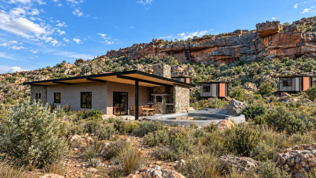
Private accommodation pod among sandstone rocks on The Cederberg Trail
Bedroom and en-suite bathroom inside a Cederberg Trail pod
San rock paintings beneath a sandstone overhang on The Cederberg Trail
Seasonal waterfall flowing into a rock pool on The Cederberg Trail
Communal camp building and swimming pool beneath sandstone cliffs
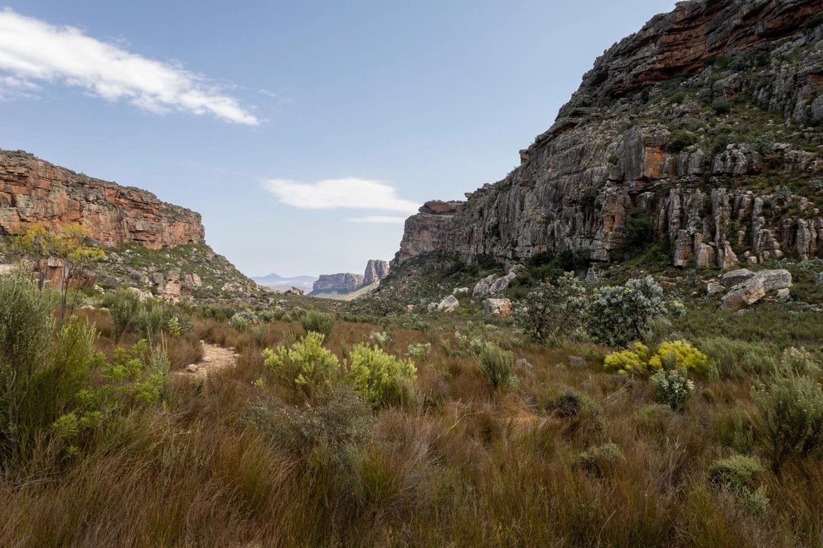
Sandstone cliffs and fynbos in the Western Valley on The Cederberg Trail
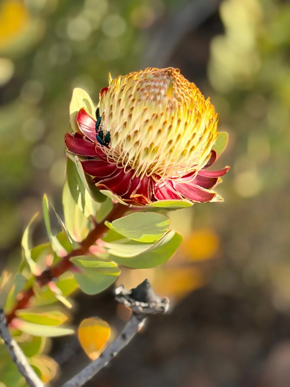
Protea flowering beside The Cederberg Trail
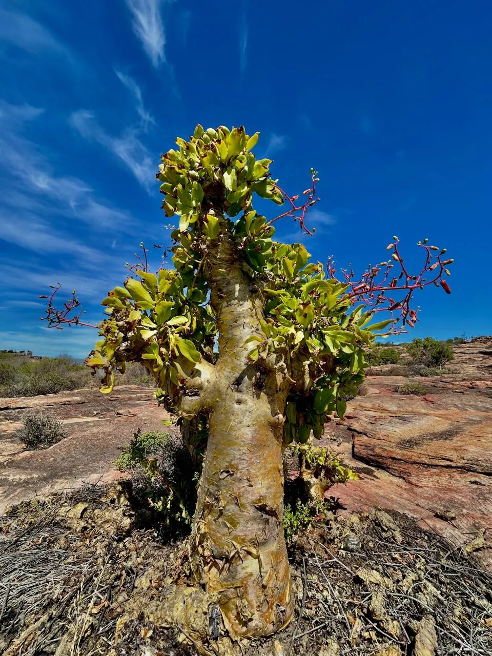
Botterboom - Thick-stemmed succulent growing among sandstone rocks on The Cederberg Trail

About The Cederberg Trail

The Cederberg Trail is a four-day, three-night slackpacking route through the private Klipopmekaar Wilderness near Clanwilliam in the northern Cederberg. Covering approximately 50 km, it combines sculpted sandstone formations, mountain fynbos, San rock art and seasonal waterfalls with comfortable overnight accommodation. Two shortcuts reduce the total distance to approximately 43 km.

Opening: Bookings are open, with the first trails scheduled to start on 1 July 2027.

About the trail

This purpose-built, clearly marked route is designed for private groups who want to explore the Cederberg carrying only a daypack. Personal duffel bags, food boxes and cooler boxes are transported between the three overnight camps, leaving hikers free to enjoy the landscape.

The standard option is self-guided and self-catered. Hikers bring their own food and drinks and prepare meals in the equipped camp kitchens. A guided and catered option is also advertised for 2027; contact the operator for availability and arrangements.

One private group starts each day. Groups normally comprise eight to twelve hikers, with each overnight camp reserved for the group. Smaller groups of two to seven can book at the minimum charge applicable to eight people.

Accommodation and slackpacking support

Each of the three camps is planned with six private pods. Each pod accommodates two people in single beds that can be joined into a king, with linen, an en-suite hot shower, basin and toilet. Hikers bring their own towels and toiletries.

Shared facilities include an equipped kitchen, lounge, dining area, braai deck and freshwater swimming pool. The camps have solar power, refrigeration, cooking facilities and drinking water. A daily luggage and food-box transfer service, trail briefing, maps and an emergency satellite phone are included in the standard trail offering.

Difficulty and best time to hike

The operator grades the route as moderately strenuous. Good general health and mountain-walking fitness are required, particularly for the full third day. Although the route requires no scrambling, there are stone staircases and a short ladder descent. River crossings may be necessary after rain, and the operator requires all hikers to be able to swim. The published age range is 10–70 unless otherwise agreed with the operator.

The trail is bookable throughout the year from its opening. Winter brings rainfall and colder nights; seasonal rivers and waterfalls generally flow from July to November. Spring flowers are a further attraction, while summer can be very hot. Waterfalls and river swimming depend on rainfall, and extreme heat or flood conditions may affect departures.

There is no reliable mobile reception or Wi-Fi on the route or at the overnight camps. Wi-Fi is available at the Visitors Centre, and each group receives a satellite phone for emergency use. Groups must stay together and follow the marked route. San rock paintings must not be touched.

Communal camp building and swimming pool beneath sandstone cliffs
Sandstone cliffs and fynbos in the Western Valley on The Cederberg Trail
Protea flowering beside The Cederberg Trail
Botterboom - Thick-stemmed succulent growing among sandstone rocks on The Cederberg Trail

Hike Directions

The route day by day

Day 1: Visitors Centre to Hole in the Roof

Approximately 10 km | 4 hours walking

Descend through mountain fynbos and succulent Karoo vegetation to the Waterfalls River, then follow the river upstream past sandstone formations, waterfalls and pools when the water is flowing. The first night is spent at Hole in the Roof camp. An approximately 8 km shortcut takes around two and a half hours, but misses two of the main waterfalls. The operator recommends arriving at the Visitors Centre by 11:00 for preparations and a briefing before setting off around midday.

Day 2: Hole in the Roof to Die Bassie

Approximately 11 km | 4–5 hours walking

Continue along the Waterfalls River before crossing weathered sandstone hills towards a tributary of the Klipopmekaar River. In the wetter months, cascading pools provide places to pause along the way. The route passes Neill’s Arch, rock passageways and a San rock-art cave before descending to Die Bassie camp.

Day 3: Die Bassie to Dragon’s Lair

Approximately 18 km | 7–8 hours walking
Shortcut option: approximately 13 km, around 6 hours.

The longest day crosses the Klipopmekaar River and heads towards Karin’s Arch, the Enchanted Forest and further San rock art. A gradual climb leads across sandstone plateaus towards the Western Gate Valley and Pillars. Fit groups with sufficient time and suitable weather can take the Noordkrans Peak loop for extensive mountain views. The shortcut bypasses this more demanding section. Both options continue into Verkeerde Valley, past the Dainty Frog formation and Jack’s Tower, to Dragon’s Lair.

Day 4: Dragon’s Lair to the Visitors Centre

Approximately 11 km | 3–4 hours walking

Cross the Klipopmekaar River again and climb through sandstone country and proteas towards Suurkop. Views open towards the Doring River region, Tankwa escarpment, Biedouw and the mountains above Wupperthal. A final rock-art site precedes the return to the Visitors Centre, where hikers can shower before travelling home.

About the area

The Cederberg Trail explores the private Klipopmekaar Wilderness near Clanwilliam in the northern Cederberg, Western Cape. This quiet mountain landscape is characterised by weathered sandstone cliffs, natural arches, rocky plateaus and sheltered valleys. Along the route, sculpted rock formations give way to wide views across the surrounding mountains.

Mountain fynbos and succulent Karoo vegetation bring variety to the landscape, with proteas, hardy succulents and seasonal wildflowers growing between the rocks. Following winter rains, streams, waterfalls and natural pools add another dimension to the walking. These waterways are seasonal, and the drier months reveal the sandstone channels and rock formations shaped by flowing water.

San rock paintings provide a connection to the area’s human history. These fragile sites should be admired without touching the paintings or disturbing their surroundings.

The northern Cederberg has a dry climate with winter rainfall, cold winter nights and potentially intense summer heat. Spring flowers and changing water levels mean the landscape offers a different experience through the seasons. With little artificial light and no reliable mobile reception along the trail, evenings offer time to enjoy the mountain quiet and, on clear nights, a sky full of stars.

Address & Contact details

The trail starts at Klipopmekaar Wilderness & Rooibos Farm, Agter-Pakhuis, near Clanwilliam in the Western Cape. The operator estimates approximately 290 km, or three and a half hours, from Cape Town, including a final 17 km on gravel roads. Ordinary vehicles with normal ground clearance are suitable; very low-clearance cars are not recommended. Access must be arranged in advance, and directions are provided to booked groups.

Seasonal waterfall flowing into a rock pool on The Cederberg Trail
Email: Lauren van Jaarsveldt — This email address is being protected from spambots. You need JavaScript enabled to view it.

Location Map